
With the rise of digital technologies, mobile apps, autonomous driving, IoT, and other technologies, the word “map” has significantly evolved. It seems that its meaning has evolved with time, and it is now understood differently between generations, cultures, and geographies. No doubt, the development of location-based technologies has led to a growing need for the systematization of basic concepts, including defining what a map is. Last year we’ve supported reachers trying to gather the data about differences in understanding of the term “map” and now the research is finally out.
The research conducted by Dariusz Gotlib and Robert Olszewski (Faculty of Geodesy and Cartography, Warsaw University of Technology), and Georg Gartner (Department of Geodesy and Geoinformation/Research Division Cartography, Vienna University of Technology), explored how modern geoinformation technologies, affect the understanding of what a map is. The research reveals the role of the map in indirect cognition and learning of geographical space. This research on a group of nearly 900 respondents from various countries shows that a social understanding of mapping concepts is evolving and covers the entire spectrum of geoinformation products. Without a doubt, the latest geoinformation solutions, for instance, navigation applications and, specifically, applications supporting autonomous vehicles’ movement, have had a particular impact on the map concept.
Of course, you must have come across several instances in which the words “map” and “mapping” have been used, for example, mathematics, logic, biology, cartography, robotics, and computer technology. You will find all these terms in cartography virtually because it is a discipline that deals with the art, science, and technology of making and using maps. According to International Cartographic Association (ICA), a map is “a symbolized representation of geographical reality representing selected features or characteristics, resulting from the creative effort of its author’s execution of choices, and is designed for use when a spatial relationship is of primary relevance.” However, there is no one fit all definition for maps. For instance, a commonly used description is; “a map: graphic representation, drawn to scale and usually on a flat surface, of features—for example, geographical, geological, or geopolitical—of an area of the Earth or any other celestial body.”
According to the research, more than 75% of the interviewees believed that they could use a car navigation system without looking at the screen. In contrast, two-thirds thought that the visually impaired could use a map. Most of the respondents, more than 80% actually, claimed that autonomous cars need a map to drive correctly. In comparison, another vast majority-more than 90%, concluded that a map could be three-dimensional as well as virtual.
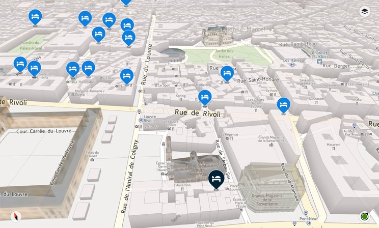
The survey also revealed some exciting responses when the interviewers were asked what they were willing to consider a map. Most respondents strongly believed that LBS applications are maps or use maps. In the car navigation application assessment, 40% of the respondents thought a car navigation application is a map. Interestingly, 80% agree with this assertion in the case of the Google Maps portal. Interestingly, as for many use cases, Google Maps is, in fact, a car navigation map.
Noteworthy, the survey results show consistency across respondents using different languages. In other words, the vast majority of the responses to questions raised in the questionnaire were consistent despite the different languages used, except for subjectivity or objectivity of the cartographic information message. 62% of the English-speakers thought the map is a cartographer’s subjective way of seeing reality, while 14% thought otherwise. 49% against 34% of German-speakers held similar views, while 57% of Chinese people believed the map is an objective reflection of reality and only 30% said the opposite.
This research definitely represented different cultures, places of residence, and different languages, and it is worth noting that the respondents had a comprehensive understanding of maps. In other words, there was no significant relationship between the responses and the gender, age, country of origin, and cultural backgrounds of the research participants.
Interestingly, many people believe that the graphic form of a map is not crucial in calling the product a map. The good news is that most of them are aware that the map user is no longer necessarily a human being. And that the cultural difference or language does not affect one’s understanding of the map concept. In fact, many people, as shown in the survey, considers maps to be models of geographical space that facilitate navigation. It has also come out clearly that many think maps to be carriers of information, not graphic images. This broad understanding of the map’s role today is precious in an era of widespread use of navigation and LBS applications.
Without a doubt, the general public’s perception of the map concept is extensive and far different from the “flat graphic representation at a specific scale.” In other words, the public seems to agree that maps are not solely associated with visualization. That is, visualization is not a prerequisite for the existence of maps. Instead, the map is a geographical reality model that can be communicated to the user in many ways by utilizing many senses. It is also important to note that the vast majority of the public admits (indirectly) that the user of the cartographic modelling process is not necessarily a human; it may be a machine, such as an autonomous vehicle.
In conclusion, we can say that digital technology development has significantly influenced the public perception of cartography’s role and the meaning of the map. It is apparent that the map concept is understood much more broadly now than even a decade ago. It is critical to note that regardless of age, gender, or language, people recognize the association between modern geoinformation products and the map understood as a reality model. Therefore, we can easily say modern cartography’s role is to adapt geoinformation products to the needs of a wide range of consumers of contemporary maps, including those who do not use graphic images as a source of information about surrounding space.
As noted by the authors of the research, when understood as an organized spatial dataset, a map becomes an essential element of interpersonal communication and the decision-making processes performed by robots, as exemplified by M2M (machine to machine) communication. The authors of the research determined that “a map means arranging data and giving them a proper structure in a way that is appropriate for cartography, according to a particular data model, to ensure optimal spatial information communication.”
Detailed research results and authors’ views on this subject can be found in the article available here.

#Science

Next article


Government gazettes don’t typically make for riveting reads. The documents run into dozens and dozens of pages, you need to navigate through a ton of jargon and legalese, and there’s a lot of going back and forth involved – because the penalty for ‘contravention of sub-rule (1) of rule 23’ would suddenly manifest 20 pages later without a link back to the original rule.
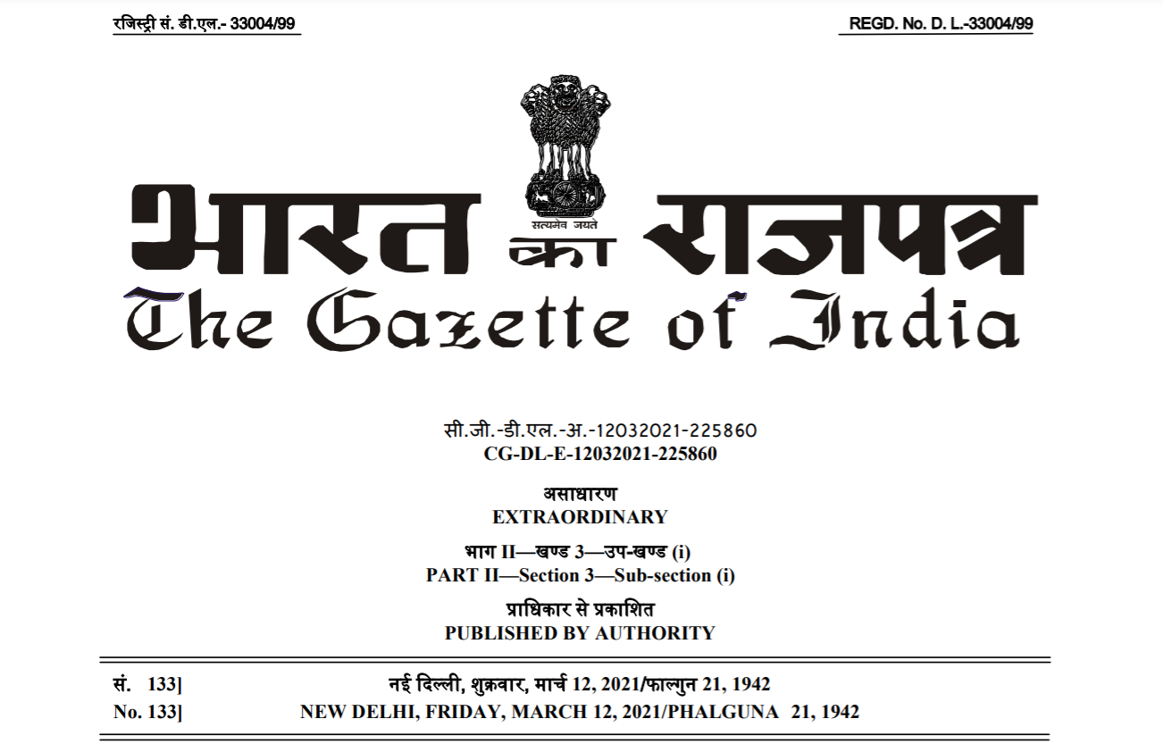
Government gazettes rarely make for riveting reads, except when they come in the form of a notification from India’s Ministry of Civil Aviation, detailing the 2021 rules for the drone industry. Because here, clause after clause is designed to make your jaw drop. The more you read, the more you are gripped – by the sheer implausibility of it all.
Related: Thinking of importing or manufacturing drones in India? Read this first
The rules came into force the same day they were published in the Official Gazette – March 12, 2021. And just as simply as Thanos could set off mass extinction with a snap of his fingers, these rules deemed the entire drone industry in India illegal.
To be fair, much of the operations were being done furtively before March 12 also – chiefly because the government’s online platform designed to grant flight permissions and ensure the smooth functioning of all drone-related activities has been perpetually under construction. Only now, the unlawfulness of drone operations will attract much more severe penalties – not just for the owners, operators (commercial and recreational alike), service providers but also for the manufacturers, importers, and traders.
As per the Unmanned Aircraft System Rules, 2021, every stakeholder of the industry needs to procure an official certificate of ‘authorization’ from the Directorate General of Civil Aviation (DGCA) to continue doing what they may have been doing for years now – right from manufacturing the simplest of drone components, such as a wire or a screw, to conducting research and development of an unmanned aircraft system. And this is just the first step. The new rules are deliriously high on the licensing system.
Once you have received your ‘authorization’ certificate, you need to submit a separate application to the DGCA to obtain permission for the manufacture or import of a prototype drone (for a fee, of course. There’s a fee to be paid with every application). Each prototype drone that you create or import will be assigned a unique identification number by the DGCA. Hold on to these UINs, because their transfer from one stakeholder to another will also entail a time-consuming paper trail and fee at each step.
Now, to obtain a certificate of manufacture and airworthiness, you send another application to the DGCA, post which you handover your prototype drone and all the design documents to an ‘authorized’ testing laboratory chosen by the Director-General.
And then, you wait. Maybe for weeks, maybe for months. The rules don’t specify any timeline or tracking mechanism for the progress of any of these applications.
What they do specify is that if you need to import a spare part for a drone for which a certificate of manufacture and airworthiness has already been granted to you, you still need to take prior approval of the DGCA by filling out yet another application form. And no, it doesn’t help that the Directorate General of Foreign Trade has already issued you an Importer-Exporter Code (IEC) number.
By now, you should have understood that a passion for seeking approvals is a skill you must be able to highlight on your resumé if you are to survive in the Indian drone industry. So, before each test flight, you take prior clearance from the local authority and the Air Traffic Control – even when these test flights are to be conducted under the direct supervision of an appropriately licensed remote pilot at a predesignated site notified by the Central Government.
Also read: Flying a drone in India? See what 2021 drone rules say for pilots
That said, chances are, you may never reach the test flight stage. It would take nothing short of a miracle for you to find ‘authorized’ manufacturers for all the components the DGCA says your drone must have before it makes its way to a testing laboratory.
And by the time you check off the boxes on the list of the technical requirements, your drone would have become economically unfeasible for today’s markets.
A 360-degree collision avoidance system, for example, has been mandated for a Micro category drone (weighing ≤ 2 kg) that would be flown by a trained, ‘authorized’ operator within the visual line of sight. And an emergency recovery system is absolutely essential for a Small category (weighing ≤ 25 kg) agricultural spraying drone that has been designed to fly only 2 meters above the ground level.
Even toy drones (weighing less than 250 gm) are to be outfitted with Global Navigation Satellite System (GNSS) receivers and have high-tech features like geofencing capabilities and autonomous ‘Return to Home’ options.
For a hobbyist, however, the higher price point for a beginner drone will not be the only barrier to entry. To fly any drone weighing more than 250 gm for recreational purposes, you are required to undergo a week-long training program costing upward of INR 25,000. Two separate pilot permit applications need to be submitted to the DGCA – first as a student and then, after the completion of the training, as an operator. Two other applications must be submitted to get both the drone and the drone owner registered with the authorities.
And even after all this, you cannot just wake up one morning in a hotel and decide to capture your vacation moments from the air. Here also, you need to take prior permission from the DGCA, defining clearly the area where you want to fly. And how do you take this permission? Through the same defunct online portal, of course!
Interestingly, India is part of Joint Authorities for Rulemaking of Unmanned Systems (JARUS), a group of experts from National Aviation Authorities (NAAs) of five continents, EUROCONTROL, and the European Aviation Safety Agency (EASA). In 2019, JARUS published a document – debated and developed over a period of 4 years – to recommend the level of regulatory involvement for various types of drones and drone operations.
This document suggested that based on the unmitigated risk associated with UAS operations, every drone and drone operation should be characterized by one of the following three categories:
Category A (Open)
In this category, JARUS recommends self-certification. Adoption of industry standards may apply but airworthiness requirements should not be made mandatory. Risk mitigation should be applied through the adoption of operational limitations, such as no-fly zones and visual line of sight operations, without requiring approvals issued by an aviation regulator. The operator should be deemed responsible for safe operations.
Examples of operations falling in this category include toy/Nano drones as well as recreational, hobbyist drones of the Micro category. This category could also include commercial drone operations that present a low unmitigated risk, such as low airspace survey of critical infrastructure located far away from human habitation.
Category B (Specific)
As the operations go beyond the limitations of Category A, an acceptable level of risk is ensured by a risk assessment of the operation and identification of mitigation steps. This could include requirements addressing the design of the drone, operational limitations, and qualifications of the drone pilot. Varying levels of oversight are recommended for this category.
Category C (Certified)
This is the category that should have full regulatory oversight because the high levels of risks here cannot be solely mitigated through operational limitations. As such, risk mitigation here would involve a type design approval (Type Certification), a certificate of airworthiness, flight manuals, instructions for continued airworthiness (maintenance), production approvals, and other associated certificates of traditional civil aviation.
India’s 2021 drone rules, it would appear, group all drones and drone operations under Category C. This, when JARUS bluntly provides multiple reasons for having a provision for Category A. Some of the reasons why JARUS members feel Category A self-regulation is important for the growth of the drone ecosystem include:
- Experience in various countries has shown that such a regulatory concept can ensure safety in an effective and efficient manner.
- The classic approach to aviation regulation, even if adapted in a very light manner, would most probably be too burdensome, because aviation authorities are inherently not fit for this task.
- Burdensome and disproportional regulation would most probably lead to the development of illegal operations due to difficulties in enforcement.
To be fair to DGCA, mandating geofencing is something that JARUS also recommends. But their report is quick to clarify that “in keeping with the overall concept of Category A, this technology should be available at a reasonable cost as well as easy to implement. This should be considered when determining if geofencing should be mandated for all drones or just to a subset depending on size or weight.”
India’s first Civil Aviation Requirements (CAR) for drones came out in 2018. It took the drone industry nearly two years after that to reach a stage where a handful of UAS companies could enjoy exemptions granted by government ministries and departments to conduct operations – primarily due to urgent demands presented by global issues like the COVID-19 outbreak and locust infestation. To date, the government’s ambitious online platform for monitoring drone operations, Digital Sky, is inoperative.
Now, the industry is in consensus that the new rules will make compliance virtually impossible, and as such, any drone company that does not have explicit exemptions from the government to do business in India can be penalized – and penalized heavily – at any moment.
Industry insiders and lobby groups, who have been continually engaging with the DGCA for amendments and improvements to the 2018 rules, feel that they have been grossly sidelined by the government. The problem is not only that their suggestions have been ignored by the DGCA but also that several more layers of operational complexities have been added through the new rules. By incorporating a multi-level, multi-license system, the ease of doing business has been impacted adversely even further.
Aviation Ministry officials have been vocal about their vision to make India the “drone capital of the world”. It is truly regretful that we seem to be moving in the opposite direction.
Time to assemble the Avengers? Join the discussion on LinkedIn.