
This week the new Star Wars movie hits movie theatres around the world. Millions of geeks, including me, were waiting for that moment for the last decade. Will it be a great movie or just a short journey to back to our childhood? We’ll learn soon. But Star Wars is not all about the battle of light and dark side of the Force. It is also about maps… Maps of the Galaxy.
Other the last 2 decades we’ve seen several maps of the galaxy far, far away. Some of the good, some them even better. Today we’re bring the best of these maps to you in the chronological order.
1998
The first map of the whole galaxy officially published with the release of Star Wars digital encyclopaedia Behind the Magic back in 1998
1999
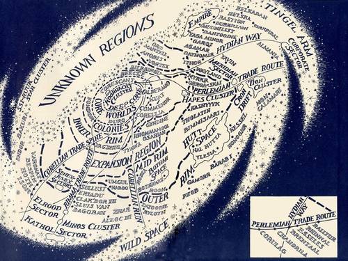
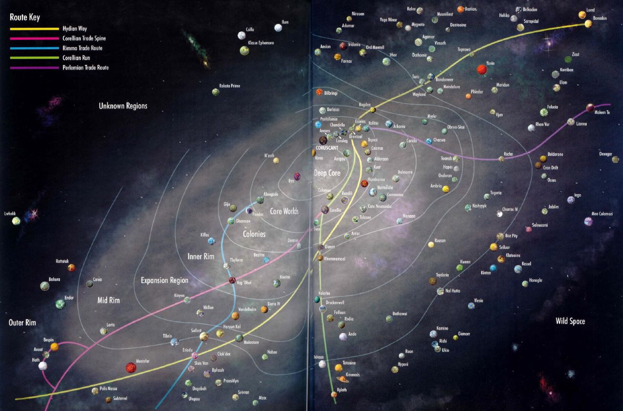
The second map was a part of Vector Prime novel published 1999. The map has been than reused in 2000s Balance Point novel.
2001
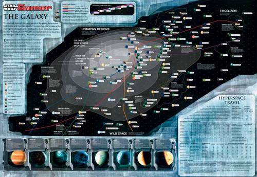
In 2001 the Star Wars Gamer magazine got interested in the topic and published its own Galaxy map.
2002
In 2002 The Official Star Wars Fact File has been published with the following map.
2005
The Star Wars New Essential Guide to Chronology contained a map updated for the Episode 3
2006
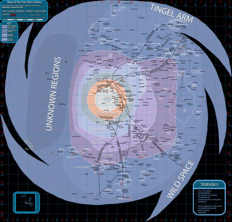
Map of the Star Wars Galaxy compiled by “Modi” back in 2006
2007
In 2007 W. R. van Hage independently published The Star Wars Map Of The Galaxy.
2009
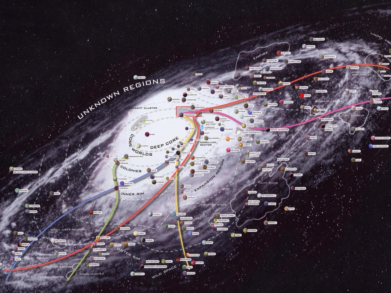
2009 brought a new cool map in the Star Wars – The Essential Atlas.

2013
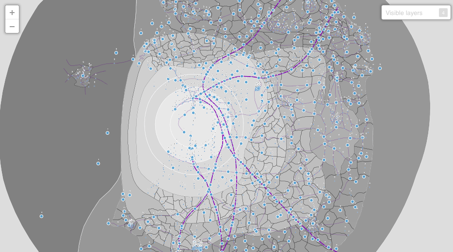
On the first web interactive maps of the Galaxy based on CartoDB engine.
2015
Interactive map of the Galaxy which we’ve covered in Geoawesomeness in October 2015.

source: Tor, StarWars.com

#Business


Next article

As the saying goes “All Roads lead to Rome”, is geographically obvious at least in Europe but the more interesting question on this quest for mobility is – if you ever to travel to Rome from a remote corner of Europe which route would you take?
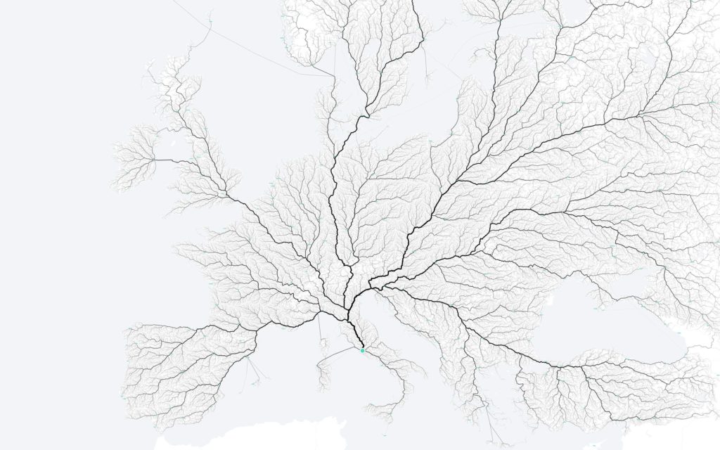
Do all roads lead to Rome? © 2015 moovel Group GmbH
Do all roads really lead to Rome? This is the question that bugged us all summer … But now we finally solved the biggest unsolved quest of mobility. – Raphael, Moovellabs
All Roads lead to Rome, but then which one do you take?
In case you were wondering, there are more than half a billion routes that one can take across Europe to reach Roma Aeterna.
To approach one of the biggest unsolved quests of mobility, the first question we asked ourselves was: Where do you start, when you want to know every road to Rome? – Moovellabs
In order to answer that question, they created a 26,503,452 km² grid covering the whole of Europe; assigned each cell in this grid as a starting point, ending up with 486,713 starting points to find out the route to Rome.
Hey Siri, Can you show the route from 486,713 “Starting points” to Rome!
Obviously, Siri was not going to be pleased with that request. The Moovellabs teams used GraphHopper and OpenStreetMap data on a MacBook Pro (Apple fan rejoicing 😉 ) and 5 hours later, they had the awesome map that we are looking at now!

The #GeoawesomeMap showing all the roads that lead to Rome © 2015 moovel Group GmbH
Data Art. Map Art. Whatever you want to call it, the map is simply geoawesome and the best part is – its available as a poster, on your Mug, for your iPhone or Galaxy smartphone. Great job @MoovelLab it can’t get more geoawesome than this 😉
Open Source and the Geo Community
The Roads To Rome project by Moovellabs is yet another great showcase for the amazing stuff that the Open Source community keeps creating time and time using spatial data. If you are interested in taking a peek behind the maps, head here.
One more thing!
In typical “Stevenote” style (Yes, that’s a thing and even has a Wikipedia page), the team extended the idea to map the route to Romes in the USA (Fun fact: there are ten of them in the USA), the routes to the state capitals in USA and the national capitals in Europe.
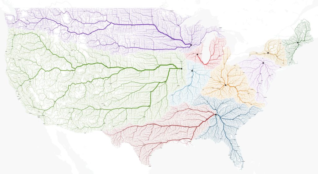
Roads to Rome (10x) – USA version © 2015 moovel Group GmbH
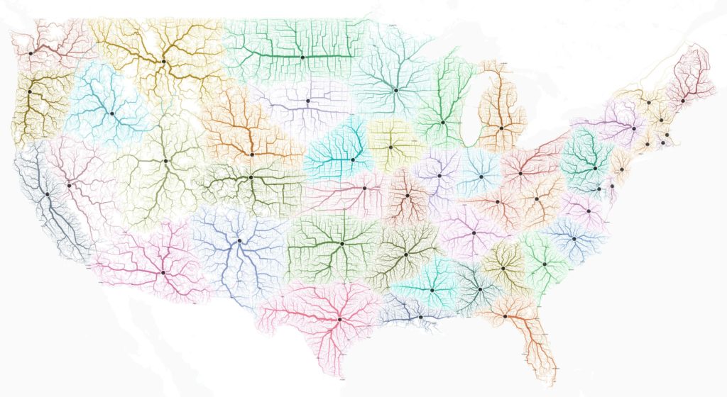
Roads to Federal Capitals in USA – © 2015 moovel Group GmbH

Roads to the capitals in Europe © 2015 moovel Group GmbH