#Featured
#Fun
Top 8 maps and charts that explain Halloween
Evolving from the ancient Celtic holiday of Samhain, modern Halloween has become less about literal ghosts and celebrating those who passed away and more about costumes and candy. Below you’ll find the collection of the best maps and infographics that will let you understand Halloween a bit better.
How countries around the world celebrate Halloween

source: Angles Fancy Dress
The acres of harvested pumpkins by state
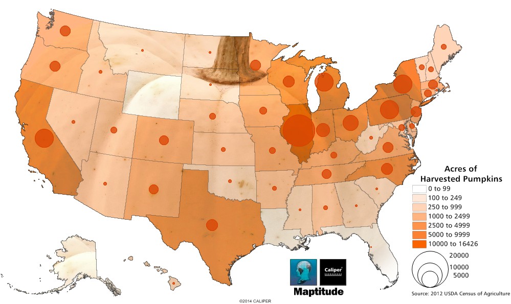
Maptitude Mapping Software Pumpkin Harvest Map
source: Caliper
Countries with candy import peak in October
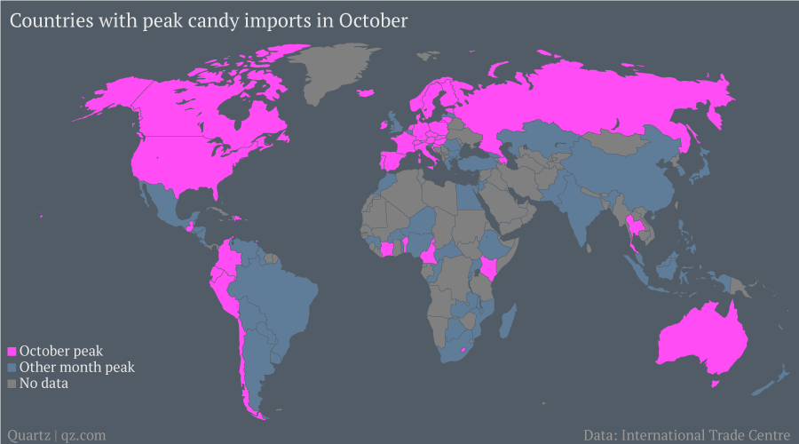
source: qz
The most popular candies per states
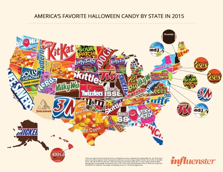
source: Cosmopolitan
The Most Googled Halloween Costumes
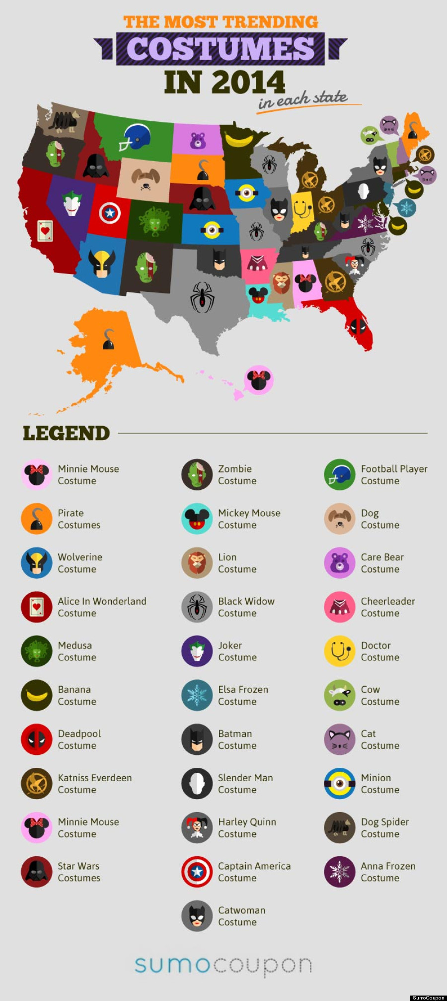
source: Huffington Post
Halloween spendings across the US

source: Halloween Spending Across America
The Best Cities for Trick-or-Treating
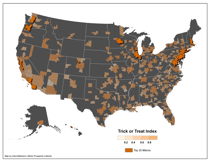
source: The Atlantic
Where horror films took place
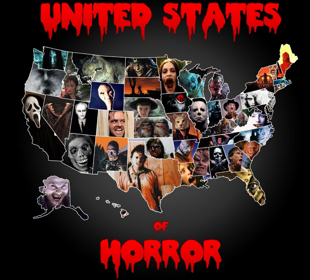
source: Horror Freak News
[td_smart_list_end]

#Featured
#Events
#Featured
Team Geoawesomeness at INTERGEO 2023
#Business
#Featured
Demystifying satellite data pricing: A comprehensive guide
#Contributing Writers
#Featured
#Fun
#Ideas
#People
Share Your Insights: Geoawesomeness is Looking for Contributing Writers


