
Love and geography go together well! These satellite images from TerraServer.com reveal that love is all around us.
Satellite imagery captures the Earth’s landscapes in unexpected forms, often resembling hearts, showcasing nature’s inherent beauty and whimsical patterns. These heart-shaped landscapes serve as captivating reminders of love’s presence in the natural world, evoking a sense of wonder and appreciation for our planet’s diverse and enchanting features.
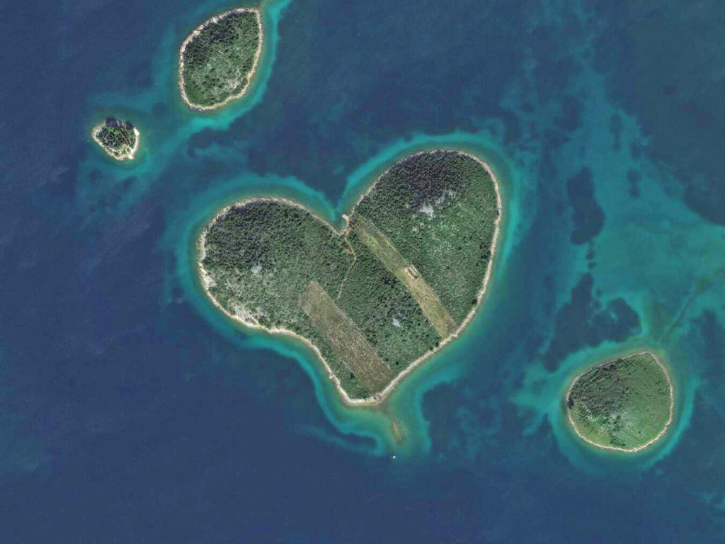
1. Galešnjak Island, Croatia
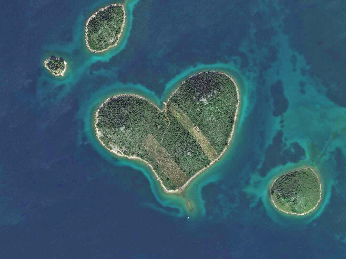
Image taken on 2016-10-31, 43.9785357, 15.3811181
2. Sri Sathya Sai Sanjeevani Hospital, Raipur, India
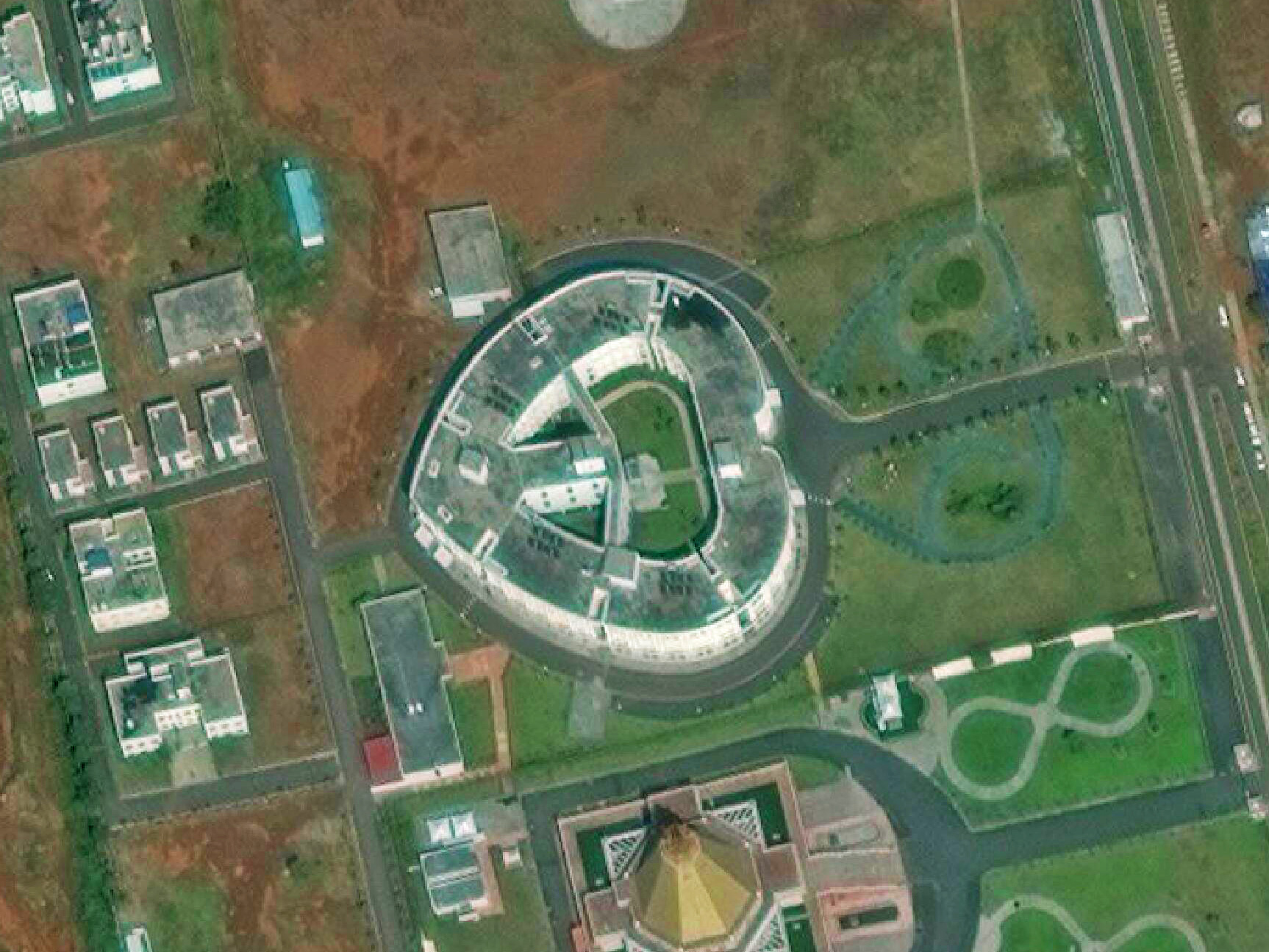
Image taken on 2016-11-03, 21.210944,81.8106802
3. Heart of Voh, New Caledonia
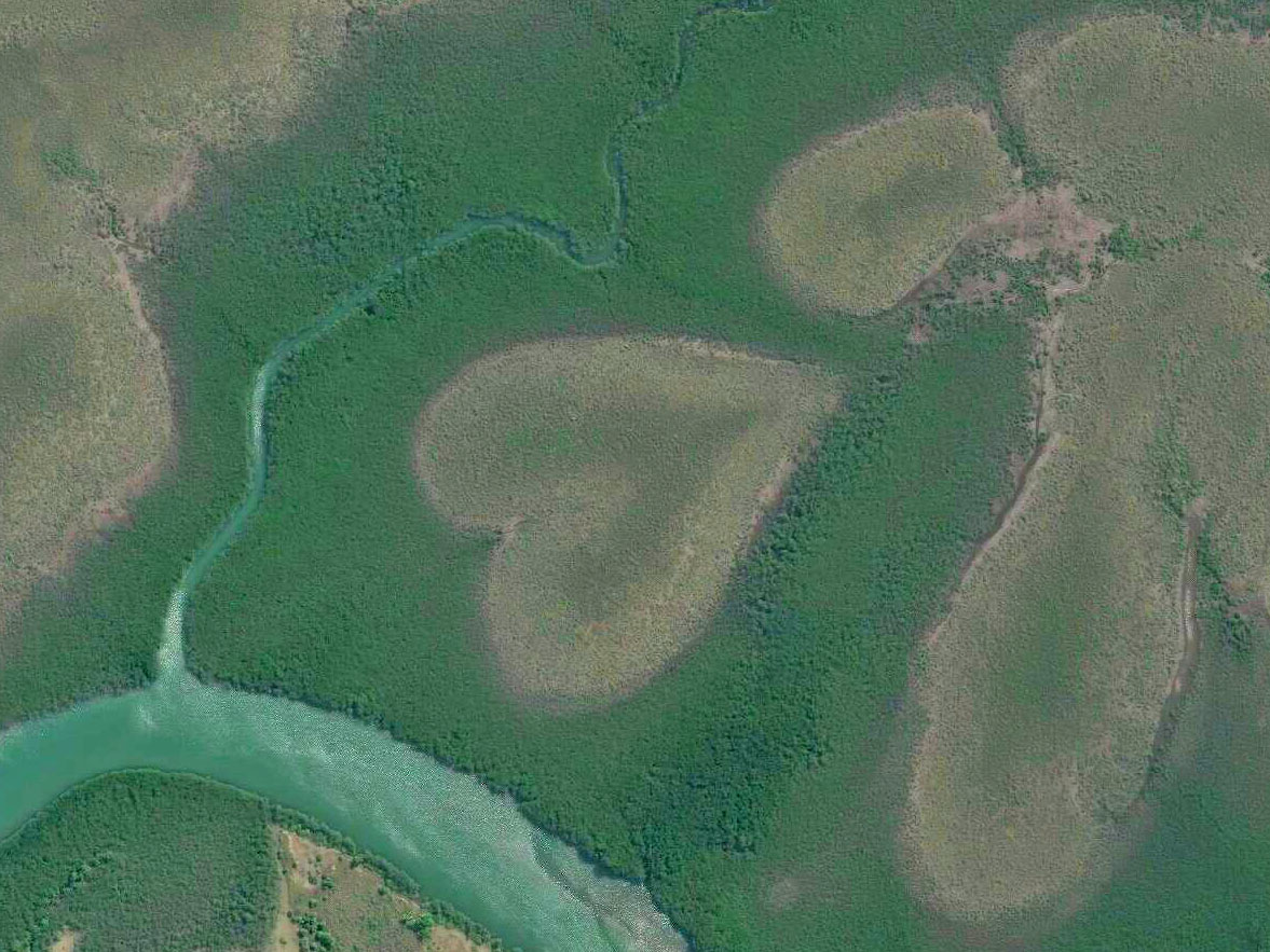
Image taken on 2016-08-07, -20.9368846, 164.654972
4. Three heart-shaped ponds near the Halmstad Airport, Sweden
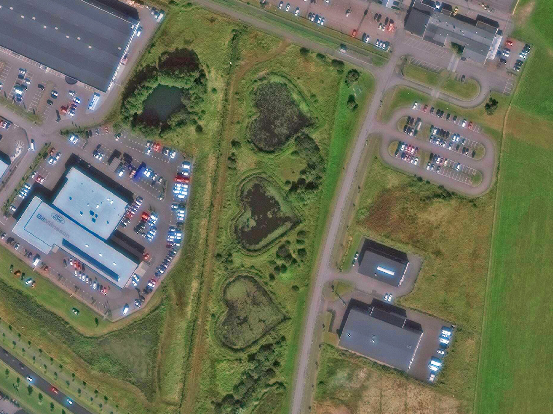
Image taken on 2015-08-20, 56.679884, 12.812780
5. Heart Lake, Canada
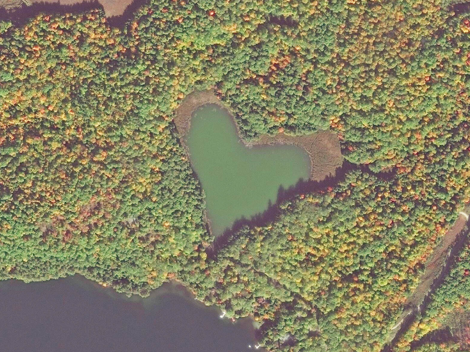
Image taken on 2016-10-10, 45.0189738,-76.9007247
6. Heart Shaped Field in Kingswood, UK
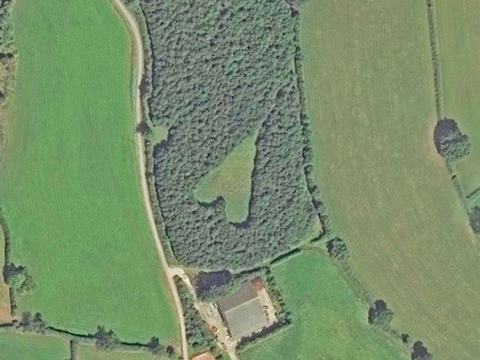
Image taken on 2016-08-30, 51.607267, -2.386522
7. Heart-shaped pond in Strongsville, Ohio

Image taken on 2016-08-03, 41.303921,-81.901693
8. Heart-Shaped Island-South Korea
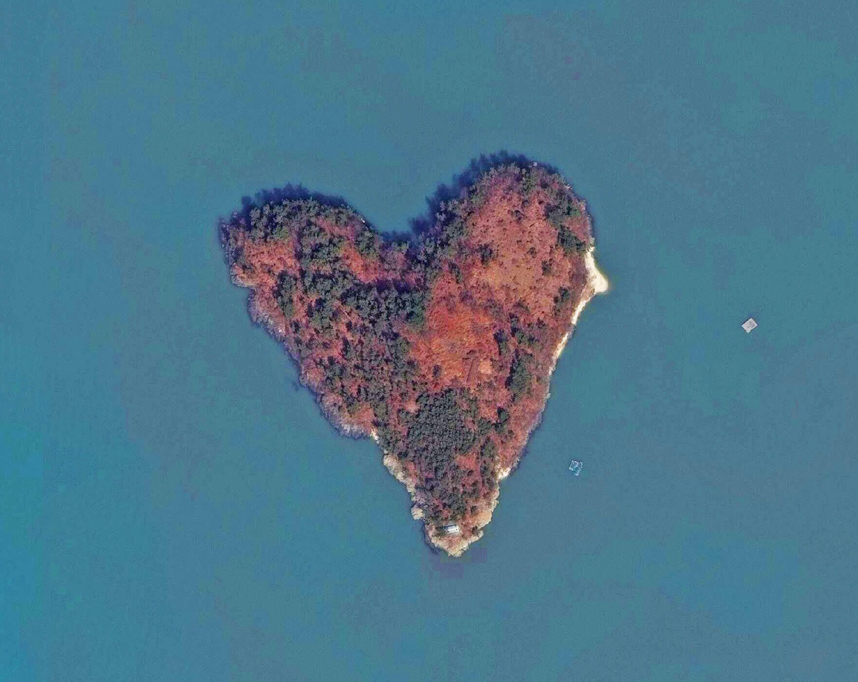
Image taken on 2015-03-08, 34.781691, 127.557114
Satellite images revealing landscapes shaped like hearts provide a delightful nod to Valentine’s Day, offering unique opportunities to spread love and joy. Consider sharing these images on social media, sending personalized greetings, or even organizing outdoor events centered around these heart-shaped natural wonders. Let these images inspire creativity and foster connections as we celebrate love in all its forms.
Did you like this article? Read more and subscribe to our monthly newsletter!

#


Next article
Humans have changed the surface of the Earth much more and much faster than any other species before us. In nature, we observe many animals also shaping their surroundings, just look at ants or beavers. But the scale of human influence on our planet is uncomparable. It lasts already for over 10 000 years (dating back to the beginnings of agriculture) but it dramatically accelerated in the last few decades. 2008 was the first year in which more people lived in urban areas than in rural regions.
The German Aerospace Center (DLR) has created a project which maps this impact and visualises human footprint around the world. The team of researchers processed and evaluated a total of 180,000 individual images and more than 308 terabytes of data and came up with this unique, minimalistic 3D globe. The map has been created using just three colours: black for urban areas, white for land surfaces and grey for water.
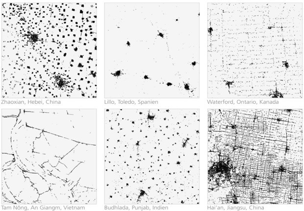
The images are based on data acquired by the German radar satellites TerraSAR-X and TanDEM-X. The images were taken from the altitude of over 500 kilometres with the resolution of 12 meters (40 feet). The two sibling satellites needed 2 years to cover the entire surface of Earth and this was possible only as the radar sensors are able to ‘see’ through clouds and can even record data at night. The task facing the scientists was to calibrate the automatic survey process in such a way that structures like trees or lampposts would not be recorded, while individual houses could still be detected. This all allowed to create a dataset with a precision currently unparalleled by any other global surveys.
Amazing project.