
In this article, I’ll cover the navigation steps I take when preparing for a backpacking trip:
- Downloading offline Google Maps to navigate safely in dead zones.
- Printing out or purchasing paper maps.
- Making paper maps better by contacting park rangers with questions about your route.
- Plotting out a route on the free version of GAIA GPS and importing it onto a GPS device.
Download offline Google Maps
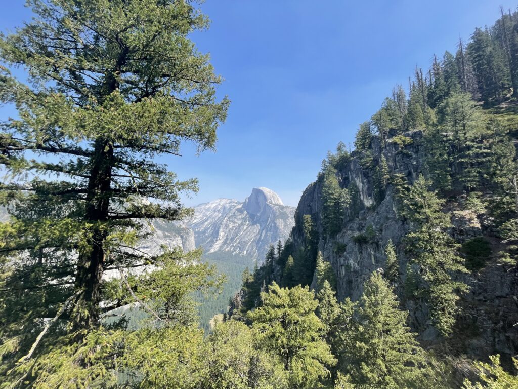
There’s always a dead spot. Or at least, that’s what you should assume and prepare for every time. For instance, there are a lot of dead spots near and within Yosemite National Park. Last year, I was picking up my backpacking permit from Big Oak Flat Information Station. I overheard someone telling the rangers that they were struggling with navigation because they didn’t have any service. The rangers told him that there are large dead zones outside of the Valley and the nearest verified area with service was in the Valley itself. Don’t be that guy. Be prepared!
Although larger parks like Yosemite have rangers that are always happy to help you, save yourself the stress and download the maps for the entire park or natural area you’re visiting. Better yet, download the maps for the full route you plan to take when going to and from a natural space.
Be mindful of the fact that offline maps do require large amounts of data and that they will expire eventually. Always update your offline maps before heading off.
Learn more: Download areas & navigate offline.
Get your paper maps ahead of time
Do not rely on rangers or information centers to have paper maps available. Every park does it differently, and the onus is on you to figure out how to get the resources you need ahead of time. For example, when I backpacked for the first time in Sunol Regional Wilderness Preserve, I received a park map with my Ohlone Wilderness Regional Trail Hiking Permit in the mail. That’s how East Bay Parks does backpacking permits. The National Parks system manages permitting via an online booking system (Recreation.gov). Your permit details are delivered electronically, so you need to get a paper map separately.
Do it yourself: This is a great option. There are amazing GIS experts who work for your local wilderness preserves, forests, and parks. Their goal is to give you as much information as possible so that you can enjoy your time outdoors safely…for free! Search for “maps” in the appropriate website and you’ll find some high quality, up to date topographical and/or trail maps to download. Print out the area you need and bring it with you.
Buy it: For more complicated areas like National Parks, I will purchase a large, foldable paper map because I do not have a color printer at home. I prefer having a color copy because I find them easier to read when there are a lot of map elements. National Geographic National Parks maps can be purchased directly from National Geographic or from local outdoor suppliers like REI.
Make your paper maps better
Always, always, always plan out your route if you’re going on longer journeys. Get out your pen and write where you’re camping first, second, third, etc. Trace the trail or highlight it. And then call ahead.
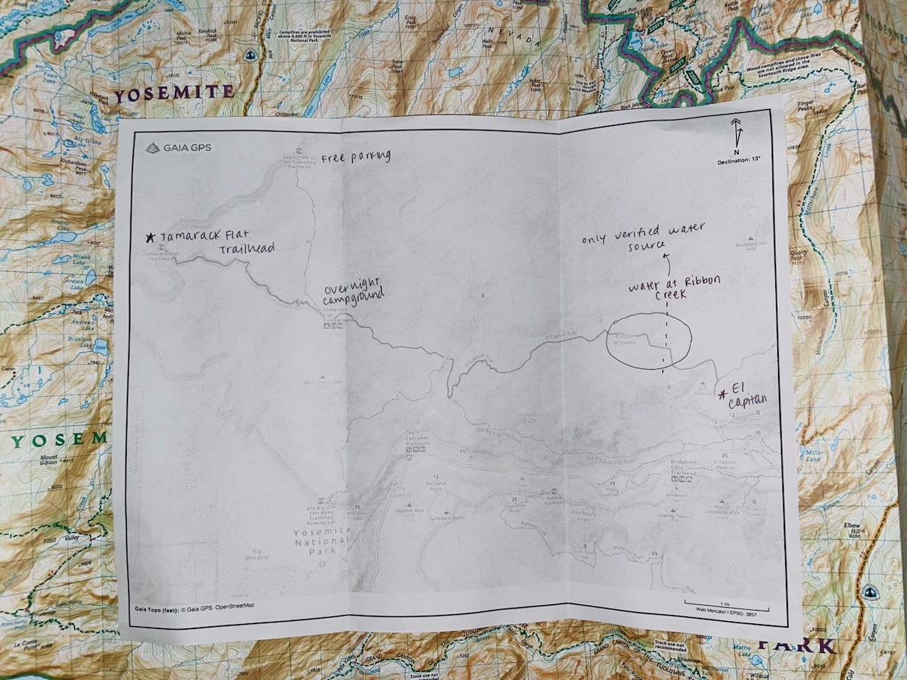
Annotated paper map on top of National Geographic map
Here’s some geography-related questions I asked the rangers for my most recent trip to El Capitan in Yosemite National Park:
- Parking: I am planning on starting at the Tamarack Creek trailhead. Where can I park for two days near this trailhead?
- Water: I’m planning on taking the Tamarack Creek Trail from the Tamarack Creek trailhead to El Capitan. Has anyone been out on the this trail recently and observed water? Where is water typically available in this area during this time of year?
- Trail conditions: Have there been any bear sightings in this area recently? Where?
- Trail conditions: What’s the state of the trail? Are there overgrown areas, or areas where the trail is lost?
- Trail conditions: Are there any good, flat areas where people usually set up camp on this trail?
- Backpacking rules: How far out do I need to hike from the trailhead before I set up my camp? How far away from the trail do I need to be?
- Distance: Just to confirm, what’s the distance from the Tamarack Creek trailhead to El Capitan?
- Elevation: Just to confirm, what’s the elevation change between Tamarack Creek trailhead and El Capitan?
Now mark all of the answers to these questions on your map. I usually make notes of other important things on the back of my map, like permit numbers, weather forecasts, and the leave no trace rules (camp 100 ft from water, dispose of waste 100 ft from your camp).
Plot it out with GAIA GPS
I use the free version of GAIA GPS for trail mapping. AllTrails is also a great option and allows GPX file downloads. National Geographic trail maps can be downloaded onto GAIA for a yearly fee if desired, but that has not been necessary for my trips.
Generally, using GAIA is as easy as dragging and dropping waypoints and telling it to find the route between them (e.g. Waypoint 1 here is Tamarack Flat Campground, Waypoint 2 is El Capitan). GAIA is intelligent enough to pick up on defined trails in well-traveled areas. It also tells you the distance and elevation change of your route.
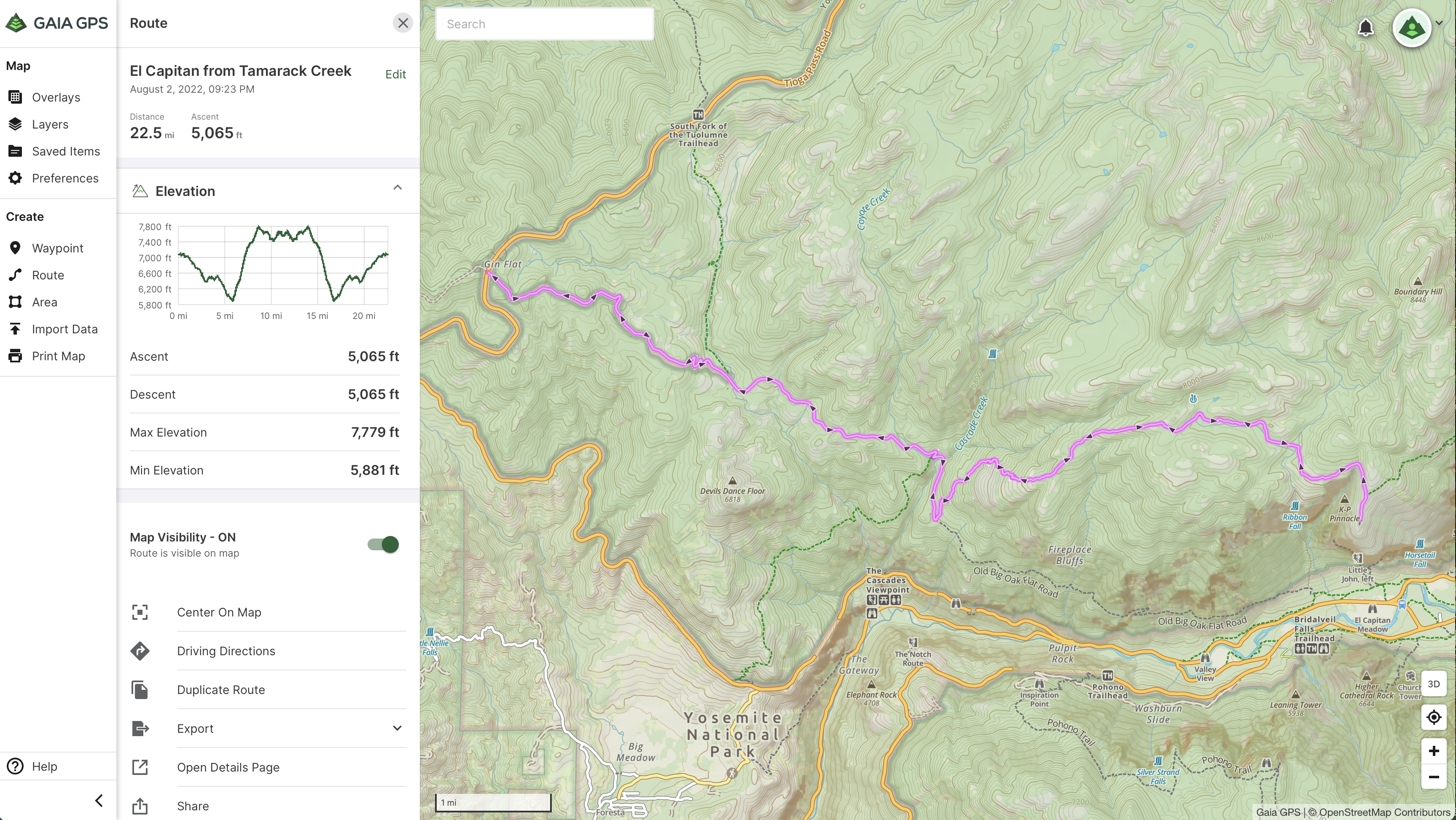
GAIA GPS map editing page
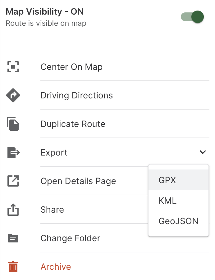
To export from GAIA GPS, click Export and select GPX.
GAIA GPS export to GPX
Learn more: Videos and Tutorials.
Getting GPX onto GPS devices
If you’re getting into longer backpacking trips, it may be time to think about getting a handheld GPS device. I decided on the inReach Mini 2 from Garmin, a company that is sort of like the “Esri” of handheld GPS devices. Regardless of the brand, you’re probably going to be handling GPX files if you want to import a map onto your GPS device.
What is GPX?
GPX stands for GPS Exchange Format. Location data, including waypoints, routes, and elevation, are stored in tags that can be interchanged between GPS devices and software.
- wptType stores individual, unordered waypoints.
- rteType stores routes as ordered lists of route points.
- trkType stores tracks as ordered lists of waypoints that describe a path.
For example, one route point along my route is stored as <rtept lat=”37.76213″ lon=”-119.769202″><ele>2154.5442911999635</ele><time>2022-08-03T04:23:16Z</time>.
Learn more: GPX Exchange Format.
How do I get GPX onto a GPS device?
Each GPS device has a slightly different software-hardware interface. Generally, you will export your planned route as a GPX file. Some GPS devices, like the Garmin Explore app, can be synced with software that allows for GPX imports. Other times, the GPS device must be physically plugged in to the computer. Find the tutorial page for your particular device and get hiking!
Learn more: How To Export Gaia GPS Tracks to Garmin – Avoiding Chores.
⛰️ Stay safe and happy hiking!
? Connect with Claire on LinkedIn.

#Fun


Next article


Re: What is Geoawesomeness Digital Meetup in a nutshell?
Geoawesomeness Digital Meetup (GDM) is all about bringing the spatial community together and enabling interactions within the community whether its for fun or profit. And along the way, we hope that the meetup will help us all better understand how location data and technology are transforming the world for better. Registration for the events is free and the event is always focused on a particular topic/use-case/vertical.
Re: Okay, how is GDM different from the other digital events in the space?
Good question! Of course, each digital event is unique in its own way. There are always particular quirks and traditions that make each event attractive to a particular set of members. Our events tend to focus on a couple of things, which we believe makes it unique
- Its all about engaging presentations and building a connection with the community
- There is always an customer/end-user in the speaker line-up: Understanding how location data and technology are transforming the world for the better always requires that you listen to the end-users keenly.
The understanding part of it is what makes GDM unique compared to other digital events hosted in the geospatial industry.