
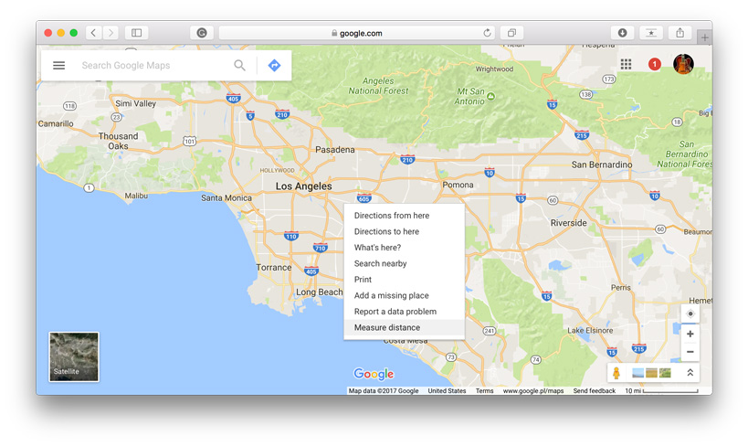
Google Maps is a hell of a tool. Over the years Google created the best web mapping environment one could imagine. It’s not made for geospatial analysis, but some features can make your life easier. One of such tools will let you measure a distance between two or more points, not a driving distance but a straight line between any locations. Here is how to do it:
1. Go to your starting point on the map, right-click and choose Measure distance.
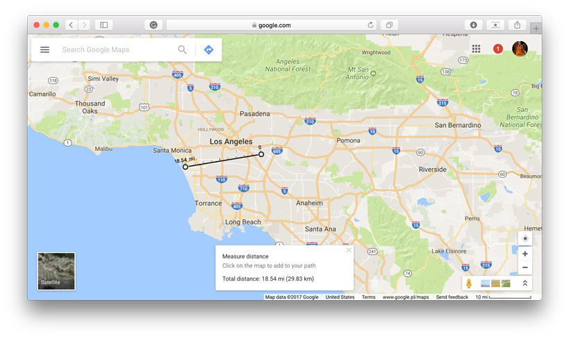
 2. Click anywhere on the map to create a path you want to measure. At the bottom, you’ll find the total in miles (mi) and kilometers (km).
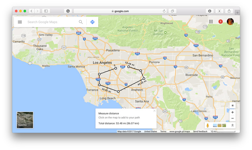
3. You can edit the path by dragging the points.

4. Add other points by clicking anywhere on the map. You’ll get the total distance of the path.
It’s that easy and it works also on iOS and Android.

#GeoDev
Next article

If you had any doubt that there was a clear separation between your offline life and online activities, Facebook’s latest announcement on offline conversions certainly does put it to rest. Facebook has announced that it will allow advertisers to target customers who have visited their stores in person.
![]()
Why is Facebook interested in tracking offline activities?
Why would Facebook be interested in knowing which stores you visited in person? Well, according to Facebook’s post, over 90% of purchases are still made in physical stores and not online. That means Facebook is missing out on charging their advertisers for conversions that don’t happen online.
Assume you saw an ad for the latest iPhone (from Apple) on your Facebook feed and in the next days you actually visited Apple’s store and bought an iPhone. Normally, this sales conversion wouldn’t have been attributed to Facebook, but now with this new location tracking feature, Facebook can actually charge the advertiser for this conversion (a gold mine really!). Offline conversion tracking is the next big revenue source for social media.
Can I opt out?
Well, if you don’t want Facebook (or other social media) to track your offline activity – the easiest way would be to disable location tracking in the app. At the time of writing this blog, I couldn’t find a setting for specifically turning off ads based on “offline location tracking” on Facebook – do let me know if you were able to find it.