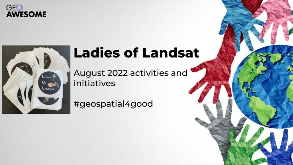

Building a more diverse, inclusive, open and welcoming geospatial industry is all about giving a voice to a more diverse group of geospatial experts and it’s a pleasure to showcase Ladies of Landsat and the all the awesome work they do! Here is the summary of their activities during August 2022.
August 1 – Manuscript Monday feature of Dr. Iryna Dronova & Dr. Sophie Taddeo
.@dronova_iryna & @SophieTaddeo (2022) review opportunities to advance vegetation phenology with remote sensing, including multi-temporal data accessibility, data fusion, and novel technologies in combo with field ecological studies. #LoLManuscriptMonday https://t.co/2pCz7t0qCs pic.twitter.com/2GRuQtbmdC
— Ladies of Landsat (@LadiesOfLandsat) August 1, 2022
August 5 – Co-Director Dr. Morgan Crowley was featured on NASA’s 50 Years, 50 Stories celebrating Landsat’s 50-year legacy
August 8 – Manuscript Monday feature of Dr. Akansha Singh Bansal
.@akansha_asb (2022) proposes new data-driven techniques for better controlling, modeling, and forecasting residential solar power using physical, #machinelearning, and #deeplearning models on #GOES-R data and derived data products. #LoLManuscriptMonday https://t.co/h2252rkLtb pic.twitter.com/SS8JtotmEP
— Ladies of Landsat (@LadiesOfLandsat) August 8, 2022
August 11 – Co-founder and co-director Dr. Kate Fickas spoke at the NASA – USGS Handover event for Landsat 9 in Sioux Falls, USA and interviewed DOI Assistant Secretary Tanya Trujillo as part of her talk.
https://www.usgs.gov/centers/eros/news/event-celebrates-satellites-new-phase-and-landsats-legacy
August 15 – Manuscript Monday feature of Dr. Ana Bastos
.@Ana__Bastos et al. (2020) use data from #ERA5 and #SMOS #SAR to identify asymmetries in vegetation productivity and regional anomalies in carbon and water exchanges due to 2018’s extreme drought and summer heatwave in Europe. #LoLManuscriptMonday https://t.co/8w0pSzN0gh pic.twitter.com/O9lzRitj28
— Ladies of Landsat (@LadiesOfLandsat) August 15, 2022
August 22 – Manuscript Monday feature of Viola H.A. Heinrich
.@vh_trees et al. (2021) use #MapBiomas #Landsat-based #LULC data & the ESA-CCI #ABG product to quantify the influence of environmental & disturbance drivers on tropical secondary forest regrowth in the Brazilian Amazon from 1985-2017. #LoLManuscriptMonday https://t.co/avCOVtQf1k pic.twitter.com/s7XvSxGA06
— Ladies of Landsat (@LadiesOfLandsat) August 22, 2022
August 29 – Manuscript Monday feature of Dr. Anni Yang
.@anniyang0406 et al. (2022) use #iNaturalist citizen science data and #EO data from #Sentinel5P, #MODIS and more in a #RandomForest model to investigate avian species' mortality events related to winter storms and wildfires in 2020. #LoLManuscriptMonday https://t.co/6FNyW4WmEP pic.twitter.com/VnlIvbDQry
— Ladies of Landsat (@LadiesOfLandsat) August 29, 2022
August 30 – Dr. Kate Fickas, Dr. Flávia de Souza Mendes, Dr. Crista Straub and Maureen Duane organized a social networking event at ForestSAT 2022 with support from UP42, GeoChicas OSM, Sisters of SAR, Dames of Drones, and Women of WaveForms.
https://www.eventbrite.com/e/after-hours-forestsat-social-ladies-of-landsat-and-up42-tickets-396905574257
Overview Ladies of Landsat:
Ladies of Landsat is a supportive and intersectional organization for underrepresented remote sensing scientists. It was founded in 2018 by Dr. Kate Fickas and joined soon after by co-director Dr. Morgan Crowley and lead-organizers Dr. Flávia de Souza Mendes and Dr. Meghan Halabisky. Ladies of Landsat aims to lift up, retain and attract underrepresented scientists to Earth observation sciences through our many outreach activities and networking events!
- USGS Video: https://www.youtube.com/watch?v=hlZWnGBeois
- Manuscript Monday database: https://github.com/ladiesoflandsat/LOLManuscriptMonday/blob/main/README.md


#People


Next article

Editor’s note: This article written by Kaz Smith is part of the “Young and Geoawesome” series. The series aims to encourage young professionals to share their passion for all things geo and thereby build a more diverse, inclusive and welcoming geospatial community.
Kaz Smith, New Zealand
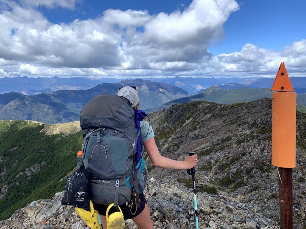
March 2021. I was somewhere in the South Island of New Zealand, 4 months into my 5-month Te Araroa thru hike. Every step I took in the icy cold river that morning sent shivers up my spine. My feet were numb and my boots were heavier than bricks. It was early in the day though, and we had a long way to go until the next hut, let alone the next town.
“Take the river route!” They said. “It’s much easier than the trail!” They said.
What liars.
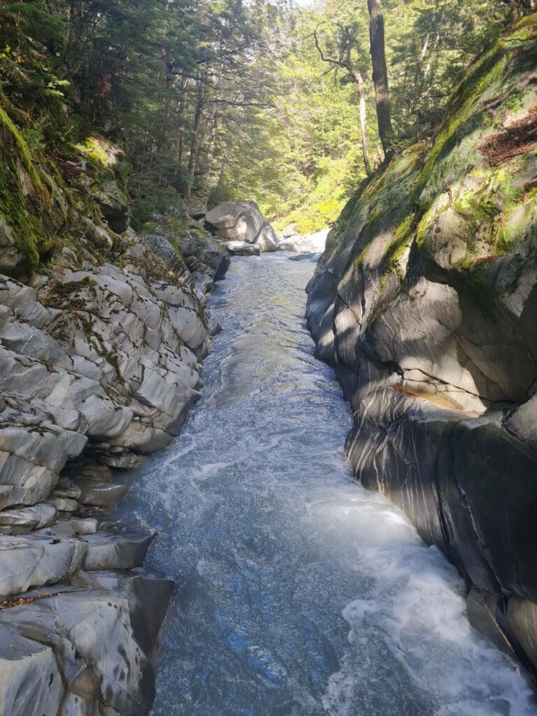
Numerous other hikers advised us to take the unmarked river route, so we naively took their advice. After 2 hours of wandering through the river with my partner, I slowly began to realize that this “river route” was getting trickier and trickier. We started throwing our hiking poles ahead of us and using our hands and knees to slide down boulders, landing in waist-deep pools of water. I pulled up the map on my phone to check how far we had gone. Only 3 kilometres, as the crow flies. Surely the trail couldn’t have been worse than this, even with the elevation gain. But we had come too far to turn back, so we just kept walking down the river, one icy step at a time.
Not long after checking the map, we came to a gorge. Walls of rock on either side of the river towered over us. Below us, a small waterfall fed into a deep rock pool. I had a sinking feeling in my chest – we would either need to swim, or boulder our way across the rock face.
My partner went across first. With his big backpack and wet shoes, he made his way across the rock face. Easy! He landed on the riverbank looking proud of himself.
I shouted over the roaring waterfall, “Do you think I can do it?!”
His response: “If you think you can do it, then yes!”
Well, I didn’t really have an option, did I? I wasn’t going to turn around and try to find the actual trail by myself. The rock climb was dodgy, and there was a chance of falling in the water, but it wasn’t dangerous. I thought good vibes only and pulled out some fake confidence.
I threw my hiking poles across to my partner so I could use my hands. The first few steps across the rocks were easy. There were convenient foot holds and some rocks to hold onto. My feet were numb from spending all morning in the river, and my boots were wet. The heavy pack was putting off my centre of gravity. One moment, I was optimistically bouldering my way across the rock face. The next, I was fully submerged in the river, head under water, pack under water, fully clothed.
My pack, although heavy, had enough air inside of it to act as a life jacket, and I quickly bounced back to the surface and gasped for air. The rushing river pushed me to the riverbank, where my partner pulled me up and frantically made sure I was ok.
As I sat on the riverbank shivering and crying from shock, I had a seemingly more and more common thought pass through my head – why the hell am I doing this.
And why didn’t we just follow the map.
In the middle of the pandemic in 2020, my partner and I decided to quit our jobs and hike the length of New Zealand on a 3000 km trail called Te Araroa. I had been working in the GIS industry for 2 years when I decided it was time for a change, time to get out of the office and challenge myself, and what better time to do this than when the borders were closed and there were no tourists in the country. Although I left the geospatial industry for this adventure, it turns out geospatial never left me.
I accidentally discovered GIS when I was at University in the United States pursuing my Environmental Science degree. Part of the degree requirements was to take 1 GIS course, and I ended up really enjoying the class and completing a full GIS qualification alongside my degree. After University, I moved to New Zealand where I started my geospatial career.
Something that has always fascinated me about GIS is its many use cases. It’s relevant across all industries, from conservation to marketing to utilities. And as it turns out, it’s also extremely applicable for 5-month-long thru hikes.
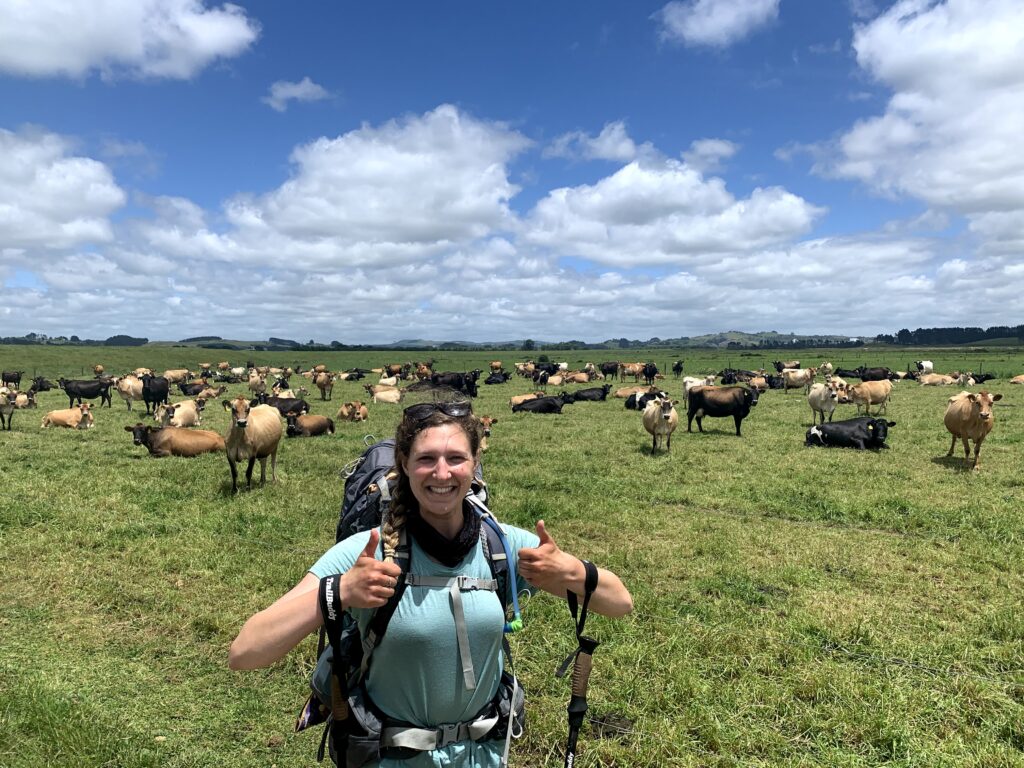
While walking Te Araroa, we were heavily reliant on maps for navigation, and these were mostly in the form of mobile apps. There were many days on the trail where we were completely reliant on our GPS maps, like when we walked through Waikato farmland for 8 days with no clear trail and rarely any trail markers. We would check our maps frequently to make sure we didn’t miss a turn or walk through the wrong paddock with an angry bull.
Other times, like in the remote Richmond Ranges, the trail was so well marked and clear that we probably didn’t even need a map for navigation. But our mapping apps provided more than just navigation; we would use the maps to plan each section of the hike. The Richmond Ranges section can take 9-11 days to complete, with no towns in between, so we needed the maps to roughly plan out each day. Factors such as the weather, estimated walking times, and huts were all taken into consideration to confirm the most important thing: food. We had to pack enough food to get us through, but also be conscious of our pack weight.
Since we had never walked any of the trail before, we didn’t know what to expect each day. But being able to visually see where we were going on a map was invaluable to our comfort and confidence throughout the hike, even if we did decide to ignore the map a few times and take the river route…
We met a lot of other hikers along the way, many of whom were not from New Zealand or didn’t speak English as their first language. Most people weren’t that confident with their navigation and spatial awareness – yet all of them got from Point A to Point B every day. Even people without geospatial backgrounds still use GIS in their day to day lives whether they know it or not.
My experience on Te Araroa made me aware of the lack of confidence many people have around navigation and spatial awareness. Using Google Maps for directions to a friend’s place, or using Uber to get a ride into the city are both common examples that most people in the world are familiar with. So when people on the hike would tell me “Oh, I’m not good with directions” or “I can’t read a map”, I would try to bring some confidence to them by simplifying all of the geospatial capabilities around us.
The ability to clearly explain and share GIS with the world can often be swept under the rug, but it is a valuable skill that we should promote and applaud in the geospatial community.
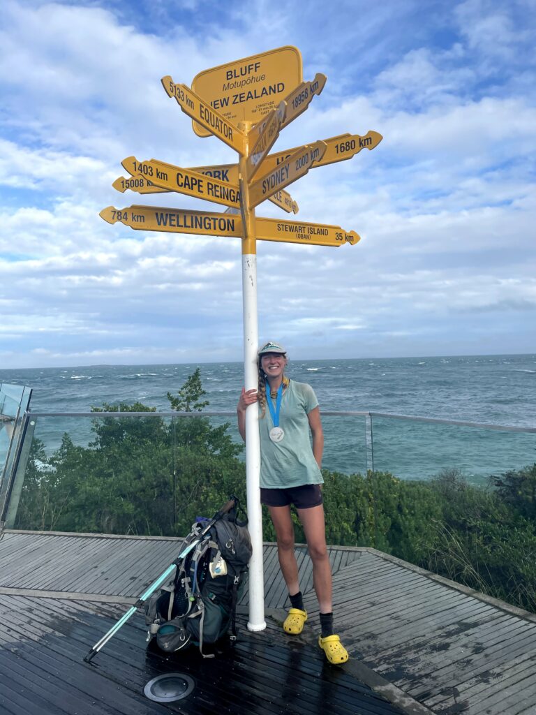
One of the most rewarding parts of Te Araroa was being able to look at the map every night and see how far we had walked, how much ground we had covered, getting closer to our end goal literally one step at a time. And although some days, like the day I fell in the waterfall, were challenging, cold, muddy, and exhausting, there was no better feeling than seeing that signpost at the bottom of the South Island and knowing I walked there.
I did it. We did it.
And we honestly couldn’t have done it without GIS to guide us.
Going back into the ‘real world’ after Te Araroa lead me straight back into GIS consulting, but with a new emphasis on usability and practicality so that anyone in the world can access GIS technology with no prior knowledge. If you are part of the geospatial community, I encourage you to engage with people outside of this community and bring awareness to the geospatial capabilities we all use every day.
Kia tupato kia pai to hikoi
Me te titiro whanui, kia koa
Kinga taonga kei mua i a koe
Walk the path in safety
Look deeply and learn
From your surroundings