
This is going to be a long one so get comfortable and maybe get yourself a coffee/tea before you get started. The past couple of months have been rather eventful for us at Geoawesomeness with the launch of our new logo, website and the very 1st time we were mentioned in a press release (for the launch of our EO hub together with UP42). We couldn’t be more happy with where we are after 11 years of Geoawesomeness! But did we always know that we will get here eventually?
A few facts about blogging
To be perfectly honest, if you would have asked us back in April 2011, if we would be here where we are today, think the answer would have been no. And before you roll your eyes at the “fake humility”, here are a few facts about blogging that helps put things in perspective (source: bloggerspassion.com).
- Over 600 million blogs, out of over 1.9 billion websites.
- Over 3 million blog posts are published per day.
- over 70 million blog posts are published each month on WordPress platform.
- In comparison, geoawesomeness has published a grand total of 2251 posts.
The reason that Geoawesomeness has survived the test of time isn’t due to total number of posts or the average length of our posts or the zillion other metrics that one can read about blogging and how to get your blog to be the best in the world. The metric that makes Geoawesomeness unique is the number of contributors!
300+ contributors that help shape Geoawesomeness
332 is the actual number of contributors who have either written blogs, articles, reports or have created video content for our YouTube channel or spoken at one of our IRL meet-ups in Munich, Germany or have shared the podcasts they have created on our podcasts site or helped rank the Global Top 100 Geospatial companies. This isn’t even counting all the wonderful people who constantly send us the latest news articles, feedback and the like.
Granted, Aleks and Muthu are the two earthlings whose names are usually associated with the platform as co-founders of the initiative but it is definitely these 300+ contributors who have shaped Geoawesomeness to be what it is today – a global and open platform for all things geo!
11 years and 332 contributors are not bad numbers at all but if we are going to achieve our vision of building the world’s best geospatial platform then we are going to have to do a lot better.
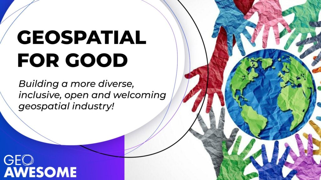
Building a more diverse, inclusive, open and welcoming geospatial industry
It took a while to get for us to get to the main message here, didn’t it 😉 Nevertheless, this is an important message – the geospatial industry as a whole needs to do a better job at being more diverse, inclusive, open and welcoming. Sure, this isn’t a challenge unique to the geospatial industry but this is a challenge we can tackle together.
Climate change and the challenges that it brings along with it aren’t going to be solved without geospatial. The impact of decisions that we as a society make and will make to tackle this existential threat will be felt all across the planet. These decisions are going to be made on the basis of inputs people and organisations prepare using geospatial data and tools. A closed-minded geospatial industry has the potential to result in closed-minded planetary decisions that create further divisions and friction in the society. This isn’t a gender or racial and ethnicity issue alone. This certainly isn’t about “saying the political right things just because”. Diversity actually makes financial sense and makes sense when it comes to tackling biggest challenge of our lives as well. This is about empowering the best minds on this planet regardless of the personal identities of the person, including but not limited to race, gender, ability, sexuality, beliefs, culture, age, and body type.
When a soap dispenser doesn’t work for everyone that is a nuisance, an inconvenience, a sign of lack of diversity in the company that designed the product in the first place but imagine if the geospatial tools that are designed for making policy decisions and tackling climate change are similarly broken. Let’s best not imagine such a world.
https://twitter.com/nke_ise/status/897756900753891328?s=20&t=-GkfiEF4aEJYghX7D30Lzg
How do we even get started?
Highlighting the problem is just one part of the job. To truly build a more diverse, inclusive, open and welcoming geospatial industry, we are going to have to do a lot more. We’ve clearly established that there is a lot to do and if we are being honest, the challenge does sound daunting. Is it even possible to tackle something as systematic and ingrained as the diversity and inclusion in one blog? This is where Ed Freyfogle and/or Bill Gates come in with their words of wisdom (not sure who said it first). This is where the experience of working with 300+ contributors comes in handy.
“Most people overestimate what they can do in one year and underestimate what they can do in ten years”
The best way we as Geoawesomeness can help build an inclusive and welcoming geospatial industry is by building a more diverse and open geospatial community platform. A platform where we actively try to highlight diverse voices from all over the planet.
The promise of Geoawesomeness
Community.
Planet.
Purpose.
We see ourselves as a community platform that is energized by the purpose of leaving a positive impact on the planet. For years now, we have used whatever advertising revenue we’ve generated not just to keep the platform active but also to give back to geospatial – through donations to humanitarian activities and directly supporting members of the community to attend conferences and such.
We strive to be a force for positive change.
This now includes a renewed and active focus on being a more diverse, inclusive, open and welcoming geospatial platform.
In simple terms this means that we are going to do a better job at inviting more people from all over the world to share their opinion and expertise about all things geo – regardless of the whether they chose to do it on Geoawesomeness or elsewhere.
That’s the promise of Geoawesomeness.
We need your support. We need you to be our active partners on this journey. If you are interested in contributing or know someone who might be interested in contributing or have ideas/suggestions/hints on how we should be going about this in a professional way, do reach out to us. Fastest way would be to send an email to either info@geoawesomeness.com or muthu@geoawesomeness.com
Even the simplest of suggestions help. It can be as simple as helping us understand that there is an awesome alternative to saying “hey guys”
Fews weeks ago, we were discussing this with our friends from @SistersofSAR and @LadiesOfLandsat and a quick @DuckDuckGo search provided the answer y'all!
P.S: Love the fact that y'all sounds like something a character from Looney Tunes would say 😉https://t.co/C6BllUqCIC
— Geoawesomeness (@geoawesomeness) June 2, 2022
Let’s build the future together!
Sisters of SAR and Ladies of Landsat: Promoting geospatial awesomeness of women all over the world
And in the spirit of togetherness, delighted to highlight the efforts of two amazing initiatives in the geospatial industry that have/are doing a lot for diversity and inclusiveness.
Ladies of Landsat: mission, vision and all the fun things they do
Sisters of SAR: mission, vision and all the fun things they do


#Ideas

Next article


Over the years we’ve shared with you hundreds of amazing maps featuring them on the website and as #GeoawesomeMapOfTheDay on our social media channels. We’ve decided to select 20 most stunning maps we’ve ever shared or wrote about. It was a difficult choice and we would like to add to the list maps that we’ve missed, so please share them in comments.
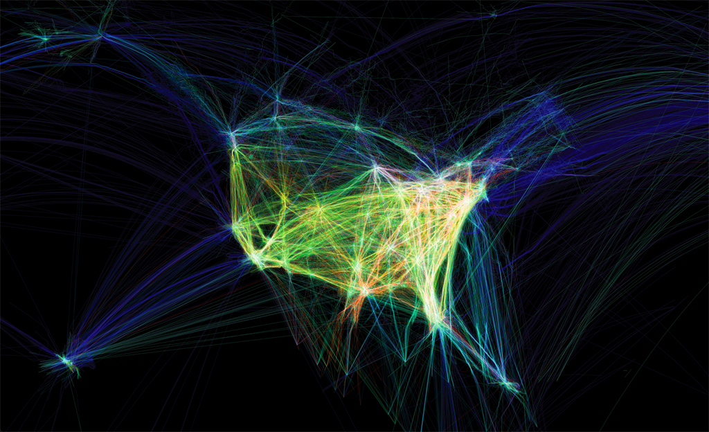
1. Global Internet Map
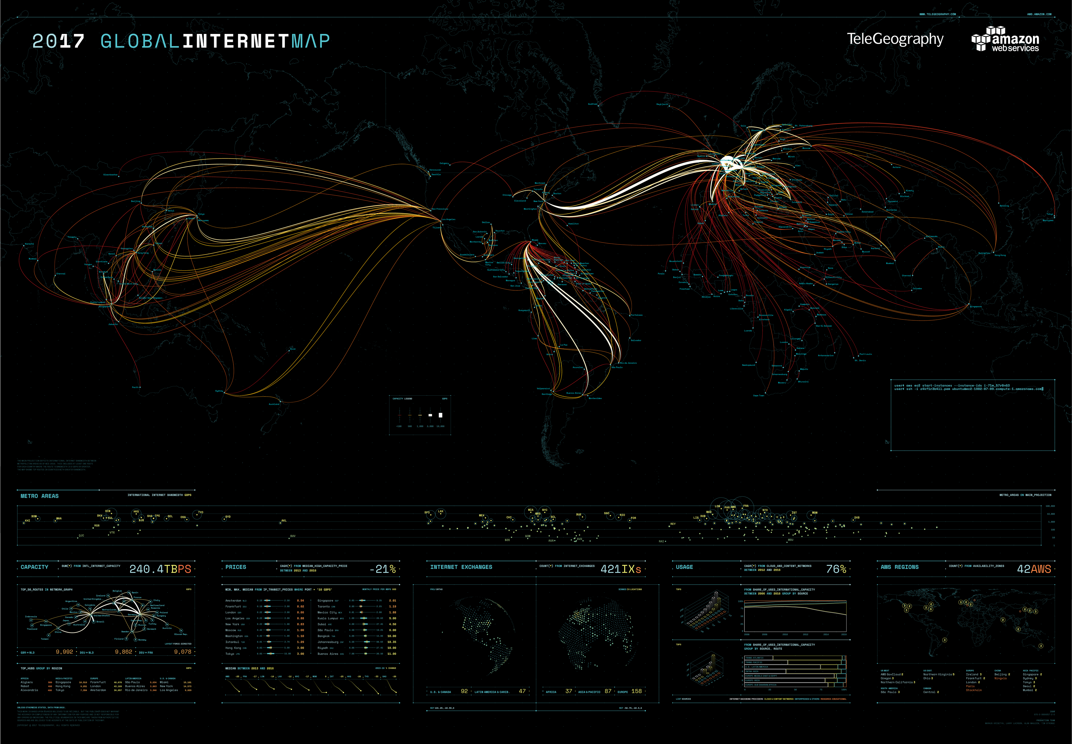 source: TeleGeography
2. Map of all hurricanes and tropical storms since 1851
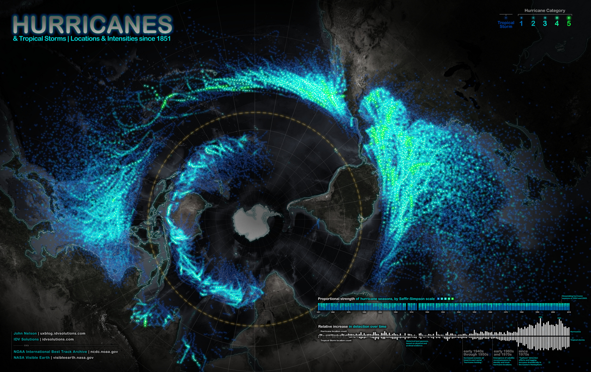
source: IDV Solutions
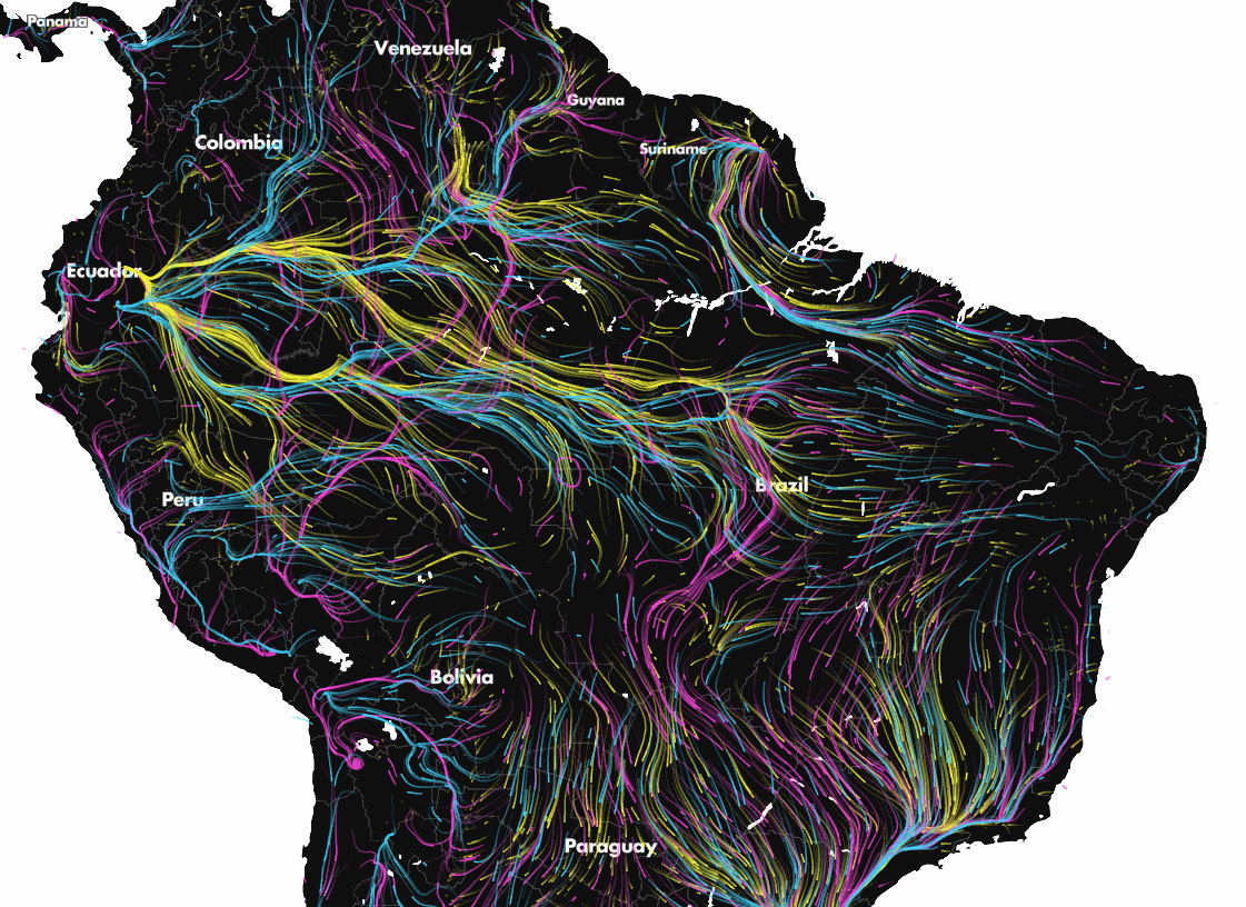
3. Map of rivers
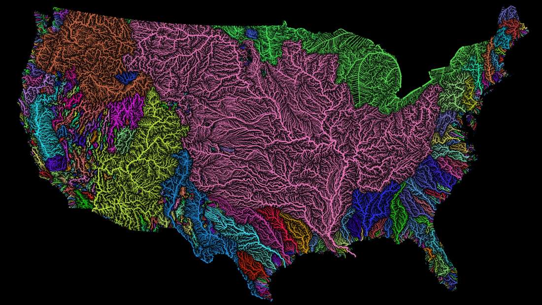
source: Geoawesomeness
4. Each and every road in Australia
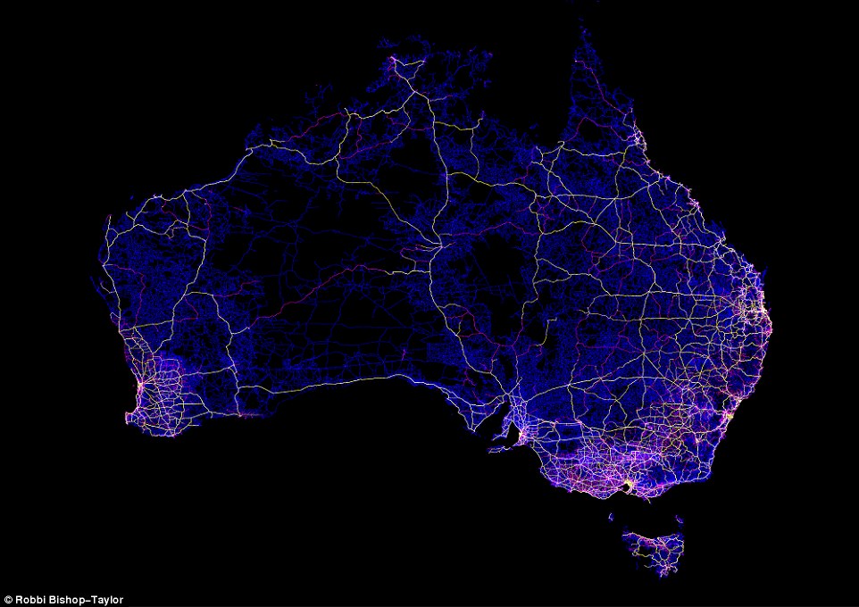
source: Robbi Bishop-Taylor
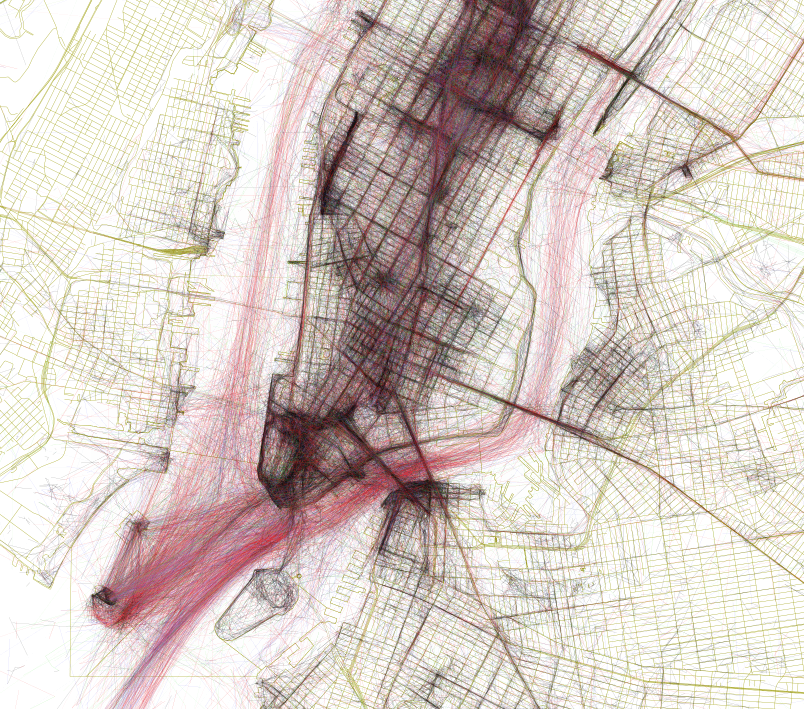
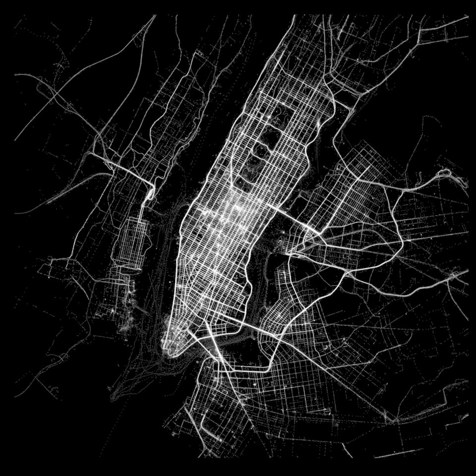
5. Map of shadows in NYC
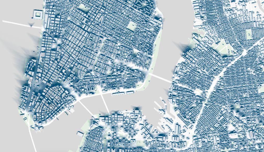
source: New York Times
6. How animals will have to migrate because of the climate change
source: The Nature Conservancy
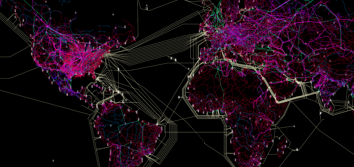
7. Map of air traffic network
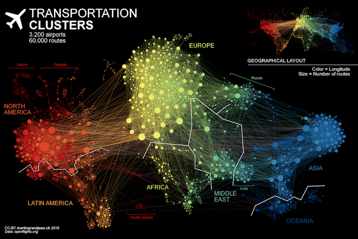
source: Martin Grandjean
8. What is located on the other side of the ocean
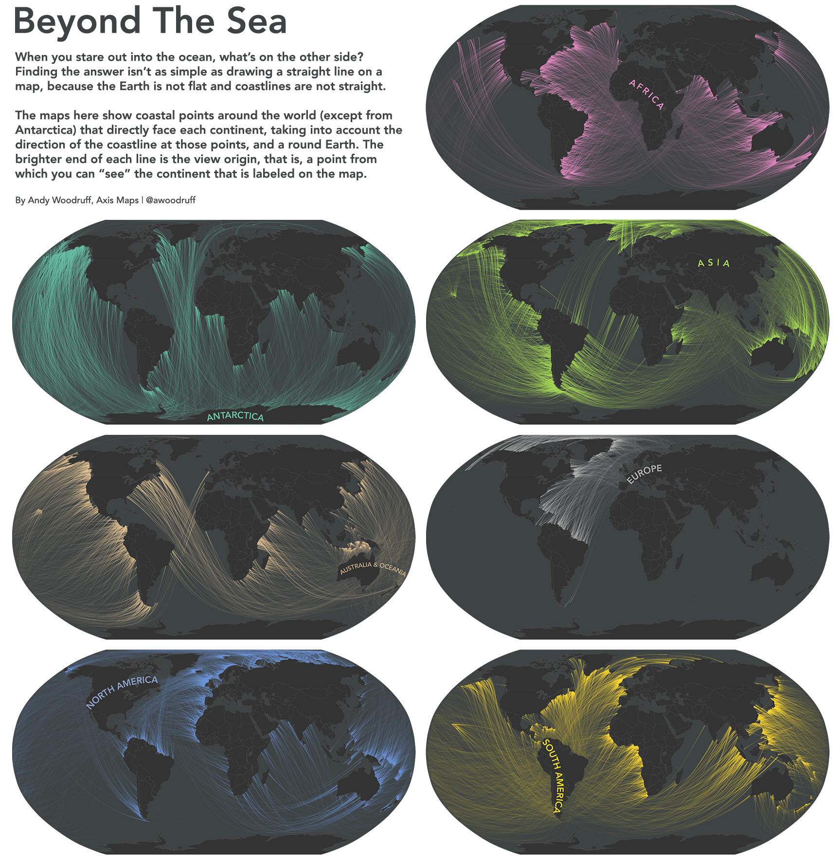
source: Axis Maps
9. Connectivity Atlas
source: Connectivity Atlas
10. Elevation model of the Willamette River Valley
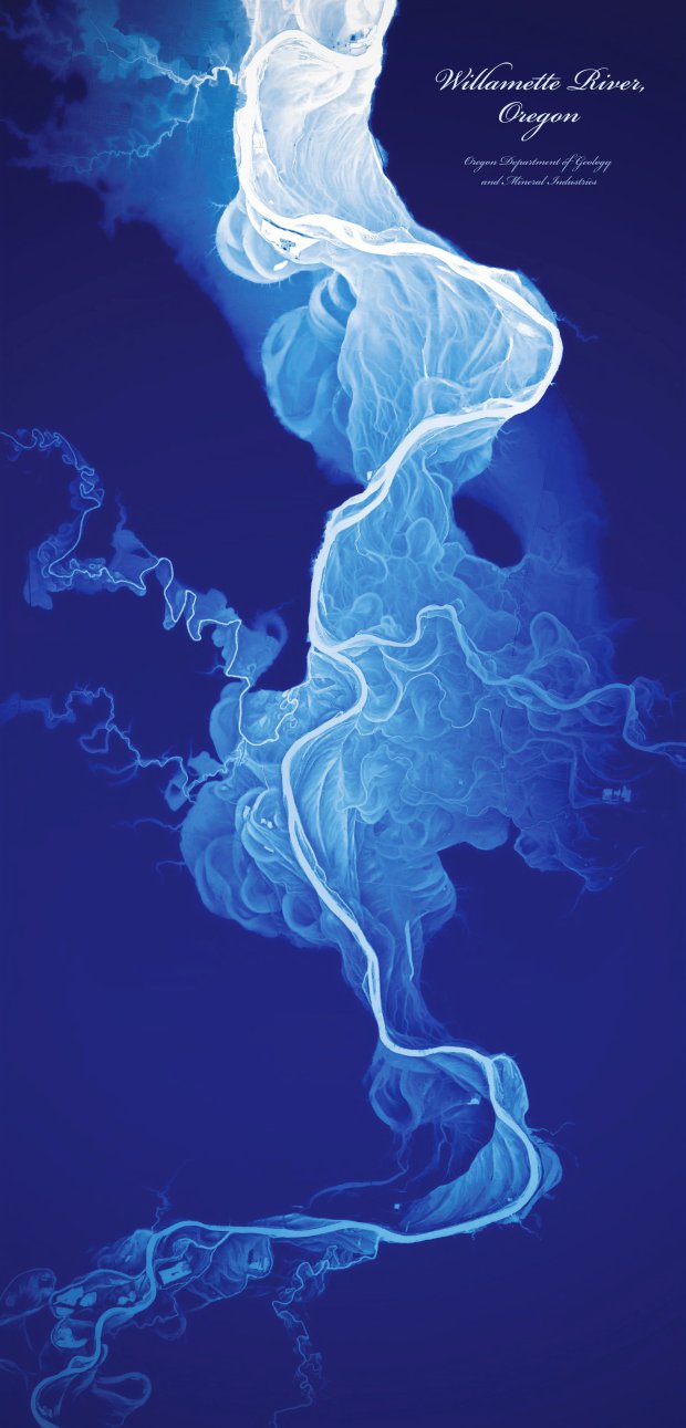
source: Dan Coe
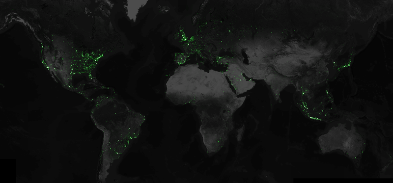
11. The map shows locations of all Flickr photos from last 10 years
source: Mapbox
12. Maps Made Of Food
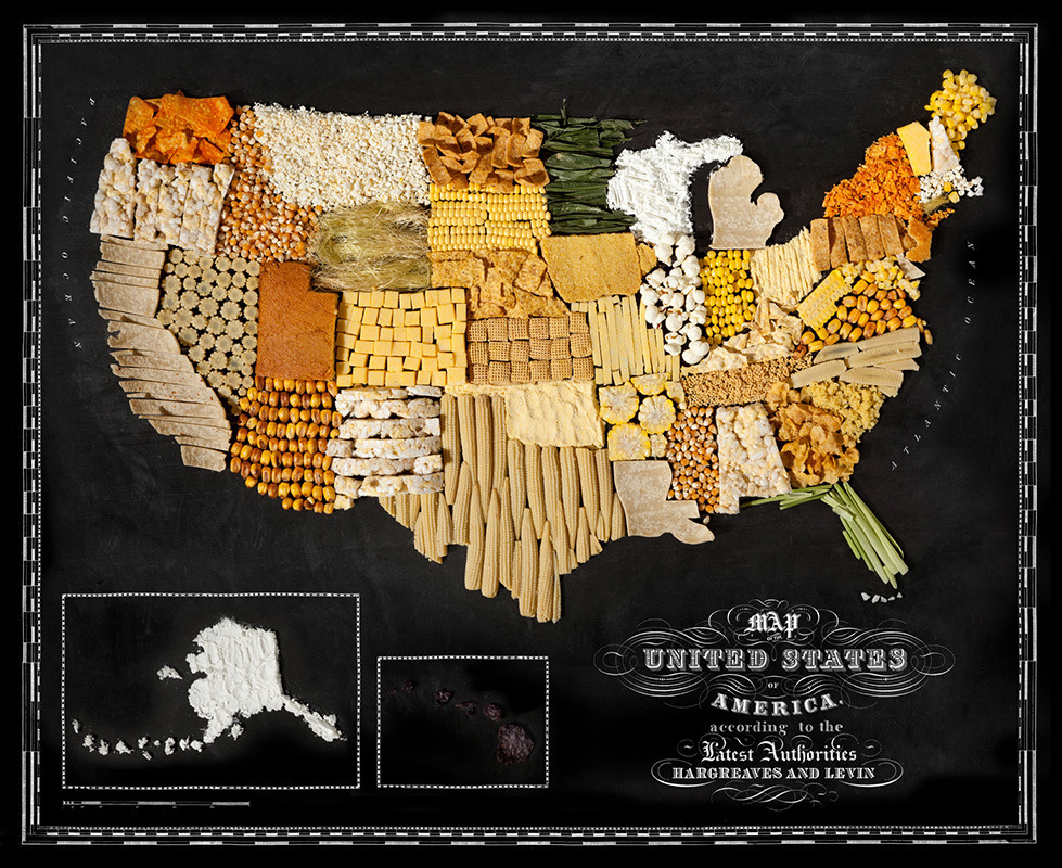
source: Geoawesomeness
13. Submarine Cable Map
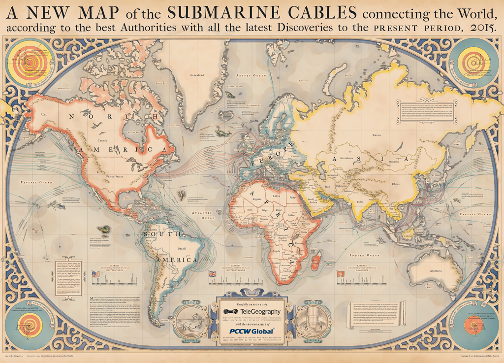
source: TeleGeography
14. Map of flight patterns
source: Aaron Koblin
15. Mapping Facebook connections
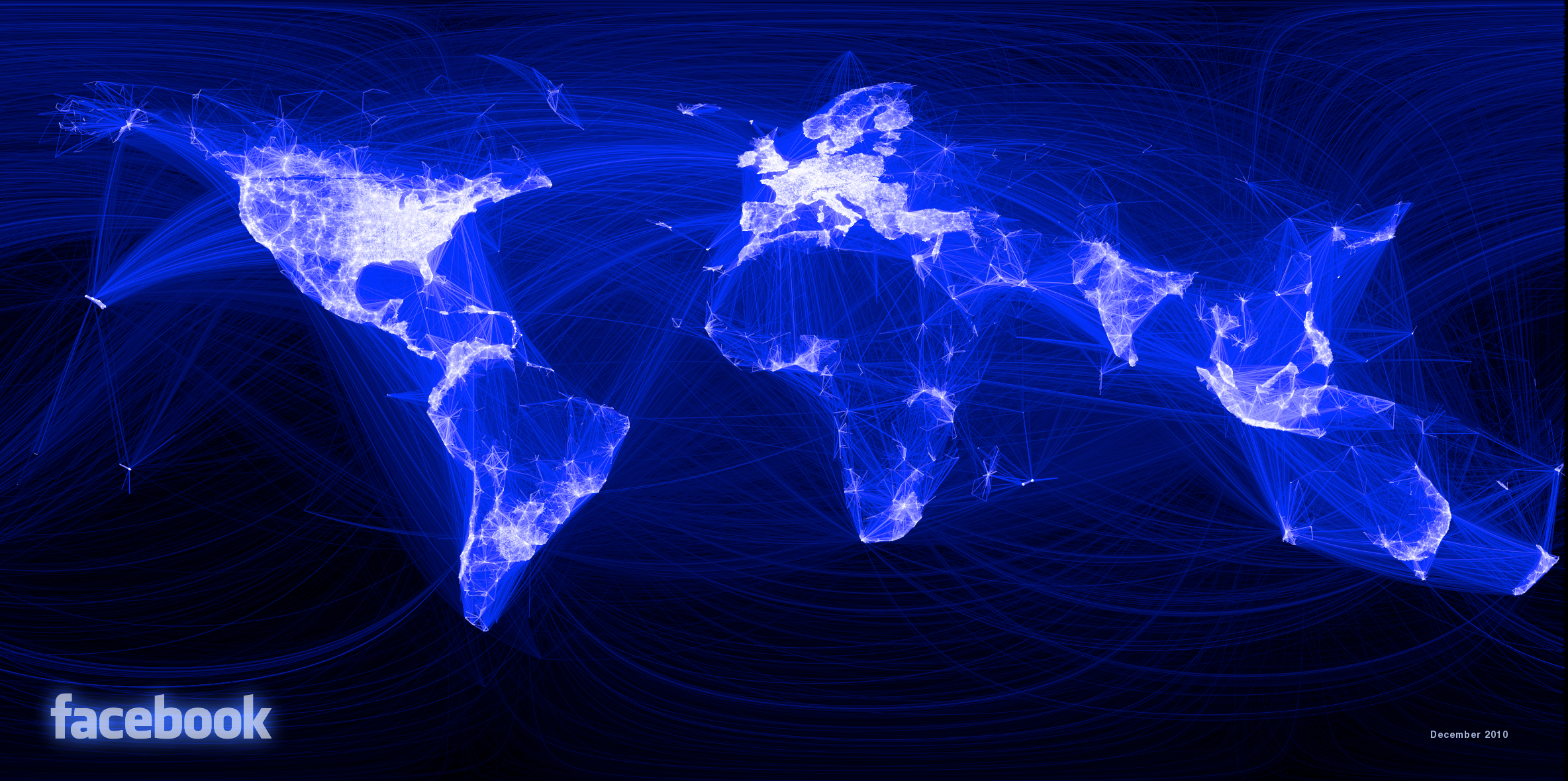
source: Facebook
16. Map of all earthquakes by magnitude since 1898
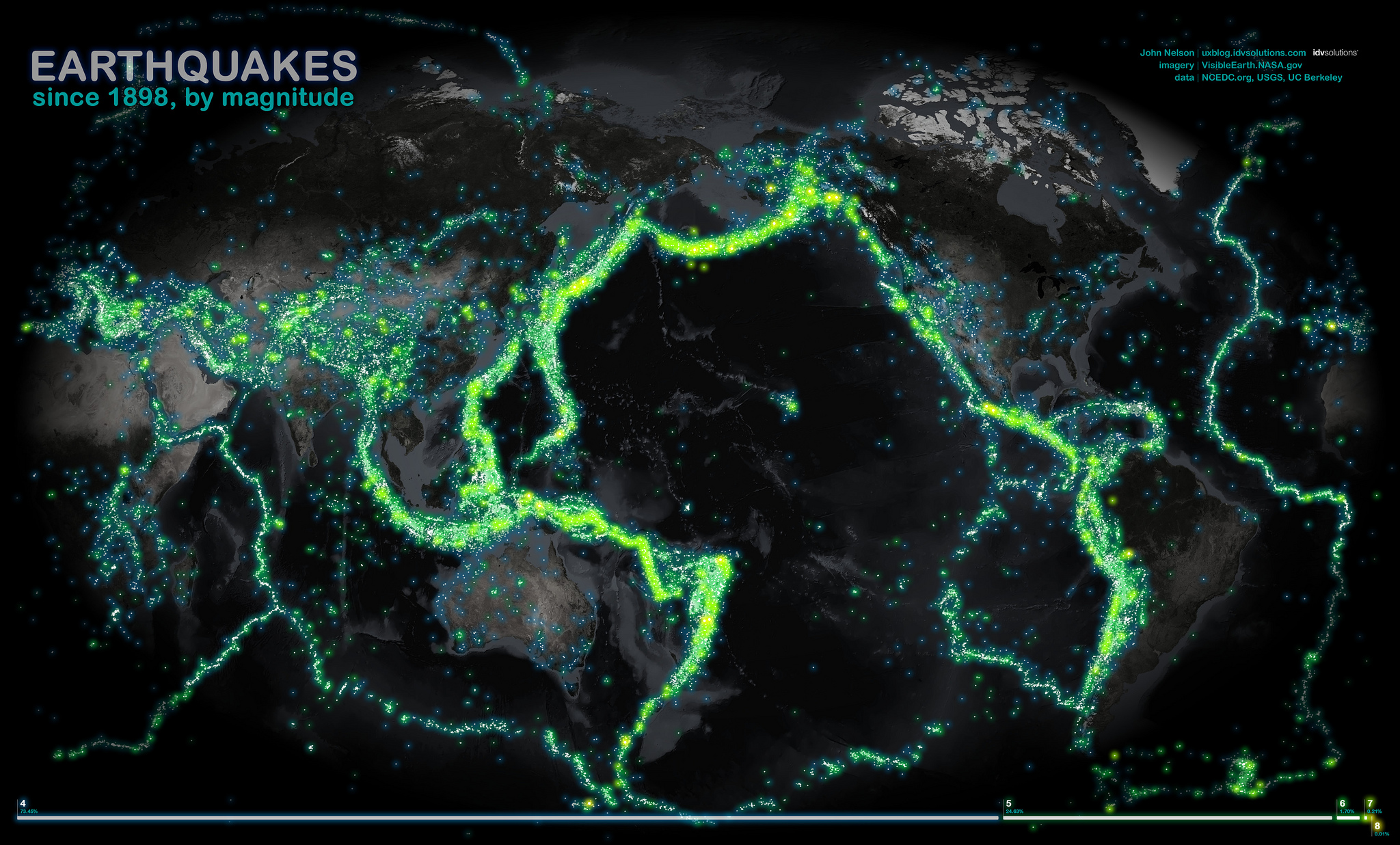
source: IDV Solutions
17. Nighttime Map of Earth
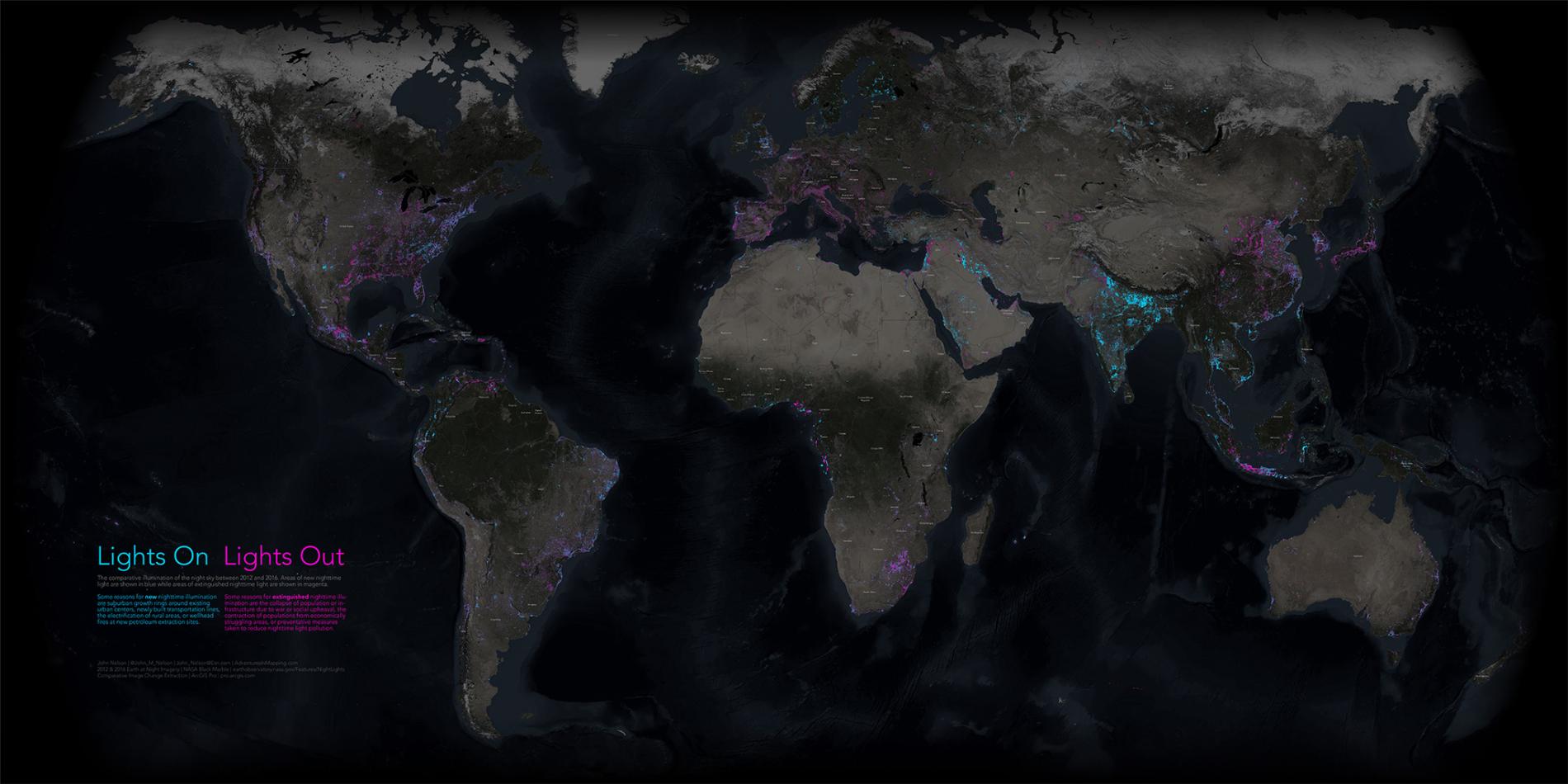
Source: National Geographic
18. Tracks of motorized transport tracked by Human app
source: Human
19. Map of 6.3 billion geotagged tweets
source: Mapbox
20. Wind map
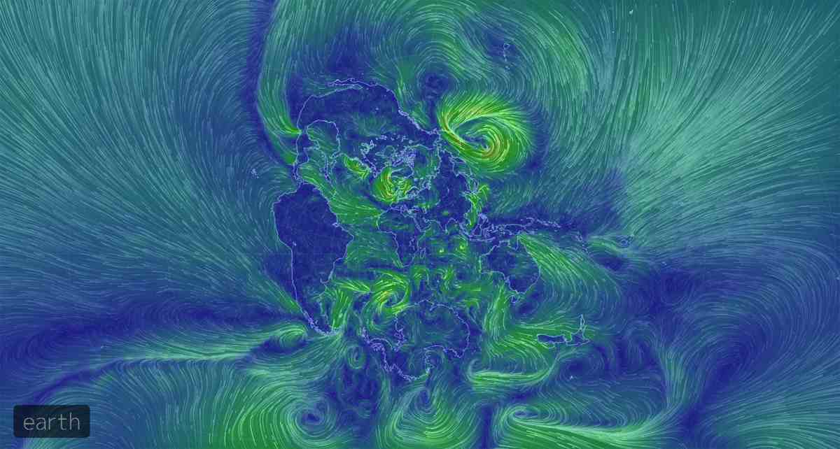
source: Earth