
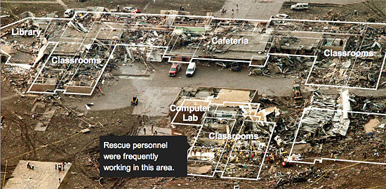
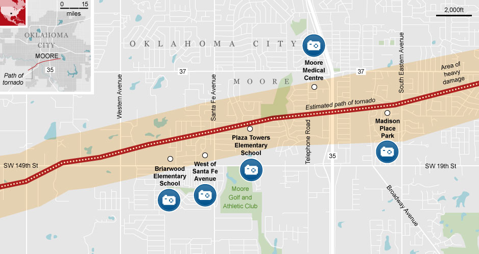
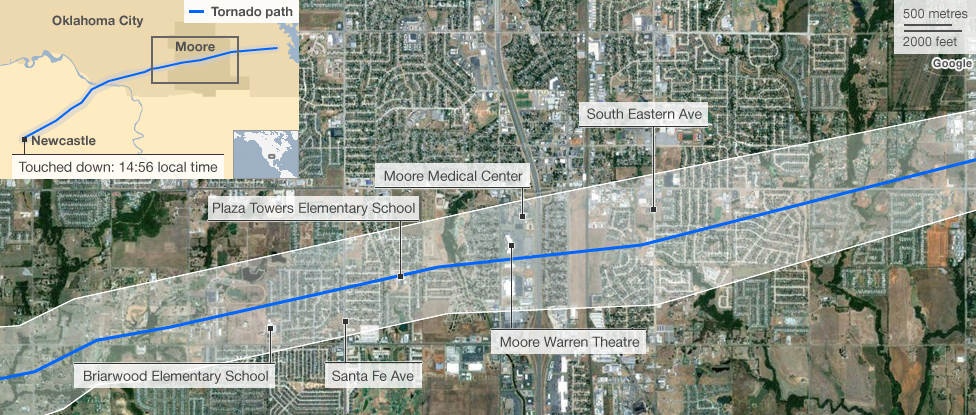
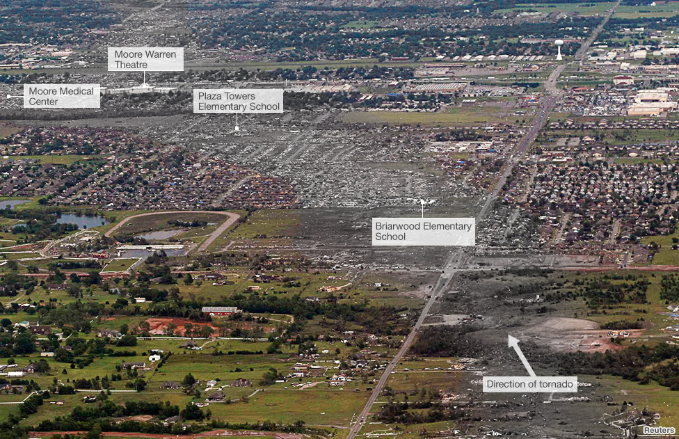
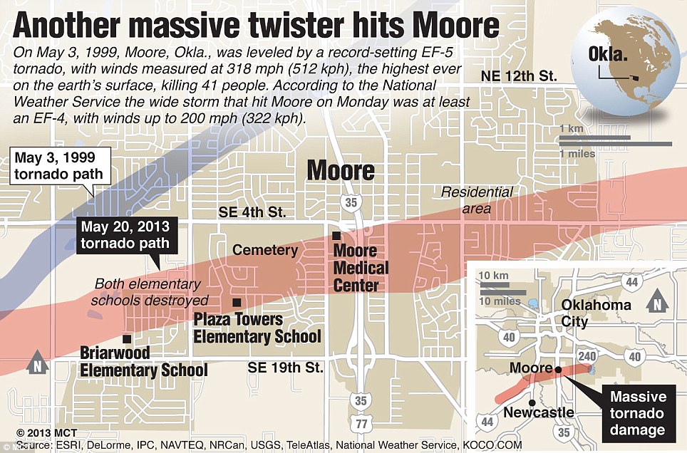
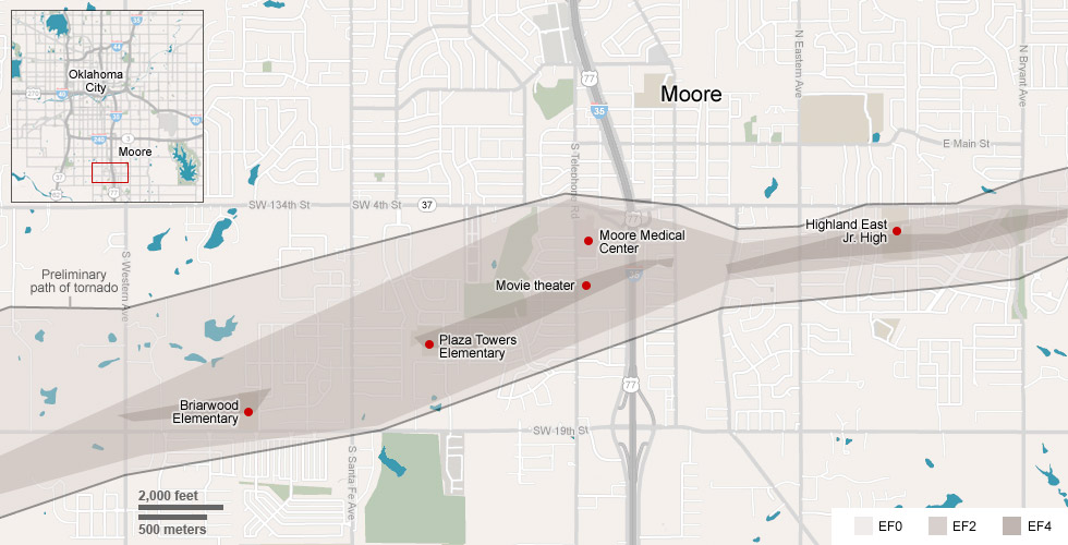
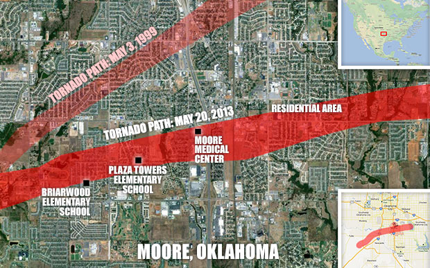
On May 20, 2013, a massive tornado swept through the area of Moore, Oklahoma, killing 24 people and left swathes of the suburb of Moore in ruins. In a few hours media around the world mapped the track of the tornado in many different ways. During catastrophic emergency situations like this mapping is one of the basic steps to effectively manage resources to save lives of victims and simultaneously to show people around the world the scale of the disaster.
Here are a few examples:
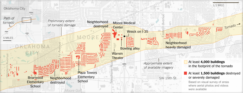
BBC:
ESRI:
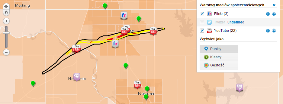
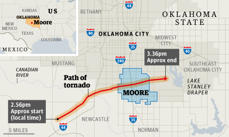
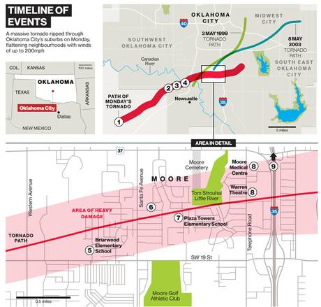
CNN:

#Featured


Next article

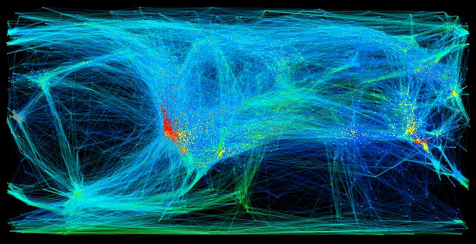
People are familiar with graphs, which illustrate mathematical or statistical data. The interaction designer and information architect Manuel Lima is focusing on the visualisation of information that can be geographic or non-spatial. In the latter case he proofs that actually any kind of information can be mapped and become ‘spatial’. Illustrating information generally helps the observer to understand the content as we automatically organise what we see – e.g. the viewer perceives clusters, distances, shapes, etc.
Manuel Lima is founder of the project visual complexity – a visual exploration on mapping complex information. It comprises more than 700 single works that aim to visualise information assigned to different categories ranging from biology to music. Some of the works as for example transport networks represent classical ways of mapping, while other projects visualise abstract data (Writing Without Words, Health Infoscape, etc.). At the bottom you find a selection of the projects. All projects have one further thing in common: they show that geography is art.
The World of Music: This visualization shows 9,276 artists and how they are related to each other. The artist relation data is mined from user ratings of artists in the Yahoo! Music service.
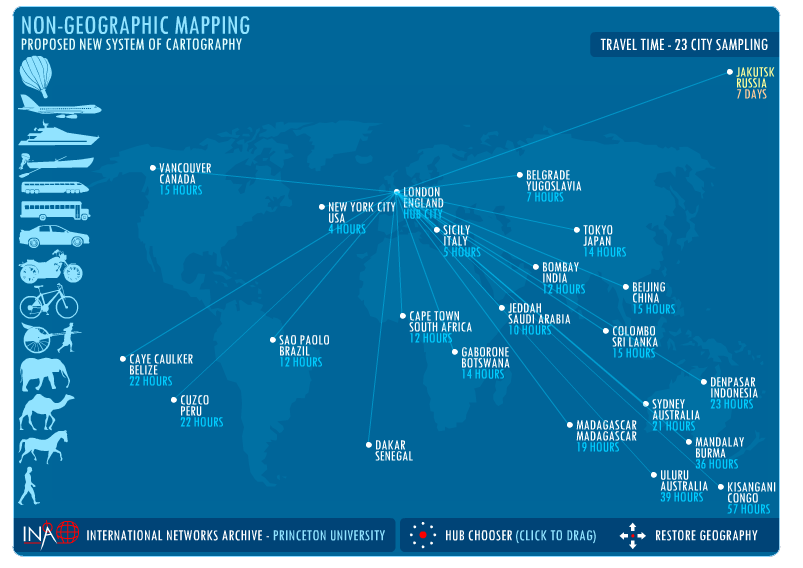
There is the opinion that in a globalised world geography is becoming increasingly irrelevant, and that there should be a new system of mapping, based on global transactions instead of geography. This map is an exploration into this theory, and reconfigures 23 world cities based on travel time between the cities instead of distance. By clicking on different cities, the other world cities will slide to reflect their travel time from the chosen hub. The icons along the left of the window represent the various means of transport, and the time cost of each, in travelling between the hub and the highlighted city.
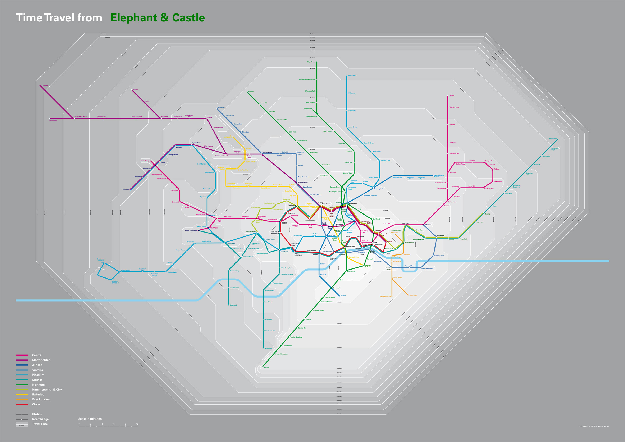
The map visualises the time scale in minutes that is needed to reach London locations from the underground station Elephant & Castle.
Source:
Manuel Lima: https://web.archive.org/web/20191222181453/http://www.mslima.com:80/myhome.cfm
Visual Complexits: https://web.archive.org/web/20240206132637/http://www.visualcomplexity.com/vc/