
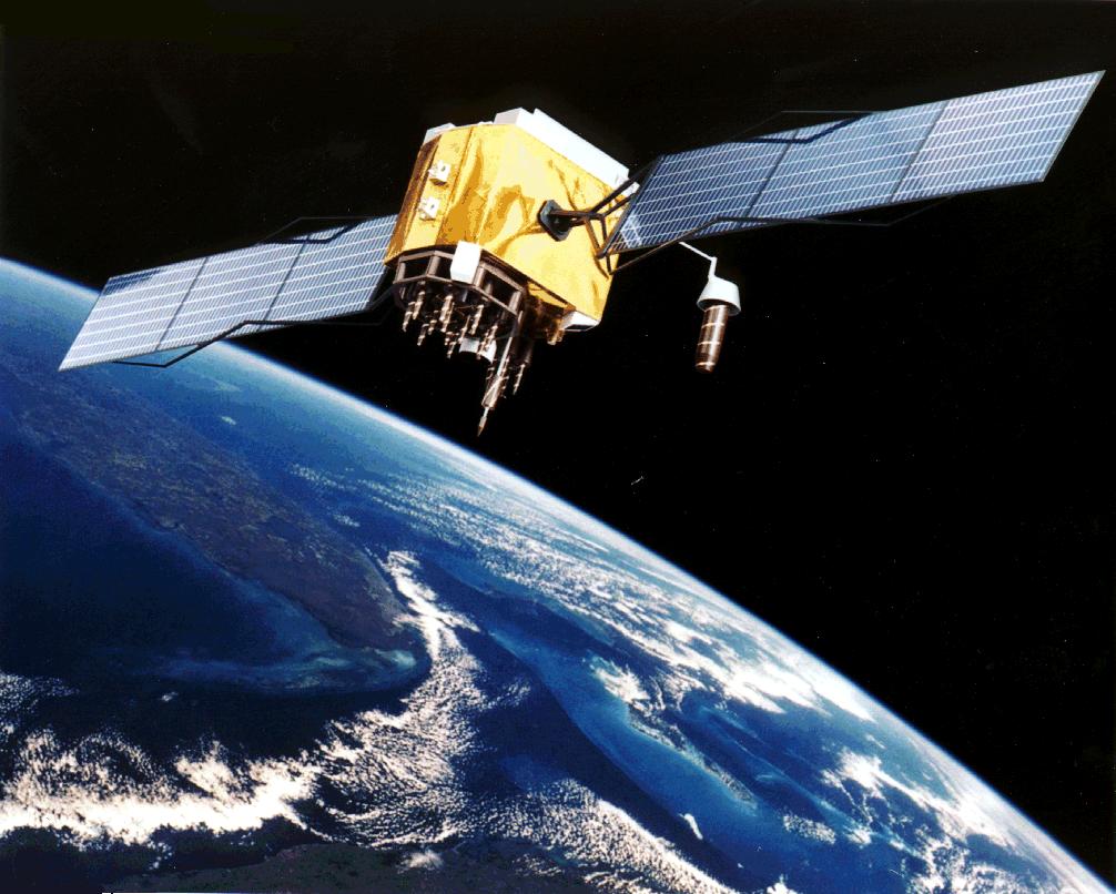
The navigation apps we carry around in our smartphones may have made getting lost in foreign lands a distant memory, but our dependency on the Global Positioning System (GPS) runs far deeper than we realize.
GPS satellites, owned by the United States government, carry onboard the atomic clocks that maintain the time standard followed by the world – Coordinated Universal Time (UTC). And accurate timestamps are crucial for the smooth functioning of everything from electric power grids to high-speed financial transactions where each millisecond translates into millions. Even the Internet service you are using to access this blog relies on precise GPS timestamps to route data, as do all digital communication systems.
So, if the GPS were to fail, the ramifications would not be limited to airborne flights and the ships at sea finding themselves isolated from the rest of the world. Armies would lose all control over drones monitoring natural disasters or surveilling terrorist outfits. Weather forecasts would be totally off and digital television and radio will not be able to continue transmission. Essentially, a total collapse of GPS could wreak havoc on a large number of systems intrinsic to the smooth functioning of our lives.
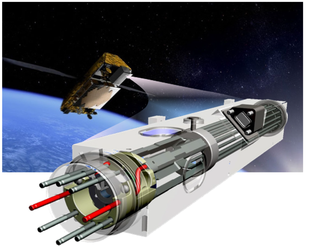
Deep space atomic clock
Last time when GPS failed…
In January 2016, when the US Air Force decommissioned a GPS satellite, an incorrect timestamp was uploaded to other functioning satellites. Their clocks recorded a discrepancy of 13 microseconds – or 13 millionths of a second. The error may seem minuscule in writing, but the ensuing chaos lasted for over 12 hours across the world.
Reports from several parts of the United States and Canada said police, fire, and radio equipment was not functioning, and anomalies were detected in power grids. What’s even more mind-blowing is that the slip resulted in BBC digital radio going kaput for two whole days!
At least the error was unintentional, right? Right. But today, the problem of intentional GPS disruption is becoming more and more widespread.
In 2009, GPS interference was detected around Newark airport, compromising the air traffic controllers’ ability to receive precise location information about airplanes. An investigation revealed that the disruption was caused by a truck driver who was using an illegal GPS jamming device so his employer couldn’t track his whereabouts. A similar device used at a wrong place could affect maritime navigation as well.
And let’s not forget nature. In 1859, the world witnessed a solar storm so strong that if it were to take place today, it would knock out all satellites orbiting our planet. Known as the Carrington Event, after the name of the astronomer who discovered it, this superstorm was powerful enough to cause severe geomagnetic disturbances on Earth and send telegraph systems into a tizzy. NASA even reports, “Just before dawn… skies all over planet Earth erupted in red, green, and purple auroras so brilliant that newspapers could be read as easily as in daylight. Indeed, stunning auroras pulsated even at near tropical latitudes over Cuba, the Bahamas, Jamaica, El Salvador, and Hawaii.”
So, are we doomed by our deep-rooted dependency on GPS? Not necessarily.
The way out: alternatives
For starters, several nations have built their own satellite navigation systems to rival the US-owned GPS. Russia’s GLONASS, China’s BeiDou Navigation Satellite System (BDS) and the European Union’s Galileo operate at a global level, while India and Japan have developed regional navigation and augmentation systems.
Atomic clock failure, however, is a problem that has plagued these systems too. Last year, nine clocks across 18 Galileo satellites in orbit stopped working without warning. India, meanwhile, has reported the failure of seven of the 21 clocks it has in its constellation of navigation satellites.
And let’s not forget that the signals from these satellites can be jammed too. Which highlights the need for non-satellite-based alternatives…
For years, the US Coast Guard used a land-based radio navigation system called Loran-C. That system became obsolete once GPS was widely adopted, but there’s no reason why an upgraded version of the same cannot serve as a promising backup. South Korea is reportedly already developing such a system and the US wants to follow suit.
Another option could be ground-based fiber optic cables. In a recent experiment, the US Department of Commerce’s National Institute of Standards and Technology partnered with the Naval Observatory to test signal transmission between two federal time scales. The results showed that the official world timescale (UTC) could be transferred with a stability of less than 100 nanoseconds, so long as the connection was not broken.
Well, one thing is for sure, without navigation satellites, the world as we know it will look like a very different place. And while the utter and complete failure of GPS may only be a dystopian scenario, it never hurts to have a Plan B in place.
If you enjoyed this article, read more and subscribe to our monthly newsletter!

#

Next article
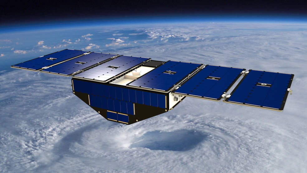
They are the hurricane-hunters, the wind-watchers, the storm-seers. But one year after the Cyclone Global Navigation Satellite System, or CYGNSS, mission started sending in data for hurricanes and aid forecasts (mission update), researchers have discovered an unlikely capability of this constellation of eight micro-satellites: They can also detect floods like no other satellite.
Yes, when it comes to flood detection, CYGNSS is proving to be better than the mighty Landsat birds operated by USGS and NASA, or even the European Space Agency’s Sentinel 1 and 2 satellites. Unlike Landsat (which cannot see through clouds) or Sentinel (which draws a blank on hitting vegetation), the CYGNSS satellites can see through all things – clouds, rain and vegetation – that could obscure floodwaters.
Moreover, since CYGNSS has eight satellites collecting data instead of just one to two, you get more coverage in a shorter span of time. Considering that flooding from hurricanes can lead to a life or death situation in only a matter of hours, this reduction in time between observations becomes all the more crucial.
How the CYGNSS constellation is making unprecedented flood maps possible is even more interesting. Instead of using space-based sensors, these micro-satellites utilize the constant signals emitted by the Global Positioning Satellite (GPS) system. These signals are receptive to reflections from still water and moisture in the soil as well.
Clara Chew, a researcher at the University Corporation for Atmospheric Research in Colorado, explains that while scientists did have an inkling that GPS reflection data could be used to study various things, there were not many concrete observations to prove that.
“With the launch of CYGNSS we’ve finally been able to really prove that yes, these signals are very sensitive to the amount of water either in the soil or on the surface,” Chew says, adding how the first flood inundation maps developed using CYGNSS data shocked everyone. “You can see a lot of the tiniest, tiniest rivers throughout the basin, and nobody knew that we were going to see rivers a hundred meters wide or so in the data.”
That said, this type of detection is still in its early days of development. The researchers still need to figure out how to shorten the two-day process it currently takes to access the CYGNSS data, and use the information to complement soil moisture and flood data from other satellites.
If you enjoyed this article, read more and subscribe to our monthly newsletter!