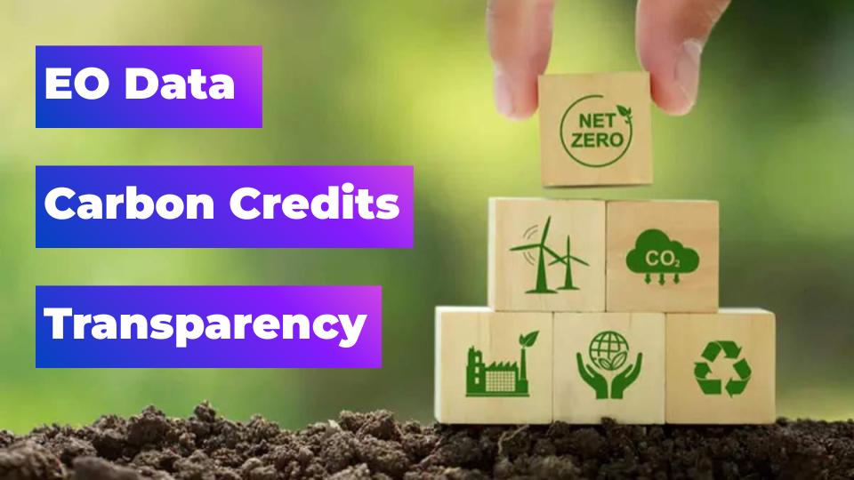
Can Earth Observation Technology Help to Restore Trust in Carbon Offsetting?

With the world’s major economies still heavily reliant on fossil fuels, and the net zero targets set by the Paris agreement of 2015 still a pipe dream, our planet is on the brink of devastating climate change. Despite concerted efforts of global governments and grass-roots activists, most companies are failing to decarbonise at the necessary rate, and many of them will still be producing significant volumes of greenhouse gases by 2050.
One solution which has increasingly been used by companies to compensate for this lack of progress is carbon offsetting—an appealing solution by which companies can plot a route to net zero not by reducing their own footprint, but through funding projects that sequester carbon or reduce overall global emissions.
However, in recent years, trust in the carbon offsetting market has been massively eroded, with details emerging about bogus projects or exaggerated claims. Is there a way to ensure that carbon offsetting projects are really doing what they claim to do, or is the whole system fundamentally flawed? Satellites may provide an answer…
Carbon offsetting and the carbon market
First, a quick summary of the carbon market, which has two main elements. The first is the regulatory carbon permit system, whereby large-scale polluters like power plants, factories, and other industrial infrastructure properties are incentivised financially to reduce their carbon emissions. The other is carbon offsetting—which is often voluntary—in which polluters compensate for their emissions, rather than reducing them.
The carbon market operates on a system known as ‘cap and trade’. Through cap-and-trade, governments set a cap on the level of emissions permissible by large polluters, and this cap is divided into a number of carbon permits—effectively forming an allowance to emit a specific amount of greenhouse gases (GHGs). Permits are priced by metric tonne of CO2, and can be bought directly from the government, or traded between companies if they are over their limit or have a surplus of credits. Each year, the cap on total emissions gets lower, and individual permits get more expensive. The world’s largest and longest-running cap-and-trade system is the European Union Emissions Trading System (EU ETS), which started in 2005.
Carbon offsetting is another way for companies to contribute to a global reduction in emissions, but instead of directly reducing their own, they compensate for them through investing in projects that reduce or sequester GHGs. Carbon offsetting can be part of the carbon market if the relevant regulatory system permits the use of ‘carbon credits’ as a means to offset excess emissions. In these cases, one carbon credit is treated as equivalent to one tonne of CO2 under the cap-and-trade system.
How does carbon offsetting work?
The story of carbon offsetting began in 1989, when the company Applied Energy Services financed an agriforest in Guatemala to ‘offset’ the building of a coal-fired power station. Today, businesses can buy carbon credits from projects that involve renewable energy generation, reforestation or afforestation (establishing a forest on land not previously forested), carbon capture and storage etc. Carbon offsetting by businesses is voluntary—and they often do it to meet their own sustainability targets or to raise their environmental credentials—but it has also been common for offsetting credits to be permitted in cap-and-trade systems, subject to varying rules.
Unfortunately, businesses have tended to hide behind carbon credits while making little effort to reduce actual emissions, leading to understandable accusations of greenwashing and an overall loss of trust in the concept of offsetting. Even more alarmingly, carbon offsetting projects have often been misleading and failed to deliver on their promises. Earlier this year, a stinging report into the carbon standards organization Verra, issuer of the Verified Carbon Standard (VCS), indicated that as little as 10% of its offsetting projects produce the emissions reductions they claim—while some projects are entirely fraudulent, producing no reduction at all.
In this context, it’s not surprising that the EU ETS has not permitted the use of international offset credits in its carbon market since 2020. However, as part of the agreement signed at COP26, polluters will be able to continue offsetting emissions, subject to certain criteria, and predictions are that this market could be worth $200 billion by 2050.
Whether it’s part of a cap-and-trade system or the voluntary market, it is crucial to ensure carbon offsetting projects are effective and genuine. As such, projects are required to adhere to principles of Additionality (must lead to a new and measurable reduction in emissions that would not have otherwise occurred), Permanence (must have long-term durability) and Verification (by an independent and accredited organization). Aside from the now-discredited VCS, independent standards include the Gold Standard, and the Climate Community and Biodiversity Standards (CCBS).
It is vital that carbon offsetting projects adhere to these principles—not just to ensure they contribute to the overall goal of reducing greenhouse gas emissions, but also to increase credibility and rebuild trust.
Satellite data monitoring offsetting
Many reforestation or carbon sequestering projects are located in remote or hard-to-reach areas, which presents a challenge for measuring their success. Here, satellites have significant advantages over aerial or drone monitoring, not to mention conventional in-person measurement, all of which are costly and time-consuming. Using SAR and multispectral data, combined with vegetation indices, biomass and carbon stocks can be estimated with a high degree of accuracy. Frequent revisits can confirm project permanence, and high-resolution imagery enables analysts to view activity in both the project area and control areas, to ensure additionality.
There are now several companies turning to satellite data to verify the success of carbon offset projects. One such company is Pachama, which uses three types of satellite imagery—optical-infrared, radar, and lidar—in combination with artificial intelligence to monitor and verify the effectiveness of forest-based projects. They also provide a platform for businesses to discover and invest in high-quality carbon offset projects that meet strict additionality, permanence, and verification criteria.
British company Sylvera specializes in providing independent, data-driven assessments of carbon offset forestry projects using satellite data and advanced analytics. Sylvera’s platform offers project ratings that help businesses identify high-impact projects. Tel Aviv-based Albo Climate is another company using machine-learning algorithms and multispectral data to measure ‘above ground biomass’ (AGB) carbon stocks.
One of the most interesting companies in this sector is CarbonStack, increasing transparency through innovative use of two technologies. The company supports afforestation projects, using blockchain technology to make a publicly accessible ledger of activities, and also utilising satellite observation for forest monitoring. CarbonStack has partnered with UP42 to gather this high-resolution satellite data, using imagery from the Pléaides Neo constellation, whose 30cm resolution enables the company to identify individual trees. The relationship enabled Carbon Stack to monitor 50,000 trees planted across Europe in 2022—and provided significant time and cost savings when compared with drone or aerial photography.
Monitoring by satellite has another big benefit. As high-resolution satellites can measure carbon sequestration in areas as small as 10m2, they present an opportunity for small landowners to take part—and share some of that $200 billion market. This means that offsetting can benefit everyone, not just the multinational corporations or NGOs.
Satellite data = transparency = trust
It’s probably an uncomfortable truth, but one we should acknowledge, that for many industries, fully decarbonising may never be possible. Therefore, offsetting GHG emissions—authentically and verifiably—will have to be part of any net zero solution. To do this, we need transparency and trust.
By using remote sensing data and other technologies to assess, evaluate, and authenticate projects, companies like those above are generating a higher degree of transparency in carbon offsetting projects, and thereby going some way to restoring trust in the sector. This, in turn, makes it a more reliable tool for addressing climate change.
Satellite imagery has a rich history when it comes to protecting our planet—it was of course the iconic ‘Earthrise’ photo of Earth rising over the moon’s horizon, taken during the Apollo 8 mission in 1968, which served as a catalyst for the environmental movement. The trend looks set to continue: by ensuring the authenticity of carbon offsetting projects, satellites can play a major role in our transition towards net zero.
Did you enjoy the article? Read more and subscribe to our monthly newsletter!

#Categories

Next article
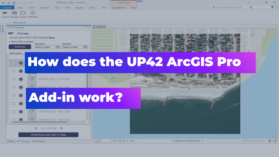
This Add-in Will Make Your EO Data Workflows in ArcGIS More Effective at Scale
Satellite data represents a critical component of a large number of geospatial analytics use cases, yet many GIS solutions, such as ArcGIS, have not been designed to work with raster data at scale with a corresponding level of efficiency. Typically, these tools allow for effective analysis on a single scene, but the moment that you have a larger EO data set, you need more sophisticated and much more expensive solutions like ArcGIS Image Server.
To get around this and effectively work with satellite data, many users have resorted to working with satellite images outside of ArcGIS and then importing the output data into the system, which is a workable but suboptimal solution. Excitingly, there is a new add-in for ArcGIS that offers the capability for a more effective and efficient workflow.
Working with Satellite Data in ArcGIS
UP42 has always focused its efforts on making life easier for geospatial professionals, and they understand just how important EO data is for geospatial use cases of all kinds. They’ve stepped in here to provide a free integration add-in that pulls the power of UP42 into ArcGIS to streamline the workflow and allow for better management and usage of large raster data sets within the platform. More importantly, the add-in will let users seamlessly buy archive data or task new satellite data for use in the Esri environment.
The Berlin-based start-up offers one of the most comprehensive marketplaces for satellite data from multiple vendors, as well as data processing infrastructure and an algorithm marketplace allowing for a wide range of different practical applications.
The UP42 ArcGIS Pro Add-in brings all that power into ArcGIS Pro, allowing users to access their UP42 data sets and projects from within their ArcGIS instantiation. This add-in will help to reduce the amount of time it takes to access data, build workflows, and develop geospatial solutions on top of satellite data. Without needing to leave the Esri ArcGIS environment, customers can use the new add-in to access the UP42 platform, where they can open projects that they are already working on, download purchased data sets into ArcGIS itself, and view related metadata.
This goes a long way to extending the usage of ArcGIS and making it more conducive to projects that require large EO data sets in order to generate the desired results. By eliminating this bottleneck, users can now accomplish much more with much less, which is a very positive step for the geospatial community more generally.
How Does the Add-in Work?
You can download and install the free add-in directly from the UP42 website or the Esri marketplace. Once it is installed, you’ll need to copy and paste the Project API Key and the Project ID from your UP42 account into ArcGIS Pro to connect the two.
Once you’ve done that, you’ll have immediate access to your project’s satellite data archives and you can download the required data directly to ArcGIS Pro for analytics. More importantly, you can also process and analyse your data within the UP42 environment, using any of the dozens of available data sources and algorithms in the marketplace, before seamlessly importing those outputs into ArcGIS Pro.
There are some interesting productivity features included in the add-in, e.g. users can create a mosaic of multiple images to easily verify if the available imagery dataset intersects with their AOI.
Moreover, once the imagery has been processed, it can be shared and published using ArcGIS Online, which makes collaborating on the data much more effective.
It’s certainly one of the most efficient and affordable ways to process your EO data in the cloud without needing to invest in the entire Esri imagery suite which is powerful but also very expensive. This solution allows you to leverage an UP42 platform subscription more effectively, giving you the flexibility to effectively work with satellite data in a more affordable way.
You can also now place orders for satellite data through the UP42 catalog directly from ArcGIS within the context of whatever you are working on. This makes the workflow even quicker and easier, which goes a long way toward improving overall project outcomes.
In addition, the value of this integration will compound over time as UP42 continues to work on new geospatial data products, tools, and algorithms. Being able to bring all these directly into ArcGIS Pro allows for more effective workflows, all within the same intuitive interface that they’ve become comfortable with, and without spending a fortune along the way.
If you’d like to read the official documentation which provides some further details, you can find that here. But truly, the best way to get a sense of why this enables such an effective workflow is to download it and try it for yourself. Once you’ve plugged it into your ArcGIS setup, you’ll see how much more efficient you can be by having UP42 access at your fingertips.
Conclusion
In summary, this add-in is one of the most affordable and effective tools for circumnavigating ArcGIS’s limitations in terms of working with EO data at scale, and it opens up a wide array of use cases that would not previously have been possible without investing a significant amount of money into the project. It will significantly reduce the amount of time it takes to access data, build visualisation workflows, and develop geospatial solutions.
This is great news for the geospatial community because making it easier to access and work with satellite imagery at scale is a key building block that can push the industry forward. Reducing this barrier and making these use cases more accessible should help to increase the adoption of satellite imagery across all geospatial applications.
Did you like the article? Read more and subscribe to our monthly newsletter!