
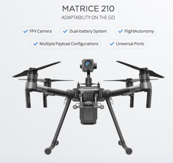
Though, DJI drones are better known for aerial photography and cinematography, there are many people who having been using it for other purposes including mapping (Related: Step by step guide to complete your first drone mapping project). With the launch of MATRICE 200 series of drones, DJI hopes to change that perspective.
It’s the first time that DJI has launched a dedicated drone for the enterprise market – targeting the commercial inspection and data collection industry.
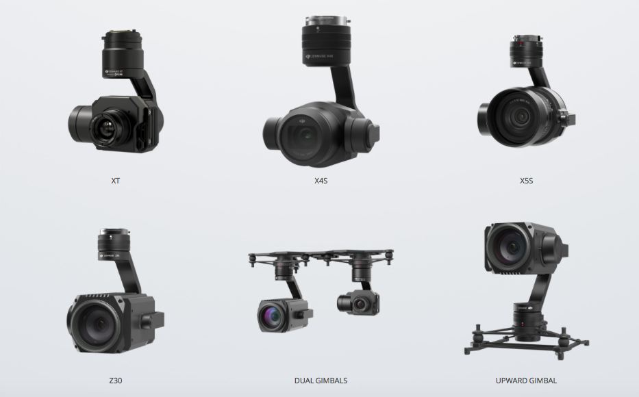
Not one but two cameras!
The MATRICE series is basically three different drones – M200 (the basic model), with a single downward Gimbal system that can be changed according to your needs. The M210 and M210 RTK variants are perhaps the more interesting ones with the option to mount not one but two downward facing Gimbal systems or if you prefer, a single upward facing gimbal system! The upward facing camera mount is going to be pretty handy for bridge inspection and other applications.
M200 series has a pretty impressive set of camera mounts as well but apparently its not possible to mount all three gimbals at the same time, due to the design/placement of the GPS receivers.
Flight Autonomy and Collision Avoidance
Collision Avoidance and Flight control seem to be a pretty standard feature in most drones these days, the M200 series doesn’t lag behind in that regard either. With a total of 7 sensors, the M200 series drones are capable of detecting obstacles up to 30 meters ahead, while the infrared sensors that are upward facing can sense obstacles within a 5-meter range.
In addition to these sensors, DJI’s M200 has an additional safety feature in the form of an ADS-B receiver. ADS-B or Automatic Dependent Surveillance—Broadcast is used by Aircrafts to share their location and communicate with other nearby aircrafts. Although DJI’s drones that use the ADS-B to transmit their own location, they will be used to inform the drone pilot when an aircraft is coming in range. This way, the drone pilot or perhaps even an flight autonomy application can automatically land the drone before it gets in the way of a commercial airliner!
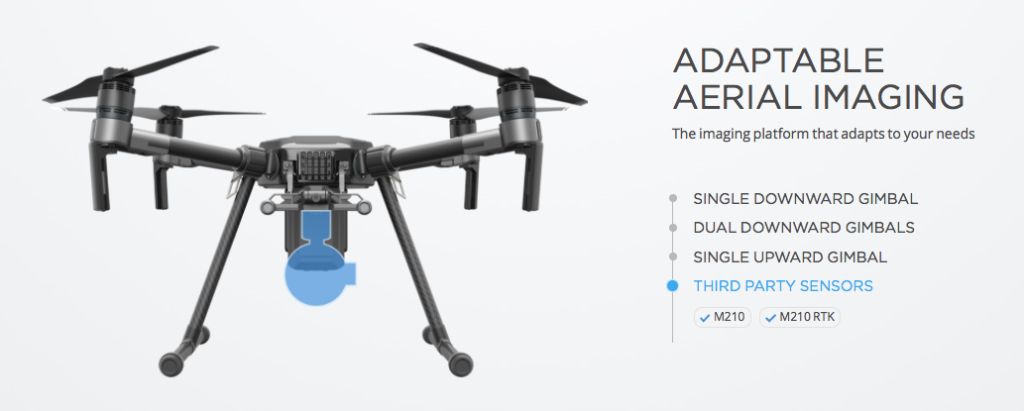
Third Party Sensors
In addition to the existing camera mounts that DJI supports, the M200 series will also be able to support third party sensors as well. It’s probably not going to be long, before someone decides to build a LiDAR sensor for the M200 series!
DJI had announced that the drones will start shipping in the second quarter of this year. There is no official word on the price yet but its fair to expect that this will be DJI’s most expensive drone yet!


#Business


Next article

Humankind has always been fascinated with the lay of the land, and as the generations have passed we’ve combined new information with new media forms to create an ever-evolving, shared concept of the way Earth’s land masses and oceans are distributed. The pursuit of a complete map has taken some odd turns over the years, from Kircher’s assertion of a hollow globe beneath us, to notable figures from Homer and Democritus up to NBA star Kyrie Irving that the world is flat.
cordiform (heart-shaped) projection
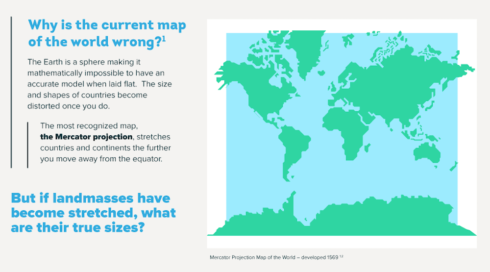
Yet the preference for foldable, pocketable cartography means that 500 years after Gerardus Mercator’s development of his canonic world map, we still rely on a basically misleading document to form our mind’s image of the world around us. Based on accurate rendering of nautical directions rather than precise preservation of the shape and size of land masses, Mercator’s simplification is the reason Colombia and the UK appear roughly the same size (Colombia is in fact over four times bigger), Greenland outsizes the whole of South America (which is eight times bigger), and Antarctica appears to dominate half the globe (it’s pretty big, but still – only twice the size of Australia).
Somewhat inconveniently, our spherical planet refuses to flatten neatly into a 2D representation without compromise. The 16th century cordiform (heart-shaped) maps of Johannes Stabius, for example, are complete only as a triptych, and then only with some overlapping.
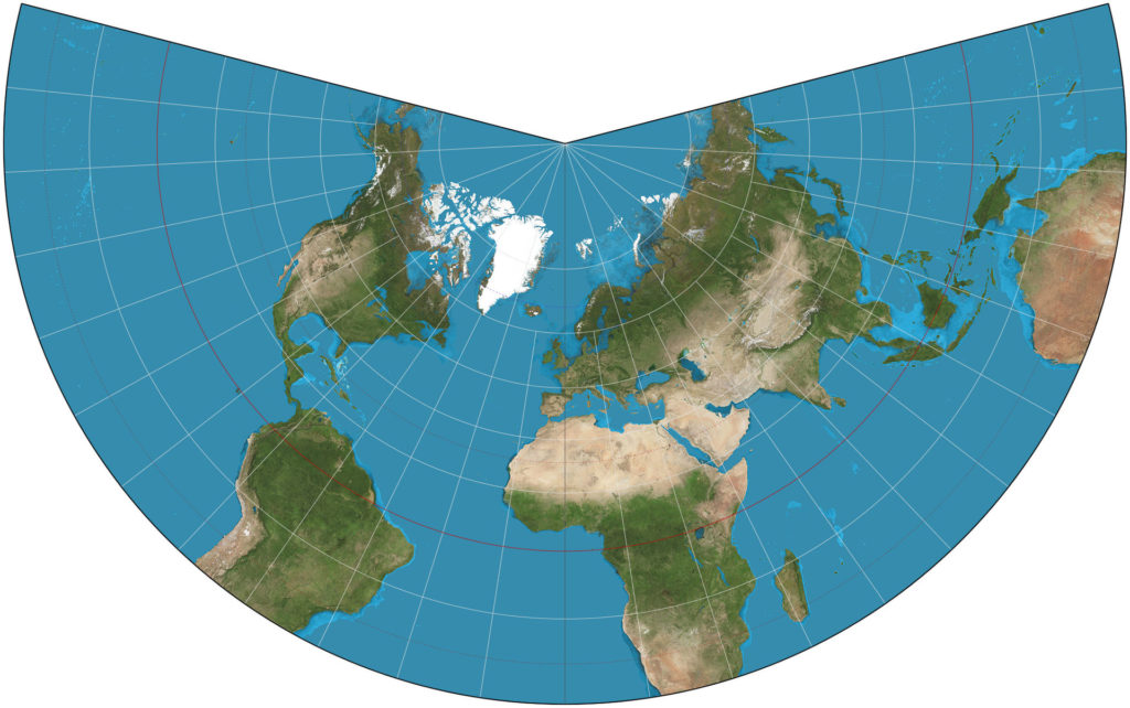
Lambert Conformal Conic Projection
However accurate they may be, they just don’t seem catchy enough to knock Mercator off the top spot. Likewise, Johann Heinrich Lambert’s conformal conic projection is still reinterpreted today for aeronautical charting, but is hardly intuitive enough to appeal to the average tourist, rambler or flaneur.
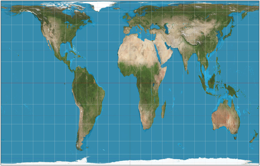
Gall Peters Projection
One representation that manages to preserve both scale and a handy, smart phone-ready rectangular frame is the Gall-Peters equal projection map. Developed in the 1970s, it was not the first map to attempt such fidelity to scale, and actually gained controversy over the implication that it was. Perhaps this controversy is what helped to gain it wider recognition. It certainly benefitted from good timing – with the changing face of imperialism and widening concern and communication regarding social justice, the map’s apparent fairness to the mainly developing nations that were ‘squashed’ by the Mercator map saw it introduced by progressive organizations such as Oxfam, concerned religious groups, and even a number of British schools.
Still, the Mercator projection’s prevalence could be considered self-perpetuating: it has become a standard, and such standards become harder to shake the further they become embedded in our new information age. Perhaps, though, further developments in new media will see new standards emerge in new dimensions: imagine a hologram globe hovering in your leather-tiled study, spinning to the desired point in response to your gestural commands, or manipulable interactive 3D maps experienced through VR goggles.
The new infographic and explainer video from Expedia Canada expand on some of the inconsistencies between the Mercator projection and what we actually know about the world. It includes some interesting variations on how we might look at it – because now and then, it seems we need to be reminded that the Earth is neither rectangular – flat!
About the author: G. John Cole
 John is a digital nomad and freelance writer. Specialising in leadership, digital media and personal growth, his passions include world cinema and biscuits. A native Englishman, he is always on the move, but can most commonly be spotted in Norway, the UK and the Balkans.
LinkedIn: https://www.linkedin.com/in/gjohncole
Twitter: https://twitter.com/gjohncole