Air pollution is a serious issue in most cities across the world, a recent study from China is testament to how serious the issue is. In spite of all the awareness, it is still difficult to get access to air pollution data in the same way we can google for weather data.
Quite a lot can change if we had access to air pollution data in such an easy fashion. For starters, you can avoid commuting at a particular time if you realize the air pollution is too high in the route that you take. The city planners can figure out where they need to increase traffic restrictions and perhaps improve public transportation. The possibilities are endless and with such data easily available, if might even become an election issue (I certainly hope so).
Google Street View Cars To Map Air Pollution
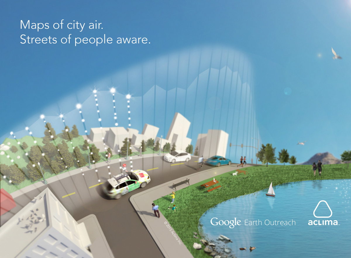
As part of the Google Earth’s Outreach program, Aclima, California-based startup that works on Environment monitoring sensors, has been working with Google to equip the Google street view cars with their sensors to map air pollution. After 750 hours and 150 million data points, they are done mapping Denver and if you like to look at the insights from their project, here’s the link.
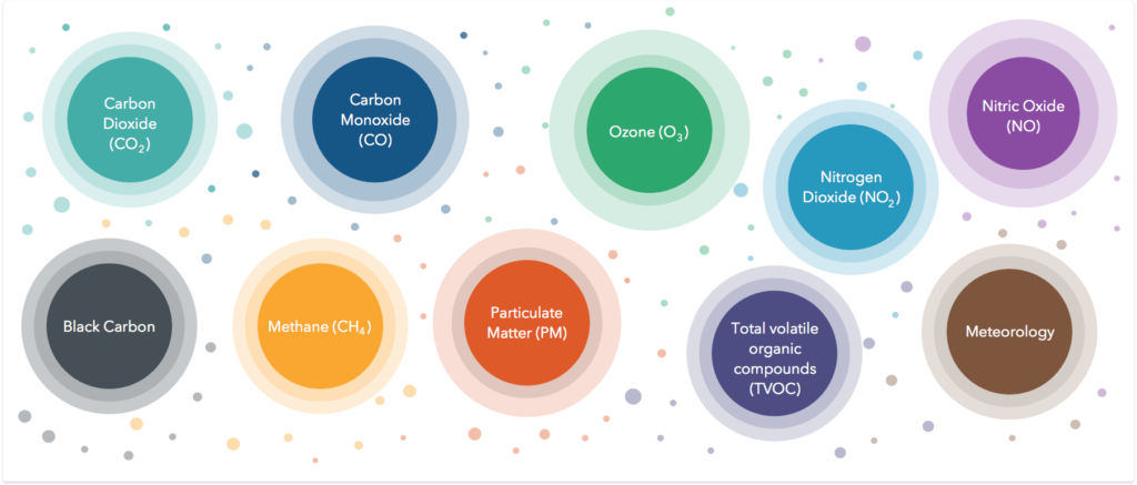
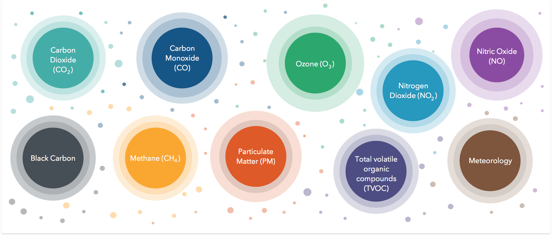
What the Aclima sensor onboard the Google car can sense
Imagine what we can do if we had access to Air pollution data the same way we had access to weather information!
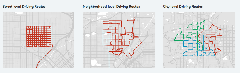
How the Google car equipped with the air pollution sensor was driven around Denver
It’s a really interesting project and with Google involved in it, it has already captured the attention of a lot of people and hopefully when it debuts on Google Earth, even more people will start taking air pollution seriously. The only issue with such an approach is that the data is never going to be up-to-date! Unless of course, Google plans to drive around every single day of the year (which would be ironic, considering we would be mapping air pollution with cars). That’s where IoT sensors like AirBeam are going to helpful. There is a need for such data and the Aclima-Google partnership is definitely going to be a great help in getting more attention to the issue.
Can Wearable Tech Help Monitor Air Quality?
Wearable Tech has come a long way in the last 2-3 years and now we even have wearables for monitoring the environment. Organization like HabitatMap have been working on wearable air quality monitors for a while now (Related: Internet of Things, Maps & Environmental Monitoring). They are not the only ones, startups like Chemisense, TZOA Wearables are also working on this. Wearable tech together with Crowd Sourcing can really help bridge the data gap that exists today and help increase awareness when it comes to protecting yourself from pollution in general. (Related: With Wearable Devices That Monitor Air Quality, Scientists Can Crowdsource Pollution Maps).