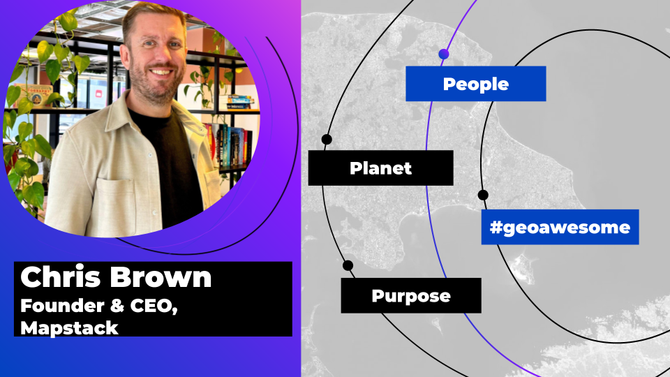
Meet the founder: An interview with Chris Brown as Mapstack is awarded prestigious UK Innovation Smart Grant

We’re so pleased to announce that Mapstack, the world’s first social network of maps and data, has received a prestigious UK Innovation Smart grant.
Administered by Innovate UK, the UK’s innovation agency, the funding acknowledges the potential of Mapstack’s game-changing R&D project to make a significant contribution to the UK economy.
We sat down with Mapstack’s Founder and CEO, Chris Brown, to find out more.
Congratulations on securing the Innovate UK Smart Grant. Mapstack is poised to democratize access to open data, which you believe is a fundamental human right. Can you explain what Mapstack is and delve into how this belief has shaped Mapstack’s business model and offerings?
Similar to Github with code, Mapstack’s mission is to become the global hub for open data. Currently, open data is spread across the internet in complex data portals, making it hard to find, difficult to access, and nigh-on impossible for most people to make any use of.
We want to change that by bringing all open data together in one place, making it simple to access and use.
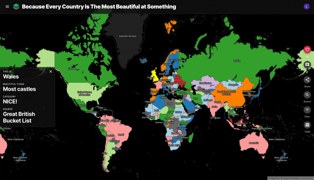
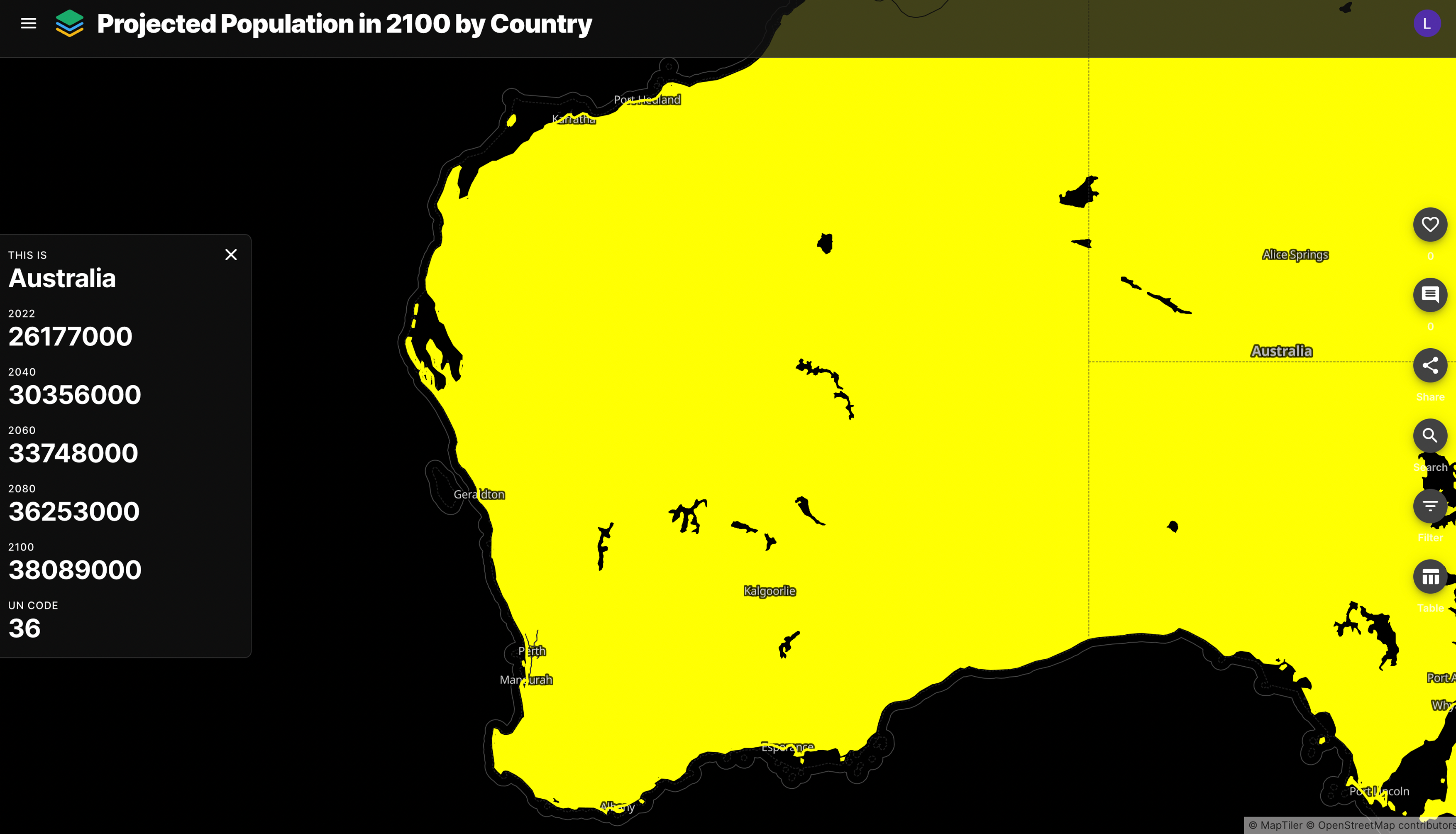
All of the open data in Mapstack will be visualized in engaging, interactive digital maps that people can freely explore and make use of, even if they have little prior experience in mapping or data analysis. Ultimately, open data is this huge, valuable resource that belongs to everyone, but it’s currently out of reach for most people.
Mapstack was founded with the belief that valuable open data should be accessible and free to all. Could you share more about the company’s origins? How was the idea for the community-driven platform born?
Mapstack was born out of the long-held frustration of needing to find open data, but having to trawl through the existing open data portals that are largely too complex for most people and not user friendly at all. Also, once people find and extract the data they’re looking for, they then need to use complex tools to make a map. We want to start with the map, an engaging, easy-to-use format that everyone can find, access and make use of.
You envision Mapstack as the “Wikipedia or GitHub” for open data – a bold aspiration. What mechanisms are you implementing to ensure the accuracy and credibility of the vast array of data, and how will these efforts encourage user trust and frequent engagement with the platform?
We have a guided upload process whereby people can provide the data source and a link to that source. Like with a research paper, anyone viewing the map will be able to follow the link and verify the data source to ensure its accuracy.
During upload, people are also able to add tags to provide additional context about the data they’re uploading, making it easier for people to search later. Everyone will have their own profile and can create multiple public Workspaces to group data into specific topics or themes.
We’ve also added social proof features such as likes, comments and shares so people will be able to provide feedback about each map and dataset, ensuring we offer a more social experience around data exploration as well as live feedback.
The challenge of technical complexities and integrating data into existing workflows is often a barrier for SMEs, nonprofits, and educators. How does Mapstack intend to simplify this process, and what tools or features are you offering to make data analysis more accessible for these users?
People will be able to search our ecosystem of open data maps and then use the search, navigation and filter tools within the map to begin exploring the data and gain the insights they’re looking for.
We’ll also be prioritizing new UI improvements in the future, with the success metric of making our data maps so simple to use that anyone can find and gain fresh insights and perspective from them.
Mapstack plans to offer both free access and paid plans for more private, secure data uploads. Could you explain how this dual approach works within your business model?
Anyone is able to upload open data to the platform and create a public map for free, forever. They can then share this map, either to distribute interesting data they have collected, collaborate with others, or use it for a work or school project, whatever they wish. If people would like to upload private data and make a map, they can pay a low monthly fee so it’s securely stored in their personal account.
We foresee that public maps will get many people using maps with public data for the first time; once they’re comfortable with that, we hope they’ll go on to map their own data.
We love that Mapstack is committed to making the world a better place by providing data-driven insights. What current global issues are on Mapstack’s radar and how could the platform help these issues by enabling informed decisions that lead to better outcomes?
We believe Mapstack will be a powerful tool for educators, NGOs, businesses and many others. Having one place where anyone can find and easily make use of open data will be empowered in whichever project they’re currently engaged in, whether it’s an environmental group tracking deforestation, journalists adding vital context to a trending news story, or citizens having a greater understanding about their local living environment. The use cases really are endless.
Why do you think interactive maps are so powerful when compared to spreadsheet-based data visualization?
We believe when it comes to location data, a map is by far the most inclusive medium to consume for most people. Even with tabular data, it takes a fair amount of technical knowledge to properly withdraw insights and context, and it’s not a visual medium. But most people are able to view a map, discern the color coding, and begin exploring by clicking around to find insights. It’s a much easier starting point.
With a spreadsheet, you start with data and then get a map—so long as you have the technical know-how and tools. With Mapstack, people will start with the map, and can then work back to the data.
Finally, considering Mapstack’s ambitious mission, where do you see the platform in the next five years? What will be the measure of success for you and your team?
Our goal is to become the global hub for open data, so in the next 5 years, that will be our core focus. The measure of success for us is the number and richness of the open datasets we have in our ecosystem.
We also have a strong community focus, so we see the number of people publishing maps as well as people viewing and using them as key success metrics. We have already witnessed an incredible diversity of data that people have been contributing, so we’re looking forward to seeing and learning more as we progress over the next 5 years.
Our Beta is live and you can find all of the data currently uploaded at mapstack.io, so come check us out!
Did you like this article? Sign up to our newsletter!

#Business

Next article
MapAction looking for volunteers to unlock information management barriers in humanitarian sector
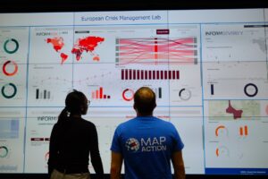
MapAction is looking to fill six new volunteer positions with candidates who have the right skills to support work in the following fields: geospatial, development of geospatial training content, data science, data visualisation, software development and data engineering. Help MapAction and the humanitarian sector mitigate climate change and health emergencies through innovative use of software, geospatial technology and training, visualisations and data solutions.
Every day we hear news of how climate change is having devastating consequences for communities worldwide. As the effects become more clear and prominent – floods, droughts, hurricanes and natural disasters – it is easy to feel helpless before the mitigation task at hand.
At MapAction we are working to strengthen early warning systems, anticipatory humanitarian action, so that communities exposed to climate change and health emergencies can be more prepared and resilient.
Frontline communities affected by a health or climate emergency depend on humanitarian agencies getting decisions right. These decisions, in turn, depend on good use of data.
At MapAction, we are always looking for innovators who can bring their skills and experience to create data solutions that can support saving lives in humanitarian disasters. That is why we are inviting a software developer who can unlock information management barriers with innovative data solutions, a data engineer who can unlock devops challenges and review data and code hygiene issues, as well as a data scientist who can design innovative data-delivery breakthroughs for humanitarian agencies and partners. The geospatial volunteers will help us to continue to place the benefits of mapping and geospatial analysis at the service of humanitarians.
Data scientist and data visualiser
The data scientist performs statistical analysis of geospatial data and helps us create data visualisations and dashboards. They review literature, collaborate with partners and help design and provide internal and external training. The data visualiser, on the other hand, will maintain the highest standards for visual communication, produce and test reports and dashboards, as well as charts and infographics. Each of these roles will work closely with the others.
IN IMAGES: MapAction conducts simulated volcanic eruption response exercise on Isle of Cumbrae
Each role, however, is designed to streamline the work MapAction does: delivering a more efficient and data-driven humanitarian operations field, to support decision-makers in getting it right, so that lives are not needlessly lost or negatively affected. For a data engineer this might mean running a prototype environment to review how MapAction integrates software projects alongside mapping/data projects. It might mean cleaning script redevelopment – code hygiene – or deploying source controlled python scripts into a project workspace. For a data scientist, it might mean working with a software engineer or a specific disaster model or a tool to support early warning or relief decisions. Data and software engineers will also review coding standards and guidelines.
Geospatial specialists
For a geospatial volunteer, it might be one map that opens up a huge aid solution or unlocks critical early funding for a CSO or humanitarian resilience network. In 2023 alone, our geospatial volunteers have responded to major crises alongside the UN in Turkiye, Libya, Kosovo and Peru. As a geospatial training content developer, you might engage in any number of activities: from providing support to CSOs in Southeast Asia or Southern Africa, to working with regional partners like the Caribbean Disaster Emergency Management Agency (CDEMA) or developing simulation for specific disasters, such as hurricanes.
Many of these roles will entail opportunities to travel and work with some of the world’s leading humanitarian organisations: from the UN, WHO or WFP, to regional disaster response coordinators in four continents.
READ ALSO: MapAction disaster mapping volunteers supporting UN on response to floods in Libya
Working closely with MapAction’s inhouse tech and geospatial departments – which include software engineers and data scientists – as well as the UN’s Centre for Humanitarian Data in the Hague and other global partners, whoever fills these roles will get the opportunity to develop software, maps, training programmes, visualisations and data solutions that will broadly impact the humanitarian sector, as well as regional and national disaster relief agencies. These will pave the way for long-term impact and resilience. Working closely with national disaster agencies through the Start Network and INFORM, our innovation and tech team review national disaster models and preparedness worldwide, with a frontrow seat to enact sustainable change.
It is an opportunity for people with the right tech skills to see how the wider humanitarian system operates from the inside and where data and geospatial solutions play a role: a front row seat to understand global trends and pressures driving world events and their consequences on people
Volunteers also provide vital support to UN agencies and other partners in emergency operations centres worldwide, both in-person and remotely. MapAction has been involved in more than 140 emergency responses worldwide in the last 20 years.
Like what you’ve read and want to get involved? Please click here to see the full list of roles and apply by 14 November 2023.