
LandViewer is a powerful satellite data processing and analytics platforms. It allows you to select a geographic area for analysis, choose various types of remote sensing data and do all sorts of analytics on-the-fly, which may improve working with satellite imagery.
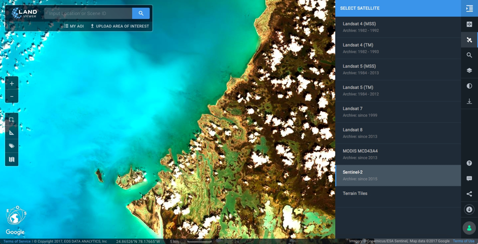
I reviewed LandViewer a few months ago, and it was very impressive. With the latest update, it got even better. Besides initially available Landsat 8 and Sentinel 2 you can now access the huge data archives of Landsat 4, Landsat 5, Landsat 7 and MODIS, including coverage of the entire surface of the Earth and daily updates.
For those who decided to use LandViewer for the first time, developers have added a useful step-by-step interactive guide which you can access by clicking on the button with a question mark in the lower right corner of the screen.
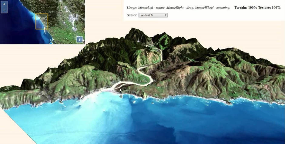
One of the coolest new features is a 3D viewer, that allows you to build a three dimensional model of the Earth’s surface on-the-fly. To build the model LandViewer uses a basemap elevation coverage data, taken from the Amazon open public database. The texture is automatically superimposed on the model from Sentinel-2 and Landsat 8 satellite images. The tool is based on three.js library that allows to zoom, rotate and move the model along any axis, among other cool features.
The platform gives the opportunity to simplify the work and calculate spectral indices for different dates. You can now receive information from remote sensing data directly in the browser with no need to download huge amounts of satellite imagery.
Moreover, working with defined Area of Interest has become much more convenient. Previously, when loading your GeoJSON or KML file in LandViewer only a single area could be impoerted. Now it is possible to upload multiple polygons, lines or points from external files that can make your life much simpler.
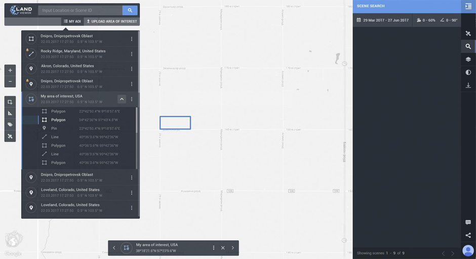
In addition, you can now draw the AOI directly in LandViewer, save it to the lists and download created AOIs to your computer. The turning on the notification function and receiving the email notifications of new images with a preview and characteristics is also available for AOI.
The LandViewer analysis is also much easier to integrate with your other software. Using the standard protocol for maps serving, Web Map Service (WMS), you can now browse the imagery from LandViewer directly in your desktop or online software applications like Qgis, ArcGIS, etc.
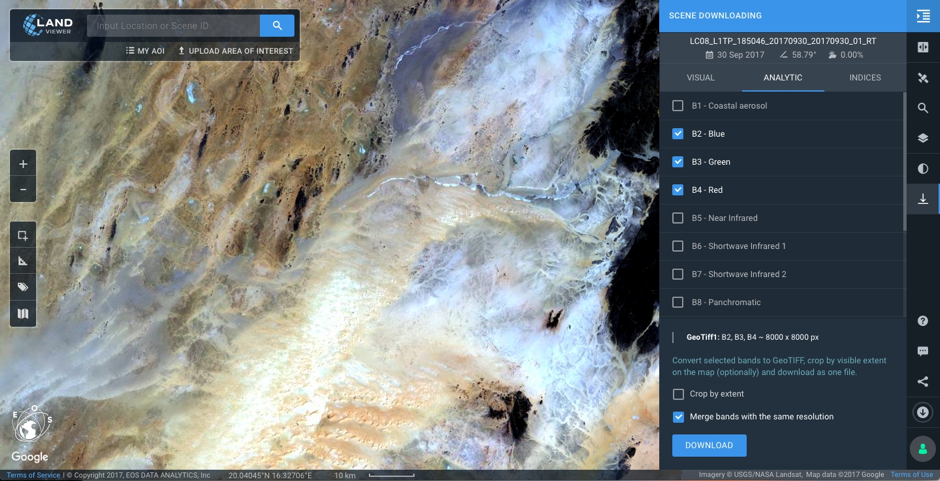
Moreover, new features for data download were added. Now the image visible in LandViewer can be downloaded in any band combination and with any contrast settings as JPEG for the web or print. There is no need to download the whole image if you are only interested in a specific part of it. Cool! Downloading bands can be done either individually or as a single file in GeoTIFF format. It also became possible to load pre-calculated spectral indices in GeoTIFF.
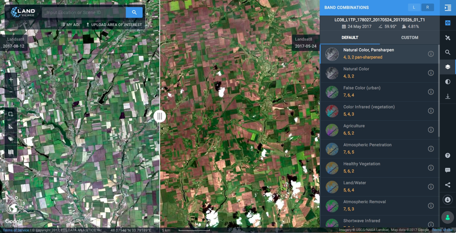
One more interesting solution is the new viewing functionality that allows to open two images and provides the convenience of comparing pictures with the slider that split the screen into two parts. User can choose to compare images with any band combinations (even created by his own) or spectral indices. It is possible to compare images not only from one satellite but from different ones.
Great job LandViewer team!

#
Next article

With the advent of drones and drone mapping, remote sensing has now finally entered mainstream usage. A large community of people are already using optical remote sensing to keep track of their farms and many other cool applications. “Echoes from space”, the 1st MOOC on Radar Remote Sensing by the European Space Agency (ESA) promises to provide us with a deeper understanding of a technology that will definitely enter the market sooner than later. “Echoes from Space” is designed to educate and inspire a new generation of Earth observation professionals. This course offers an in-depth exploration of radar technology and its applications in monitoring and understanding Earth’s surface.
Echoes in Space
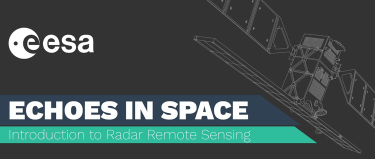
The 1st MOOC on Radar Remote Sensing by ESA
The course is set to begin in October and is spread over 5 weeks (3 hours a week). You can already enrol for the course at ESA’s EO College website. The five modules in the course are shown in the screenshot below. EO College is a platform dedicated to providing high-quality, accessible education on Earth observation and remote sensing technologies. Its courses, designed by experts in the field, cover a wide range of topics from basic principles to advanced applications, catering to both beginners and experienced professionals.
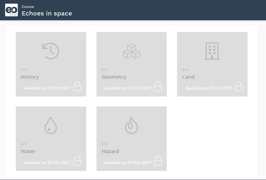
The 1st MOOC on Radar Remote Sensing – courses
If you enjoyed this article on ESA’s launch, read more and subscribe to our monthly newsletter!