
With the advent of drones and drone mapping, remote sensing has now finally entered mainstream usage. A large community of people are already using optical remote sensing to keep track of their farms and many other cool applications. “Echoes from space”, the 1st MOOC on Radar Remote Sensing by the European Space Agency (ESA) promises to provide us with a deeper understanding of a technology that will definitely enter the market sooner than later. “Echoes from Space” is designed to educate and inspire a new generation of Earth observation professionals. This course offers an in-depth exploration of radar technology and its applications in monitoring and understanding Earth’s surface.
Echoes in Space
The 1st MOOC on Radar Remote Sensing by ESA
The course is set to begin in October and is spread over 5 weeks (3 hours a week). You can already enrol for the course at ESA’s EO College website. The five modules in the course are shown in the screenshot below. EO College is a platform dedicated to providing high-quality, accessible education on Earth observation and remote sensing technologies. Its courses, designed by experts in the field, cover a wide range of topics from basic principles to advanced applications, catering to both beginners and experienced professionals.
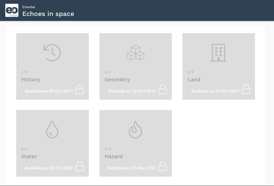
The 1st MOOC on Radar Remote Sensing – courses
If you enjoyed this article on ESA’s launch, read more and subscribe to our monthly newsletter!


#


Next article
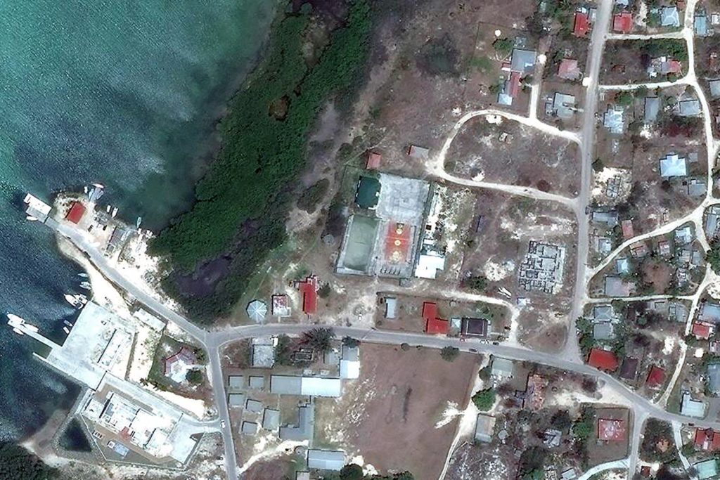
Last week Digital Globe published a series of striking satellite images taken before and after Hurricane Irma. It shows a terrible scale of destruction caused by one of the most powerful storms ever recorded in the Atlantic Ocean.
The imagery has been provided for a few affected areas but lets us see the scale of the damage. The landscape after Irma looks like a war zone. Torn-off roofs, damaged buildings, downed trees. Take a look at these before -> after images:
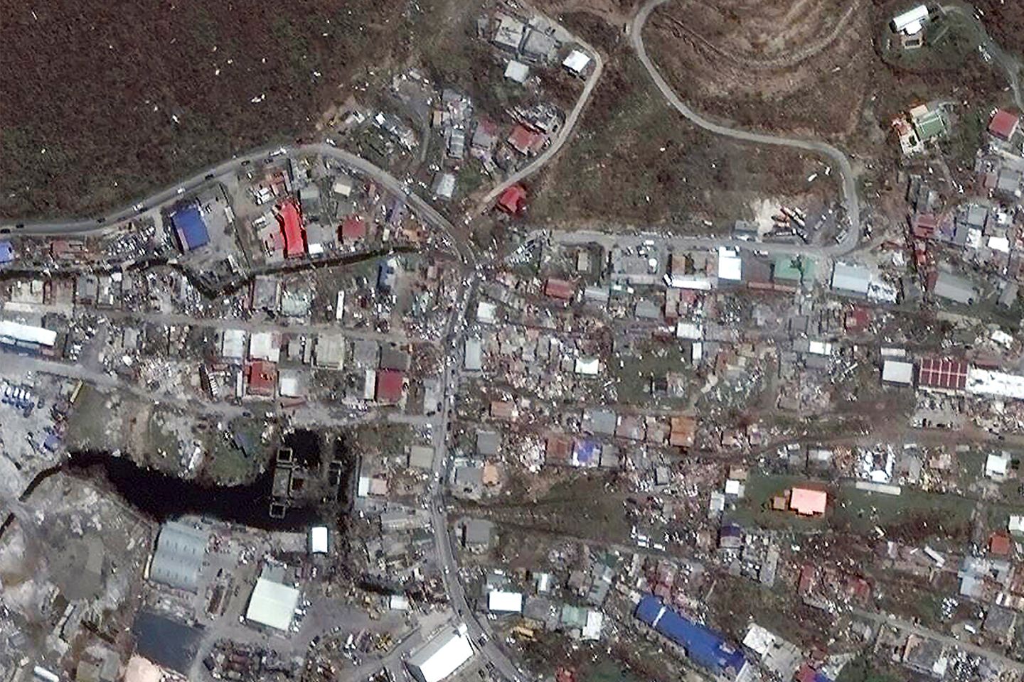
Impact of the Hurricane Irma: Codrington Port, Barbuda

Credit: Digital Globe
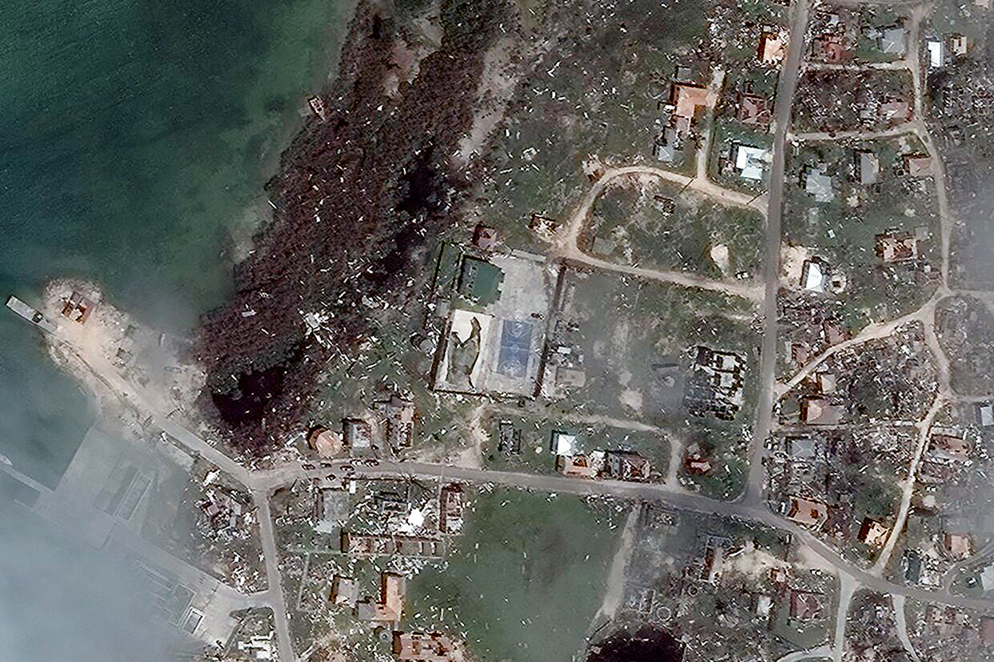
Credit: Digital Globe
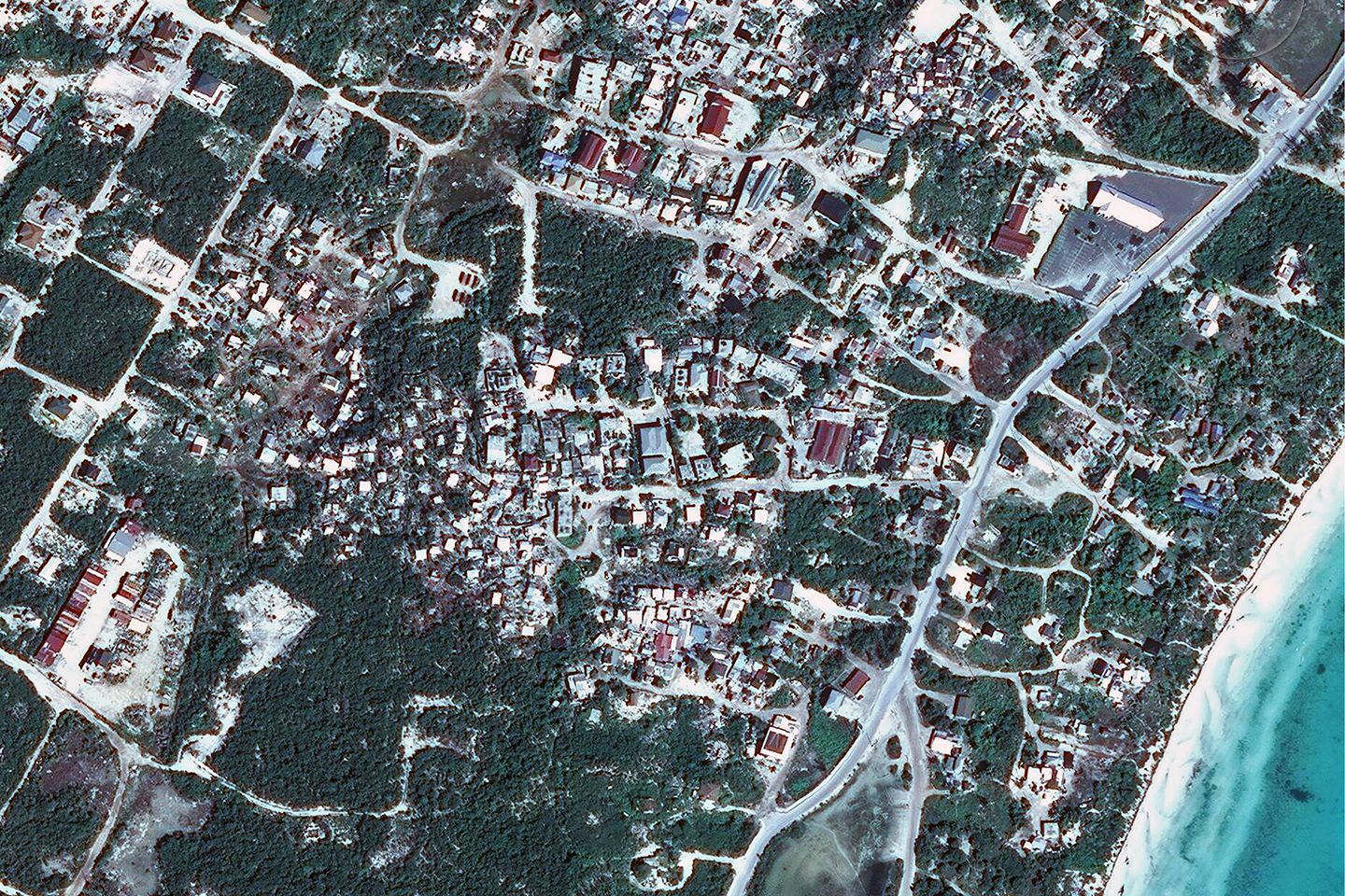
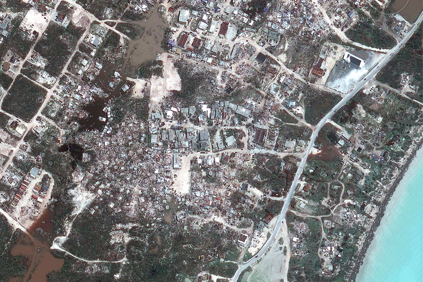
Impact of the Hurricane Irma: Parham Town, Tortola

Credit: Digital Globe

Credit: Digital Globe
Necker Island
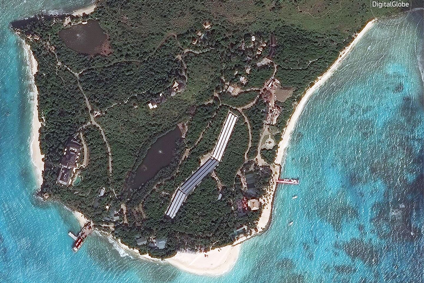
Credit: Digital Globe
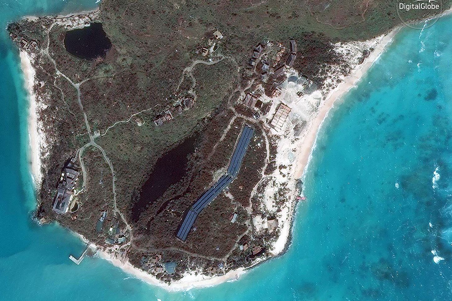
Credit: Digital Globe
Key West, Florida
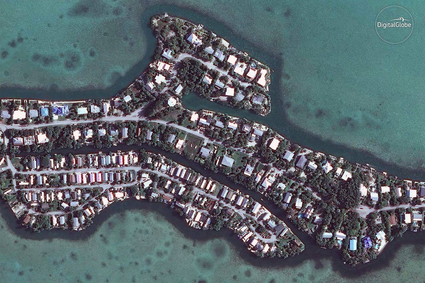
Credit: Digital Globe
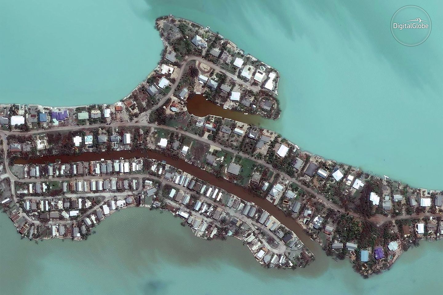
Credit: Digital Globe
Philipsburg, Sint Maarten

Credit: Digital Globe
Credit: Digital Globe
Providenciales, Turks and Caicos
Credit: Digital Globe
Credit: Digital Globe
Satellite imagery plays a crucial role in managing disasters like Hurricane Irma by providing real-time data that is essential for assessing the extent of damage and planning effective response strategies. These images help emergency services to identify the hardest-hit areas, enabling quicker and more targeted aid distribution. Additionally, satellite data is invaluable for long-term recovery and rebuilding efforts, offering insights into environmental changes and infrastructure needs.
If you enjoyed this article, read more and subscribe to our monthly newsletter!