
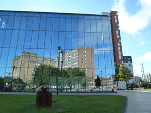
Aston University
What will OpenStreetMap (OSM) look like in 2018? Will it beat Google Maps in popularity or will it just grow into a larger community as more people will start using OSM for their own benefit? In short: what will the future bring OSM? These and other questions were part of debate during the international congress State of the Map 2013, which was held at the Aston University in Birmingham (UK) at the beginning of September. More than 300 members of the OSM community gathered together for their yearly held congress and shared their experiences with OSM.
OSM is what we call a collaborative project to create a free editable map of the world. Maybe you haven’t heard of it yet, but there are over a million mappers – as OSM users call themselves – worldwide. And this community is still growing larger day by day. It was created in England in 2004 by computer engineer Steve Coast. Coast didn’t like the large sums of money government-run and tax-funded organization asked for using their maps. Since then the OSM community grew to over a million users, all volunteers, who collect data using GPS devices, aerial photography, and other free sources. These crowd sourced data are then made available under the Open Database License. More than 20 million kilometer of motor ways, bicycle paths and walking paths have been mapped.
International
Everybody is free to participate in this community. Map data is usually collected using a GPS unit, although this is not strictly necessary if an area has already been traced from satellite images. More and more companies discover the advantages of this detailed open source data. For example, the White House used OSM for president Obama’s change campaign. Also Wikipedia, Flickr, Foursquare and Apple are using OSM for several purposes.
The OSM maps are almost real time updated and improved. This is also one of the major advantages over Google Maps where for example each change must be approved by a so-called “reviewer” and is wholly owned by Google. Or where data supplied by the mapmaker can later be removed.
More apps needed
But why is OSM less known by a larger audience than for example Google Maps? It is not a PR problem, experts say. It is actually the famous chicken and egg story. The more companies and administrations use OSM and invest in OSM, the more people will get to know the advantages of this free open data and because of that the more companies will use OSM in new applications. But if everyone works with Google Maps, few companies will be interested to develop applications for OSM maps.
 The so called Future Group of the OpenStreetMap Foundation also struggles with these dilemmas. Its members want to see OSM in a broader perspective: Where will it be in five years? What will we as a community have achieved by then and what is needed to get there?
Simon Poole, chairman of the OSM Foundation: ‘We do not provide services such as Google, but free to use data instead. We must therefore ensure that we become more visible. We can do that by creating a good balance between the people that capture the data – the mapmakers – and the organizations using the maps for a variety of applications. As more and more organizations use OSM maps and also let people know they do so, the use of OSM and interest in this open source data will surely increase. OSM needs companies like Mapbox to deliver a complete product.’
More open data
Mapbox was one of the sponsors of the State of the Map congress 2013. No wonder, as CEO Eric Gundersen is a strong supporter of open data. ‘The freer the data, the more you can do with it, the more you can innovate, the more the user will benefit. The fact that we now use global navigation systems in our cars, is only because we can use free GPS data that was created by the United States Army. Data that was released because the U.S. government decided to make all data freely available which was government funded.’ An initiative that very soon will be followed in all EU countries, as the law changes in 2015 and government data will be opened up. A great result of the open data initiative by European Commissioner Neelie Kroes from the Netherlands.
 Gundersen predicts a growth of OSM use in the future. ‘It’s not a PR problem, it’s a tool problem. As soon as more tools come available to OSM, the number of users will grow by itself. Just look at the fact that now we have acquired VK, the second largest social network in Europe, at once 195 million new users get acquainted with OSM. VK is particularly active in countries like Russia and Belarus. If all those people use these maps and complete information, we automatically get better detailed maps from those areas. The community of OSM should in our opinion mainly keep doing what they are doing now: producing good maps. And companies like Mapbox provide the services around it.’
Humanitarian aid
Also Kate Chapman, board member of the OSM Foundation, is convinced of the usefulness and necessity of OSM. Chapman is executive director of HOT, the Humanitarian OpenStreetMap Team, that bridges the gap between traditional humanitarian aid and OSM. HOT was founded shortly before the Haiti earthquake. The organization could immediately show how important it is to help the community and infrastructure fast and free with an accurately well detailed map of the disaster area. The same happened later in the areas that were devastated by the tsunami.
Chapman: ‘We talk within the OSM community not just about technology, but also about the possibilities of open source data. So far we have mainly focused on Europe and North America, where most of our users live. Now we also focus on areas where users need us most. Next year our conference State of the Map will be held in one of these countries. This also gives an immediate problem: OSM is mainly working with volunteers. That delivers beautiful results, but isn’t always practical. Not anyone can take time off from work to attend a conference. We could have paid staff for strategic issues, but that in turn requires fundraising and we don’t want to be too dependent for money on one single party. I also think we should focus on other languages. English, German and French are the main languages within OSM. More languages should be supported. Then it becomes easier for people to use OSM in their own environment.’
Innovation
 Stefan Keller, professor of Information Systems at the Hochschule für Technik (HSR) in Rapperswil, Switzerland, is using gamification to interest a whole new group of users in OSM. Gamification uses game elements to motivate users to work on a project and thus gain experience that way. ‘Two of my students figured out how you can reach enthusiastic new groups and also how one can ensure that mappers that are no longer active become active again. The game [www.kort.ch] indeed attracts new users.’ According to Keller gamification is just one of the many roads that OSM can take to attain more popularity and growth amongst a wider audience. ‘More importantly: what does the OSM Community want to attain in five years time? Do they only want to make maps that support their open database or do they want to make a map that can also be used for other purposes?’
Skobbler CTO Philipp Kandall (Germany) and member of the OSM Community hopes for the latter: ‘I certainly hope OSM will become the predominant map as Wikipedia has become the predominant encyclopedia. I believe open maps are a very important goal, and therefore my hope is that OSM can go beyond a display map and be used more and more by everybody from automotive companies to everyone else. In 2018 OSM will – as I hope – be the default map on many huge portals and apps such as Facebook, Apple Maps and TripAdvisor and become a significant and major competitor for Google Maps. The community should have reached 1 billion+ people who use apps/sites with OSM data and 10 million editors, with at least 10.000 of them being actively mapping every day. Then we most likely will be leaders in the mapping space all over the world.’ Or as Mikel Maron (former member of the board of the OSM Foundation) puts it: ‘I can’t imagine a future without it.’


#Science


Next article

 Are there Geocoders in the house? Well you don’t necessarily have to be a Geo-coder to quickly get these Codes working on your machine. Just a little tweaking/bidding settles the matter.
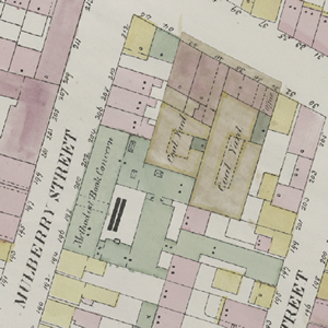
I was gonna talk about these piece of codes posted by New York Public Library Lab on Github. This is an outcome of the Map-Vectorizer project they embarked upon to quickly do the things they were doing.
They sought to develop a kind of ‘’OCR for Maps’’, Map-Object Character Recognition (MOCR) aimed at automating the process of scanned image vectorization.
I have used lots of auto-vectorization programs in the past including ArcScan , R2V etc. but this very program does a far better job.
This program can extract neatly polygon shapes as well as the color attribute of the polygons.
However, the program has not been made stand-alone yet, it is still dependent on the following programs running on your machine; some programs bidding required.
To get the Code (program) properly tweaked and nicely doing the job, you need: Python with OpenCV, ImageMagick, R, GIMP and GDAL.
Provided below is some piece of information from Github to give you a clear guide in achieving the goal; Thanks to Github!
Dependencies
A few things to be installed in your system in order to work properly. So far it has been tested on Mac OS X Lion so these instructions apply to that configuration only. I am sure you will be able to adapt it to your current configuration.
- Python with OpenCV
- ImageMagick with the
libtiffdelegate. If usingbrewthis means:brew install libtiffbrew install imagemagick --with-libtiff- To verify all is well:
convert -list formatshould displayTIFFandTIFF64in the list
- R – Make sure it is in your PATH (so you can run it via command-line by typing
R). - You’ll need the following R packages. On OS X simply navigate to
Packages & Data, choose your CRAN mirror region, then search for and install:rgdalalphahull(you will needtripack,sgeostat,splancsas dependencies)igraphshapefiles- On the CLI (by typing
Rin a terminal window) you will know you have all the required dependencies if you can run this with no errors:
    library(rgdal)
    library(alphahull)
    library(igraph)
    library(shapefiles)
    quit() # this will quit R
- GIMP
- GDAL Tools, on OS X try version 1.9. Per MapBox: The first time you install the GDAL package there is one additional step to make sure you can access these programs. In Mac OS, Open the Terminal application and run the following commands:
    echo 'export PATH=/Library/Frameworks/GDAL.framework/Programs:$PATH' >> ~/.bash_profile
    source ~/.bash_profile
- It is also a good idea to install QGIS to test your results
First run
These step by step instructions should work as-is. If not, check all the above are working before submitting an issue.
- Take note of the path where the GIMP executable is installed (the default value in the vectorizer is the Mac OS location:
/Applications/Gimp.app/Contents/MacOS/gimp-2.8). - Run the script on the provided test GeoTIFF:
python vectorize_map.py test.tif - Accept the GIMP folder location or input a different one and press ENTER.
NOTE: The vectorizer has problems with filenames that contain spaces. This will be supported eventually.
This should take about 70 seconds to process. If it takes less there might be an error (or your machine rulez). Take a look at the console output to find the possible culprit.
If it works, you will see a test folder with a test-traced set of files (.shp, .dbf, .prj and .shx) and two log files.
Customizing The Vectorizer to your own maps
The Vectorizer was made to work with the NYPL map atlases. It is likely that your maps have different quality and colors. In order for this to work in your maps, you first need to do some minor config adjustments to generate a proper threshold file for your set (assuming it is a map set similar to the provided exampletest.tif):
- Your map needs to be in WSG84 projection. Other projections might be supported in the future.
- Open a representative from map (or maps) in GIMP
- With the color picker, select the color that most represents the paper/background color (using a 5-pixel averaging pick would be best). Make note of the red, green and blue values (0-255).
- Do the same for the building colors (like the pink, green, blue in the example).
You now want to produce a neat black-white image where lines are black and all the rest is white:
- Apply
Colors > Brightness-Contrast...looking to make the lines darker and buildings/paper brighter. The default values are -50 brightness and 95 contrast. These may or may not work for you. Make note of the values that work best. - Now apply
Colors > Threshold.... This takes a black and a white value. Anything darker/lighter than these values will become black/white respectively. The default values are 160 black and 255 white. Make note of the values that work best.
You now have the configuration values for your maps (map color list, brightness-contrast values, threshold values). Open vectorize_config_default.txt and replace the default values with your custom values. Save it as vectorize_config.txt (and keep the default just in case). Your config file should look like:
BRIGHTNESS_VALUE,CONTRAST_VALUE,BLACK_VALUE,WHITE_VALUE, brightness-contrast-thresholdblack-thresholdwhite
PAPER_RED,PAPER_GREEN,PAPER_BLUE,paper
BLDG_RED,BLDG_GREEN,BLDG_BLUE,somebuildingcolor
BLDG_RED,BLDG_GREEN,BLDG_BLUE,someotherbuildingcolor
...
It should always start with brightness/contrast/threshold in the first line and paper in the second line. There should also be at least one building color. You can add as many building colors as you wish (since our maps at NYPL are hand-colored, colors are not uniform so we have lighter/darker versions to compensate that).
When you run the vectorizer again, it will find this config file and use those values instead of the defaults.
It is likely that the vectorizer won’t produce excellent results in the first try. It is a matter of adjusting these color values to generalize as much as possible to your map set.
Source: Github.com