

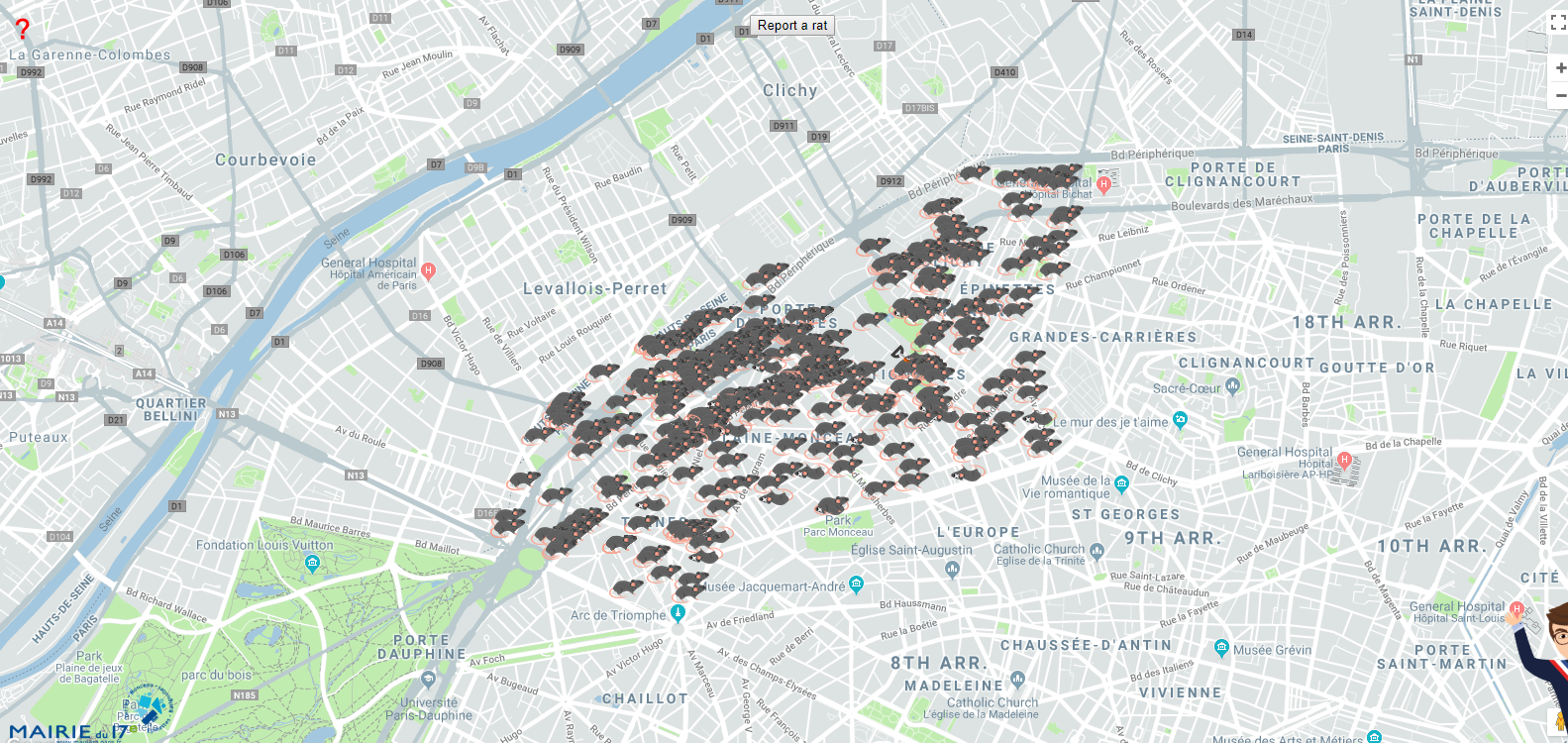
So, this is a map you don’t expect to see every day. Riddled with tiny rat icons, what you see above is a catalogue of Parisians reporting rat sightings in the 17th Arrondissement of the French capital.
The brainchild of Geoffroy Boulard, the head of the municipal council of the 17th Arrondissement, ‘Report a Rat’ map came up after a daycare center’s playground in Paris was found to be infested with rats.
In an interview with a local television network, Boulard explained, “The presence of rats in public space is worrying and has become more and more serious. We had a crèche surrounded with rats dead and alive. Nobody is taking their responsibility. It’s a matter of public health. The city has to react to this sanitary problem. It’s not just the 17th [arrondissement].”
Boulard is not kidding. For every human being in Paris, there are 1.75 rats roaming the streets. The New York Times has declared the situation the ‘worst rat crisis in decades’. And the last couple of years have seen everything from overworked rat catchers going on strike to garbage collectors releasing a nauseating video of a swarm of rats trying to escape from a dustbin.
With ‘Report a Rat’ map, Boulard is hoping to catch the attention of Anne Hidalgo, the mayor of Paris, and let her know that her $1.7 million campaign to eradicate rats is not working out too well for the 17th Arrondissement.
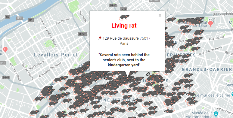
The interactive ‘Report a Rat’ interface allows citizens to record their rat sightings at a precise location, down to the lat-long level, and neatly label the annoying vermin as dead or alive. People can also leave additional comments, like the one you can see above, to help out the sanitation workers responding to the incident. For those who cannot access the Internet, a rat reporting hotline has been set up. Once the pesky rodent in question has been taken care of, its symbol on the map will reportedly get replaced by a shovel.

#Ideas


Next article
Meet Awesome Maps – the startup that is bringing the awesome back to maps! #TheNextGeo

In an age where maps are almost always digital and are designed to highlight places of interest rather than to look like a work of art, it is hard to find maps that stand out and remind us of the awesomeness of cartography. So naturally when you read about a startup called Awesome Maps with the tagline “Awesome Maps has been helping globetrotters see the world differently since 2010“, you want to check out their maps and see what all the buzz is about and honestly, they exceed all your expectations 🙂 I spoke to Simon and Katharina to learn more about Awesome Maps and their vision! Read on.
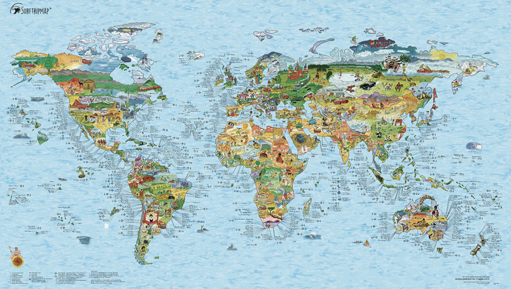
all the awesome maps
Q: In an age where there is an app for everything and maps are almost always digital, what motivated you to start awesome maps? What is really interesting is that awesome maps isn’t a passion project, it is actually what you and your team work on full time!
A: A few years ago, I’d been on a surf trip through Europe, and wanted to pin down all the places I’d surfed as a memento of the trip. I soon realized a political world map is really boring for that, so I decided to make an illustrated world map for surfing. While researching I learnt so much, like that there is actually great surf in Oman! That had to be included, so we decided to add all sorts of different surf spots and information. When the map was completed, it had become not just something to record all the places you’d been, but also something inspirational- a map where you can see all the regions with good surf on the planet. Surf where you’d never expect it, like Oman. The purpose of our maps isn’t to give you instructions on how to get there, because we have google maps for that and digital really is the best way to do this. However, having all this surfing information at one glance in a physical product is magical. You can explore where you want to go, pin where you’ve been and it’s just a constant reminder of the beautiful world that is out there.
So what started as a passion project to solve my own problem became something that inspired others. Once we started, people kept asking for other maps and themes and so we grew slowly but constantly and are now a “real” company with the mission to inspire people to explore the world around them.
Q: The first ever awesome map was the “bucket list map” which was launched 4 years now at a time when you guys called yourself “a group of bearded germans”. A lot of things have changed since the bucket list map isn’t your only map and your team isn’t just “a group of bearded germans” another. What maps are you working on now?
A: The first map was actually the Surftrip Map, which was released in 2010. Other than that, the beard has grown longer and we have released about 20 maps! We are always looking for inspiration and our community is the best source. People who buy our maps are very passionate about exploring and their hobbies and usually come up with the best ideas. That’s how, for example, the Kitesurf Map was born, and we are currently working on some really cool activity maps – one is about hiking.
Q: Designing an hand-drawn map isn’t easy and certainly involves a ton of work. Could you walk us through your design process? How long does it take before the map is ready to be shown to the outside world?
A: We have long discussions every year deciding what to work on. We speak to our community as well as looking at certain factors that give us an indication of whether there is enough of a market.
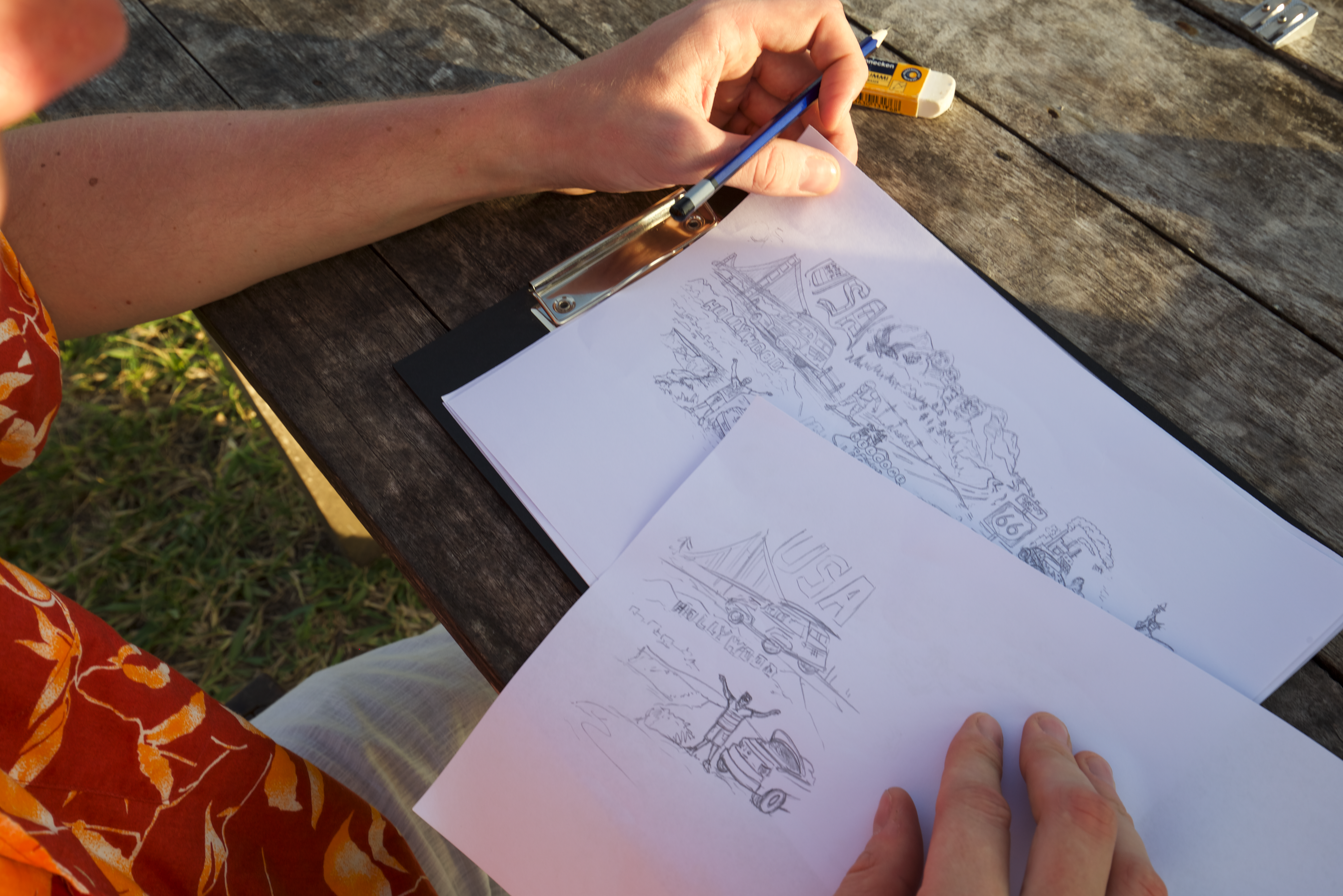
Hand drawn maps are always a work of art!
Then if the map is about something we don’t personally have experience with, we talk to people who do. For the diving map, we took some scuba diving classes to get a basic understanding of what it is that makes divers tick. We spoke to as many divers as possible and reached out to our community to find divers who could help research the map. The information needs to be very condensed, and making a map full of illustrations and information is actually more about saying ‘no’ than it is about saying ‘yes’.
While the research is getting done, we find an illustrator who gets started on the illustrations.
Once everything is done, we assemble the map, marry the artwork with the information, double check the facts one last time, and off it goes to the printer! The whole process takes at least 6 months per map.
Q: Maps used to be a work of art. You had a lot of colours, interesting illustration and dragons and other *mystical* sea creatures in the corner. Is it just us or do you guys also think that it is time for the dragons and other *mystical* sea creatures to make a comeback? I mean with Game of Thrones, dragons are the rage anyway!
A: We were, in fact, debating whether to make a map of mythical creatures! This year it didn’t make the cut, but it’s a hot contender for next year.
Q: I have had an awesome map in my room for many years now and I absolutely love it. But what’s with the obsession with the Mercator projection? What do other projections have to do to get some awesome maps love 😉
Actually, the copper map is a mix of the Mercator and Robinson Projection. We use the Mercator Projection (we have actually tweaked it a little in the very North) because it’s a very balanced projection in terms of proportions, and that really helps when filling the map with illustrations. Imagine the tiny illustrations we could accommodate in Europe if we were using the Peters Projection.
Q: You launched awesome maps thanks to a highly successful kickstarter campaign that raised over $56K in 2013. 27 maps and 5 years later, what comes next for awesome maps?
A: We launched Awesome Maps (branded back then as simply Surftrip Map) in 2010 but the Kickstarter campaign really helped us gain some recognition. We are still passionate about inspiring people to explore the world and still have a long list of maps we want to do. We really enjoy the process so expect more maps to come!
Q: As a startup founder, I am sure that there are many things that you must have learnt along the way. What was the most interesting feedback that you received so far?
A: The most important thing I’ve learnt is that you cannot achieve anything on your own. Finding the right people and keeping them close is incredibly important.
Q: You are based in Berlin. How’s the geo-startup scene there?
A: We feel like a unicorn in Berlin’s startup environment. Not in terms of valuation but in terms of being exotic. I always have to explain that we make physical products and it has people in disbelief! That being said, there are a ton of really cool tech startups concerned with mapping.
Q: Do you accept requests for custom designed maps? Just asking for a friend 😉
A: At this point, we don’t – but maybe a custom map builder will be released at some point. That would also make us a tech company in some way 🙂
Q: Okay, this is a tricky one – on a scale of 1 to 10 (10 being the highest), how geoawesome do you feel today?
A: Always 10!
Q: Any closing remarks for anyone looking to start their own geo startup?
A: This goes for any start-up. Find something you’re really passionate about and where you enjoy the process. You’ll need a blind eye for criticism otherwise you’ll never ship your product. And you need your passion and belief to keep going when you have setbacks- how can you inspire people to work with you if you weren’t be burning for what you’re doing?
The Next Geo is supported by Geovation:
 Location is everywhere, and our mission is to expand its use in the UK’s innovation community. So we’re here to help you along your journey to success. Get on board and let’s start with your idea…
Learn more about Geovation and how they can help turn your idea into reality at geovation.uk
About The Next Geo
The Next Geo is all about discovering the people and companies that are changing the geospatial industry – unearthing their stories, discovering their products, understanding their business models and celebrating their success! You can read more about the series and the vision behind it here.
We know it takes a village, and so we are thrilled to have your feedback, suggestions, and any leads you think should be featured on The Next Geo! Share with us, and we’ll share it with the world! You can reach us at info@geoawesomeness.com or via social media 🙂