
Be a Hipster, buy a map. Ordnance Survey increases sales of paper maps after decade of decline.

We live in the digital era. Everything is online. We’re constantly connected. We shop, we meet, we exist virtually. But after couple of years of life among gadgets I started to feel a growing need of becoming more analogue again. Let me give you an example. When I got an iPad I started to read all books on the tablet. Than I decided to switch to Kindle which was more convenient due to e-paper technology. Today I read all my books in a printed versions. The technology couldn’t make up for the experience of touching and smelling the actual paper. I had a similar experience with maps especially during hiking trips. Over the years I have been testing a lot of different mapping apps which would enhance my real-life experience in mountains. They were helpful to position myself in the field but non of them could actually replace the traditional paper map.
It seems that it’s not only my personal experience. Ufff. Ordnance Survey – British official mapping agency reported that the first time since 10 years their map sales revenue increased. They sold 3% more paper maps in 2014 than a year earlier and the increase is continuing, with a 7% rise this financial year. Nick Giles, managing director of Ordnance Survey Leisure, commented:
It’s great to see that sales of paper maps are increasing. We understand that the increase isn’t huge; however, the significant news is the downward trend has been reversed.
Of course one could argue that the sales of paper maps decreased so drastically that it would be quite easy to get any increase but I believe that there are a couple of other reasons. First of all there is certain sentiment associated with using paper maps. Most of us still remember times when there were no smartphones or PNDs. Somehow we’ve also managed to get from A to B without any problems.
Secondly I believe that in many cases paper maps are simply much more convenient than using a smartphone. Traditional maps don’t require a battery or a 3G reception. Moreover the large format gives you a better perspective of space around you than 4 a tiny smartphone screen. Finally using paper maps is simply much more hipster/lumber than carrying an iPhone in your hand. Don’t you think?

#Business


Next article

JavaScript is constantly ranked as the numbero-uno programming language by several organizations and research groups including our own open-data survey “What is your favourite way to learn coding for Geospatial”. Regardless of whether you believe in such “rankings” and the methodology behind such experiments, if you are interested in developing WebGIS applications you need JavaScript, which makes it an interesting programming language to learn if you are a Geospatial professional (Overview of JavaScript for Geospatial).
There are a lot of ways to learn JavaScript on the web. You can use specific guides like Codecademy or Eloquent JavaScript. Or you can make maps. – MapBox
While it is certainly nice to know the detailed concepts of JavaScript, you certainly don’t need to know everything before you even get started. Sometimes the black box approach to programming isn’t really the worst idea. So forget the basics of JavaScript for the moment and get started. Let’s make maps!
Getting started with JavaScript with OpenLayers
The first thing you would want to do is to install a development environment to start writing (or Copy-pasting) your JavaScript code. Eclipse IDE is certainly one of the best and very popular IDE, which means there is a better chance that your questions are already answered either in the documentation or on Stackoverflow.
[Update: If you don’t prefer Eclipse or would like to explore more IDEs, have a look at the JavaScript IDE search results by DuckDuckGo and Google.]
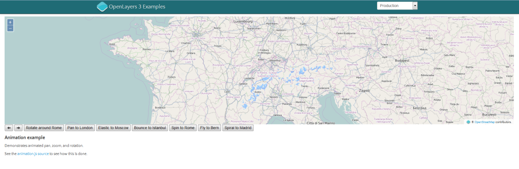
Once you have your IDE set up, you probably would like to start with programming part. One of the best ways to get going would be to try out the OpenLayers examples and see if they work on your environment. It might look confusing in the beginning but OpenLayers isn’t really too complicated and the documentation makes things a lot easier to understand (Basic concepts of OpenLayers).

OpenLayers Example
Isn’ there an easier way to explore things?
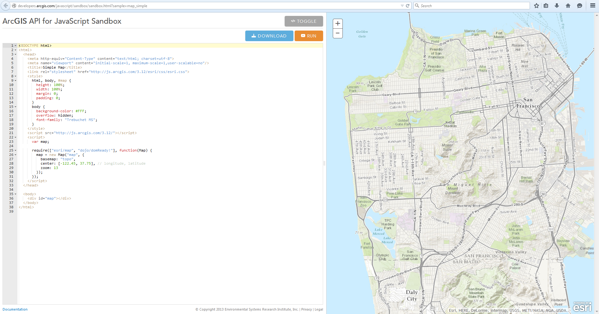
Well, there is always an easier way to explore things 😉 If installing an IDE and running some OpenLayers’ examples doesn’t sound interesting, check out ESRI’s JavaScript sandbox. It is a really simple way to see what happens when you edit the code and change things on the fly. But before you start editing the code (and wondering how to debug), have a look at their getting started guide.
 What next then?
So your IDE is all set and you are getting a hang of JavaScript and this is when you really need an Introduction to JavaScript course or tutorial, if you ever needed one. Trying to just the theoretical details are super boring and sometimes the examples & exercises listed in such a course can be irrelevant to you.
If you think that is the case, then start trying out these mapping exercises,
More Resources
- OpenGeo tutorial for JavaScript
- Mapbox: How JavaScript & Mapping works
- ESRI has a detailed getting started guide for JavaScript
- CartoDB: getting started with CartoDB.js
- HERE Maps API
- Leaflet examples
Related Courses
- Looking for more information on how the different stacks in a web application i.e. SQL, JavaScript, HTML, CSS work together? Coursera has an interesting course on Web Application Architectures that starts on 16th March, 2015.