
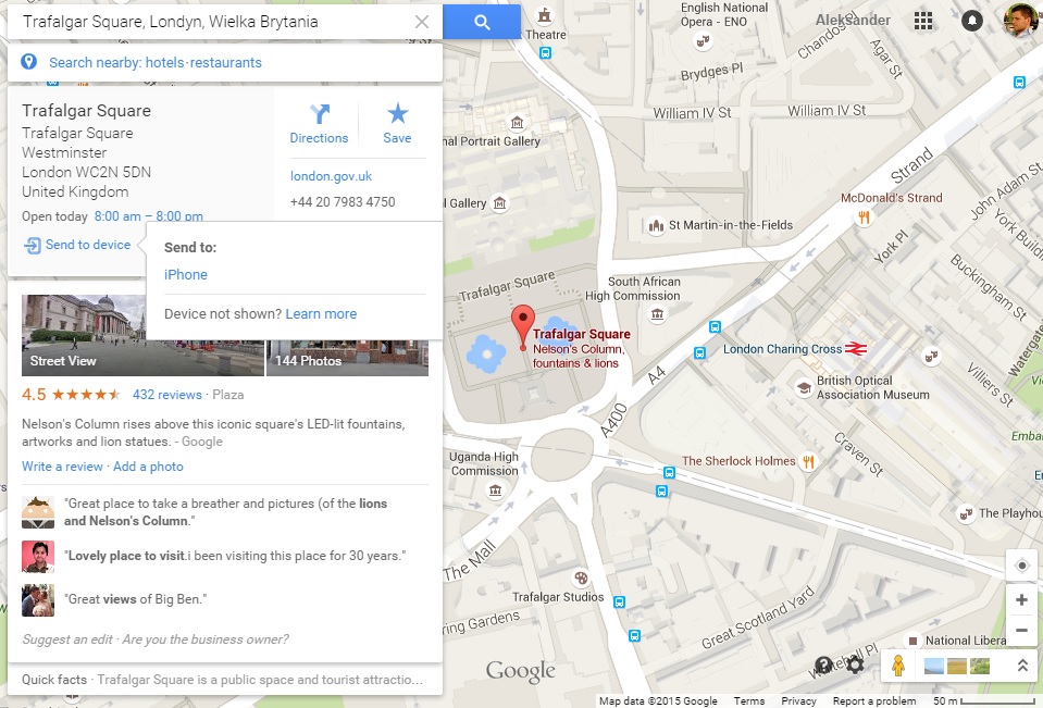
Google released “send to device” feature for Android in April. It allows users to search for a particular location on Google Maps on your computer and easily send it to your smartphone. This week Google released a similar feature for iOS.
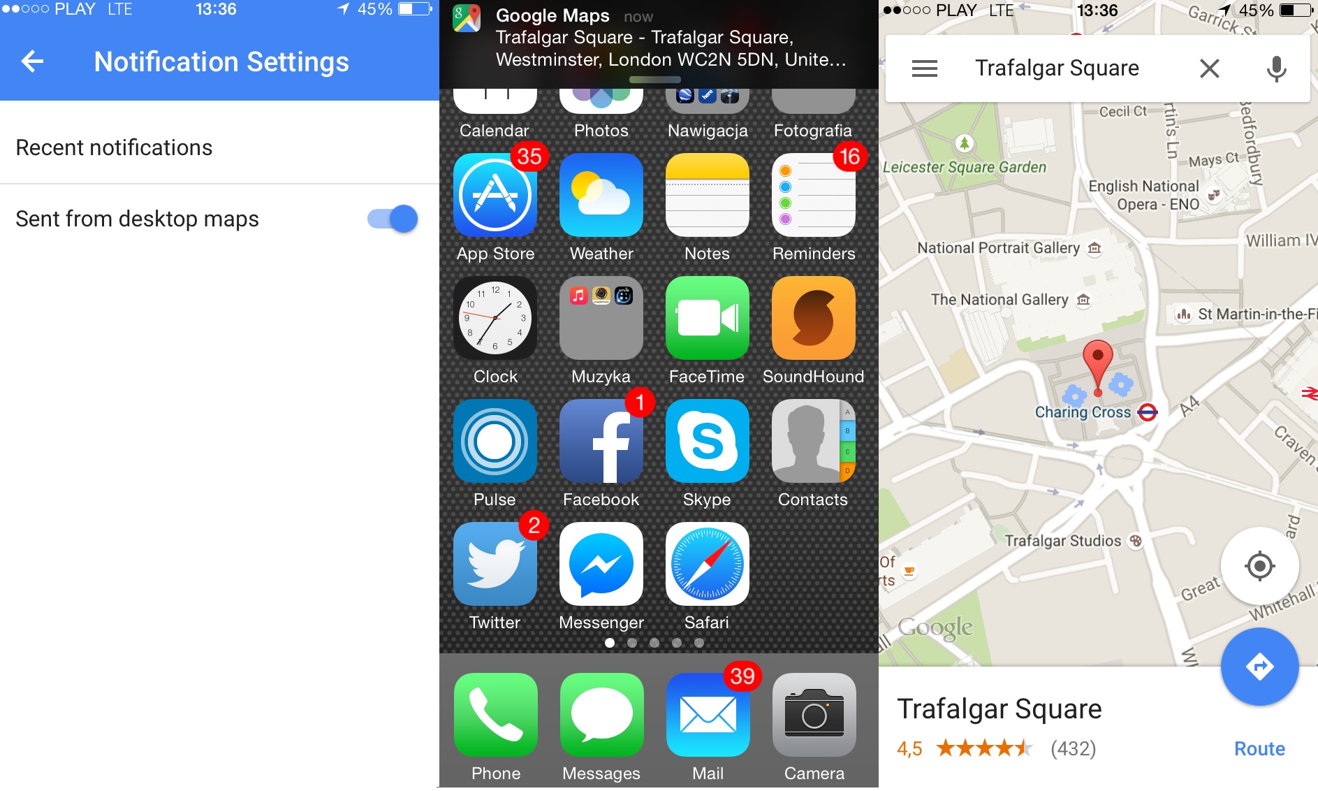
In order to activate this functionality, first you’ll need to enable it in the settings menu on your iPhone or iPad. The option is available inside the app under notifications settings. You’ll find there a new option to allow notifications “Sent from desktop maps.” After you turn it on, and you’re signed into the same Google account on your computer, a new “Send to device” option will appear on desktop.
But frankly speaking I’m really disappointed by that feature. Everyone knows that the new version of Goole Maps released a year ago is extremely slow. It works much more smoothly on a smartphone. The only use case when I prefer to use Google Maps on desktop is when I want to customize my route (with shortcuts and alternative routes) rather than to choose the one proposed by Google.
The problem is that there is no way to send this route to your smartphone and the app does not offer the option to manually drag and drop extra points on your route. I was expecting “send to devise” option to finally support it.
I hope that Google will add it in the next released of the app.

#Business


Next article
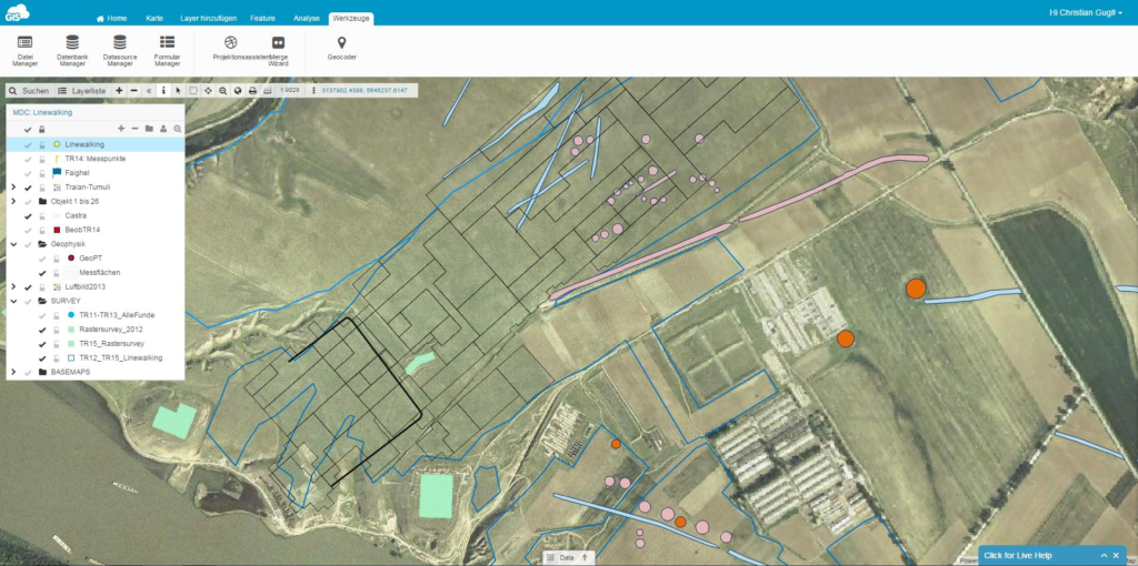

We did an interview with Dr. Gugl from the Institute for the Study of Ancient Culture in Austria. They have been using GIS Cloud in their research of Roman Military Camp – Municipium – Late Antique and Byzantine Fortification.
BACKGROUND
GIS Cloud: Can you tell us some basic information about the project you are doing and why was there a need for a cloud GIS based solution?
Dr. Gugl: Troesmis is the name of a Roman and Byzantine city on the lower Danube, nowadays situated in Romania close to the modern city of Tulcea. In 2011, the Austrian Academy of Sciences started an archaeological field project in close cooperation with the Archaeological Institute of the Romanian Academy of Sciences. Another project partner is represented by the Institute of Archaeology of the University of Innsbruck (Austria). The involved project partners perform different tasks on this huge archaeological site which is one of the largest archaeological settlements in Romania, including a Roman legionary fortress (2nd century AD), a Roman town (2nd/3rd century AD) and two other fortifications dating from the 4th to the 13th century AD.
In the last years different kinds of information were collected by the project partners: air photo and satellite photo interpretation, airborne laser scanning, geophysical prospection, archaeological field surveys and the documentation of archaeological traces, still visible on the site, using CAD-software and photogrammetry.
CHALLENGE
What were some of the challenges that your project had and that you overcame with GIS Cloud apps?
In the Troesmis project, usually different teams were working on the site with the need of an easy usable, GIS based technology to do the documentation work. Especially the mapping of archaeological findings in an area of approximately 35 km² by a survey technique called line walking (4 to 6 archaeologists arranged in a line were walking over the accessible fields) is an ambitious task. With the help of GPS and GIS technology in combination with a cloud based solution this could be organized much more efficiently.

SOLUTION
Can you describe us your project workflow once you deployed GC apps?
GIS Cloud apps are easy to use. Most people are familiar with smart phones and within a short time, they can handle the device. The data collection app provides an elaborated functionality, so that each team had a mapping device in their hands. Consequently, if you can accept a mapping accuracy of 5-10 m, there was no need of expensive GIS field computers. It is possible to provide both base maps and vector data to the different teams which are essential for evaluating archaeological features on the ground. In an open scenery like in Troesmis where you are facing a steppe-like landscape, it is important to determine your own position in relation to known archaeological features, for instance crop marks which are mostly not visible from the ground. This additional information is made available via the GIS Cloud, which is extremely helpful if you intend to map new features or artefacts.
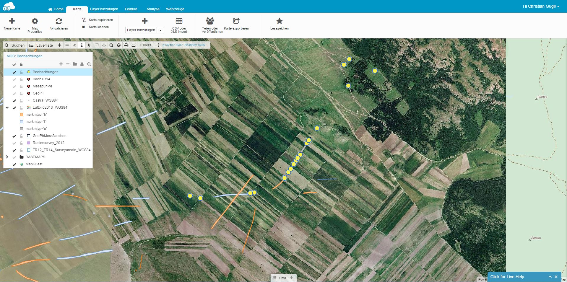
Even in a rural landscape like in this part of Romania, where you are in between the meandering watercourse of the Danube and the slopes of the Măcin Mountains, data acquisition via the internet worked surprisingly well. The GSM network coverage is mostly sufficient and even if you are moving in a remote area, we had no problems because of the buffer storage of the devices.
RECOMMENDATION
What would be 3 key features in your opinion that you would recommend GIS Cloud for coming from Archaeology perspective?
- The possibility to provide different teams with the same easy to use mapping tools
- Easy to use mapping tools on smart phones have a positive effect on enrollment costs
- General advantages on web based GIS technology (availability of the same data sets, …)
Originally published on GIS Cloud blog.