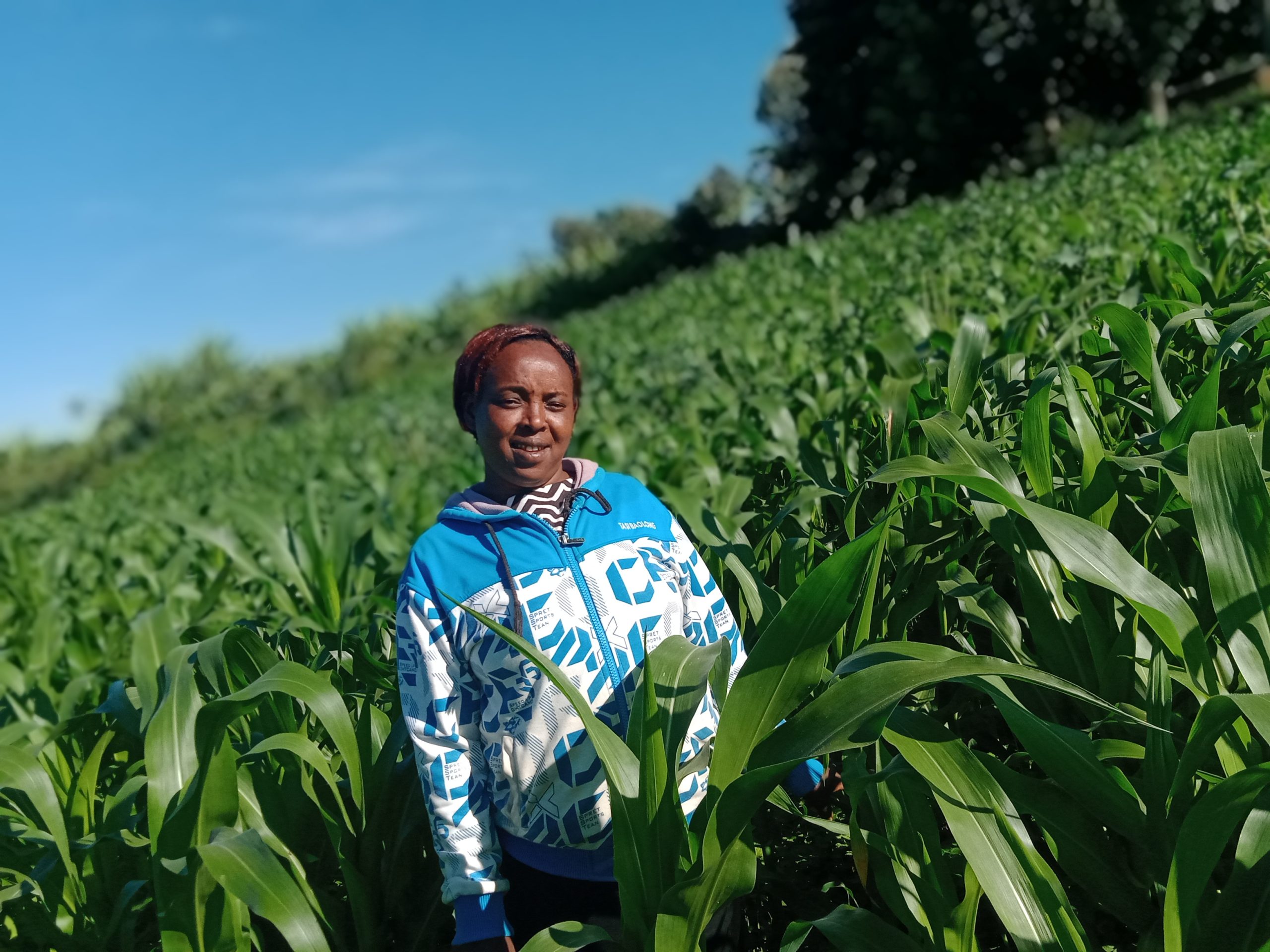
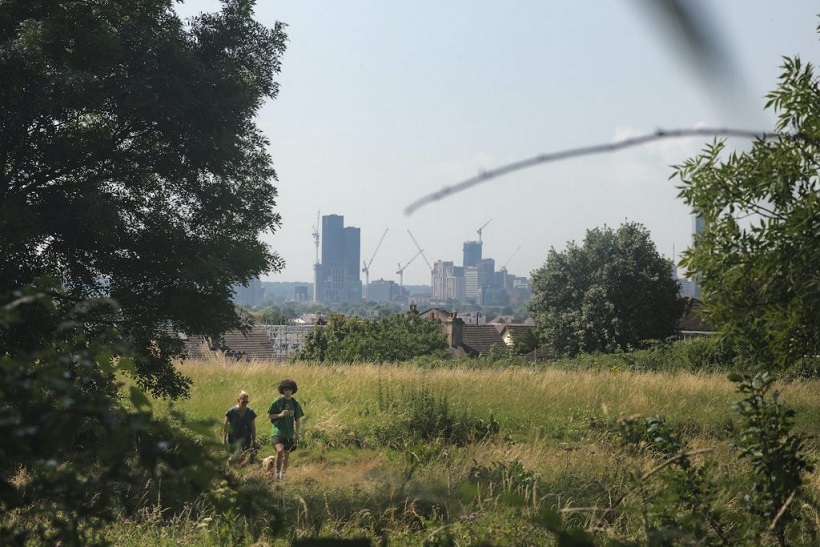
Photo by Njambi Kimani
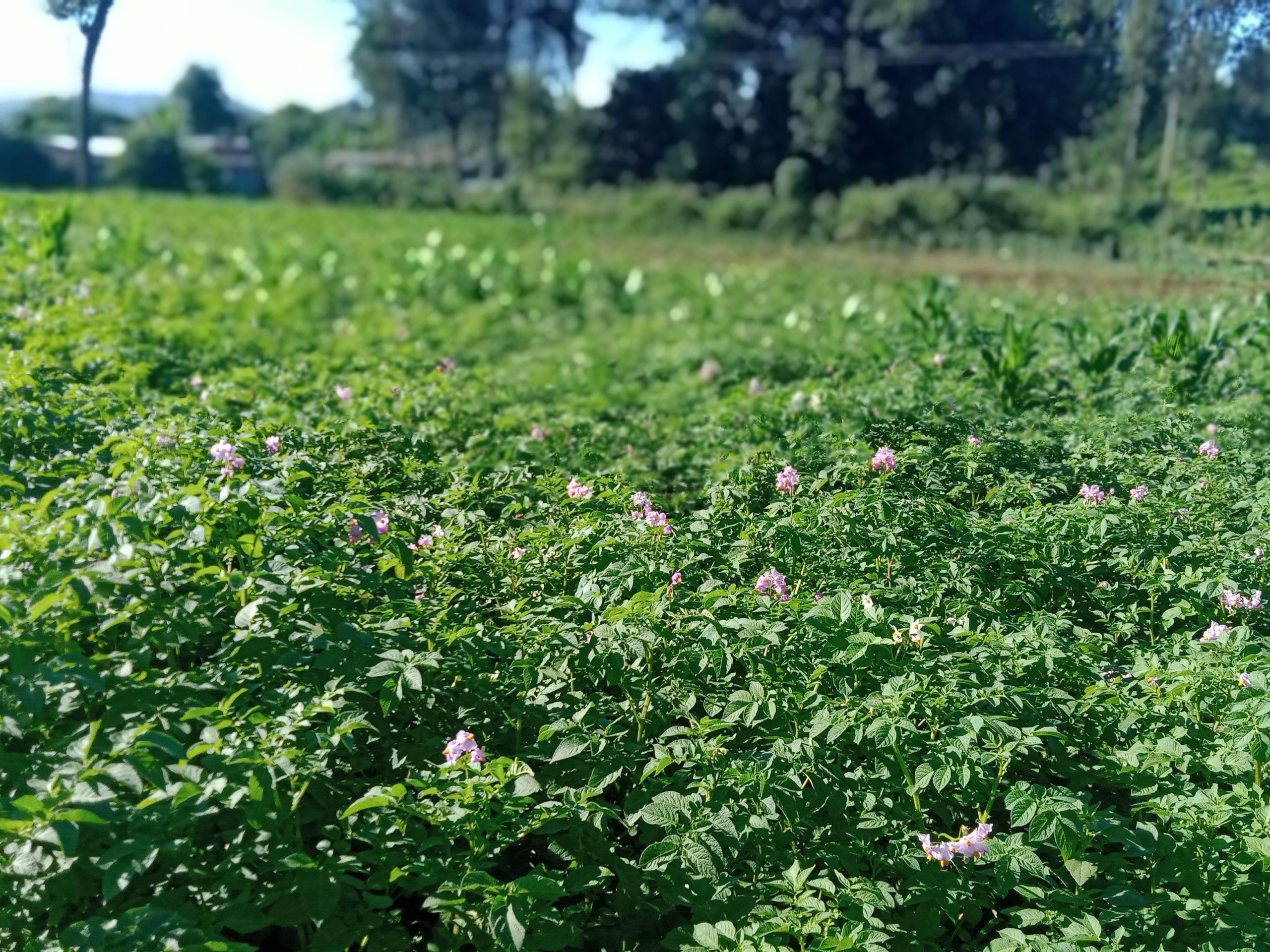
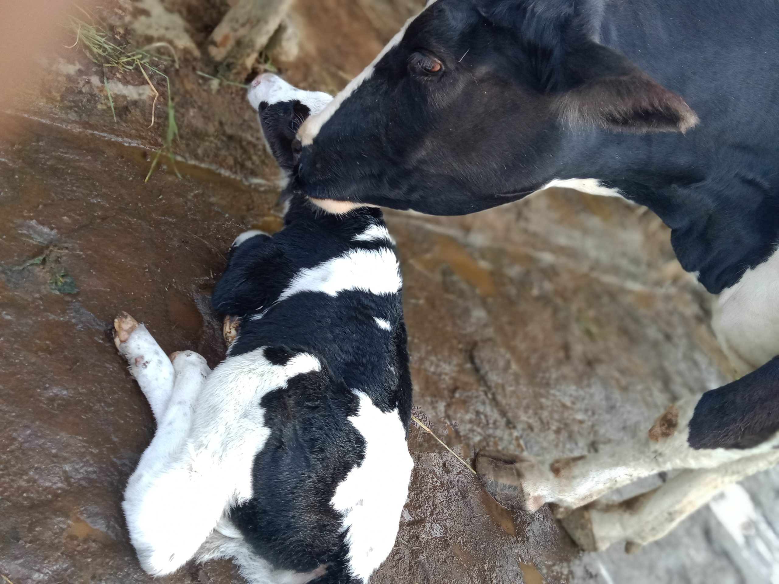
It’s the beginning of April and Wambui a small-scale farmer in the Bahati Settlement area of Nakuru- Kenya is worried that the rains are a little late. She plans to plant potatoes, beans, and maize in the two hectares farm where she also resides and keeps three dairy cows. On the other side of the river, Mr. Ndoro has over a hundred laborers working to complete the wheat harvesting before the rains begin. He is a rich man with over two hundred hectares of both tea and wheat – an incredible combination that lay beside each other forming a beautiful canopy that transitions from green to brown. He uses a helicopter to spray herbicides on his crops- it’s beautiful. In the dry regions of Solai, Rono takes his two beef cattle to the farmers’ market. The two are the only remaining ones from a herd of almost three hundred cattle he had the previous year. He wants to shift to growing avocados and he is hopeful that the sixty seedlings he plans to acquire from the cooperation will give him a fortune.
Wambui is my mother, and she is still a little green in the field of geospatial analysis even after she put me through five years of school. She laughs it off when I remind her of this and in her subtle way, challenges me to a task on how my experience can be of help to her agricultural prospects.
All around the different forms of agriculture vary from place to place affected by different factors. Ranging from environmental factors, climatic conditions, and soil composition, a lot of variables come into play in determining sustainable agricultural practices. Geostatistics, spatial analysis, soil mapping, and sampling are among the vital methods involved in the process. Understanding the different requirements for crops in terms of soil factors (eg. pH, organic carbon), climatic conditions (eg. temperature, precipitation), and environmental factors such as altitude and surrounding ecosystem is crucial. Geospatial technologies have become a holy grail in agricultural research and mapping. Geospatial data has made it possible to carry out suitability analysis for these crops. The area that meets the most of a crop requirement is usually mapped. Spatial analysis paves way for extensive agricultural research such as sustainable seeds and fertilisers.
Environmental modelling, climate modelling, and prediction are research themes that have now become achievable through geospatial science. Integrating both spatial and non-spatial data provides a clearer picture of the state of agriculture and food systems which are now a global concern. Given that the world continues to evolve in industrialization, technology, and urbanization, a healthy population is dependent on good and sustainable agricultural practices. To be conscious of this, incorporating modern technology with geospatial science to match the ever-evolving world is important. New methods of earth observation science are coming up and coupled with machine learning and data science it is fascinating to see how this geospatial field is becoming more dynamic.
Today, Wambui has become more conscious of the environment and her agricultural practices have become more sustainable. Through soil sampling, she can understand what seeds and fertilisers to purchase. From the climatic patterns and predictions, she can decide on what to plant and when. Once in a while, she gets the chance to showcase her farming methods to her neighbours, and when asked how she transitioned from the traditional methods of farming, she mentions geospatial science.


#Business


Next article

Walking in urban spaces – Copyright Dan Raven-Ellison
Geoawesomeness has already reported on the phenomenon which is Slow Ways, however nearly a year later and with the project team awarded significant funding from the Lottery Community Fund it is time to once again showcase this innovative project and update readers on how this is a case study of Geospatial for Good.
“Good geographic information and understanding is at the heart of making Slow Ways a success. In addition to ongoing uncoordinated activity, we will use our geographic data, knowledge and intelligence to specifically target settlements, local authorities and regions across Great Britain.” Dan Raven Ellison, 2021
To recap, Slow Ways is a UK project dedicated to the development of a trusted active travel network enabling people to go on walking journeys from A to B rather than navigate the disjointed system of public rights of way. The Slow Ways Team want more people to walk more often, further and for more purposes and they propose to do this by both inspiring and supporting people to use and contribute to a trusted walking network. Walking brings personal benefits to health and wellbeing as well as deeper solutions to the health, ecological and climate crises, (check out more benefits here). The Slow Ways team will aim to spark the interest of people at all levels from local authority councils down to individuals, and the team intends to use geographical analysis to identify areas to target.
Prior to the COVID-19 lockdown guerrilla geographer Dan Raven-Ellison planned for the initial network to be created via a series of hack days but when the nation was put into lockdown in March 2020 the project had to change course. Stuck indoors hundreds of volunteers digitised a network of over 8,000 routes following a set of rules using open data, ordnance survey maps and local knowledge. By the time lockdown began to ease a website had been developed to enable those same volunteers to support the next stage of the project in verifying these routes (each route must be reviewed three times to be considered verified!).
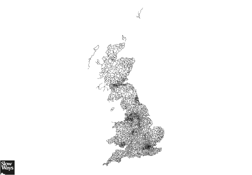
A snapshot of the Slow Ways route network, the dynamic interaction between users and routes result in this map frequently changing – where will you walk today?
How is Slow Ways supported by geospatial technology? What skills and techniques have been utilised? How is this a Geospatial for Good case study?
Currently the Slow Ways infrastructure incorporates ESRI’s ArcOnline web based mapping software which stores the Slow Ways data. Alongside this cloud based environment desktop software (FME and QGIS) has been used to manipulate the data and build a more robust network. Geospatial technology has enabled the Slow Ways project in three particular ways;
- A means to store and manage the network
- A means to add value to the data
- A means to carry out geospatial analysis
First, the network digitised by the lockdown volunteers is dynamic; it is constantly being updated with new routes and additional attribute data by the users on the website. To maintain the integrity of the spatial and attribute information the linear route data is stored in a spatial database. The Slow Ways project uses Survey 123 to allow users to undertake more detailed surveys of routes and this information is also held within the geodatabase. The data is managed as needed using the ArcOnline data tools or by the geospatial lead connecting via ArcGIS Desktop and it is served up to the website via Leaflet which delivers interactive maps to users.
Secondly geospatial workflows add value to the data. By integrating the network with strategic demographic and environmental land use datasets the Slow Ways team can develop a better understanding of the routes. Dynamic statistics can be provided for users, where are the most wooded routes/shortest routes, which routes are flatter and for the slow ways team who can drill down to gather statistics which can be shared on social media to engage users.
Thirdly geospatial analysis can support the Slow Ways team in their drive to nurture user engagement with Slow Ways. Development of visualisation tools such as web maps and dashboards will directly support the Slow Ways team in their targeting of communities to increase participation. Geospatial analysis will also identify areas where there are gaps in the network, or provide insights into the proximities of populations to the slow ways network.
The opportunities for geospatial technology to support Slow Ways will only increase, there are plans to deliver a more dynamic user experience on mobile devices and to also develop active routing so users can plan a journey from their doorstep. In time Slow Ways will hopefully become embedded in the other networks we use allowing users to plan journeys that combine slow ways with public transport.