

Wind as an alternative and sustainable resource for producing energy has become reality and enjoys an excellent reputation of being a green form of electricity. The area of wind farms is extending worldwide. Before a new area is developed the wind conditions need to be studied, in order to estimate if an exploitation of wind energy is feasible or not. When a wind park is operating, the wind properties are monitored to detect changes in direction. Therefore, the wind properties somehow have to be observed! Recently (after 2005), remote sensing was discovered to be an alternative for mapping wind properties. Particularly the refinement of existing remote sensing technologies as the LIDAR and SODAR one contributed to an enhanced application of remote sensing for wind mapping. In this article I want to reflect on the use of traditional vs remote sensing means for wind monitoring.
Traditional method and recent trends
The traditional method to monitor wind over a certain surface relies on MET (meteorological) towers, normally lattice towers that are equipped by anemometers. They can be installed quickly and are useful to deliver data over a long period at fairly low cost. Recently, industry developers moved into untapped regions of lower wind regimes. In those places the wind turbines have to be bigger, in order to catch the energy, the hubs become taller and the rotors longer. Those low-speed wind turbines measure around 80-100 meters in range and are able to capture more reliable winds in greater heights. In this case, the wind data for heights above 60-80 meters have to be extrapolated (as the standard towers are too low), which implies uncertainties e.g. about the site’s potential production and therefore a higher risk and difficulties to get a project financed. On the other side, higher MET towers to advance respective heights are disproportional more costy than standard height towers and therefore would quickly loose the edge of being a cheap technology. Due to this problems remote sensing gained importance in the discussed topic.
Wind remote sensing
The two favoured options of wind remote sensing are SODAR and LIDAR. Sodar emits and records acoustic impulses. It measures wind properties up to a height of 600m, whereas the measurements above 120m are not useable for exact wind mapping due to deteriorating quality. The signal may be eroded by obstacles (trees, objects, …), precipitation and even strong wind velocities that produce sounds.
Since its invention in the 1960s, LIDAR was used for wind measurements not before the early 2000s. Lidar generally provides data with better accuracy, especially at greater heights (up to 200 meters) and is less susceptible to adverse site conditions. It is significantly more expensive than Sodar or MET towers. Both remote sensing technologies are faster in installation and more flexible than MET towers, which on the other hand are more appropriate for long term observations. LIDAR’s laser does not penetrate fog and anemometers on MET towers on the other hand are susceptible to icing. Every technology has its advantages and disadvantages, its application depends on the scope and needs. Generally, Sodar and Lidar tend to get attention before and during the construction of windfarms, whereas MET towers provide a good and useful data source throughout the entire project lifespan. Still, with the development of side-scanning lidars experts forecast the solely use of remote sensing as a desicion tool for developing new wind farms and even a gain of importance in the operating phase. Technology will proof.
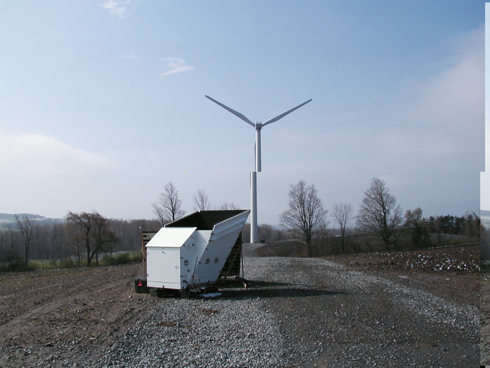
Sodar system
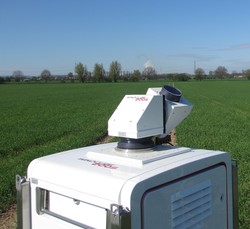
Doppler-Wind-Lidar
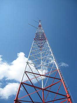
MET tower
Source: Renewable Energy World

#


Next article

 Our location addiction and expectation to be able to seamlessly navigate from one place to another is something we take for granted. The behaviour of checking google maps for directions has become so common that when I ask for directions in a new city, the person (if he/she is not old) is surprised and invariably has to check the smartphone for directions.
What happens when we are denied the luxury of having a GPS/GNSS. Are other technologies capable of helping us navigate when GPS/GNSS is unable to do so? A few weeks ago, I read an interesting article on what’s next in the field of navigation? Naturally as a Geomatics engineer I was intrigued by the latest technologies that were being developed to substitute GNSS in certain applications. One of the most promising areas for new age navigation is Micro-Technology.
Most defense establishments around the globe are looking to Micro-Technology to help tide over GPS emergencies which by the way look very much possible in the near future. The DARPA (Defense Advanced Research Projects Agency) has an entire team working on such technologies: Micro-Technology for Positioning, Navigation and Timing (Micro-PNT) program. One of the primary goals of the project is to to develop technology for self-contained, chip-scale inertial navigation and precision guidance. Micro-Gryos are very popular in this regard and Northrop Grumman group has come up with a new prototype “micro-Nuclear Magnetic Resonance Gyro (micro-NMRG)” for the MICRO-PNT division of DARPA.
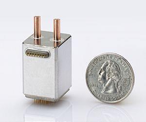 Micro-Nuclear Magnetic Resonance Gyro! Definitely sounds way too complex 😉 The concept behind this complex sounding technology device is spin of an atomic nuclei. Fundamentally, the micro-NMRG technology utilizes the use of the atomic nuclei to detect and measure rotation which in reality helps us locate ourselves and thereby navigate from A to B. The advantage of using such a Gyro in comparison to the one that is routinely being in our smartphones is that the Nuclei based gyro has no moving parts which helps avoid measuring unwanted vibration and acceleration that may be caused to the mechanical parts.
So has it solved our dependence on GPS/GNSS?
Well the answer is no! The Gyro is part of a bigger puzzle that will over a period of time help develop an alternative to GPS/GNSS but in reality the gyro is rather useless without knowing where we are i.e. initial location. GPS/GNSS still happens to be that technology that provides us information to answer the “Where” question in a global scenario.
micro-technology for navigation, positioning and timing: Promising!!