
Well designed transit maps are a rare thing these days. I was really surprised to discover that one of the best I’ve seen for a long time comes from Ukrainian.
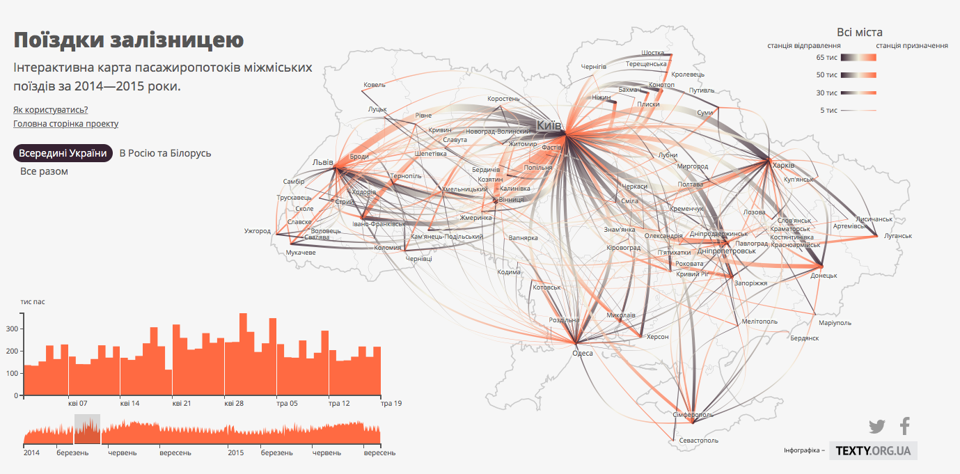
I believe that Travel By Rail is one of the best transit maps out there. It visualizes the number of intercity train travels between every two cities in Ukraine, as well as Russia and Belarus. It is complemented with graphs visualizing temporal distribution of train journeys.
You can click on each city to explore journeys from a given location. You can also select a range of dates on a graph to analyze the data for a given time.
Really interesting and well designed project.

#Ideas


Next article
![]()
When Apple launched its Maps back in 2012 it quickly became the laughing-stock of the internet. Streets and town were missing, famous landmarks were misplaced or distorted… Apple proved to the whole industry that creating a really good global mapping service is harder than one can expect.
Today Apple Maps is a different story. After a terrible start in September 2012 the company hired hundreds of people to its maps department. It gradually fixed most of the errors as users submitted them. But most of the Apple Maps technologies and features come from acquisitions…
Here is a list of all mapping start-ups acquired by Apple and why Apple needed it:
wpDataTable with provided ID not found!