
Map projections are cool, but they might be a bit scary. It’s difficult to understand how can you put a very complex round-shaped surface of the Earth on a flat plane. After reading this post, everything should be clear!
1. Portraying the features of a spherical surface on a flat plane
Map projection is portraying the features of a spherical surface on a flat plane. This cool image from the Rice Space Institute explains everything.
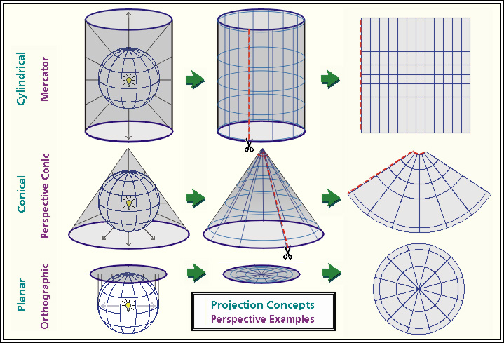
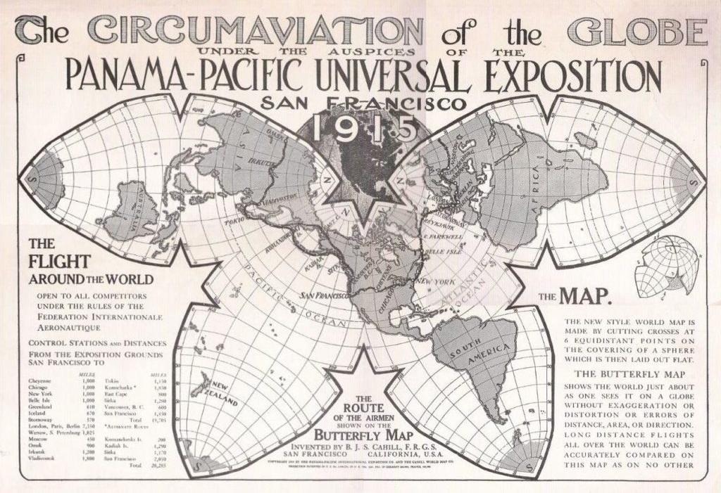
2. Amazing Map Projection Explanation From 1921
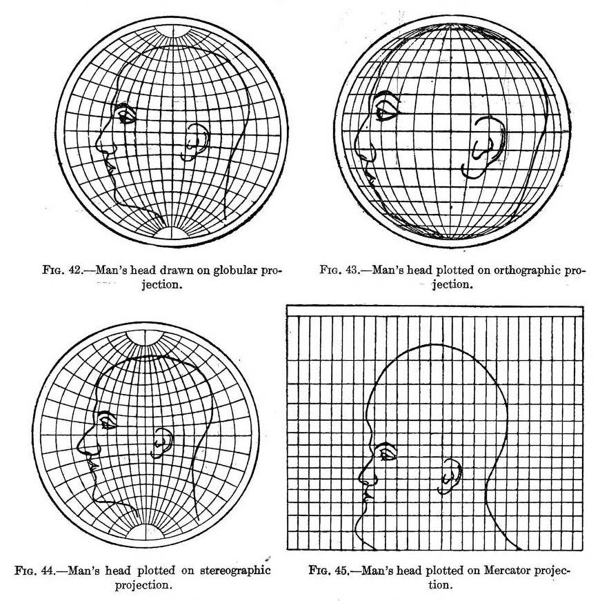
This illustration from the book “Elements of map projection with applications to map and chart construction” written in 1921 by Charles H. Deetz (born in 1864) and Oscar S. Adams, (born in 1874) is one of the best illustrations of the concept of map projections ever.
3. All map projections compared
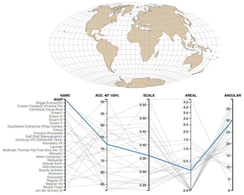
This amazing website is comparing parameters of key map projects. There are a lot of them.
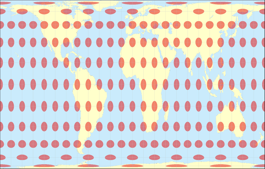
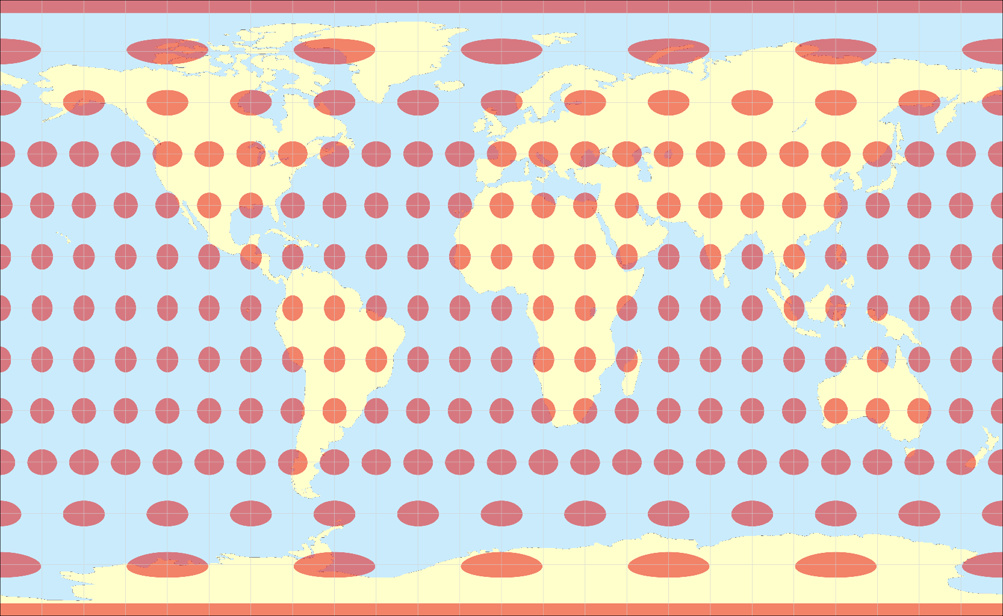
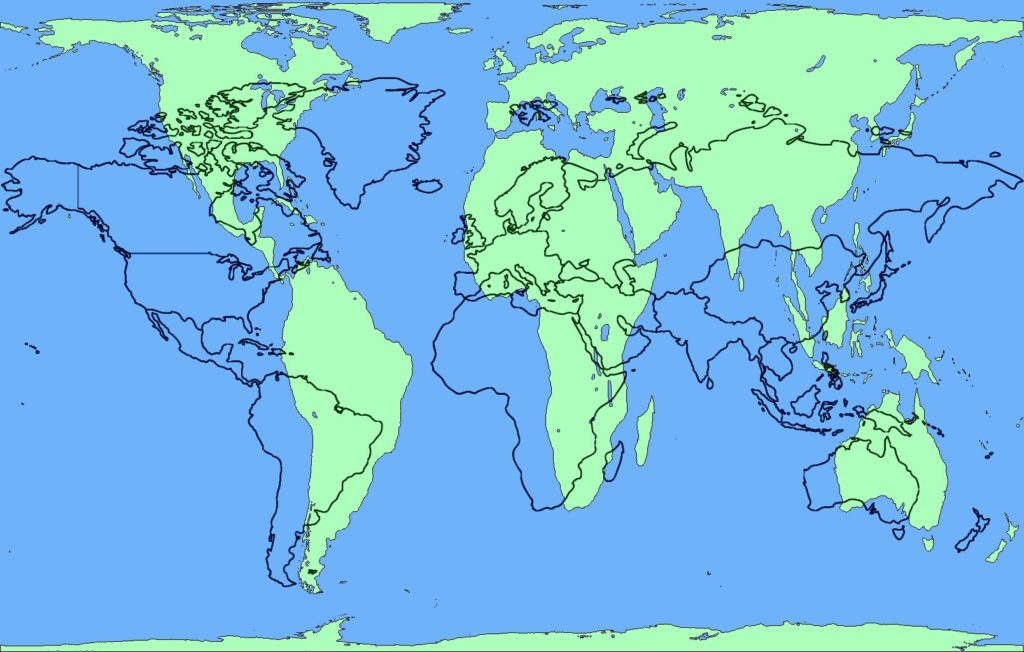
4. Map projection can keep one parameter angle, area or distance undistorted
Mercator projection is conformal, so it preserves angles making it perfect for sailing navigation.
Gall-Peters projection preserves areas. Now you can see that Africa is the largest continent.
This equirectangular projection preserves distances.
source: Map-projections.net
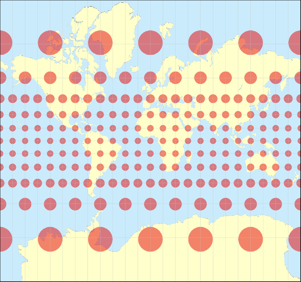
5. Mercator projection lies
When comparing conformal Mercator projection (black lines) and equal area Gall-Peters projection (green shapes) you can notice that the world as we know it from Google Maps is a lie. Africa is the second largest continent after Asia. Australia is the size of Europe. Scandinavia is a tiny piece of land. And Greenland is not as big as South America. You want to learn more about the real sizes of countries around the world there is an awesome tool to discover it.
source: flatearthdisclosure
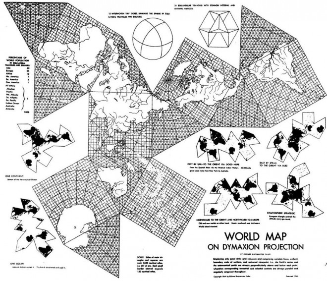
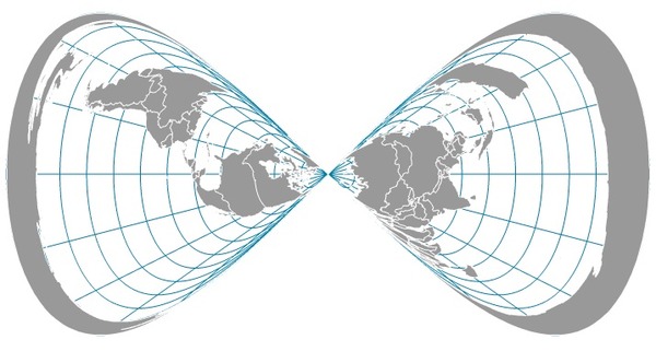
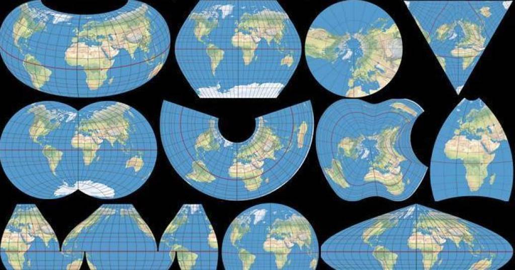
6. Map projections are not boring
Map projections are all about math. This means that you can do with them whatever you want to as long as each point on the map is mathematically defined. Check out these cool examples of crazy map projections:
7. What these map projections say about you
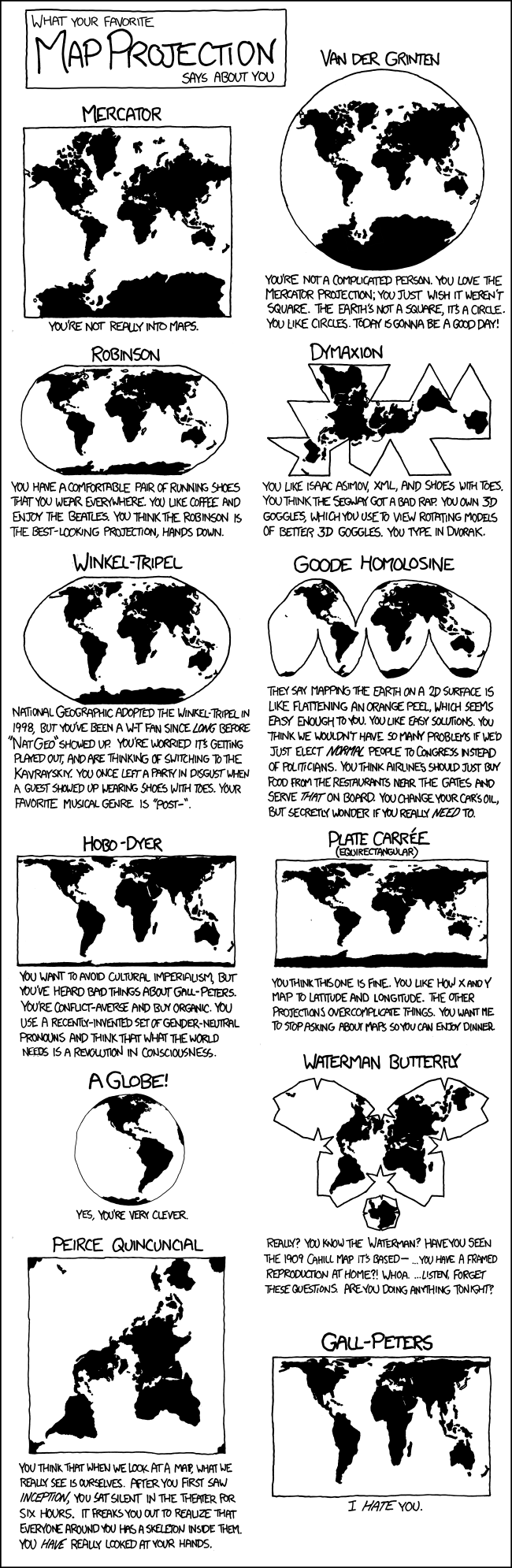
source: xkcd

#Fun

Next article

Are you afraid that Google tracks your every move? Well… you should, the company does track your whereabouts and it doesn’t really try to hide it. In 2015, Google introduced a new feature to Maps called The Timeline, where you can view where you’ve been in the last hour, day, week, month or even a year. But The Timeline is not a new concept. All these data were previously available on a website called Google Location History which was quietly existing for a couple of years but you might have never heard about it as Google didn’t really openly advertise it.
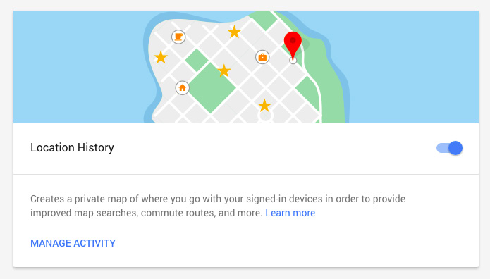
It is really fascinating what you can do with that sort of data… But it’s also scary that one company owns that much information about almost each of us and not everyone is aware of it. Fortunately there is a way to minimize the number of location data you’re giving away. You can play around your Android and iOS devices and you should find it but it’s a bit different depending on your OS version and a device. I found out that doing it via the website is much more convenient and it offers couple of cool features.
Google has a website called Activity controls where you can stop your location sharing among other services. You can pause your location sharing by simply pressing the blue button on the right.
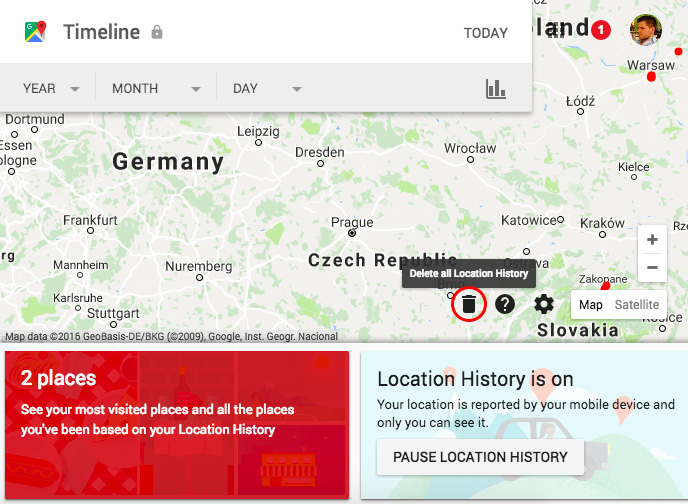
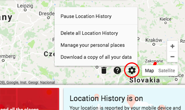
From there you can also click ‘Manage Activity’ which will bring you to Google Timeline website. On the right bottom of the website you’ll find an icon that allows you to delete your entire location history from Google services.
Interestingly if you decide to delete your personal whereabouts, Google allows you to download all your data in JSON or KML format.
When you pause or delete your Location History, Google will warn you that this might impact your mobile experience by offering you less relevant search results, ads etc. but I guess you can live with that.
The truth is that we don’t know if this will delete all your whereabouts from Google databases. If you want to be location anonymous there only one thing you can do… Stay offline.