
North Korea is one of the world’s most secretive societies. Its citizens cannot travel abroad and have almost no contact with the external world. North Korean dictators have been working on developing nuclear weapons since the 1960s, and it seems that they are very close to achieving this goal. Last month the country tested intercontinental ballistic missile that treats the stability in the region.
These maps and charts will let you better understand this country. Check it out!
1. Korean peninsula map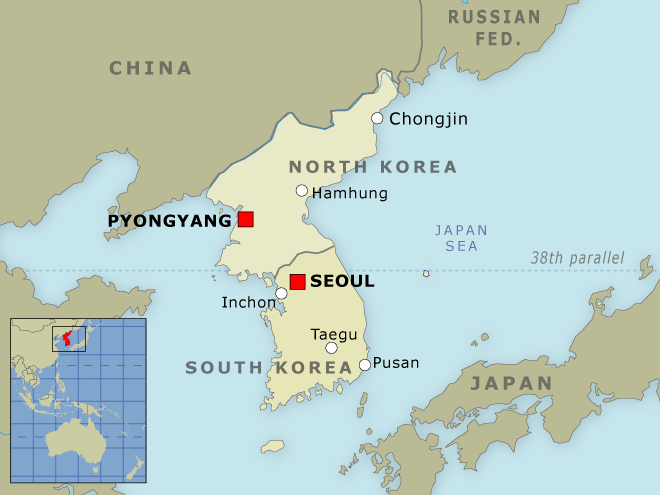
source: red24
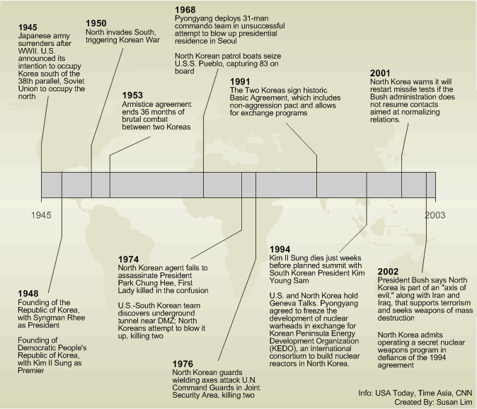
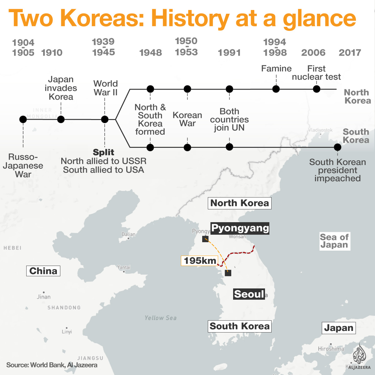
2. The history of Korean peninsula
source: Al Jazeera
3. Deep-dive into the history of Korean peninsula
4. The history of Korean War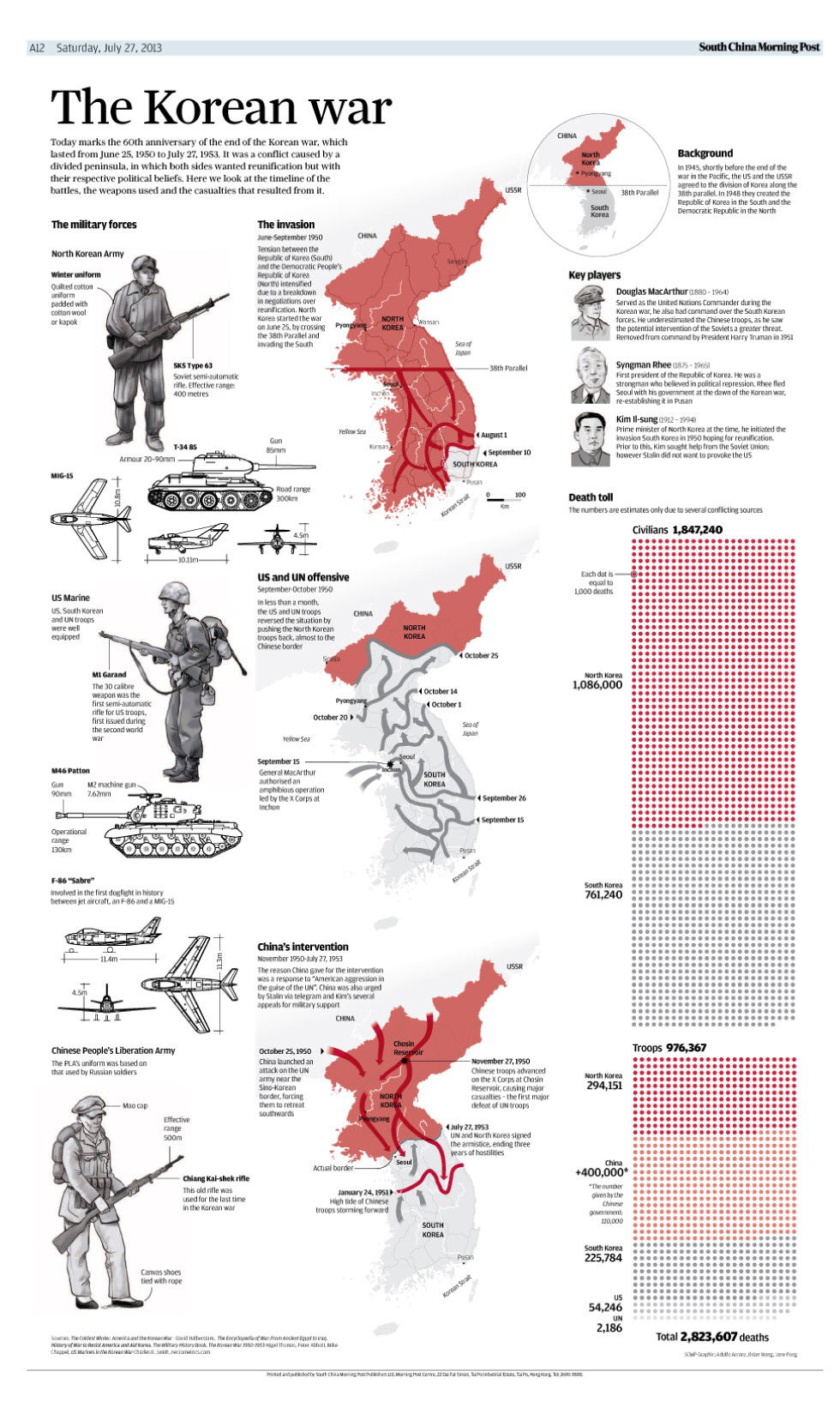
5. Key facts about North Korea
source: Al Jazzera
6. North Korean society by the numbers
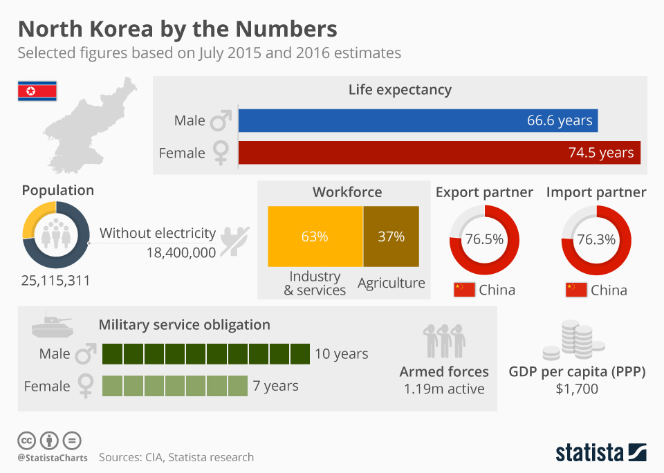
source: Statista
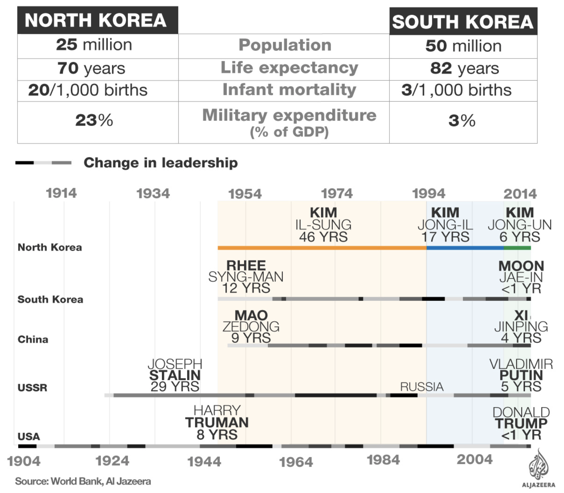
7. North vs. South
source: Guardian
8. GDP per capita change in North and South Korea
source: DMarron
9. North Korea trade partners
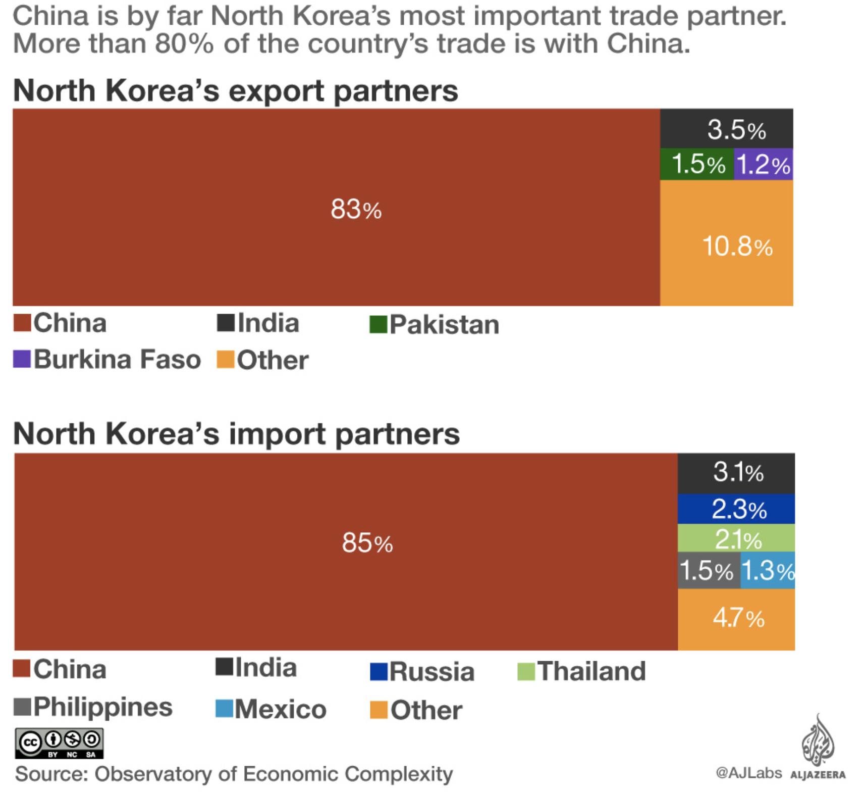
source: Al Jazzera
10. What does North Korea export?

source: Al Jazzera
11. North Korean Missile Launches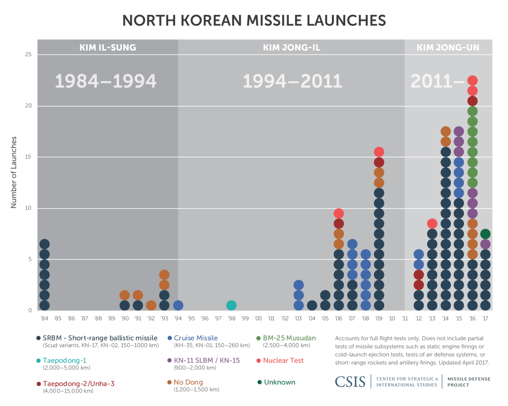
12. Which countries could be in the range of North Korean missiles?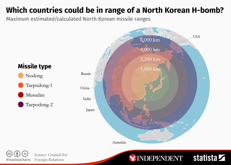
source: Statista
13. What is the reach of North Korea’s weapons?
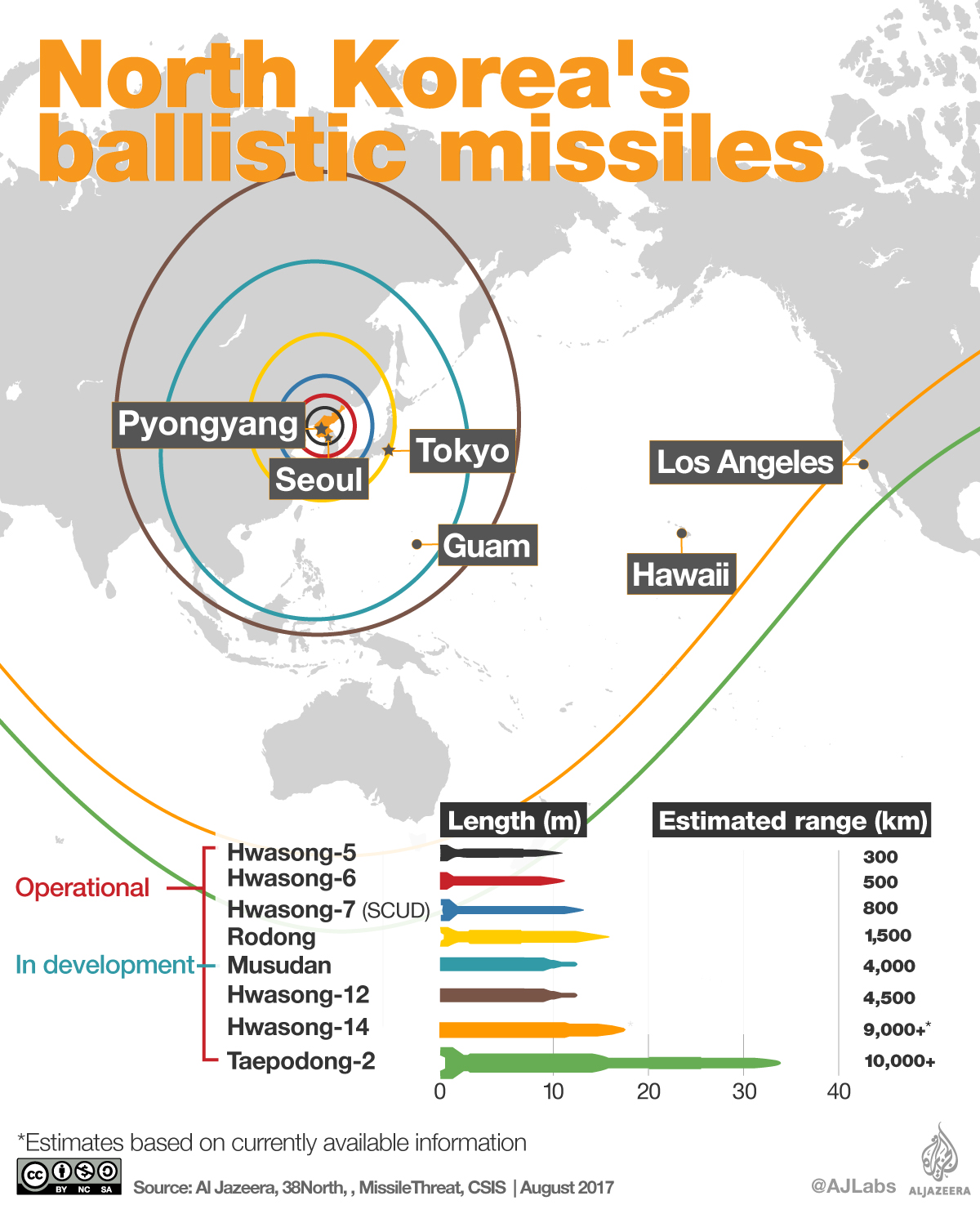
source: Al Jazzera
14. A large number US military bases are within range of North Korean missiles
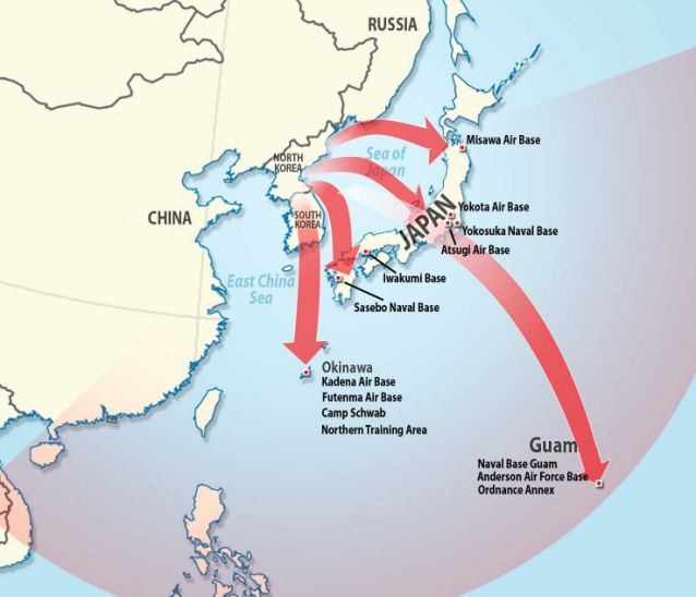
source: Daily Mail
15. Military balance on Korean Peninsula
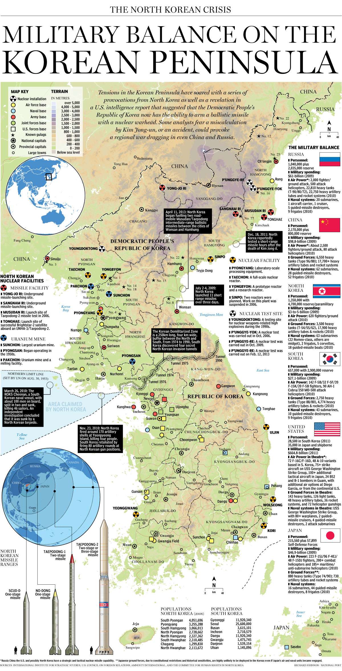
source: National Post
16. Geotagged tweets map of Korean Peninsula and Japan
 source: Geoawesomeness
17. Origins of languages spoken on Korean peninsula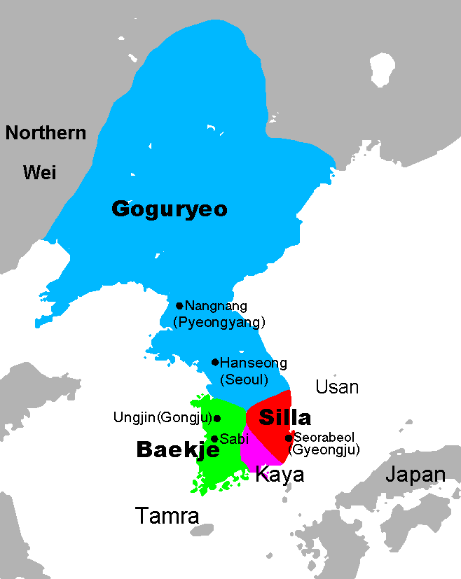
source: Wikipedia
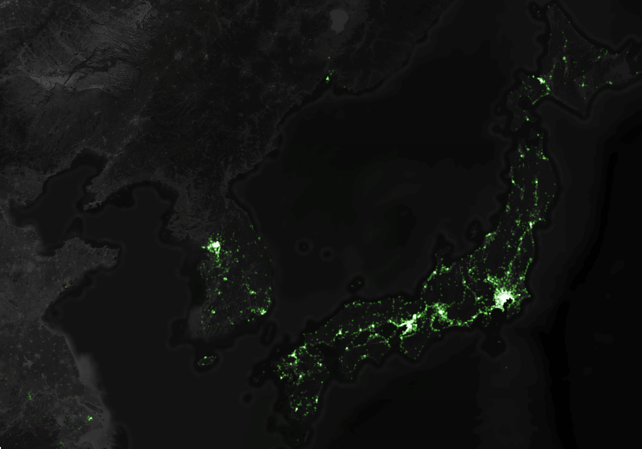
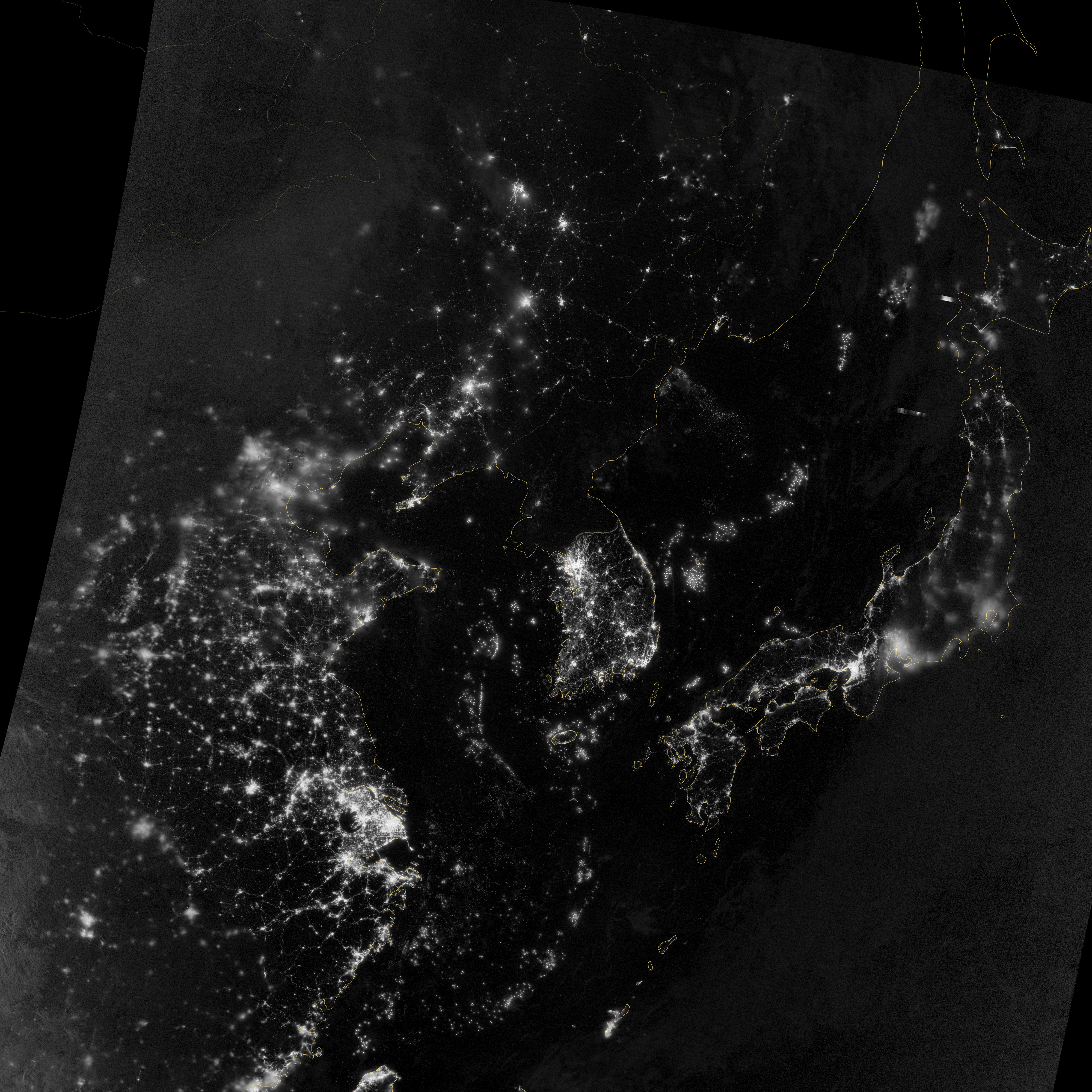
18. Night lights from space
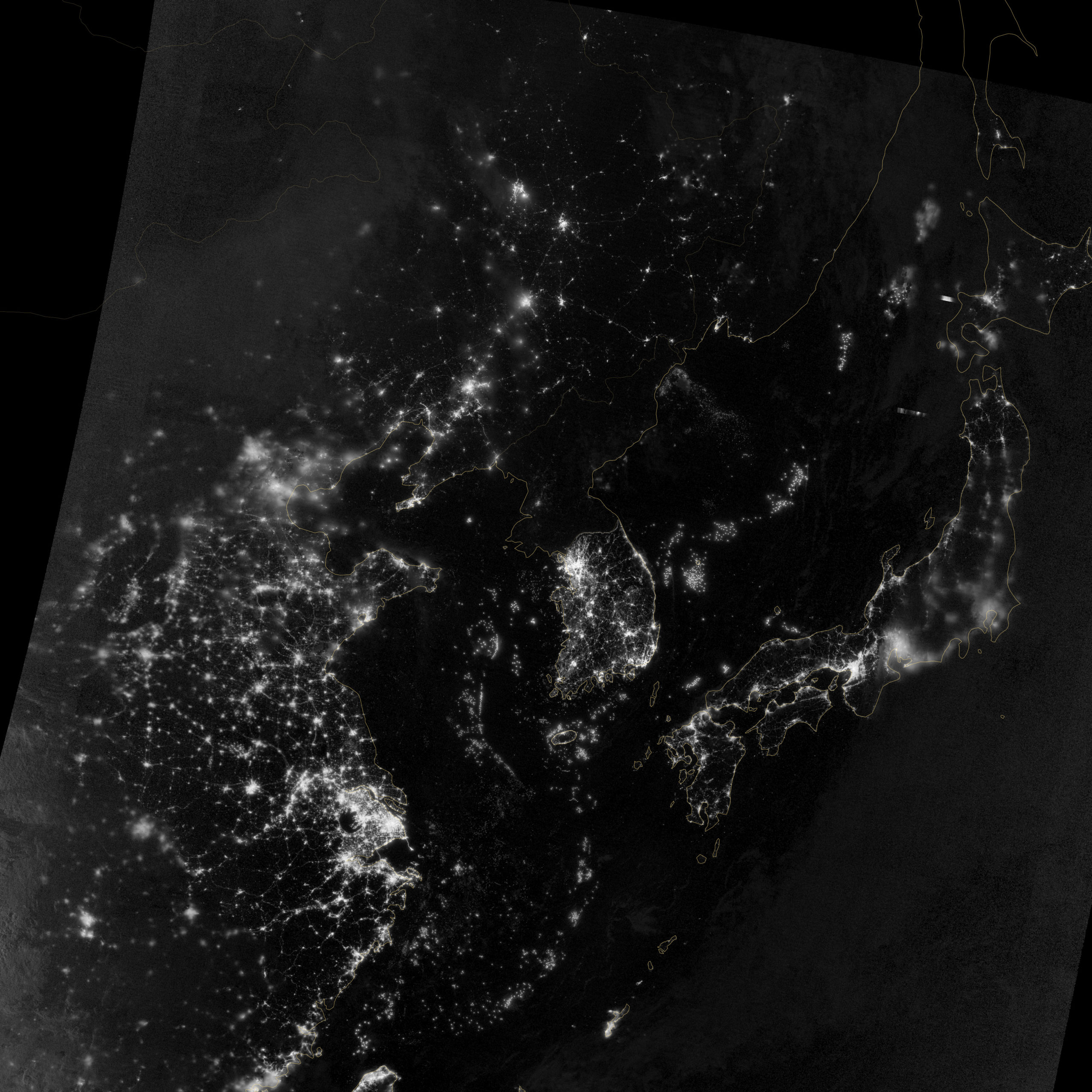
source: NASA
19. Direct flight routes from Pyongyang
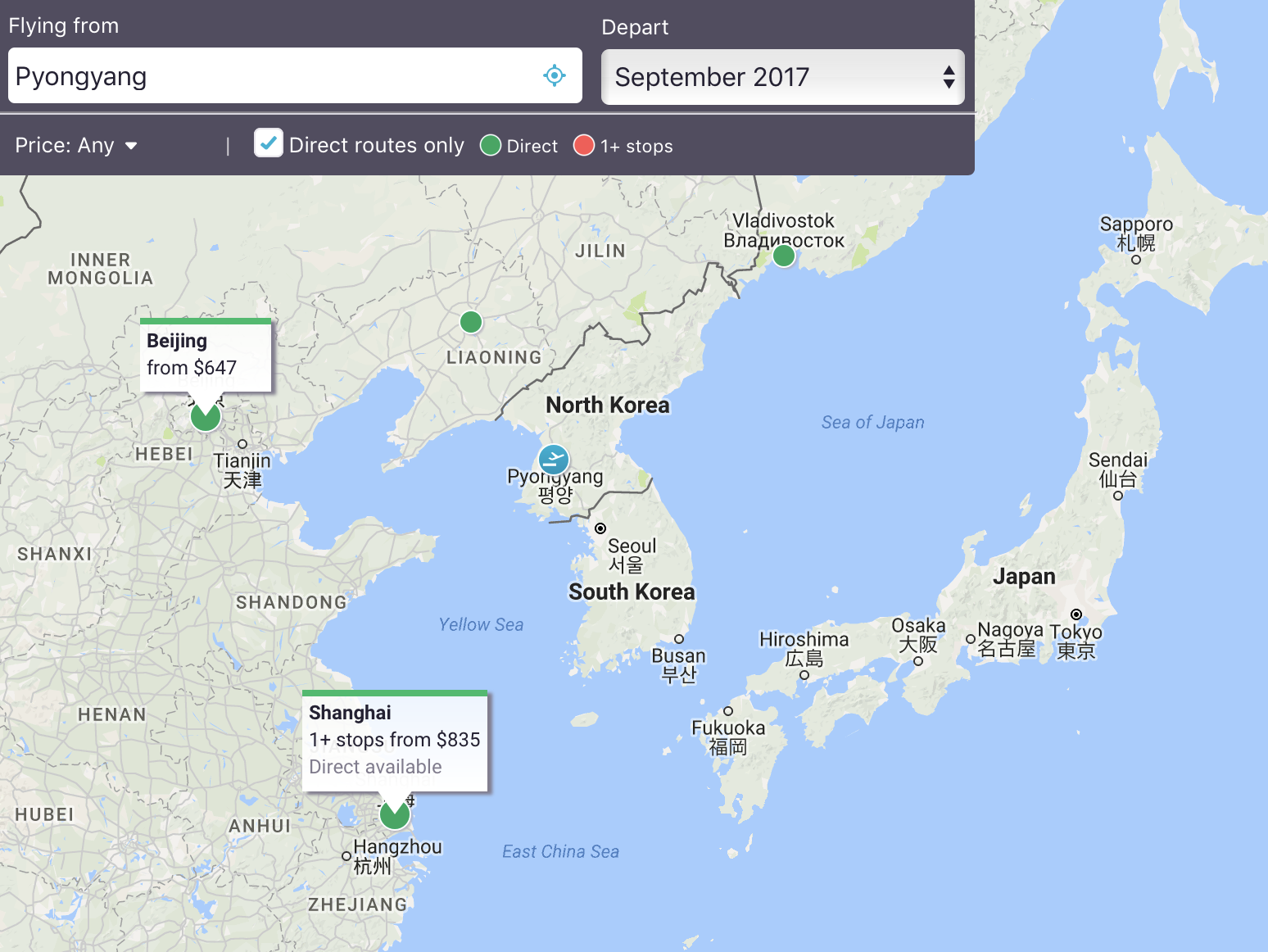
source: Sky Scanner
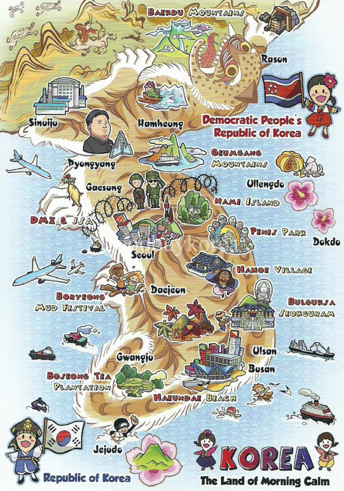
20. Touristic attractions of Korean peninsula
Did you like this post? Read more and subscribe to our monthly newsletter!

#Featured

Next article
Descartes Labs raises $30 million to create a data refinery of the physical world

Descartes Labs, a satellite data analytics startup based out Santa Fe, USA has announced that it has raised $30 million in a series B round led by LA-based March Capital. You might remember about Descartes Labs from its prediction of corn production in the US.

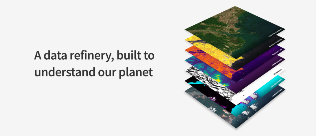
Building a data refinery for satellite industry
The funding will allow Descartes Labs to build what it calls a “data refinery” for the physical world – processing petabytes of satellite imagery to provide actionable insights to companies.
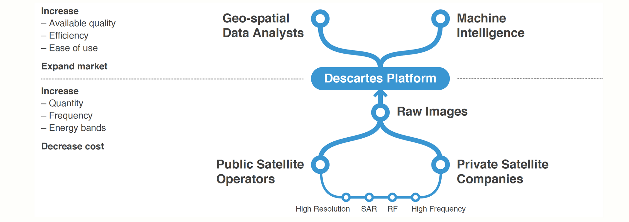
Data Refinery – Descartes Labs
Descartes labs started out focusing on the agriculture industry but they are certainly looking to expand into other industries i.e. shipping & logistics, forestry, energy infrastructure, and human activity. Their announcement about the funding round on Medium is full of interesting details about their vision (Read: Announcing our $30M Series B).
The first version of the data refinery – The Descartes Labs Platform is available now for beta testing.
Interesting times for the satellite industry! Curious to see the next big product launch from Descartes labs! Best wishes guys 🙂