

Anybody who has worked with location data will agree that geospatial analytics is one of the most powerful tools an organization can leverage today to optimize business decisions and improve profitability.
Continually improving location data technologies are being used to create new capabilities for targeted advertising, supply chain management, consumer services (maps, delivery, micro-mobility), planning and economic development, public service provision, sustainable resource management, fighting climate change, and so much more. No wonder the global location analytics industry – which was pegged at at $10.29 billion in 2019 – is anticipated to hit $31.13 billion by 2027.
But as powerful as location data may be, it is not devoid of some unique sensitivities.
Even supposedly anonymous location data can reveal highly sensitive details about people’s behaviors, patterns, and also personal life, as this New York Times investigation reveals. Paul Ohm, a law professor and Chief Data Officer at the Georgetown University Law Center, insists that location anonymity a myth and that really precise, longitudinal geolocation information is “absolutely impossible” to anonymize.
“DNA is probably the only thing that’s harder to anonymize than precise geolocation information”
– Paul Ohm, Georgetown University Law Center
So, when privacy risks are inherent in the location data ecosystem, why isn’t ethics a forefront issue for any and all organizations dealing with such data? Especially at a time when COVID-19-related tracking and surveillance has put location data at the heart of the debate around digital privacy, why aren’t individuals, businesses, and government agencies doing more to restore public trust in location technology?

Denise McKenzie, Co-Director of the Benchmark Initiative operating through Ordnance Survey’s Geovation accelerator
“Data ethics has matured as a field of exploration, and guidelines have been developed for many fields, but not for geospatial data,” admits Denise McKenzie, co-director of the Benchmark Initiative, a forum founded to open a dialogue between government, industry, and academia around the ethics of the use of location data.
“I think the first time I started to understand location data ethics as a trend was when the Cambridge Analytica story hit the news in early 2018,” she recalls. “Of course, there were various other incidents before that time, but it was this one that really crystalized for me the potential harm that could be done when we combine people’s personal data, including location, with other data.”
The steering committee member for Women in Geospatial+ had another think coming while presenting at an insurance industry event. As the participants discussed the issues surrounding the use of people’s personal location data for obtaining better insurance premiums, many avered that they were comfortable sharing their own location, but not their child’s, even if it translated into lower premiums.
“More recently,” McKenzie says, “the best light bulb moment was during one of the panels for Benchmark Initiative when the panelists were asked if they would download a COVID-19 tracing app. They all replied ‘I don’t know’. Now, this response was not because they knew the government was not handling location data properly, but because they did not have enough information from the government about what would happen with the location data and where it might be used after it was collected.”
This made McKenzie realize that one of the biggest issues that both data collectors (location industry) and data providers (common people) faced was that of communication and transparency.
“As a profession we need to get better at explaining what we are doing, why and how it is happening. And this has to be done in a way that anyone can understand and make an educated choice to opt-in,” says McKenzie, who is also the Chair of the board of directors for the Association for Geographic Information (AGI) in the UK.
A Guide for Responsible Use of Location Data
Geospatial applications are part of the Fourth Industrial Revolution, along with Artificial Intelligence and the Internet of Things. And addressing the risks and challenges associated with the ecosystem is crucial for developing the maturity and social acceptance of location technologies.
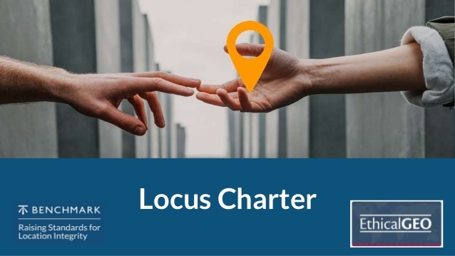
So, earlier this month, a coalition of location data practitioners launched an ethics charter to promote the responsible use of location technology. The Locus Charter, as it is called, is facilitated by the Benchmark Initiative and the American Geographical Society’s EthicalGEO program – both of which supported by a philanthropic investment firm, Omidyar Network.
As governments started building mobile apps and dashboards to track COVID-19-infected people in 2020, the conversation around the use of location data also picked up pace. It was then that the Benchmark Initiative and EthicalGEO realized the growing need for a shared set of principles and language that would help guide the world’s location data professionals in such unprecedented times.
“The realization that there was a lack of shared terms and principles was there from the start. We knew that in international data ethics debates, geospatial had been left behind a little,” McKenzie accepts. “And then in the course of Benchmark and EthicalGEO programs, on a number of occasions, questions came up as to what responsible practice should look like, and how to start codifying it.”
So then, over a course of six months, the Benchmark Initiative and EthicalGEO teams started recording ethics-related themes that came up in their work. These were then further developed into discussions and a series of international roundtables. Hundreds of people joined the workshops organized by the two groups to give feedback on the early drafts of the Locus Charter.
Finally, a version was finalized which, according to Nadine Alameh, CEO of the Open Geospatial Consortium, “balances the technical innovation work of the geospatial tech community and brings us all one step closer to well-rounded guidance on the use of location information in today’s world.”
The Locus Charter Principles
- Realize the benefits location data offer to society and economies
- Understand the potential impacts of using location datasets
- Do no harm when using location data
- Protect the vulnerable
- Recognize and address the impacts of bias in data
- Respect people’s dignity by avoiding unnecessary intrusion
- Do not collect or use more data than necessary for a task
- Actively protect privacy and seek consent
- Prevent identification of individuals
- Provide accountability about how data is used.
A Movement for Cultural Change
“The Locus Charter is all about bringing a culture change to the way we develop our location data services and projects,” says McKenzie. “This means moving toward a place where we think ‘ethical/responsible first’ and embed asking challenging questions about what, why, and how we are undertaking our work.”
McKenzie acknowledges that the Charter is only the first step toward what will be a process of “culture change”. She knows it will take time.
“We are encouraging people to use the Locus Charter in practice, and then if they find it helps them deliver value in their organization, to publicly acknowledge that. We know that most organizations can’t simply agree to a set of principles at first sight. There are always internal processes.”
But, the thing to remember is that this is the first public version of the Locus Charter, and it needs to be owned by everyone in the location data community. This is why McKenzie is urging everyone who is interested in this movement for culture change to join the Community, to keep in touch, and contribute to the development of the initiative.
“The COVID-19 pandemic generated an immediate interest in tracking infections, and many countries quickly showed that there was not a good basis of shared knowledge or values to have effective discussions about what could be done in practice,” McKenzie recollects.
“Low public trust in technology can have public health consequences, as we have seen with lower-than-expected uptake in track and trace apps that help in the fight against COVID-19. If we want location technology to fulfill its potential as an effective tool for the public good, then it must enjoy a high degree of public confidence.”
The Locus Charter offers an opportunity to do just that. By setting out the key areas where attention can improve standards of practice, help to protect vulnerable groups, and safeguard individual privacy and the broader public interest, the Locus Charter can pave the way for shared, international principles for responsible use of location data.
As Lisa Allen, Head of Data and Analytical Services at Ordnance Survey, sums up, “The ethical use of data is fundamental. Using this common framework sets a standard across location data. It is essential for our customers to trust our industry in our use of data. Location data offers greater insights, better decisions, and smarter outcomes. By embedding this charter, it is a commitment to managing and analyzing location data in an ethical way.”
To join the Locus Charter Community, click here.

#Business


Next article


Do you love mapping and running and saving lives?
Then we have just the thing for you! Run the Virtual London Marathon for MapAction on October 3rd 2021. Plot your own 26.2 mile course, at your own pace, wherever in the world you happen to be.
Join 99,999 other people all running on the same day in what promises to be the world’s largest ever marathon. As a virtual runner, you will be tracked and timed, as if you were there in person. You will have a 24-hour window to run it. The Official Virgin Money London Marathon App which will enable you to log

your 26.2 miles and earn your coveted finishers medal and New Balance finisher T-shirt.
The app will also help bring the virtual experience to life, with an exclusive audio commentary featuring famous voices providing a memorable soundtrack to the day. You will very much feel part of the team.
All open places in the Virtual London Marathon are now sold out, but MapAction has 10 places on offer. We are asking for each virtual runner to commit to raise at least £100 in sponsorship, each.
Why MapAction?
To celebrate the Geoawesomeness Blog’s 10 year anniversary, it is supporting MapAction. Why? Because MapAction is the non-profit that enables geospatial experts, people from our sector, to volunteer and apply their technical skills to many of the world’s worst humanitarian situations. If you don’t know about MapAction and its work, you can read more here.
In 2020, Stefan Schweinfest, Director of the United Nations Statistics Division, ran the virtual London Marathon for MapAction, taking in many of the sights of New York. He said “When I first learned about MapAction I instantly felt a deep affinity: MapAction is a volunteer network of mapping professionals who provide maps, data analysis and information management for humanitarian responders around the world, whether it is for floods in Djibouti or for the earthquake in Albania. I was deeply moved by their professional dedication!” You can read more about Stefan’s wonderful running and fundraising efforts here.
If you are interested in running the Virtual London Marathon, or doing anything else to help raise vital funds to enable MapAction to apply its own brand of geoawesomeness to humanitarian situations, please email Jess Walsh or fill in our online form.