
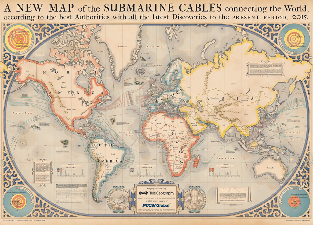
Every year TeleGeography – a telecom data research firm, releases a stunning map related to global communications. This year’s map shows global submarine internet cables. We are not aware of it but 99% of all international data is transmitted via this under water network. Without them, the world as we know wouldn’t exist.
It is a beautiful map. It pays tribute to the pioneering mapmakers of the Age of Discovery, incorporating elements of medieval and renaissance cartography. At that time maps were works of art, decorated with illustrations. Their aesthetics was as much important as their functional qualities. In the corners of the map you can also find information about “latency” (how long it takes for information to transmit) and “lit capacity” (which shows how much traffic a system can send, usually measured in terabytes) between continents.
TeleGeography released also zoomable version of their map, which you can view here.

#Featured


Next article

Time. It’s everywhere and it’s unstoppable. We use clocks and calendars everyday but how much do we actually know about it. Let’s test it. Remember to share your score with the world! And to check out our other GeoawesomeQuizzes!
THE TIME CHALLENGE
[viralQuiz id=26]
DID YOU LIKE THE QUIZ?
SUBSCRIBE TO OUR WEEKLY NEWSLETTER
[wysija_form id=”1″]