
India, the second-most populous country with over 1.2 billion people and is the seventh-largest country by area composed of more than 600,000 villages and 7,000 cities and features a varied geography with a rapidly changing and complex social and economic character. India is also ethnically, religion-wise, linguistically, culturally, climatically and agriculturally very diverse. One can imagine how complex and challenging is to develop an enterprise GIS solution to manage and maintain GIS infrastructure for the country.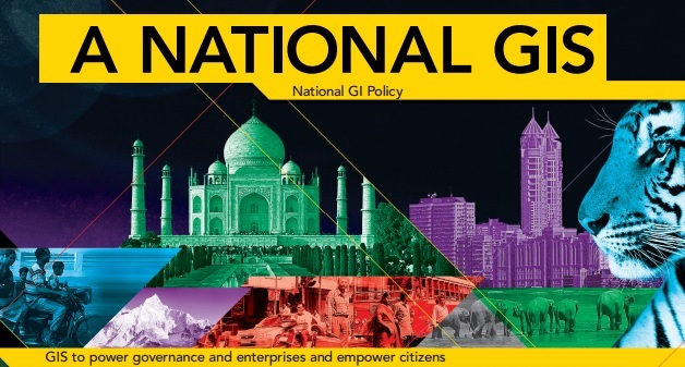
Here, I am talking about “National GIS for India” project which is India’s next-generation GIS program, envisioned as a critical support to the national governance and empowering its citizens—thereby extending GIS to all levels of society.
Though India has already witnessed to the true power of GIS with existing GIS projects in India, Nationation GIS project is different from GIS in India today.
Sam Pitroda, adviser to India’s Prime Minister for Public Information Infrastructure, has explained about the project in a detailed manner in the below video.
With a large talent pool and many veterans providing the vision, leadership, and drive, now a national movement has taken shape in India’s next-generation GIS program—National GIS. Click here for more views from key people involved in preparing the blueprint for this project.
Having discussed about National GIS, Geoawesomeness wishes a great success in the achieving the goal and looking forward to have more such GIS initiatives in future !!!


#Business


Next article
Let’s travel through the ancient Roman Empire: Stanford Geospatial Network Model of the Roman World

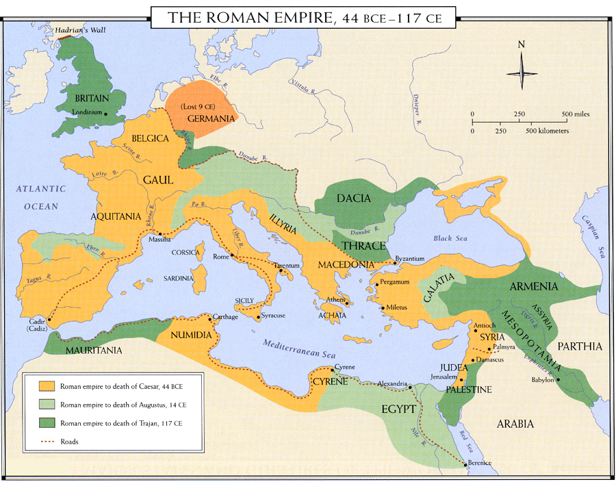
The Roman Empire at its height of power spanned over one-ninth’s of the earth’s surface over three continents, ruling over a quarter of humanity. No wonder that Roman Empire is something that finds a way to all our history books. But ever wondered how the connectivity was? How long it took and so on?
What would you use if you wanted to travel between Roma and Constantinople (nope, the aeroplane is not an option) ? Probably, Google Maps right? Well, here’s one more condition, you need to visualize the route between Roma and Constantinople during the Roman empire 2000 years ago.
The shortest route may not be the fastest one. The Fastest route may not be the safest one. The Safest route may not be the most inexpensive route!! Gosh, thats a lot of planning!
Conventional maps that represent this world as it appears from space signally fail to capture the severe environmental constraints that governed the flows of people, goods and information. Cost, rather than distance, is the principal determinant of connectivity.
For the first time, ORBIS allows us to express Roman communication costs in terms of both time and expense. By simulating movement along the principal routes of the Roman road network, the main navigable rivers, and hundreds of sea routes in the Mediterranean, Black Sea and coastal Atlantic, this interactive model reconstructs the duration and financial cost of travel in antiquity. – Standford Geospatial Network Model of the Roman World
The ORBIS is an amazing project. It lets you travel back in time and explore transportation and the complex network of routes during the ancient roman empire. Here’s how you travel between Roma and Constantinople.
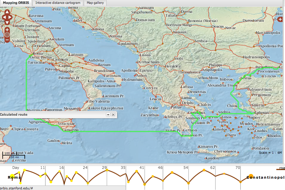
Roma to Constantinople
Wondering what sort of queries you can enter in this amazing visualization of ancient roman empire?
So you are all set for a military mission? or is it just another civilian travel? Fastest route or Cheapest route? How much money are you looking to spend to travel? Did you say you are travelling during January of April? The number of options you have to try in this query is increases exponentially. The ORBIS is based on information and conditions 2,000 years ago. Ancient maps combined together with modern-scientific models of weather 2000 years ago. That’s the ORBIS map for you! Next time, I play Civilizations I am going to need to use this map to plan my campaigns 😉
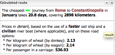
Oh, I forgot to tell you how long it took from Roma to Constantinople!
Another website that provides a similar Roman route planner is OmnesViae. But the ORBIS is much more packed and powerful in terms of query options and visualization. That said, OmnesViae map visualization is much more elegant to browse through.
Who said GIS cannot be fun or creative! Stanford Geospatial Network Model of the Roman World (ORBIS) : Geoawesome! Google Maps of ancient roman empire 🙂