

It is estimated that even up to 30% of traffic on some streets may be related to searching for a parking spot. It often happens that driving to a city center takes you less time than cruising around searching a place to leave your car, and therefore parking information is the next big thing in the navigation industry.
Unfortunately, it is a very complex issue. Every serious mapping company in the world is looking into this problem from at least a couple of years without any spectacular results. To solve it, first of all, you need to map each and every parking spot in the city. Then you need to know which one is free. The optimal option would be to put a sensor below or above each spot. In this scenario, there is a question who will pay for and maintain it. Some cities are piloting that sort of solutions but today it is still too fragmented and not standardized to use it on a large-scale.
Another solution comes with connected car sensors. Almost every new car has built-in cameras or parking proximity sensors. Data from these sensors could be used to detect free parking spots. Unfortunately, in practice it is much more difficult than it sounds. First of all the number of connects cars is still too low. Secondly, it could only work if data from many different car brands would be shared and used together which today is still difficult to image.
Finally, there is a third solution and Google is piloting it. For some cities in the US, the company has measured the number of free parking spots (most likely based on Street View) and now it is using probe data (the same data which is used to estimate traffic) to assess what is the probability of finding a free parking place in the area.
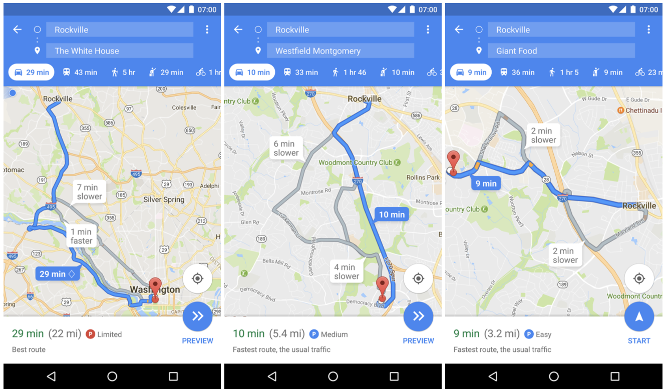
The information is displayed as a small rounded P icon next to your estimated travel time when you search for driving directions. The information is then followed by a text description. There are three levels of parking availability probability: Limited, Medium, and Easy. The accuracy of the estimations is hard to assess for users but Google can do it very accurately and calibrate the feature depending on location. When you reach the destination you have selected in the app, the company can measure how long does it take you to get out of your car. This means that the estimations should get more accurate with time.
The feature has been rolled out in a couple of cities in the US to Android users that subscribed to Google Maps beta program. It again proves that Google is a undisputable leader in the navigation industry.

#Business

Next article
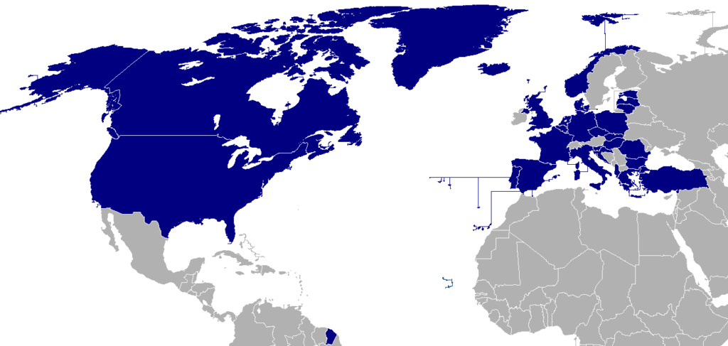
The North Atlantic Treaty Organisation (NATO) is a military alliance originally established in 1949 with 12 member states, including America, Britain and France. The goal of the alliance was to avoid future war in Europe and to allow stable growth in peace. Today, NATO has 28 members including most of Europe, representing a population of more than 900 million.
The main goal of NATO is set out in Article V of the North Atlantic Treaty, which says that an “armed attack against one” NATO member “shall be considered an attack against them all”. As the US is the biggest military power in the world effectively the agreement binds America to defend Europe.
The following maps and charts try to explain what is NATO and why it’s needed.
Also read: Top 27 maps, charts and videos that explain Ukraine and the Russian Aggression
1. NATO Member states

2. Countries with a promised invitation to NATO
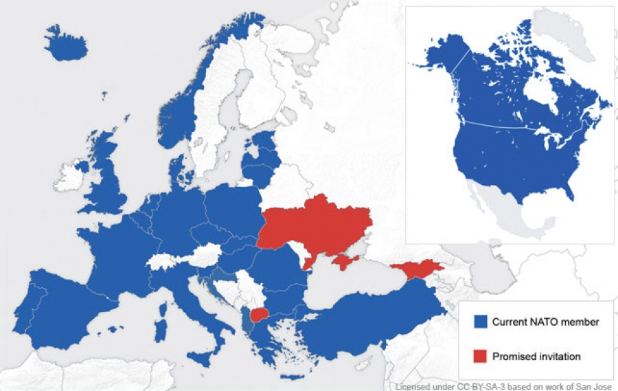
source: CNDUK
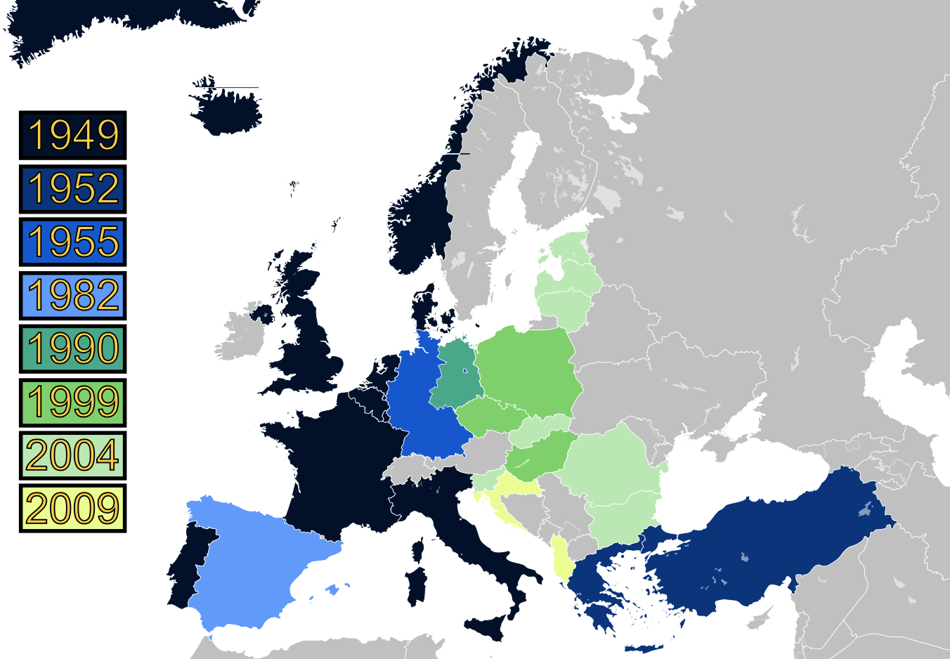
3. NATO has added 12 new members since the German reunification and the end of the Cold War.
4. NATO vs. Warsaw Pact
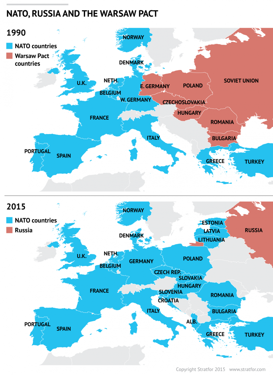
In 1949, the prospect of further Communist expansion prompted the United States and 11 other Western nations to form the North Atlantic Treaty Organization (NATO). The Soviet Union and its affiliated Communist nations in Eastern Europe founded a rival alliance, the Warsaw Pact, in 1955.
source: Stratfor
5. Russia is testing NATO’s reaction time around the world (events between 2013 and 2015)
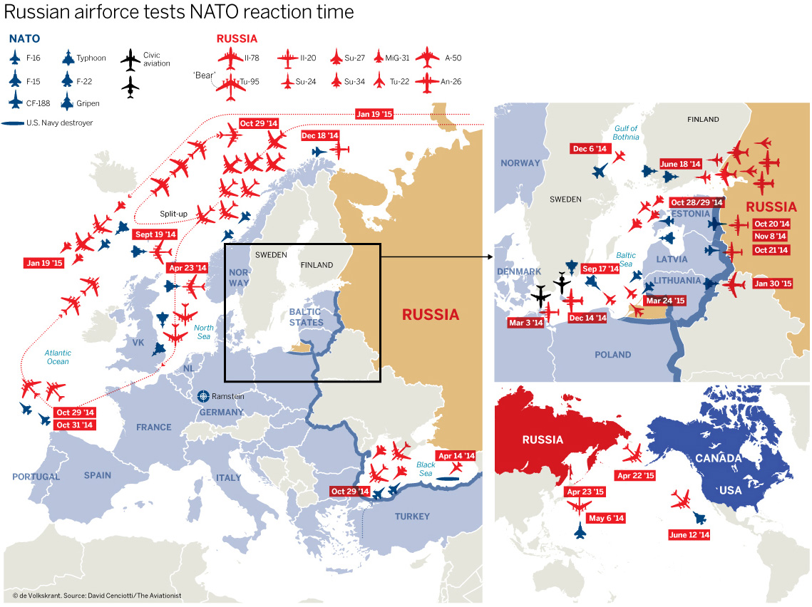
© de Volkskrant
source: The Aviatonist
6. Nuclear weapons around the world
![]()
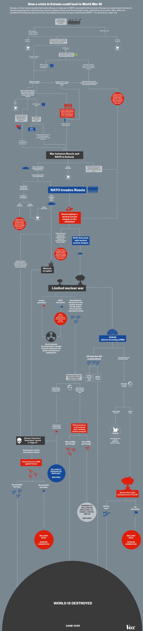
7. Risk of unintended war with Russia
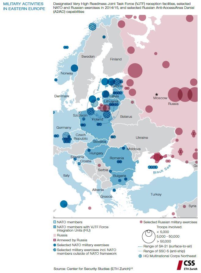
source: VOX
8. Military spendings
source: Bank of America
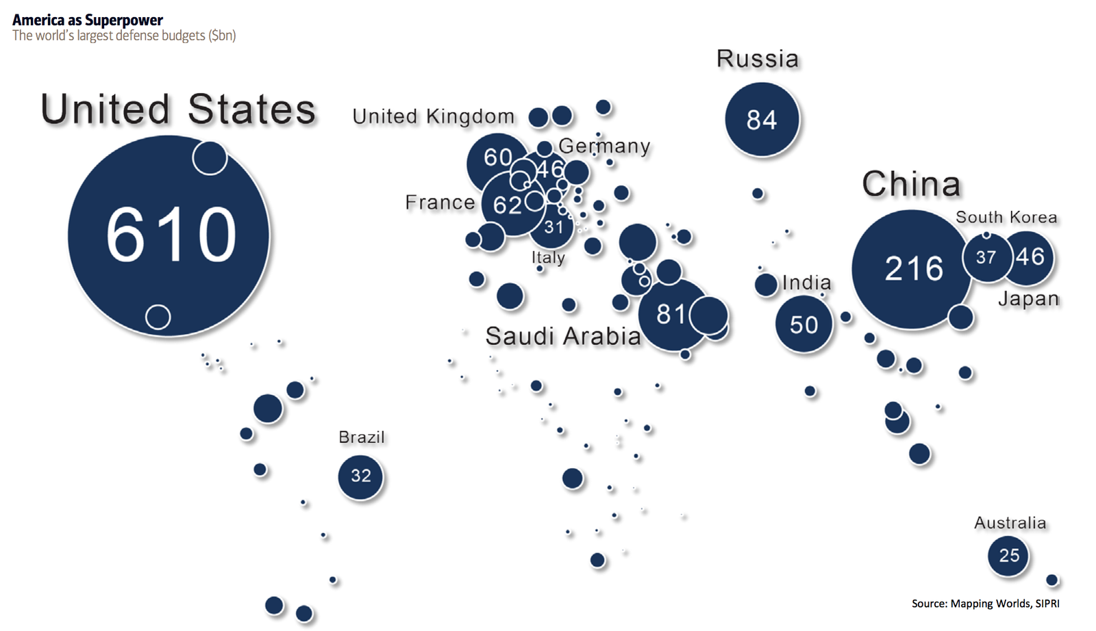
9. The US spends more on the military than the next 15 countries together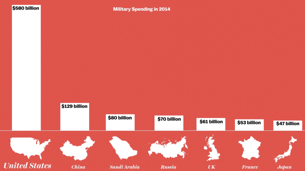

The US spends more than the next 15 countries combined on its defence budget. China is the only nation approaching the US’s defence budget, In 2015 Chinese military budget increased from $129 to $216 billion.
source: VOX
10. Eduction vs military budgets by country
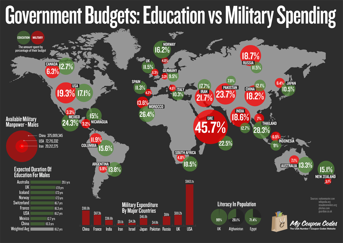
source: technocraticparty.us
11. US military based around the world
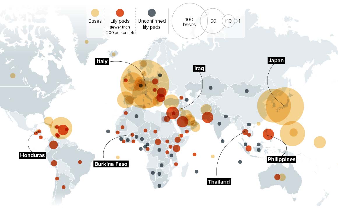
source: Politico
12. And a closer look into US military bases
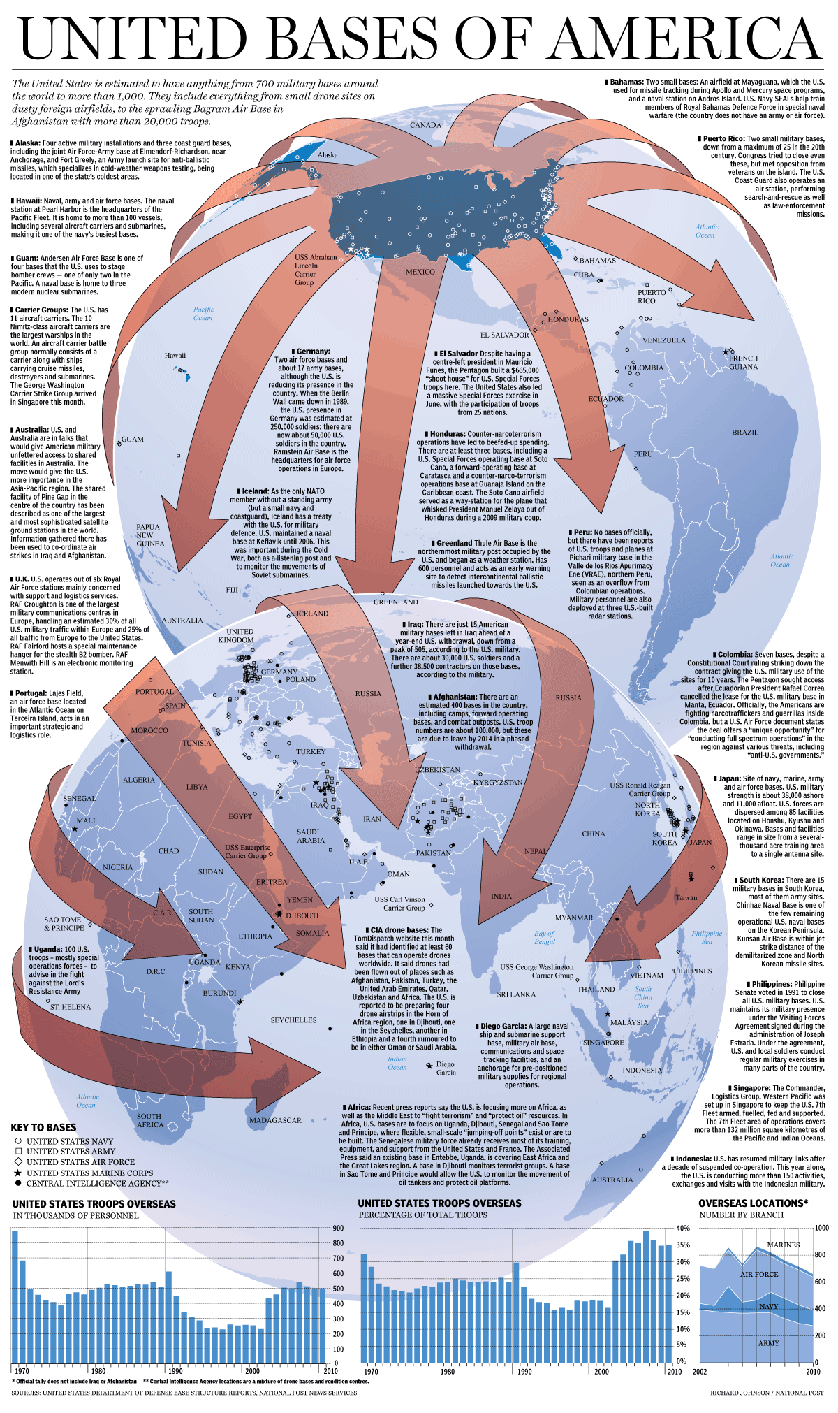
source: Makanaka
13. Current and past NATO missions
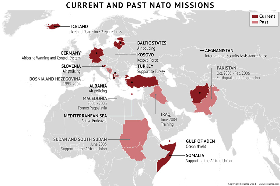
source: Stratfor
14. How World War 3 Could Destroy The Planet
source: Imgur
Also read: Top 27 maps, charts and videos that explain Ukraine and the Russian Aggression