


UP42, a developer platform and marketplace for geospatial data and analytics, is joining forces with the United Kingdom’s leading supplier of aerial photography, Getmapping. Through this partnership, UP42 customers will get access to very high-resolution aerial data of Great Britain.
More specifically, UP42 will now be able to offer 12.5 cm resolution data for some of the most densely populated areas in the region, such as the majority of England and Wales, as well as southern Scotland. Further, aerial imagery with a 25 cm base resolution is being made available for the entire extent of Great Britain. It should also be noted that UP42 will offer both fresh and historical aerial photography in one convenient location.
While UP42 has been housing a wide variety of commercial and open-source satellite and weather data sources for a while now, Getmapping is its first source of aerial data. Founded in 1999, UK-based Getmapping has over two decades of experience in providing aerial photography as well as high-quality mapping products and geospatial solutions across Europe and Africa.
Stressing that this partnership will support the growing market need for high-quality data and encourage insights to solve important problems, Gillian Melham, European Managing Director at Getmappping, points to how the company’s ortho-rectified data can be used in a range of GIS and CAD systems.
“Maps are the most well-known example of how geospatial data might be used but our data is used for many applications; 3D modeling of buildings and locations, environment monitoring for floods, vegetation, etc., pre- and post-disaster analysis and much more,” Melham says.
Sean Wiid, CPO at UP42, adds, “We couldn’t be happier to announce our first partner in aerial data. Partnering with Getmapping is a great leap forward. Our partnership is one that will support those looking to create solutions using very high-resolution imagery and provide value for customers across industries.”

#Business


Next article
On April 1, 2010, Great Britain’s national mapping agency, Ordnance Survey (OS), started to make some of its mapping data and geographic information freely available to the public, without any restrictions on re-use.
Today, OS OpenData consists of 14 continuously maintained products, including Royal Mail’s postcode data, administrative boundaries, greenspaces, and detailed basemaps. Countless cartographers and mapmakers have benefitted from these invaluable resources over the last decade. And listed below are our top open data picks that we believe can help you the most:
OS Boundary-Line
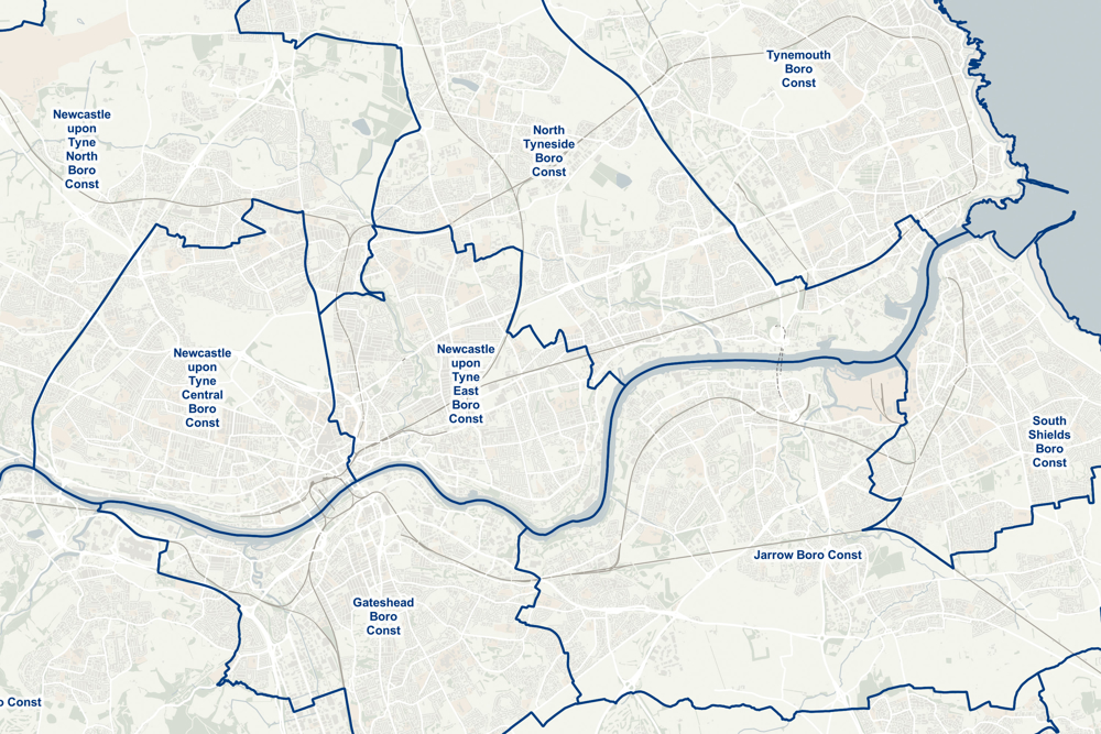
From Parliamentary constituencies to council wards, Boundary-Line maps every administrative boundary in detail. You can use the easy-to-read shaded maps to show the differences between regions or councils and bring the statistics in your reports to life.
While this data product is updated twice a year, OS also allows you to download historical county boundaries data from the late 19th Century – ideal for historians who need to analyze old census records and archives.
OS Open Zoomstack
This is a single-file, ready-to-use, customizable map of Great Britain that can be used at both national and local levels. Compatible with Geographic Information Systems (GIS), web, mobile, and offline systems, Zoomstack data covers everything from the Scilly Isles to Shetland to give you a seamless mapping experience.
While four beautiful cartographic styles are already provided, feel free to create your own look and feel by changing the colors and styles.
OS Code-Point Open

If you need postcode data to get started with geographical analysis, simple route planning, and asset management, look no further. Code-Point Open is free to view, download, and use for commercial, educational, and personal purposes. What’s more, the data comes packed with NHS authority and administrative unit codes to give you extra analytical power.
OS Open Greenspace
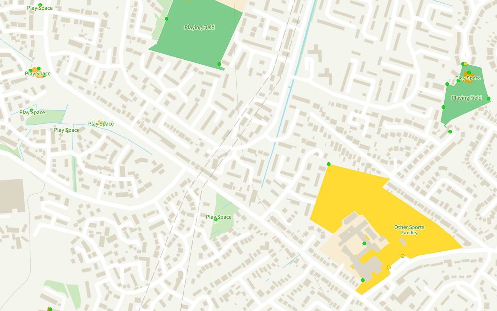
This is the most comprehensive open dataset of greenspaces in Great Britain, underpinning a range of apps, products, and innovations that are helping to create greener and healthier communities. Download this data to understand the location of public parks, playing fields, sports facilities, play areas, and allotments, along with access points for entering and exiting publicly-accessible urban and rural greenspaces. National coverage for England, Scotland, and Wales is included.
New releases coming up
Come July and OS will add even more open data products to its rich catalog – OS Open UPRN (Unique Property Reference Numbers), OS Open USRN (Unique Street Reference Numbers), OS Open TOID (Topographic Identifiers), and OS Open Linked Identifiers. For now, feel free to explore all OS OpenData products here.