
Geoawesomeness is already among us for 10 years. Time moves fast so I thought it’d be nice if we have a look at the future of Remote Sensing. Where will we be with Remote Sensing in 10 years? You could argue that, at the moment, Remote Sensing is still in its infant stage, maybe adolescent. Wouldn’t it be nice for Remote Sensing to reach maturity in 10 years?
The Magic of Remote Sensing
But what is mature technology anyway? Mature technology is a technology that is out of the way. As Arthur C. Clarke put it:
Any sufficiently advanced technology is indistinguishable from magic.
I still remember the feel of magic that Dropbox evoked when I first used it in 2007 or 2008. The magic was that nothing changed. Your workflow was the same as before using Dropbox. But somehow, some magic technology synchronized all your data to the cloud. You don’t have to do anything or understand how file-synching or the cloud works. Dropbox does that for you.
In the geospatial domain, the best example I could come up with is route planning. Everyone with a smartphone is able to plan routes from A to B without understanding GPS, spatial data formats, or routing algorithms. It just works.
What should happen in the field of Remote Sensing field to reach the same level of adoption?
Remote Sensing is a communication problem
For Remote Sensing to be perceived as magic, it should move out of the way. It should disappear. What is still very much the case in the Remote Sensing field is that a lot of companies focus on attributes of the technology instead of looking at the intricacies of the problem that they should solve.
Overselling is an issue. But also over-perception. Clients hear what they want to hear. They want your technology to be the silver bullet. It’s not. Remote Sensing companies should stop selling Remote Sensing and start selling solutions.
Step 1 in getting a technology adopted is to stop talking about it.
Filling up the gaps
Looking at satellite data providers, the first thing you’ll notice is that each occupies its own niche. There’s the optical versus radar. High resolution versus Very High Resolution. C-band versus L-band versus X- and P-band. RGB versus 8 channel versus hyperspectral. Daily versus monthly. Spaceborne versus airborne. And so on and so forth.
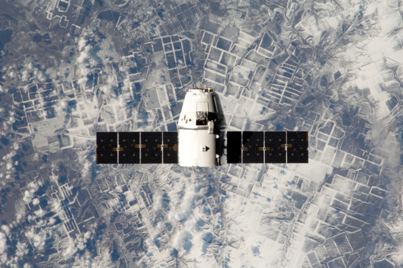
I believe in the future there will be a constant stream of data from remote platforms from your phone to satellites in any spatial resolution you like in any wavelength you like. This is already happening with the rise of privately owned and operated satellite constellations.
What is needed, are industry standards and best practices to store and offer these data in a structured way. Several Analysis Ready Data efforts and projects like STAC & openEO help shape this. Still, a lot of work needs to be done in this field.
Standards and analysis-ready data would have two major spin-offs:
- It allows for the commoditization of satellite data;
- It allows for adoption by non-Remote Sensing creative talent.
I would especially like to emphasize point 2. Call it the democratization of satellite data. If ARD is easily available and easy to use, it will find its way to a much bigger and diverse pool of creative talent than the relatively small Remote Sensing field. That will explode the number of applications and solutions. Some visual designers are already finding their way.
Step 2 is to attract creative talent from outside the traditional Remote Sensing field by filling up the technical gaps and strive for Analysis Ready Data & standards.
Data quality in the post-truth era
Finally, and this is my most speculative point, we have to explore how we can create ‘no questions asked’ trust in Remote Sensing data. A lot of clients ask about data accuracy, precision, and quality. I agree this is an important point. But I often see clients requesting precision whereas they are actually looking for reliability & consistency. I feel there is a lot of bikeshedding around accuracy and precision.
There are, of course, ways to test accuracy and quality. But with the filling-the-gaps trend described above, there will be more and more data from a wide variety of platforms with a wide variety of quality. It’s too costly, not desirable, and not scalable if every solution provider has to set up its own accuracy testing program.
A way to approach this problem could be to get inspiration in how IT solved the authentication & identity problem. In old IT, identity would be tied to a location (LAN, VPN). But with the advance of mobile devices and a plethora of cloud services, that model was untenable. Therefore, they came up with the ‘zero trust’ architecture, where networked devices are not trusted by default. The device is responsible for proving its identity to the network, not the other way around. A similar idea could be applied to suppliers of Remote Sensing data. For this we would need to solve the standards and ARD problem first though.
Step 3 is to explore how to ensure Remote Sensing data quality in analytics pipelines.
10 years ahead
Wrapping up, I think the future of Remote Sensing looks bright. Programs like Copernicus and Landsat, backed by public finance, ensure a long-term, consistent data backbone upon which ecology of platform & solution providers can evolve. Privately owned satellite constellations start filling in the gaps allowing creative talent from non-related sectors to enter the Remote Sensing realm. Standards are starting to emerge enabling Analysis Ready Data. Finally, a decent amount of work has to be done in the reliability and accuracy field to make the adoption of satellite data unquestioned.
These trends provide a push towards the commoditization of satellite data. If Remote Sensing solution providers would then solve their communication problem, I see no reasons why Remote Sensing solutions could not be adopted by a wide range of markets.
Did you like the article? Read more and subscribe to our monthly newsletter!


#


Next article
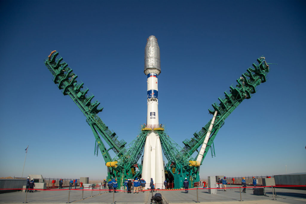

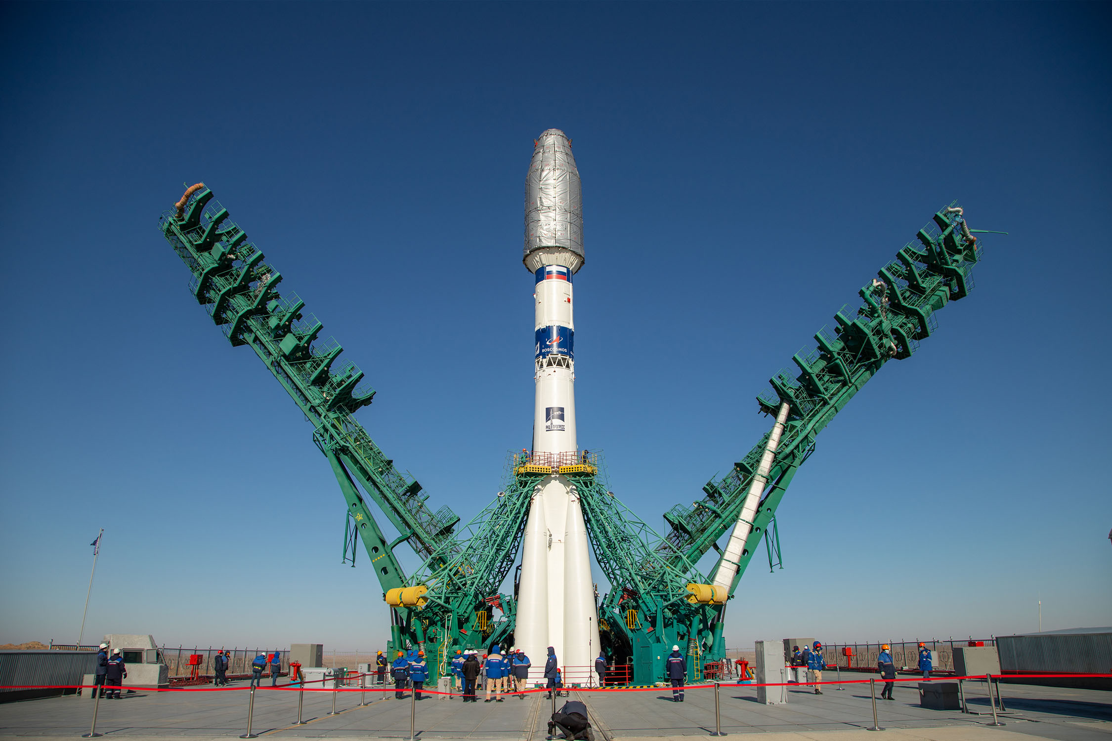
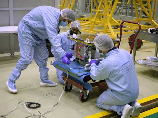
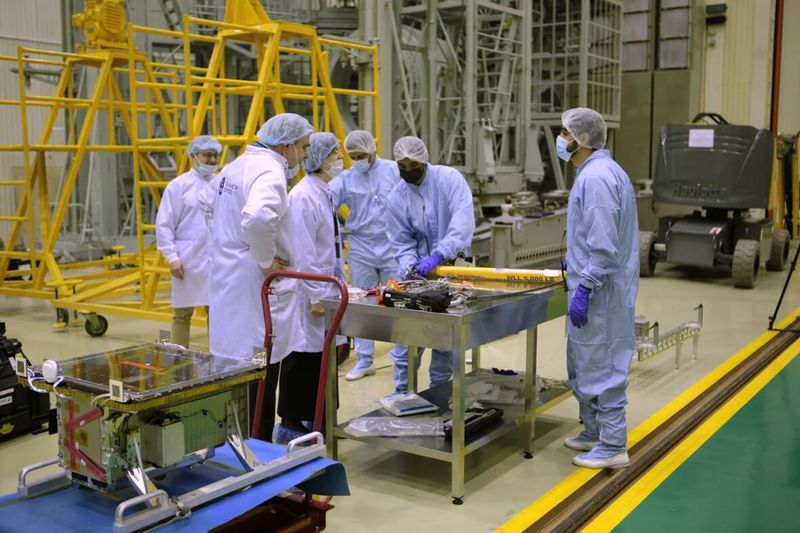
On March 22, Dubai Municipality announced the successful launch and deployment of DMSat-1, an atmospheric monitoring microsatellite built by Space Flight Laboratory (SFL). DMSat-1 launched from the Baikonur Cosmodrome in Kazakhstan aboard a Soyuz rocket. The first signal from the DMSat-1 has been received at 4:42 pm (UAE time).
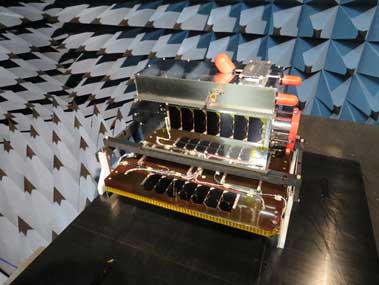
SFL developed DMSat-1 under contract to the Dubai-based Mohammed Bin Rashid Space Centre (MBRSC) in the United Arab Emirates (UAE). The DMSat-1 satellite is a 15-kilogram, 20x30x40cm microsatellite. It was built on SFL’s space-proven Next-generation Earth Monitoring and Observation (NEMO) platform, which incorporates high performance ground target tracking capability.
The launch is part of a high-technology project undertaken to develop solutions to environmental challenges and address climate change. The mission is designed to cover an area of up to 80,000 square kilometers each day.
DMSat-1 will monitor, collect and analyse environmental data as well as measure air pollutants and greenhouse gases. The environmental satellite will also help create maps of the concentration and distribution of greenhouse gases in Dubai and the UAE and study seasonal changes in the presence of these gases.
Data provided by the satellite will be used in several areas including finding solutions to environmental challenges, developing long-term plans to address urban pollution and climate change and environmental forecasting in Dubai.
“DMSat-1 will play a key role in monitoring atmospheric aerosols and greenhouse gases for Dubai and the UAE.” said SFL Director, Dr. Robert E. Zee.
SFL was selected to build DMSat-1 for its compact size and performance, including the mission-critical importance of attitude control and precise sensor pointing. SFL has developed high-performance ground target tracking capabilities that enable the small satellite to execute a slewing maneuver in orbit to accurately point its sensors at selected swaths of the atmosphere.
“Our ability to keep low-inertia, relatively inexpensive microsatellites like DMSat-1 pointed accurately and stably in orbit has made atmospheric monitoring missions possible at much lower costs,” said Zee.
DMSat-1 carries two instruments onboard. The primary payload is a multispectral polarimeter that monitors aerosols, which are typically fine particles of liquids and solids in the upper atmosphere often caused by anthropomorphic sources. Aerosols also correlate to natural phenomenon such as dust storms. The secondary payload is a pair of spectrometers that will enable MBRSC to detect greenhouse gases, such as carbon dioxide and methane over the United Arab Emirates. The key aerosol polarimeter operates in three (3) bands: Blue (480-500 mm), Red (660-680 nm) and NIR (860-880nm).
The launch of the satellite strengthens the UAE’s implementation of the Paris Climate Agreement, which requires the country to generate data on greenhouse gas emissions and build national capacities to study global warming. On a local level, the DMSat-1 seeks to calculate the rate of carbon dioxide emissions in relation to GDP as outlined in the Dubai 2021 Plan, study the environmental impact of the Dubai Clean Energy Strategy 2050 and the results of the UAE Energy Strategy 2050 as well as contribute to the ‘National System for Greenhouse Gas Emissions Management’ that is part of the National Climate Change Plan 2017-2050.
This is the Arab world’s first nanometric environmental satellite project. Overseen by the MBRSC, the project was implemented in collaboration with local and international research teams. Based on Dubai Municipality’s requirements, MBRSC built the satellite in collaboration with the Space Flight Laboratory (SFL) at the University of Toronto, which has a successful history of launching satellites similar to DMSat-1. MBRSC is also managing launch-related activities and developing advanced solutions to utilise the data generated by the mission. The Centre will continue to support the project by managing the provision of data generated by the project to Dubai Municipality.
Dubai Municipality becomes a new power in the space industry, which provides a lot of opportunities in the market. The US and Europe are not the only players. More and more Asian countries join the game to catch up with traditional aerospace, such as China, Japan, and UAE.
According to a new market research report published by MarketsandMarkets™, the global Nanosatellite and Microsatellite Market size is expected to grow from USD 1.8 billion in 2020 to USD 4.8 billion by 2025, at a Compound Annual Growth Rate (CAGR) of 21.3% during the forecast period. Earth observation and remote sensing account for the largest market size during the forecast period. The commercialization chance in Nanosatellite and Microsatellite is increasing.
The major Nanosatellite and Microsatellite Market vendors include GomSpace (Denmark), L3Harris (US), Planet Labs (US), Berlin Space Technologies (Germany), Spire Global (US), Satellogic (Argentina), and SpaceTy(China). With more and more satellites launching to space, SFL is developing into the next major vendor.
![]()
About Space Flight Laboratory (SFL) (www.utias-sfl.net)
SFL is a unique microspace provider that offers a complete suite of nano-, micro- and small satellites – including high-performance, low-cost CubeSats – that satisfy the needs of a broad range of mission types from 3 to 500 kilograms. Dating from 1998, SFL’s heritage of on-orbit successes includes 68 satellites and distinct missions related to Earth observation, atmospheric monitoring, ship tracking, communication, radio frequency (RF) geolocation, technology demonstration, space astronomy, solar physics, space plasma, and other scientific research.
SFL generates bigger returns from smaller, lower cost satellites. Small satellites built by SFL consistently push the performance envelope and disrupt the traditional cost paradigm. Satellites are built with advanced power systems, stringent attitude control and high-volume data capacity that are striking relative to the budget. SFL arranges launches globally and maintains a mission control center accessing ground stations worldwide. The pioneering and barrier-breaking work of SFL is a key enabler to tomorrow’s cost aggressive satellite constellations.
In its 23-year history, SFL has developed CubeSats, nanosatellites, and microsatellites that have achieved more than 140 cumulative years of operation in orbit. These microspace missions have included SFL’s trusted attitude control and, in some cases, formation-flying capabilities. Other core SFL-developed components include modular (scalable) power systems, onboard radios, flight computers, and control software.