
Whether it’s moving people, foods, or goods, time is of the essence. As consumers of mapping apps, we have all used the travel time feature to communicate our Estimated Time of Arrival (ETA) to our friends and family but how does it really work? How does the ETA calculation impact industrial solutions that rely on them? How can we get more accurate travel time calculations? Road characteristics, traffic patterns, vehicle types and even the weather impacts these calculations.
Join us for the final digital meet-up of 2020 as we discuss this and more with TomTom, SmartMonkey and Optimali on 3rd December. This is your opportunity to learn more about an exciting topic and also interact and network with the geospatial community one more time this year 🙂
You can register for the event here.
Full agenda and speaker details available here.


#Featured


Next article
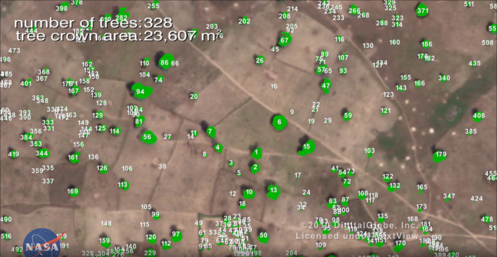

Powerful supercomputers and machine learning algorithms have led to the discovery of an unexpectedly large count of trees in the West African Sahara and Sahel regions – typically dry areas that do not receive much attention for their contribution to the global biome in climate models and other prediction systems.
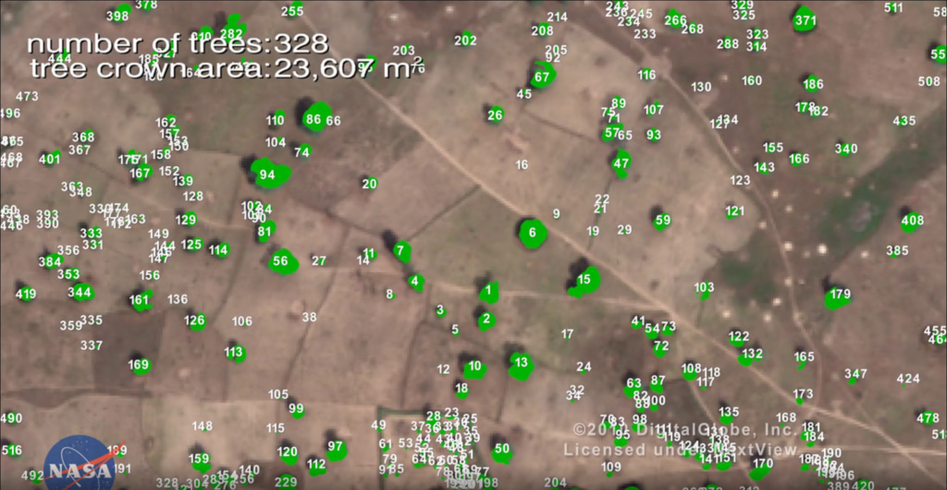
When Scientists from NASA’s Goddard Space Flight Center and a team of international collaborators trained a deep learning algorithm to identify trees using very high-resolution satellite imagery (0.5m per pixel), they were not expecting to find billions of trees in arid and semi-arid regions of the world. But already, more than 1.8 billion trees have been identified across an area of more than 500,000 square miles using the new method for mapping the location and size of trees growing outside of forests.
Traditionally, mapping non-forest trees at this level of detail would have taken months, if not years. However, this technology breakthrough provided by artificial intelligence will now be able to provide vital data to researchers, policymakers, and conservationists for preservation, restoration, climate change, and other purposes much more efficiently.
The process of coding the training data took more than a year though, NASA says. The team manually marking nearly 90,000 individual trees across a variety of terrain, allowing the deep learning model to understand which shapes and shadows indicated the presence of trees.
Martin Brandt, an assistant professor of geography at the University of Copenhagen and the study’s lead author, explains: “In one kilometer of terrain, say it’s a desert, many times there are no trees, but the program wants to find a tree. It will find a stone and think it’s a tree. Further south, it will find houses that look like trees. It sounds easy, you’d think – there’s a tree, why shouldn’t the model know it’s a tree? But the challenges come with this level of detail. The more detail there is, the more challenges come.”
Now, scientists are interested in understanding how much carbon is stored in isolated trees in the vast arid and semi-arid portions across the globe.
According to Compton Tucker, a senior biospheric scientist in the Earth Sciences Division at NASA Goddard, “Conservation experts working to mitigate climate change and other environmental threats have targeted deforestation for years, but these efforts do not always include trees that grow outside forests.” Not only could these trees be significant carbon sinks, but they also contribute to the ecosystems and economies of nearby human, animal, and plant populations.
In the future, NASA could combine the power of this AI with data from its other missions, such as the Global Ecosystem Dynamics Investigation mission, or GEDI, and ICESat-2 (Ice, Cloud, and Land Elevation Satellite-2) to open up new research possibilities.