
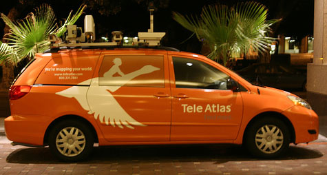
 Google launched Street View as an experimental project back in 2007. They packed several computers into the back of an SUV, stuck cameras, lasers, and a GPS device on top, and drove around collecting first images in few US cities. Around 2006 I was working with Tele Atlas (acquired by TomTom in 2007 for $2 bln) where we were collecting road data with Mobile Mapping Technology. Similar idea, yet different way of thinking… At that time we didn’t have a clue that it’s even possible to provide users all around the world with such a huge ammount of data online, so it was only used only internally (what a loss).
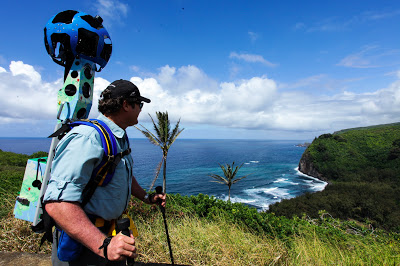
But Google as it’s a Google developed the project and managed to covere half of the world with 360-degree view of surrounds of roads and streets. Last year guys at Mountain View decided to go even further and created a Street View Trakker backpack, which gives possiblity to film all amazing places not accessible with a car. What’s cool Google lets users borrow the device if you manage to convince them that your project is truely unique. Last week the Verge: published this cool video releaving the story behind Google Trekker and the Street View. Worth watching:
source: The Verge

#Business

Next article

 Geoporters ( Geospatial Educators Opportunities for Partnership Outreach Research and Training) are seeking for active and passive Geo-Interested individuals to contribute in global Geo-awareness and Spatial Thinking programs. Taking Geo to the grassroots and spreading the good news of spatial thinking.
This is a crowdsourced funding drive courtesy of the GIS:YES (Youth and Educational Solutions). The main essence is zero down geospatial technologies and spatial thinking to the grassroots, the local residents.
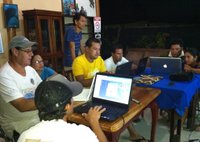
The pilot project that took place in Bahia, Costa Rica has the following to report according to GIS learning:
Goals:
- Educate, train, and build capacity of residents in Bahía Ballena and other coastal communities to apply GIS and GPS to investigate, better understand, and take action in environmentally-based community identified projects.
- Engage teachers and students in formal and informal education settings in project-based learning using geospatial technologies to enhance their communities and apply skills to future paths.
- Empower communities to apply acquired geospatial and other technological skills to investigate their own community resources and contribute to solving critical global issues.
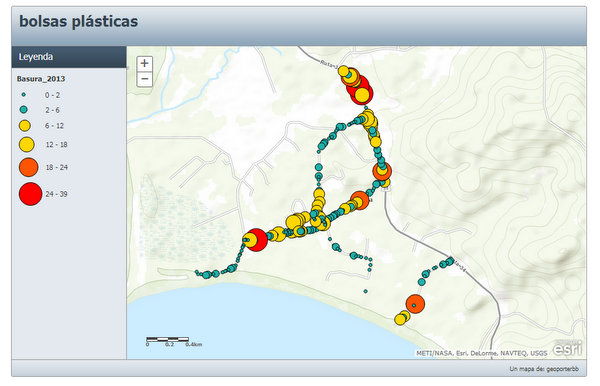
Over the course of a year in Bahia Ballena, Geoporter was able to teach 10% of the community in how to use GIS and GPS to identify and map out local concerns. The residents have participated in projects such as mapping daily humpback whale sightings in Marino Ballena National Park and collecting GIS data about trash collected from local beaches and streets.
This can be replicated in your locality borrowing leave from what took place in Bahia Ballena. Geo-people let us find a way to contribute to this laudable program and continue to take Geo beyond the gates.
Learn more about how you can start your contribution and participation in Geoporter on indiegogo.com.
Follow Geoporters activities on facebook.com for more information.
Source: Gislounge.com