
Building a more diverse, inclusive, open and welcoming geospatial industry is all about giving a voice to a more diverse group of geospatial experts and it’s a pleasure to showcase SistersofSAR and the all the awesome work they do!
Sisters of SAR
SistersofSAR is a voluntary initiative that officially launched on Twitter on April 27, 2020. Created and organised by women in SAR, they promote the exceptional advancements in SAR research and engineering around the world while showcasing the accomplishments of other women in our field. In a field historically dominated by men, they help make sure that the voices and work of women no longer go unnoticed.
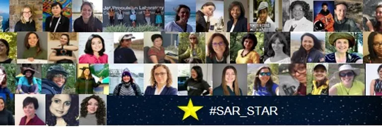
#SAR_Star
@SistersofSAR is lead by Dr. Laura Dingle Robertson, Physical Scientist, Agriculture and Agri-Food Canada; Dr. Gopika Suresh, Research Scientist, Federal Agency for Cartography & Geodesy Germany; & Sarah N. Banks, Physical Scientist, Environment and Climate Change Canada. Currently they have over 7300 followers. If you aren’t one of them then you gotta follow them ASAP 🙂
🎇It's our 2nd #Twitterversary today! 😍Thank you to everyone who's been on the ride since 2020 & those who have joined us along the way! 🙏Many thanks to our collaborators & all of our ⭐️#SAR_STARS! We can't wait for Year 3! 🥳Cheers from @LDR1, @Go__pika & @SAR_ahBanks pic.twitter.com/zCA7BXfpz4
— Sisters of SAR (@SistersofSAR) April 27, 2022
What do Sisters of SAR tweet about?
Sisters of SAR follow a weekly tweeting schedule that aims at promoting women in SAR, capacity building, spreading SAR awareness and providing up-to-date information regarding SAR missions, job opportunities, upcoming conferences and trainings. They also give shout-outs to other Diversity, Equity and Inclusivity initiatives.
They do have an amazing schedule each Monday to Friday!
- #SAR_FACT Monday;
- #TrainingTuesday,
- #DiversityDay Wednesday,
- #PictureDay Thursday, and
- #SAR_STAR Friday!
For the month of May; #SAR_FACTs were:
May 2: How backscattering varies with incidence angle ? also depends on the target? A flat dry soil surface has a stronger drop off with incidence angle than, for instance, a forest! ?
May 9: We’re talking about small #SAR #satellites today⁉️ DYK there several small #SAR ?️ companies contributing to the #GoldenAgeofSAR! Role call: @iceyefi, @capellaspace, @umbraspace, @synspective, @QPS_Inc, #EOSSAR!
May 16: For #Sentinel1, the ‘image concept’ is introduced after Level 1 processing, which re-arranges Level 0 samples in azimuth & range bins to locations on earth. ESA applies processing to generate Level-1 in 2 formats: SLC & GRD.
May 30: The first backscattered signal of a #SAR is registered for the swath edge that is closest to the sensor orbit, which is called the near range. The last backscattered signal sample is registered at the far range edge of the swath?
#TrainingTuesdays were:
May 3: Last of the four part series from @NASAARSET starts today at 10:00am ET “Part 4: Crop-Specific Time Series Analysis for Growth Monitoring”! All of the series are available on @YouTube in case you missed them! https://appliedsciences.nasa.gov/join-mission/training/english/arset-mapping-crops-and-their-biophysical-characteristics?utm_source=social&utm_medium=twitter-i&utm_campaign=CropMapping-II-22
May 10: Ever checked out @NRCan #Polarimetric Workstation? From 2010, this #PolSAR tool works with #RADARSAT2, #ALOS & #Convair580 data! https://web.archive.org/web/20221206153010/https://www.nrcan.gc.ca/earth-sciences/geomatics/satellite-imagery-air-photos/applications-development/water-wetlands/polarimetric-workstation/9747
May 17: Have you checked out #GEE’s #SAR basics on using #Sentinel1 algorithms in #GEE? https://developers.google.com/earth-engine/tutorials/community/sar-basics?hl=it! Good place to start with #SAR processing! https://developers.google.com/earth-engine/guides/sentinel1?hl=it
May 24: In person #training opp. this week is #LPS2022 in Bonn, ??! For those lucky enough to attend lots of interesting #SAR research to learn about. If you aren’t there lots of tweets of research & posters! #EOChat (Keep an eye out for @SistersofSAR’s @Go__pika)
#DiversityDay Wednesday’s were:
May 4: Highlighting today @WOMENinSTEM_IC who are “supporting & promoting women working in Science, Technology, Engineering and Mathematics at @ImperialCollege London”! Check if your college or Uni has a group supporting #WomeninSTEM today! #InclusionMatters #EOchat
May 11: Today we feature @TheGISGirl who provide “training/resources for women to increase awareness in geo”! ?Give them a follow & ⬇️check them out https://linktr.ee/thegisgirl! #WomenUpliftingWomen #WomeninGeospatial #EOChat
May 18: Today we are talking about @WomenSciAUST who are “volunteer-run, connecting all women in science, technology, engineering, math & medicine (STEMM)”! ?Check them out at https://womeninscienceaust.org #WomenUpliftingWomen #inclusion #EOChat
May 25: Highlighting @womenintechdach who are “cross-industry, non-profit association with the aim of attracting & promoting women in technical professions & making them more visible” ?Give them a follow & learn more https://womenintechev.de #WomenUpliftingWomen #EOChat
They didn’t manage to tweet on #PictureDay this May! But they do have an amazing archive of tweets for you to explore!
#SAR_STARs in May were:
May 6: @DabiriZ (Zahra Dabiri), is a researcher at the Dep. of Geoinformatics @Z_GIS1, University of Salzburg (@PLUS_1622), Austria who is focused on methodological developments using digital image processing techniques!
May 13: @cherylldoughty (Cheryl Doughty) is a #postdoc @NASAGoddard under fellow ⭐️#SAR_STAR @EarthToLola studying climate change impacts in coastal ecosystems; pairing data from the ground with remote sensing to answer ecological questions!
May 20: @bindi_dave (Bindi Satyam Dave) is a #Postdoctoral #Researcher at @mcgillu for the @McGillMSSI in the area of #Applied #Geospatial & #RemoteSensing techniques for Sustainable Engineering studies.
May 27: @HeatherSelley (Heather Selley) is a #PhD student @SEELeeds in the Institute for Climate & Atmospheric Science (@ICASLeeds) whose research focuses on changes of ice speed in West Antarctica ?? & investigating the processes driving these changes.
Additionally:
May 17th: ‘Scene from above’ podcast was released featuring our thoughts and visions of an inclusive future in remote sensing based on a scenario development workshop that Ladies of Landsat and Sisters of SAR organised and participated in. https://www.podbean.com/ew/pb-c4buz-1221aeb
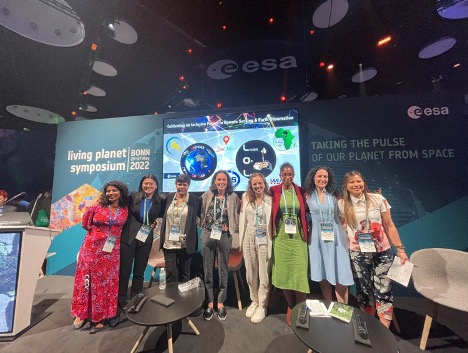
May 24th: We were present at the Living Planet Symposium 2022 #LPS22 in Bonn where we, together with @LadiesofLandsat, organised an Agora session titled ‘’Cultivating an inclusive future in Remote sensing and Earth Observation’. This session was moderated by our own Dr. Gopika Suresh (@Go__Pika) and Dr. Flavia de Souza Mendes (@Flasmendes) from Ladies of Landsat and featured women scientists from all over the world as well as videos of supporting organisations from our community.
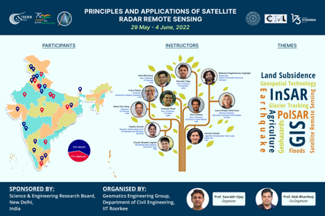
May 31st: Sisters of SAR also participated in capacity building in the InSAR Karyashala 2022 workshop organised by IIT Roorkee, India where Dr. Laura Dingle Robertson gave a lecture on ‘’ Polarimetric SAR and its applications in agriculture studies’ and Dr. Gopika Suresh gave a lecture on ‘Applications of SAR for coastal hazards’.


#People


Next article
This is going to be a long one so get comfortable and maybe get yourself a coffee/tea before you get started. The past couple of months have been rather eventful for us at Geoawesomeness with the launch of our new logo, website and the very 1st time we were mentioned in a press release (for the launch of our EO hub together with UP42). We couldn’t be more happy with where we are after 11 years of Geoawesomeness! But did we always know that we will get here eventually?
A few facts about blogging
To be perfectly honest, if you would have asked us back in April 2011, if we would be here where we are today, think the answer would have been no. And before you roll your eyes at the “fake humility”, here are a few facts about blogging that helps put things in perspective (source: bloggerspassion.com).
- Over 600 million blogs, out of over 1.9 billion websites.
- Over 3 million blog posts are published per day.
- over 70 million blog posts are published each month on WordPress platform.
- In comparison, geoawesomeness has published a grand total of 2251 posts.
The reason that Geoawesomeness has survived the test of time isn’t due to total number of posts or the average length of our posts or the zillion other metrics that one can read about blogging and how to get your blog to be the best in the world. The metric that makes Geoawesomeness unique is the number of contributors!
300+ contributors that help shape Geoawesomeness
332 is the actual number of contributors who have either written blogs, articles, reports or have created video content for our YouTube channel or spoken at one of our IRL meet-ups in Munich, Germany or have shared the podcasts they have created on our podcasts site or helped rank the Global Top 100 Geospatial companies. This isn’t even counting all the wonderful people who constantly send us the latest news articles, feedback and the like.
Granted, Aleks and Muthu are the two earthlings whose names are usually associated with the platform as co-founders of the initiative but it is definitely these 300+ contributors who have shaped Geoawesomeness to be what it is today – a global and open platform for all things geo!
11 years and 332 contributors are not bad numbers at all but if we are going to achieve our vision of building the world’s best geospatial platform then we are going to have to do a lot better.
Building a more diverse, inclusive, open and welcoming geospatial industry
It took a while to get for us to get to the main message here, didn’t it 😉 Nevertheless, this is an important message – the geospatial industry as a whole needs to do a better job at being more diverse, inclusive, open and welcoming. Sure, this isn’t a challenge unique to the geospatial industry but this is a challenge we can tackle together.
Climate change and the challenges that it brings along with it aren’t going to be solved without geospatial. The impact of decisions that we as a society make and will make to tackle this existential threat will be felt all across the planet. These decisions are going to be made on the basis of inputs people and organisations prepare using geospatial data and tools. A closed-minded geospatial industry has the potential to result in closed-minded planetary decisions that create further divisions and friction in the society. This isn’t a gender or racial and ethnicity issue alone. This certainly isn’t about “saying the political right things just because”. Diversity actually makes financial sense and makes sense when it comes to tackling biggest challenge of our lives as well. This is about empowering the best minds on this planet regardless of the personal identities of the person, including but not limited to race, gender, ability, sexuality, beliefs, culture, age, and body type.
When a soap dispenser doesn’t work for everyone that is a nuisance, an inconvenience, a sign of lack of diversity in the company that designed the product in the first place but imagine if the geospatial tools that are designed for making policy decisions and tackling climate change are similarly broken. Let’s best not imagine such a world.
https://twitter.com/nke_ise/status/897756900753891328?s=20&t=-GkfiEF4aEJYghX7D30Lzg
How do we even get started?
Highlighting the problem is just one part of the job. To truly build a more diverse, inclusive, open and welcoming geospatial industry, we are going to have to do a lot more. We’ve clearly established that there is a lot to do and if we are being honest, the challenge does sound daunting. Is it even possible to tackle something as systematic and ingrained as the diversity and inclusion in one blog? This is where Ed Freyfogle and/or Bill Gates come in with their words of wisdom (not sure who said it first). This is where the experience of working with 300+ contributors comes in handy.
“Most people overestimate what they can do in one year and underestimate what they can do in ten years”
The best way we as Geoawesomeness can help build an inclusive and welcoming geospatial industry is by building a more diverse and open geospatial community platform. A platform where we actively try to highlight diverse voices from all over the planet.
The promise of Geoawesomeness
Community.
Planet.
Purpose.
We see ourselves as a community platform that is energized by the purpose of leaving a positive impact on the planet. For years now, we have used whatever advertising revenue we’ve generated not just to keep the platform active but also to give back to geospatial – through donations to humanitarian activities and directly supporting members of the community to attend conferences and such.
We strive to be a force for positive change.
This now includes a renewed and active focus on being a more diverse, inclusive, open and welcoming geospatial platform.
In simple terms this means that we are going to do a better job at inviting more people from all over the world to share their opinion and expertise about all things geo – regardless of the whether they chose to do it on Geoawesomeness or elsewhere.
That’s the promise of Geoawesomeness.
We need your support. We need you to be our active partners on this journey. If you are interested in contributing or know someone who might be interested in contributing or have ideas/suggestions/hints on how we should be going about this in a professional way, do reach out to us. Fastest way would be to send an email to either info@geoawesomeness.com or muthu@geoawesomeness.com
Even the simplest of suggestions help. It can be as simple as helping us understand that there is an awesome alternative to saying “hey guys”
Fews weeks ago, we were discussing this with our friends from @SistersofSAR and @LadiesOfLandsat and a quick @DuckDuckGo search provided the answer y'all!
P.S: Love the fact that y'all sounds like something a character from Looney Tunes would say 😉https://t.co/C6BllUqCIC
— Geoawesomeness (@geoawesomeness) June 2, 2022
Let’s build the future together!
Sisters of SAR and Ladies of Landsat: Promoting geospatial awesomeness of women all over the world
And in the spirit of togetherness, delighted to highlight the efforts of two amazing initiatives in the geospatial industry that have/are doing a lot for diversity and inclusiveness.
Ladies of Landsat: mission, vision and all the fun things they do
Sisters of SAR: mission, vision and all the fun things they do