
A few years ago when startups like Planet Labs (now Planet), Skybox Imaging (now Terra Bella) started their ambitious efforts to monitor the planet with satellite swarms, the possibility of having a “satellite based search engine” for the world seemed too futuristic to be true. Sure, the potential of such a data-driven tool seemed enormous and the possibilities, limitless but the logistics of launching a (private) constellation of satellites to monitor the world seemed a bit ahead of its time. Fast forward to today and we have Planet, Terra Bella and Digital Globe all gearing up for the Geospatial Big Data revolution.
Earlier this week, Planet and Orbital Insight announced a new partnership, taking advantage of each others capabilities to address the needs of the financial markets.
Planet & Orbital Insight – Helping Hedge Funds with Satellite Imagery and Machine Learning
Orbital Insight, the World Economic Forum’s 2016 Technology Pioneer, wants to track the economic pulse of the world using satellite imagery on a daily/weekly basis and Planet has terabytes of data from their dove satellites orbiting the world every day. The partnership is of great interest to the financial markets that is ever hungry for more data driven analytics to give them a leg up over the competition.
“Our priority is to find high impact trends that can’t be quickly and reliably measured with traditional tools. Waxing and waning shadows on floating oil tanks reveal oil supply from space, cars in store parking lots indicate peak business hours and prefered stores, new construction indicates a prospering economy, shrinking surface water is a sign of instability. These changes, sent to the right people in near real-time, have the potential to affect thousands of decisions every day.” – Orbital Insight, Medium
Economic Development in Nanning, China over 7 months between December 2015 and May 2016. Image Copyright Planet
The future is already here!
“This partnership represents some of the most exciting trends happening in the geo world. And the reason is simple: Five years ago, a partnership like this wouldn’t have been possible because the capabilities didn’t exist. Datasets like Planet’s (broad coverage, high frequency monitoring from nano satellite constellations) were the domain of academic papers, and machine learning driven geo-analytics just weren’t happening in commercial markets. We have come an awfully long way.” – Josh Alban, Planet
Read more: Tiny Satellites: The Latest Innovation Hedge Funds Are Using to Get a Leg Up
Did you like this post about initiative of Planet & Orbital Insight? Read more and subscribe to our monthly newsletter!


#


Next article
Organizing the Olympics is a huge project not only for athletes but also for the host city. Brasil is experienced in holding large sporting events as the country hosted 2014 FIFA World Cup and although there are some complains about the quality of some venues on the ground we decided to take a look on how the preparations looked like from the space. We’ve analyzed historical satellite images from Terraserver.com to check what was already there which objects had to be built from the from the ground up. Our visual analysis showed that Rio already had a couple of stadiums that were prepared for the championship two years ago, nonetheless there are two Olympic Parks that had to be built from scratch.
Barra Olympic Park is one the hearts of the Rio 2016 Games. It hosts nine sporting venues located in Barra da Tijuca, in the west zone of Rio. Below you’ll find the visualisation of how the area changed on ever the last 6 years. On the first image you can see that it was previously a motorsport circuit that hosted the Formula One Brazilian Grand Prix from 1970s. It was demolished in 2012 to make a space for the Olympic Village.
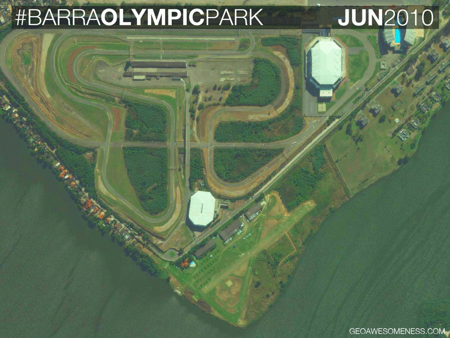
Barra Olympic Park_2010-2016
The Deodoro Olympic Park, located in the north-west part on the city, is the largest of Rio’s Olympic zones, and is set to host 11 Olympic sports including: Canoe Slalom, BMX, Mountain Biking, Field Hockey, Shooting, Modern Pentathlon, Women’s Basketball, Rugby, and Equestrian Jumping, Dressage. The images below show that the construction of the key Olympic venues started only in 2014.
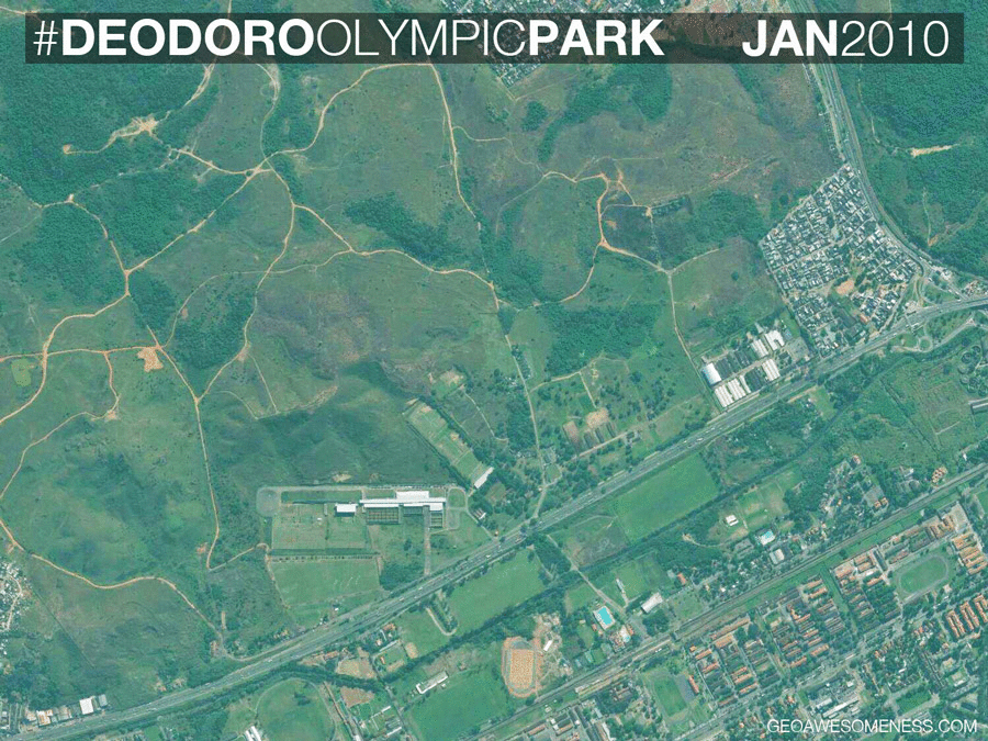
Deodoro_2010-2016
We also looked at Maracanã Stadium. You can see how it changed for the 2014 World Cup. During the Olympics it hosted the opening ceremony. The preparations for the event are visible on the last image taken in June 2016.
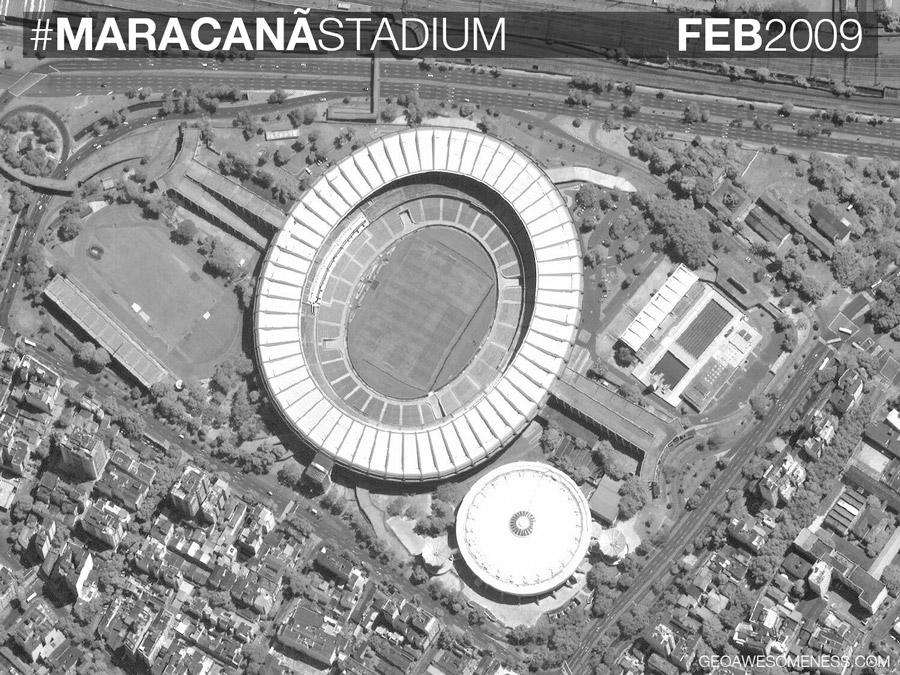
Macarrana 2009-2016 visualization
Did you like this article? Read more and subscribe to our monthly newsletter!