

Being a start up company does not only imply having new ideas, developing new methodologies and finally creating a new product, but also to care how to promote and dispose it. EOMAP, a Munich based company that I already reported of, has been specializing in information about water quality and bathymetry derived from satellite data and has become a leading provider of aquatic remote sensing solutions in the last years . Last week, the company has launched EOMAP Web Store where clients have direct access to global water quality and bathymetric data products derived from satellite imagery.
The EOMAP Web Store enables clients to instantly purchase worldwide off-the-shelf eoBathymetry 15/30m products and order subscriptions to the eoWaterQuality 30/500m service for continuous water quality monitoring over selected geographic areas of interest. The easy-to-use web store allows clients to search for appropriate products by location and date and place their orders online.
“By offering these products through the automated EOMAP Web Store, we can provide our customers with faster access to the satellite-derived data solutions they need at a significantly reduced cost,” said Dr. Thomas Heege, EOMAP CEO. “Up-to-date, standardized aquatic information has never been easier to access and incorporate into the business workflow.”
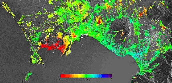
Delivered on a per-project basis for the past several years through the EOMAP processing center near Munich, EOMAP eoWaterQuality and eoBathymetry offerings for many geographic areas (see third figure) are available off-the-shelf through the Web Store, where custom orders may also be placed.
All EOMAP products are derived from a variety of satellite systems, including Landsat 7 and 8, MODIS Aqua and Terra, and soon upcoming Sentinel 2 and 3 satellites. Current off-the-shelf products are offered at 15/30- and 500-meter resolution, but they can be integrated with higher resolution products, using data from WorldView-2, Kompsat-3 and RapidEye.
EOMAP products are relied upon extensively by industries ranging from aquaculture, oil & gas, and desalination to environmental monitoring, navigation and hydrography.
The standard EOMAP eoWaterQuality service is offered at two resolution levels – 30 and 500 meters. Both offerings monitor turbidity and related suspended matter, organic absorption, chlorophyll and related algal blooms in water bodies. Designed for monitoring of large coastal zones and inland waterways, the eoWaterQuality 500 service can deliver daily updates, as requested. Priority delivery within hours of satellite acquisition is available for first continents. The EOMAP eoWaterQuality 30 offering can monitor coastal and inland waterways, including smaller water bodies, up to four times per month.
EOMAP eoBathymetry provides bathymetric data for water areas worldwide, often within less than 24hours after ordering. It is created from 30m spatial resolution satellite imagery and sharpened to 15m using additional satellite sensor information. The products cover shallow-water coastal areas to average depths of 20 meters.
The EOMAP Web Store is the first customized online geospatial portal powered by the geo-collaboration platform technology of CloudEO AG in Munich, which offers clients the IT power, data access and software tools to develop products and services. In addition, the CloudEO Store platform enables clients to market those products and services.

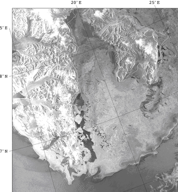
EOMAP Map Viewer showing the ares of available products.
Product view of the Online Store.
Source: EOMAP

#


Next article

Indian Space Research Organization plans to launch its C23, a Polar Satellite Launching Vehicle. Why is this important?

It is more about what this PSLV(Polar Satelite Launching Vehicle) will be carrying that is the important thing. SPOT 7, a French earth-observing satellite, will be carried on this rocket on Monday’s launch. SPOT 7, and SPOT 6(launched in 2012) will serve in tandem as an earth-observing constellation.
What is so significant about launching SPOT 7? The SPOT 7 has high-responding sensors. What this means is that the more data about the earth can be gathered. This satellite, as well as SPOT 6, will both be used for remote sensing.
The tandem of satellites have the ability to gather images up to 60 km wide. That isn’t all. On a daily basis, 6 million sq.km will be the coverage. To ascertain the greatest efficiency, weather forecasts are being included in the satellites automatically. This will reduce the amount of cloud cover found on most images.
That is just part of what makes these satellites important. Both satellites have a resolution of 1.5 metres. The images gathered from SPOT 6 and 7 will be beneficial for maps with a 1:25,000 scale.
Considering the aforementioned attributes of SPOT 7, in tandem with SPOT 6, this is why this launch is important.