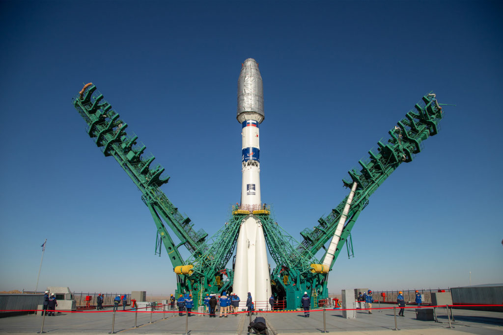

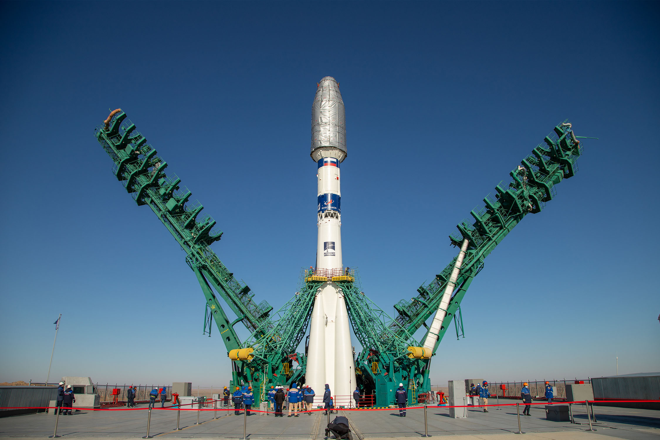
On March 22, Dubai Municipality announced the successful launch and deployment of DMSat-1, an atmospheric monitoring microsatellite built by Space Flight Laboratory (SFL). DMSat-1 launched from the Baikonur Cosmodrome in Kazakhstan aboard a Soyuz rocket. The first signal from the DMSat-1 has been received at 4:42 pm (UAE time).
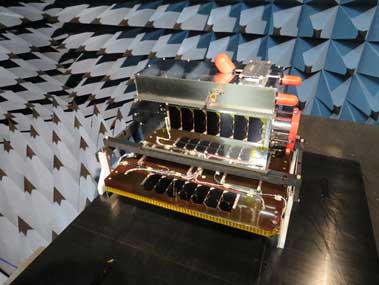
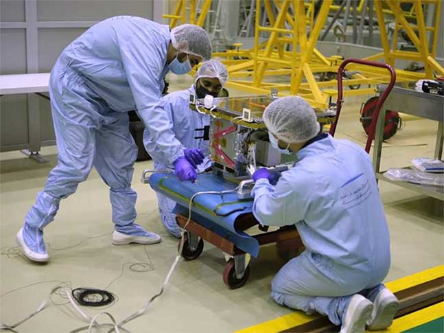
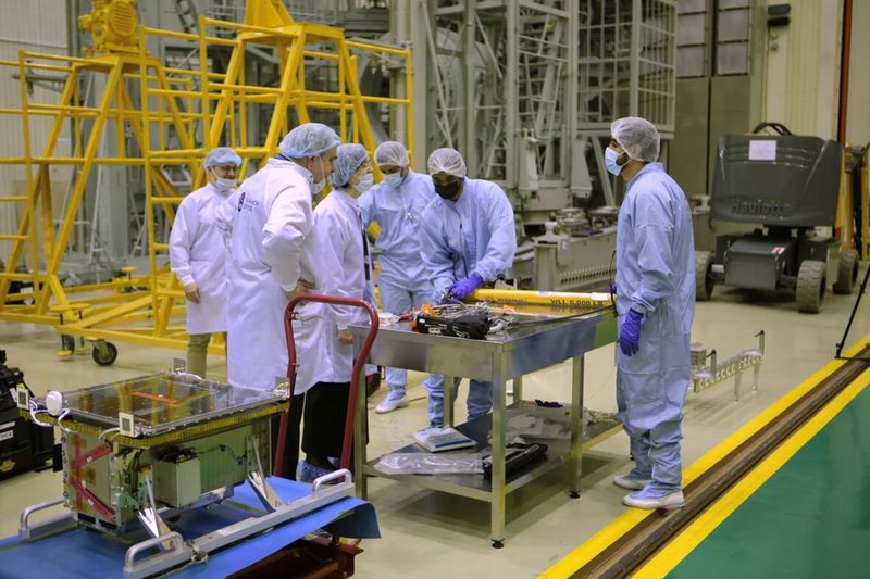
SFL developed DMSat-1 under contract to the Dubai-based Mohammed Bin Rashid Space Centre (MBRSC) in the United Arab Emirates (UAE). The DMSat-1 satellite is a 15-kilogram, 20x30x40cm microsatellite. It was built on SFL’s space-proven Next-generation Earth Monitoring and Observation (NEMO) platform, which incorporates high performance ground target tracking capability.
The launch is part of a high-technology project undertaken to develop solutions to environmental challenges and address climate change. The mission is designed to cover an area of up to 80,000 square kilometers each day.
DMSat-1 will monitor, collect and analyse environmental data as well as measure air pollutants and greenhouse gases. The environmental satellite will also help create maps of the concentration and distribution of greenhouse gases in Dubai and the UAE and study seasonal changes in the presence of these gases.
Data provided by the satellite will be used in several areas including finding solutions to environmental challenges, developing long-term plans to address urban pollution and climate change and environmental forecasting in Dubai.
“DMSat-1 will play a key role in monitoring atmospheric aerosols and greenhouse gases for Dubai and the UAE.” said SFL Director, Dr. Robert E. Zee.
SFL was selected to build DMSat-1 for its compact size and performance, including the mission-critical importance of attitude control and precise sensor pointing. SFL has developed high-performance ground target tracking capabilities that enable the small satellite to execute a slewing maneuver in orbit to accurately point its sensors at selected swaths of the atmosphere.
“Our ability to keep low-inertia, relatively inexpensive microsatellites like DMSat-1 pointed accurately and stably in orbit has made atmospheric monitoring missions possible at much lower costs,” said Zee.
DMSat-1 carries two instruments onboard. The primary payload is a multispectral polarimeter that monitors aerosols, which are typically fine particles of liquids and solids in the upper atmosphere often caused by anthropomorphic sources. Aerosols also correlate to natural phenomenon such as dust storms. The secondary payload is a pair of spectrometers that will enable MBRSC to detect greenhouse gases, such as carbon dioxide and methane over the United Arab Emirates. The key aerosol polarimeter operates in three (3) bands: Blue (480-500 mm), Red (660-680 nm) and NIR (860-880nm).
The launch of the satellite strengthens the UAE’s implementation of the Paris Climate Agreement, which requires the country to generate data on greenhouse gas emissions and build national capacities to study global warming. On a local level, the DMSat-1 seeks to calculate the rate of carbon dioxide emissions in relation to GDP as outlined in the Dubai 2021 Plan, study the environmental impact of the Dubai Clean Energy Strategy 2050 and the results of the UAE Energy Strategy 2050 as well as contribute to the ‘National System for Greenhouse Gas Emissions Management’ that is part of the National Climate Change Plan 2017-2050.
This is the Arab world’s first nanometric environmental satellite project. Overseen by the MBRSC, the project was implemented in collaboration with local and international research teams. Based on Dubai Municipality’s requirements, MBRSC built the satellite in collaboration with the Space Flight Laboratory (SFL) at the University of Toronto, which has a successful history of launching satellites similar to DMSat-1. MBRSC is also managing launch-related activities and developing advanced solutions to utilise the data generated by the mission. The Centre will continue to support the project by managing the provision of data generated by the project to Dubai Municipality.
Dubai Municipality becomes a new power in the space industry, which provides a lot of opportunities in the market. The US and Europe are not the only players. More and more Asian countries join the game to catch up with traditional aerospace, such as China, Japan, and UAE.
According to a new market research report published by MarketsandMarkets™, the global Nanosatellite and Microsatellite Market size is expected to grow from USD 1.8 billion in 2020 to USD 4.8 billion by 2025, at a Compound Annual Growth Rate (CAGR) of 21.3% during the forecast period. Earth observation and remote sensing account for the largest market size during the forecast period. The commercialization chance in Nanosatellite and Microsatellite is increasing.
The major Nanosatellite and Microsatellite Market vendors include GomSpace (Denmark), L3Harris (US), Planet Labs (US), Berlin Space Technologies (Germany), Spire Global (US), Satellogic (Argentina), and SpaceTy(China). With more and more satellites launching to space, SFL is developing into the next major vendor.
![]()
About Space Flight Laboratory (SFL) (www.utias-sfl.net)
SFL is a unique microspace provider that offers a complete suite of nano-, micro- and small satellites – including high-performance, low-cost CubeSats – that satisfy the needs of a broad range of mission types from 3 to 500 kilograms. Dating from 1998, SFL’s heritage of on-orbit successes includes 68 satellites and distinct missions related to Earth observation, atmospheric monitoring, ship tracking, communication, radio frequency (RF) geolocation, technology demonstration, space astronomy, solar physics, space plasma, and other scientific research.
SFL generates bigger returns from smaller, lower cost satellites. Small satellites built by SFL consistently push the performance envelope and disrupt the traditional cost paradigm. Satellites are built with advanced power systems, stringent attitude control and high-volume data capacity that are striking relative to the budget. SFL arranges launches globally and maintains a mission control center accessing ground stations worldwide. The pioneering and barrier-breaking work of SFL is a key enabler to tomorrow’s cost aggressive satellite constellations.
In its 23-year history, SFL has developed CubeSats, nanosatellites, and microsatellites that have achieved more than 140 cumulative years of operation in orbit. These microspace missions have included SFL’s trusted attitude control and, in some cases, formation-flying capabilities. Other core SFL-developed components include modular (scalable) power systems, onboard radios, flight computers, and control software.

#


Next article
Chinese EO startup Vastitude Technology takes on facility monitoring with radar image and spatial information technology
Risk monitoring and natural disaster emergency market is valued at more than a hundred billion in China itself but only has a few service providers. Remote Sensing application plays a crucial role in this market.
Hundred billion potential market in China: Risk monitoring and disaster emergency
Forty years ago, the infrastructure building wave started in China. After forty years, Skyscrapers, underground, dams, railways, highways become everywhere in China. On the other hand, natural disasters occur more frequently because of climate change. Reducing the risk and protecting citizens’ safety becomes an important topic in China and gets significant government attention.
The demand for urban safety monitoring, traffic safety monitoring, and disaster safety monitoring has been rapidly growing over the past few years. As traditional methods cannot address a country-wide scale, the development of high-density and accuracy satellite radar data seemed to match the use case perfectly.
One of the leading startups in China working on the topic is Beijing Vastitude Technology Co.,Ltd. The company was founded in 2016 with the mission to be an Earth Health Big Data Specialist. Until 2020, Vastitude Technology has monitored more than 400 cities in China for multiple years and developed products such as MISS InSAR time series processing software, SEonSE Ship monitoring and oil spill monitoring information platform, LarkView Platform, Urban Health Remote Sensing Diagnose Platform, SAR Intelligent Abnormal Deformation Monitoring and Warning Platform among others. The products are based on a number of global and Chinese Earth Observation coming from 12 radar satellites and 14 optical satellites. 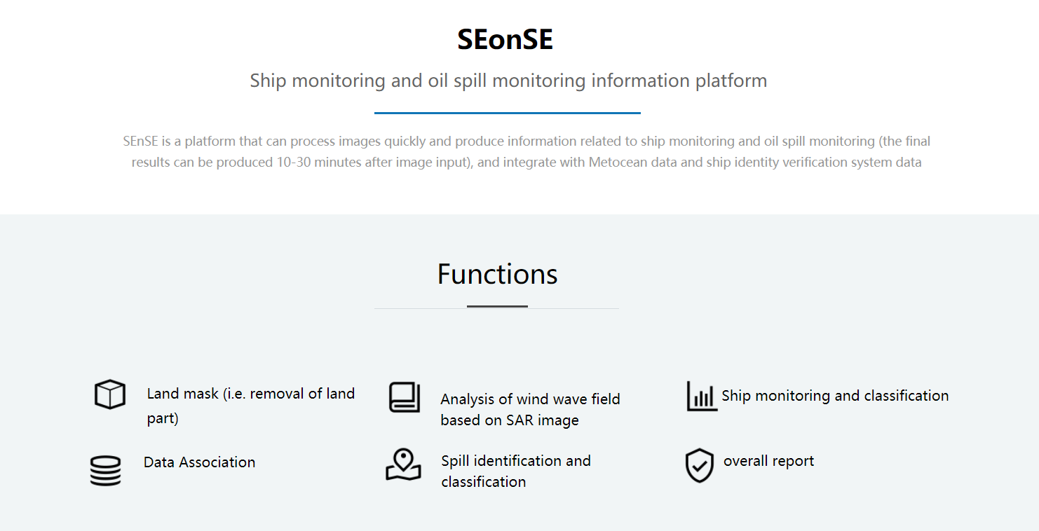
Advantages and application cases of radar satellite products
Radar satellites can accurately analyze ground subsidence, building deformation, and landslide because of the precision of Interferometric Synthetic Aperture Radar (InSAR). InSAR makes high-density measurements over large areas by using radar signals from Earth-orbiting satellites. It can capture more than ten thousands points per square kilometre. Moreover, SAR satellites don’t need to worry about the weather or daytime. All these characteristics make InSAR more and more exciting for researchers and entrepreneurs.
How to analyze and monitor the risk more accurately? The founder and CEO of Vastitude Technology JiPing Li listed four main points:
- Data resources: The quality of the SAR image is crucial for the accuracy of end products. Therefore, good data resources are the basis of the industry. Vastitude Technology has accumulated 12 SAR satellites, including COSMO-SkyMed, ALOS-2, COMPSAT-5, Sentinel-1.
- Data accumulation: To analyze the risk more accurately, long-term observation at a risk point is necessary. The best practice is at least thirty images of the monitored location. And it is impossible to form interference for different kinds of SAR satellite. Therefore, a group of the same type of satellites must monitor and observe a location for an extended period. That’s why Vastitude Technology uses recent and historical data from 9 years back for its analytics.
- Project experience: Extensive project experience is also a critical resource. Vastitude Technology team has completed thousands of projects. In Shenzhen, Vastitude Technology has monitored more than 10 million points of buildings and potential natural disaster regions for more than five years. In Beijing, Xian, Wuhan, Foshan, Changchun and dozens of cities, Vastitude Technology has some land subsidence monitoring projects.
The core company product is InSAR big data cloud platform called LARKVIEW. It enables advanced deformation analysis for large scale tracking of the risk source of buildings, subway, roads, bridges, high-speed rail, and dams. The tools give access to seven years time series of radar data and enable online data access, visualization, and analytics of InSAR data.
Moreover, Vastitude Technology is cooperating with Tencent Cloud and has recently launched Urban Health Remote Sensing Diagnose Platform for 50 cities in China.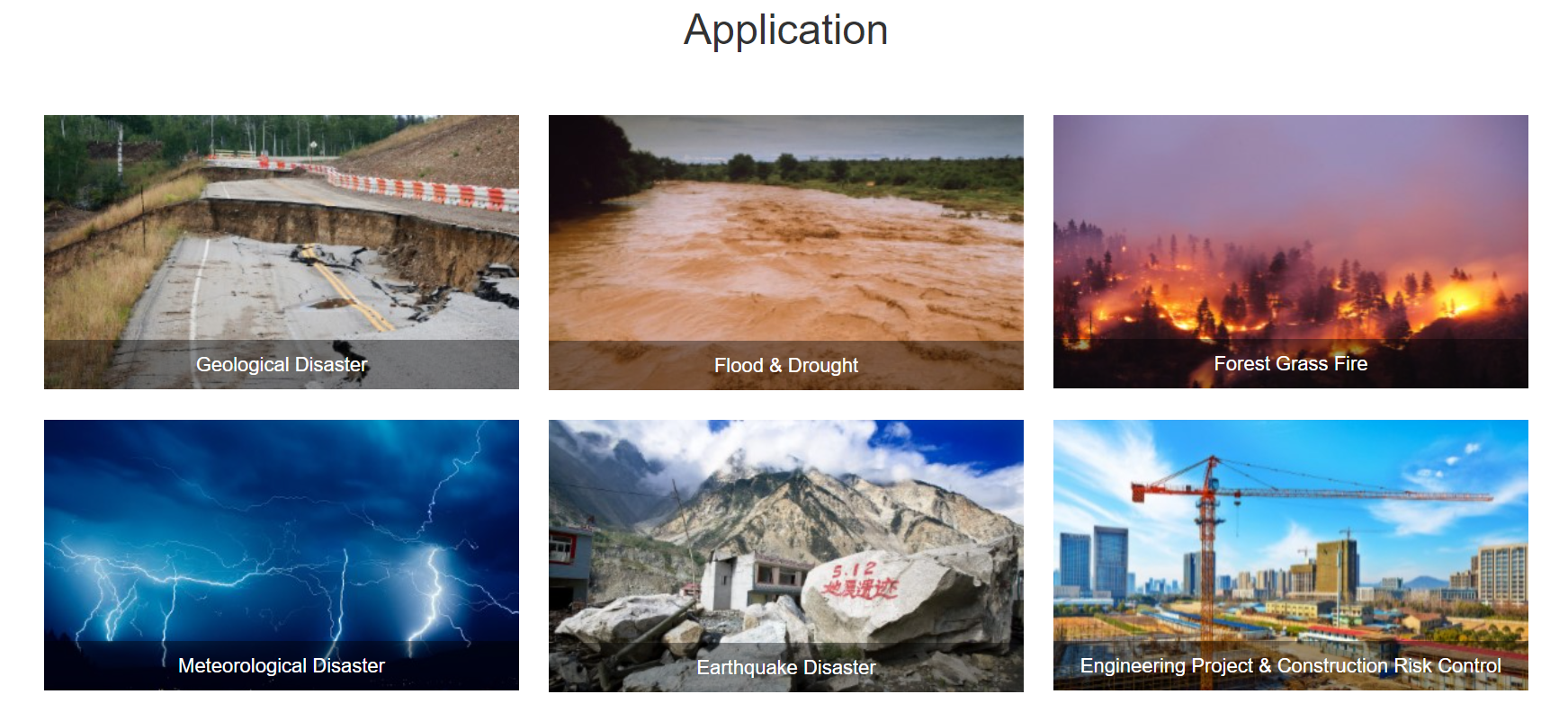 More than ten million profits
The business model of Vastitude Technology is not complicated. Vastitude Technology processes the satellite image into standardized products and provides it to customers across various industries, such as real estate, emergency management, insurance, and finance. 80% of the revenue comes from the infrastructure and natural disasters risk monitoring business. The growth rate of revenue is expected to exceed 100% in 2020 and reach ten million yuan.
More and more startups realize that the InSAR application market is heating up. Finnish startup ICEYE and Chinese startup SPACETY have both launch small SAR satellites for more services. And Chinese startup F.Squares Technology and Smart Satellite Space Technology are also planning to launch their own SAR satellites. The stakes are high as the Chinese government plans to launch the national natural disaster risk survey project later this year with an expected budget of more than ten billion yuan.
More than one million yuan of Average transaction value
Vastitude Technology offers a number of products at a flexible scale and price. The client can buy a basic risk report of a single building for a little as several hundred yuan. However, typical projects involve long-term and large scale monitoring of the entire city or region with an average transaction value of more than one million yuan right now.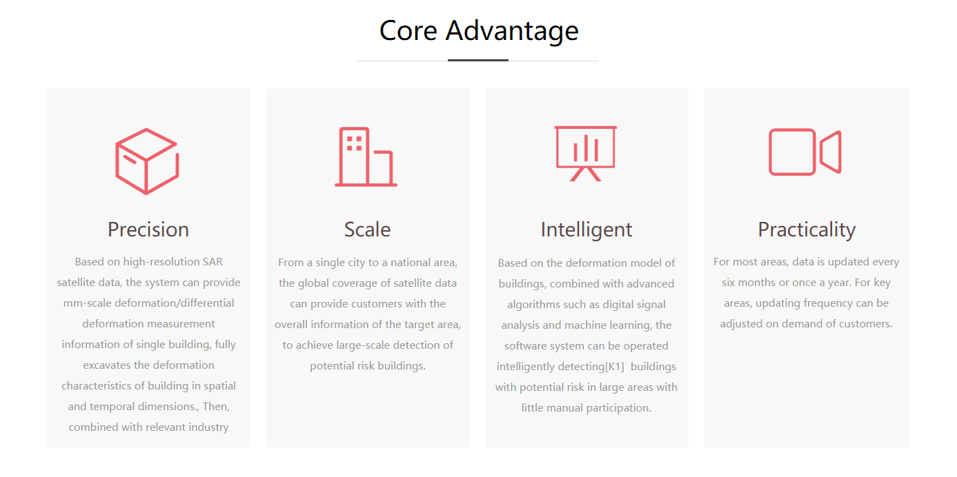
Plan and fundraising
“In these years, we are accumulating the resource and develop our algorithm. I think we have finished the zero to one process. Now, it’s time for one to one hundred,” said, Jiping Li.
Vastitude Technology plans to expand the market rapidly now. With the previous successful cases, Vastitude Technology will focus on market sales this year. Currently, there are more than fifty employees in Vastitude Technology. In 2018, Vastitude Technology close series A fundraising round from TusHoldings.
[This article was first published on 36Kr and been republished on Geoawesomeness]