

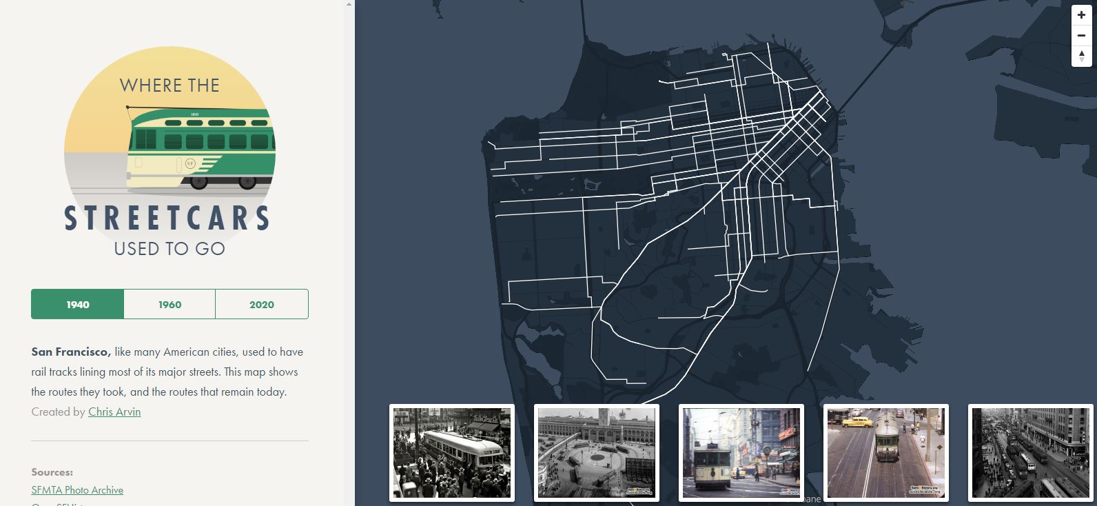
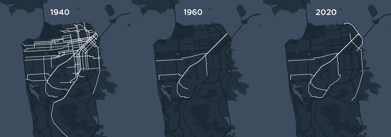
We are used to impressive, complex maps but sometimes a story can be told with much simpler means. San Francisco based designer Chris Arvin created a simple but wonderful visualisation of how streetcars routes looked like in three different eras in the history of the city 1940, 1960 and 2020 (present and plans).
Streetcars, once the symbol of San Francisco, were almost gone in 1960s. The vast majority of those routes shown in the 1940 were overtaken by buses and metro lines. The map shows that some the past routes have been reopened or will be opened before 2020.
I’ve never been to San Francisco but somehow I always thought there were a lot more streetcar lines in the city. This simple visualisation showed the reality and told a simple story. As map geeks we would probably do a lot of things differently but the project proves that you don’t need a breathtaking visualisation to tell the story. Great job!

#Ideas


Next article

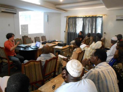
 For many civic tech communities, faith in open data goes beyond merely pulling down legal or technical barriers preventing others from using data openly for the good of society. It decisively commits to a ground truth advocacy, allowing them to harvest and use data for the benefit of their families, local communities and society as a whole. Notwithstanding, sharing their faith with open data nonbelievers can be intimidating and difficult, but also incredibly rewarding. Right now the East African Open Data Festival is about to launch, among other reasons, for a greater presence of open geodata in the Sustainable Development Goals SDG indicators production along with other multi stakeholder’s organizations and governments in diverse global forums for the good of the region.
Data is cumbersome for the many social, economic, environmental and humanitarian needs that we witness in our families and communities, but we still can’t provide good answers to when day to day problems arise or even disasters break up.
Luckily, for the geospatial civic tech initiatives, United Nations Population Commission has recently recognized that regarding SDG selection for the Global Agenda 2030, Geo-referencing makes possible the integration of diverse datasets and facilitates disaggregation lubricating the incorporation of big data in analyses and modeling. Their last April document recommends all Nat’l Stats Offices in the world to choose and make available open data standards in order to broaden the availability of complete datasets for SDG monitoring and eventually its attainment. And surprisingly, they recommend that governments should take stock and lessons of what civil society is doing in this regard.
Unfortunately, many open data has been considered by governments until now just a little bit more than a mere tech curiosity, just a technical kind of novelty only intended to be discussed by specialized practitioners and champions.
Well, we are the champions. But what should we do about it?
In the East Africa Open Data Fest we will convene to provide a platform for sharing the experiences on the adoption of Open Data and also create opportunities for investment and partnerships related to Open Data.
Organizers would like to learn, discuss, work and commit with you in order to
- Convene a growing network of local leaders to support and elevate ongoing work
- Ensure continuity of the open data conversation in East Africa.
- Support a national and regional open data culture.
- Promote market-led open data and create long lasting partnership opportunities.
- Develop an expert platform for learning, debate and collaboration between open data stakeholders.
Would you dare to join us in the data revolution?
GeoCensos Foundation is an officially registered NGO from Latin America and the Caribbean that promotes innovative projects in geospatial disciplines Author is a © Javier Carranza is a latino geo tech activist leader and good writer, geo data scientist, analyst and government advisor for substantive geo information technology projects. Founder and leader since 2008 of [GeoCensos] geotech trends blog , GeoCensos Foundation and Mapps Hackathon. http://www.geocensos.com