
 Nokia has been quietly focusing its energy and resources on building a spatial database enterprise. The recent article ” Is Nokia Building Competitive Advantage Over Google and Apple with Indoor LBS? ” is a case in point.
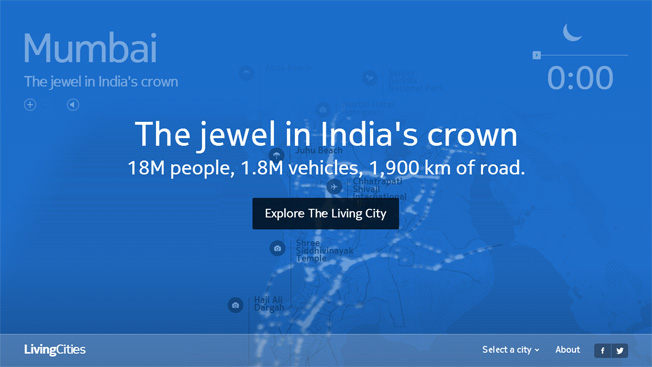
Nokia’s HERE in collaboration with CartoDB has released beautiful and dynamic visualizations of traffic for five metros across the globe – London, Chicago, Rome, Helsinki and Mumbai – The Living Cities project.
You can safely say that HERE got itself an analytical facelift! CartoDB is a high profile, cloud based mapping, analysis and visualization engine who’s clients list include the likes of NASA, Guardian and the United Nations! Pretty impressive! What’s even more impressive is their awesome API’s that let you visualize your data within minutes in a really neat and inspiring manner.
What’s so unique and different about the Living Cities project that makes it stand out from the tons of traffic visualizations that we have seen in the past?
Living Cities is basically a web project that visualises traffic in a time-lapsed format over the course of 24 hours, in five different global cities, namely, Mumbai, London, Chicago, Rome and Helsinki. The project anonymised data from the HERE platform of Nokia and allowed CartoDB to visualize traffic movements over a period of one month. CartoDB made the visualizations a lot more happening by offering users an experience to hear the sounds of the road besides pop-up windows with stats and trivia relating to the Metro along with its Points of Interest (POI). All this besides providing insights into the traffic pattern in the city. Even the colors of the map turn bright and dark in line with the weather and time of day 🙂 Wondering if all this can be shared on FaceBook and Twitter? Apparently, yes 🙂 Hail Social Media!
What does this mean for Nokia in terms of business?
Well, clearly Nokia is targeting governments and other agencies that could utilize such data – think traffic planners and logistics companies like DHL and more! They could all benefit from such data and analysis. This data might already be available but the market is still nascent and Nokia wants a piece of it.


#Ideas


Next article
The crowd sourced traffic information and navigation app, Waze was in the news recently courtesy acquisition interests by silicon valley giant like Google, FaceBook and Apple. Eventually Google acquired Waze for a undisclosed amount of money early last month. Interestingly, the US Patents Office has now released information that Apple Inc has filed for a patent that works very much like Waze does!
The patent application titled “User Specified Route Rating and Alerts” looks remarkably similar in working style to Waze! Before I make a wrong assumption here, the patent information released by US Patents Office also shows the patent was originally filed in late 2011!

User Specified Route Rating and Alerts – Apple Inc patent
Apple Inc’s latest patent offers users route choices based on criteria’s like Scenic Route, Traffic condition, etc. The patent is intended at systems that have both cellular and GPS functions – pretty much the entire Apple array of products have these. With the acquisition of Waze, Google made the right move by strengthening their navigation solution. But with this patent, Apple Inc has shown that they aren’t too far behind in the race either.
This patent should help improve the quality and functionality of iOS Maps.
The patent allows users to flag road problems including traffic conditions like “protest”, power outages, real time accident reporting and more. Pretty much follows the standard set by Waze but who knows what Apple Inc has in mind 🙂
Source: TechCrunch