
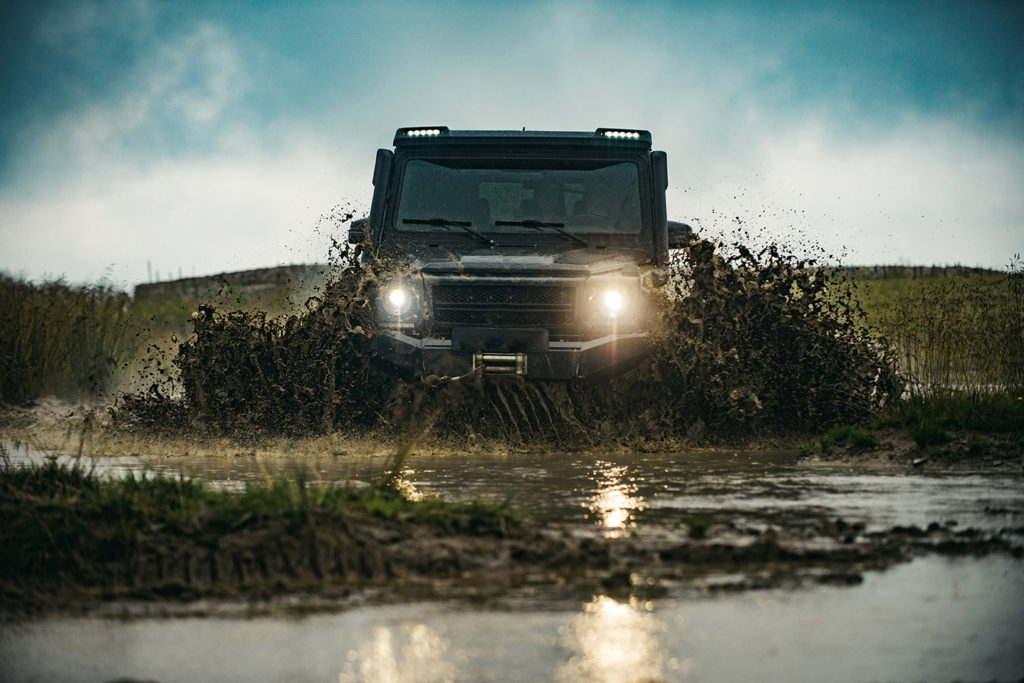
But, what if we have a vehicle that can go off-road? Carmenta Engine provides terrain routing that leverages terrain data to calculate the best route for different vehicle types. With this in mind, what criteria does our ability to traverse the terrain depend on?
Data-driven routing
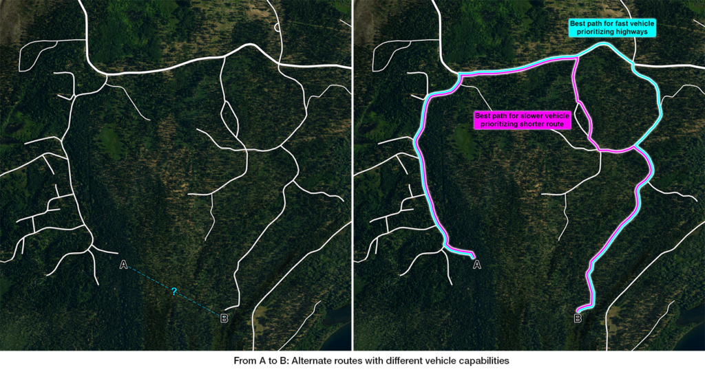
Some of these solutions can suggest alternative routes based upon different criteria. For example, with a vehicle that has a high top speed we might get from A to B faster if we take a longer route travelling on highways, rather than taking the shortest route. On the other hand, a slower vehicle might reach point B faster by following the shortest route.
Elevation data
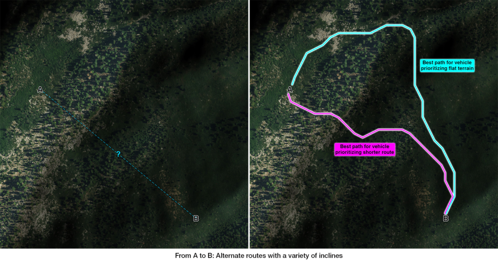
Elevation data provides us with information such as the curvature of the terrain, how much the ground inclines and in which direction.
Here we can see how elevation data can be used to visually represent the curvature of the terrain and also how the data has been used to determine two routes across it. The different paths are derived from our routing analysis that takes into account different slope-handling capabilities for two different vehicle types.
Ground conditions
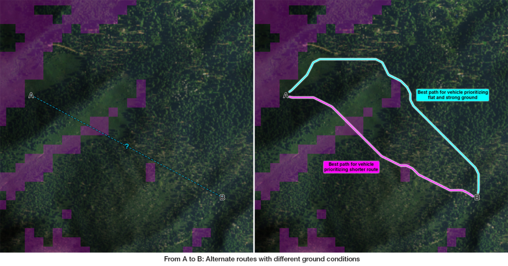
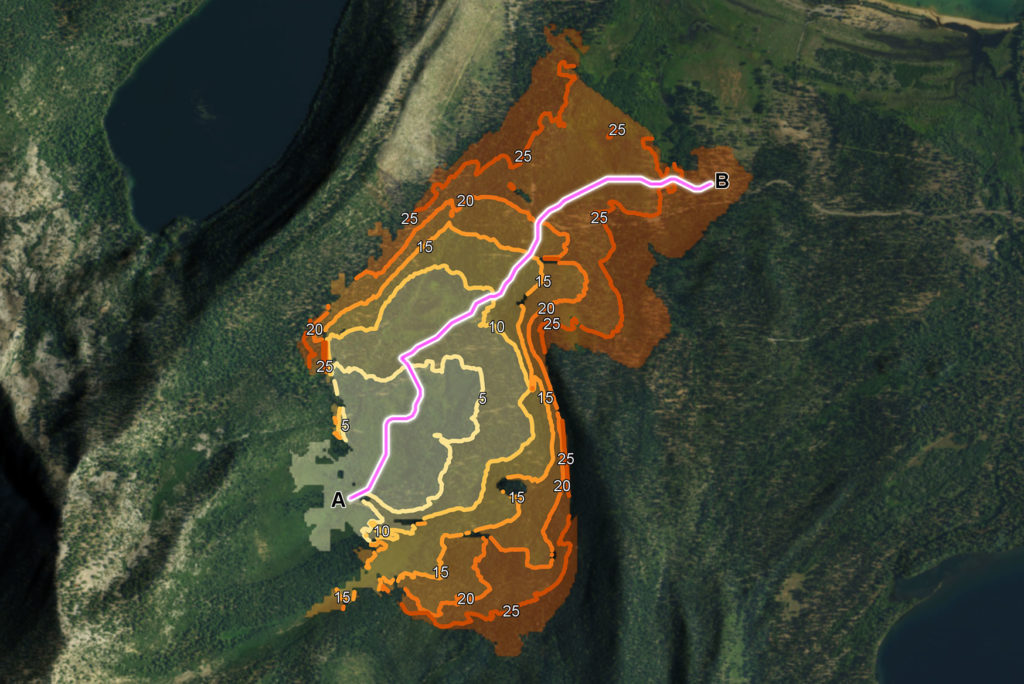
Data on ground conditions describe how stable and strong the ground is, so we know how much pressure it can take before it deforms.
Adding data about ground conditions to the analysis will have an effect on the resulting routes. Now, both the slope and ground conditions are taken into account when determining the best route. Note that a vehicle that can travel up a slope with a particular incline and also traverse weaker ground might have a problem with the same inclination combined with the weaker ground.
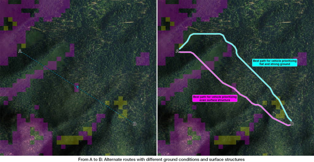
Surface structure
Another terrain property is the surface structure and this can best be described as how even the ground is.
Adding the surface structure to the analysis we further refine the available routes. Depending on the capabilities of the vehicle we can then calculate a route where we avoid the weaker ground but traverse uneven areas of terrain. For another vehicle, the result could be the opposite, that we traverse the weaker ground, but avoid the uneven terrain.
Beyond A to B
Apart from calculating the travel time and distance between two points, using fast algorithms, it is also possible to calculate the travel time to any point within a given area. This makes it possible to visualise how far you are able to travel within a specific time and to identify areas of the terrain that are impossible to reach using your current vehicle. This can be used to calculate where you can deploy your sensors, what areas you can reach with medical units and to identify gaps that might need to be covered by other vehicle types.
A flexible solution
The real-time routing analysis in Carmenta Engine results in a route where the combination of different terrain data types is considered at every step of the journey. The analysis evaluates how fast the terrain can be traversed taking configurable vehicle properties into account. Editing existing waypoints or adding new ones results in an instant recalculation of the optimal route.


#Business


Next article
Ed Freyfogle, co-founder of OpenCage, and the host of Geomob Podcast recently interviewed Aleks and Muthu to mark the 10th anniversary and to talk about the 2nd decade of Geoawesomeness. Check it out!