
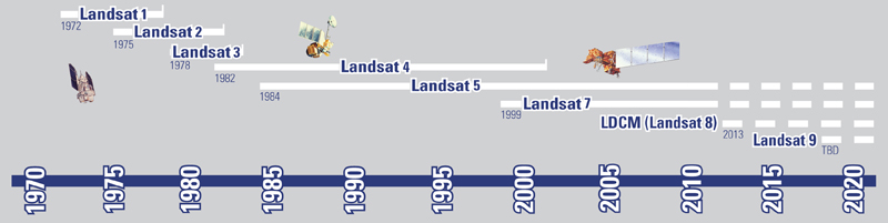
After record breaking 28 years of service, Landsat 5 was decommissioned on January 6th 2013. Landsat 6 had failed during the launch and Landsat 7 is partially blind due to its mirror problem. So, the Landsat data user community mourned the loss of Landsat 5. For them, here is the new hope. On 11th February 2013, The Landsat Data Continuity Mission has made one of the most important space launches of the year. Landsat-8 was successfully launched into orbit from Vandenberg Air Force Base in California, which will continue the continuous 40-year record of observations of huge change for the planet.
 The contribution of Landsat Mission:
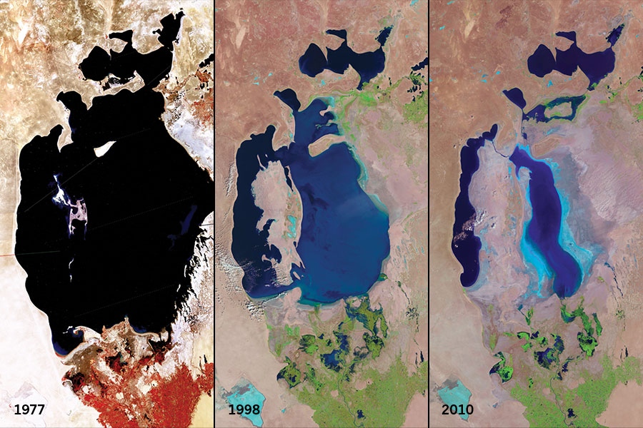
From the first launch in 1972, Landsat was designed to provide a global record of land-cover and land-use change. For an instance, from the following Landsat satellite series, collected from USGS EROS DATA CENTER, we can see that, the Aral Sea in central Asia is shrinking significantly from 1977 to 2010 because of water diversion for agricultural use. This critical piece of information can provide the information and from that we can construct our knowledge to shape our future. Like such we by using such change information we can act in time before it come to the neck and making an intervention plan on time as well. The earliest satellites captured images at several visible-light and near-infrared frequencies, all with a resolution of 80 meters. Landsats 4 and 5 could provide the images of a 30 – meter resolution and had added the infrared band which has pushed the research envelope to aid studies of soil moisture, vegetation etc. By adding a multi-spectral sensor, Landsat 7 has achieved higher spatial resolution capability and can provide with 15-meter resolution. Through careful calibration, the program has built up a continuous 40-year record of observations of huge change for the planet and Landsat 8 is ensuring the continuation of the world’s longest-lasting satellite-based remote sensing operation.
What Landsat- 8 offers?
Landsat-8 carries two Sensors. Operational Land Imager (OLI) and Thermal Infrared Sensor (TIRS). Operational Land Imager (OLI) has total 9 spectral bands (30 meter resolution), including two new bands (Band 1 – Coastal aerosol, Band 9 – Cirrus) to previous Landsats’ visible, near infrared, and shortwave infrared measurements and a panchromatic band of 15 meter resolution. Band 9 – Cirrus, is designed to collect data about high altitude cirrus clouds and Band 1 – Coastal aerosol to collect data about aerosols and water quality in lakes and shallow coastal waters. TIRS will collect data on heat emitted from Earth’s surface in two thermal bands, as opposed to the single thermal band on previous Landsat satellites. For more info visit Landsat – 8
Landsat 8 is scheduled to begin operations after 100 days after entering orbit and data products from Landsat 8 will be available to all users at the end of May 2013.


#


Next article

 The first thing that comes to my mind (probably to most Geomatics graduates from India and the rest of the world as well), when you say surveying and mapping – the long hours in the hot unforgiving sun carrying those “wonderfully heavy” equipments around! Right, I know you must be thinking what happened to all the stuff you guys study about Remote Sensing and Photogrammetry. Well, Agreed! Frankly its more fun using Google Earth or Bhuvan to zoom around the world and measure things than sweating it out in the field for the entire day just to end up mapping less than a mile.
So its Aerial photogrammetry to the rescue then, but most of these “Mining Engineers” just don’t want to wait for us Geomatics people to get our aerial/satellite imagery, do those “fancy” image processing to create orthophotos and elevation models for their open-pit mines. In fact, these guys dig so much and so fast that sometimes you need to find new satellites to get latest pictures to get the maps updated.
In comes an idea that probably has been around for sometime now as a research concept but these guys from GateWing, have taken it commercial with X100 – an Unmanned Aerial System!
So whats the idea! Well Imagine, a small remote-controlled UAS with a catapult launcher and a built-in camera for aerial photogrammetry. I must admit it sounds rather interesting, I mean think about it. You could just program your X100, go to the field, “Catapult” your UAS and built Digital Surface Models in quick time.
Gosh, this to me really sounds more like playing Angry birds – the Surveying Series!
This means you could generate aerial photographs any time, even under cloud cover (I am not sure whether the camera is infra-red) since its going to fly below the clouds anyway. With an advertised resolution of 5cms at an altitude of 150 metres and a software for flight planning and a built-in GPS for navigation, this little flying machine could make surveying almost not necessary any more.
Clearly a competitive mapping solution that will change the way we do mapping provided the resolution and quality of the aerial photographs are sufficient for the application. Aerial Photogrammetry with the high-resolution and expensive cameras will continue to have their space with their superior quality control and resolutions. The X100 marks a new beginning in automated aerial photogrammetry, bridging the gap between photogrammetry and surveying in its own sense.
The age of Any Time Mapping eh!? Who knows, it just might be it!
Source: Position Magazine