Meet Instarea: The Slovakian startup that is helping major telcos monetize their big data

Telecommunications companies probably have petabytes of information about their customers – location records, meta data about calls and much more. If structured properly (and data privacy handled correctly), this data can be quite valuable.
This is where Instarea, the Bratislava based startup comes into the picture. Instarea is a big data monetization company which through its Market Locator solution helps major telcos monetize their big data and provide it to internal marketing as well as 3rd party businesses and the public sector for location intelligence, risk scoring or targeted marketing. We interviewed Matej Misik from Instarea on #TheNextGeo series to learn more about their business, their tech stack and their vision for the future. Read on!
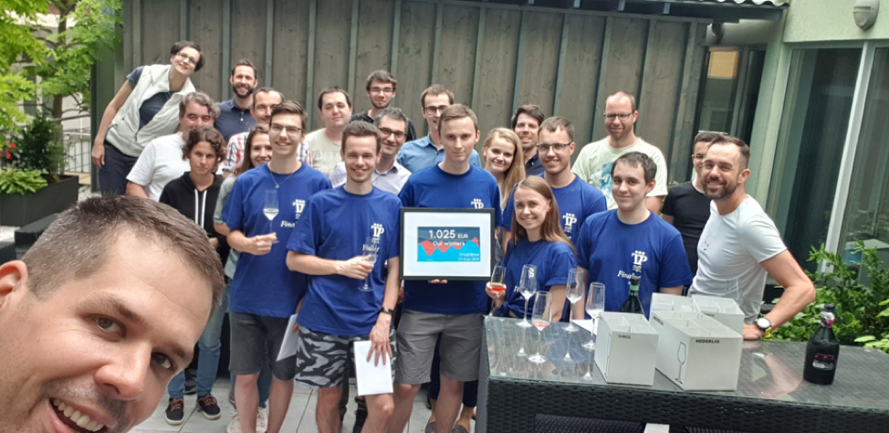
The instarea team enjoying their time together
Q1: Matej, thank you for taking the time! Let’s dive right in! You were working at a consulting firm before you decided you decided to cofound Instarea. While it’s easy to connect the dots today looking backward; What motivated you to take the leap of faith and start your own company?
At the time it actually didn’t seem as such a leap of faith. It was about taking the insights and knowledge we had from consulting in the telco / banking industries, and rather than “just” offering consulting services we decided to build a product of our own.
Q2: Instarea’s main business involves monetizing telecommunication data. Why telecom data? What made you believe that this is a problem area for big telecom companies?
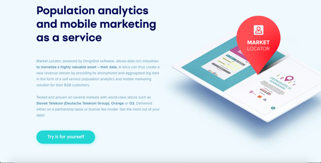
This comes back to our background in telco. Our very first product was called Callinspector, which was a telecom expense management software. While, by now, we stopped developing Callinspector, it gave us a deep understanding of telco data and a very useful network in the industry in Slovakia. This proved invaluable for our eventual pivot towards Market Locator, which is currently our primary focus. It uses telco data for location intelligence, targeted marketing and FinTel API scoring for banks.
Now, back to your question, telco data are probably the most valuable (single sector) data for population analytics and targeted marketing, plus they have strong potential for fintel scoring or various smart city solutions. Most people have their phones with them most of the time. What we thus focused on, and what many telcos lack, is a self-service platform which allows smaller clients to individually launch a targeted campaign or analyze insights from telco data. All this without exposing our privacy and that of individual telco service users.
To maybe put it into perspective – a telco typically has monthly average revenue per user (ARPU) in the ballpark of 5 to 50 EUR. Facebook generates advertising revenue of 1 to 10 EUR / user / month. A proper data monetization approach could have the potential to increase a telco’s ARPU by up to 20%.
Q3: Today, you work together with the likes of Deutsche Telekom, Orange and O2. Telecom companies aren’t necessarily known for their risk-taking. How difficult was it to convince them and get access to their data as a startup?
Definitely wasn’t easy 😊. However, with our consulting background we had a good “name” among the telcos and from the beginning we were very clear, it is not about giving us (or anyone else for that matter) access to their customer’s data. Our architecture focuses on anonymizing and aggregating the data within the infrastructure of the telco on a back-end before feeding the front-end in the public domain with purely statistical aggregated data insights. We understand and appreciate this concern for privacy, which is also one of our main priorities, as we too are a telco’s customers at the end of the day 🙂 And for telcos, once they understand their customer data is secure and they see the size of its monetization potential, the talks usually move forward.
Also, it very much varies from telco to telco and there are large regional differences in what is perceived as challenging. Yet, unsurprisingly, for many of them outside regulations, like GDPR, together with internal data policies or concerns with internal IT deliverability are perceived as the main challenges. As we have done deployments in multiple countries (also within the EU & it’s GDPR sphere of influence) with several telcos we have seen & been able to overcome these hurdles. For instance, in Slovakia where we have connected all three largest telcos into one data platform or in Saudi Arabia where we cooperate with the largest telco in the region – STC.
Q4: Do you see GDPR as a limiting factor or did it simplify your legal framework, actually enabling you to clearly define the boundaries? How does Instarea ensure location data privacy?
Both, telcos and we at Instarea, have to take GDPR as well as the general public perception of data privacy very seriously. In this light we designed the architecture of Market Locator to maintain strict separation between where personal data is stored & processed, based on what consent and where only anonymized and aggregated statistics are available for customers in a public front-end.
Even with this “security by design” setup European telcos tend to be sensitive about any topic which may have an impact on their GDPR compliance or public perception for that matter. On the other hand, GDPR has created an opportunity for telcos as they are one of the few industries which has been collecting consents from customers and additionally where customers tend to extend their contracts on a bi-yearly basis. This provides them with ample opportunity to explain the benefits of providing consent and thus increases the value stored in the data they have.
Q5: Your main product “Market Locator” is aimed at targeted mobile marketing. In a sense, it sounds like Google adwords for location-based marketing. Is that a fair observation?
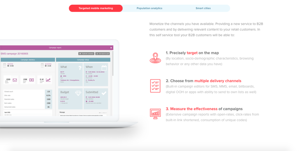
That is a very fair observation and it was one of the conception ideas when we were designing Market Locator. We really liked how the online giants made powerful marketing tools available in self-service for businesses small & large. The way Market Locator is set up is an end-customer chooses their targeting or analysis criteria, such as age, gender or frequency of travelling abroad. Based on these criteria the customer can either deliver location based targeted marketing to this group of selected people directly through e.g. SMS or MMS, or they can make generate a location intelligence / population analytics report. So, to extend – not just Google Adwords, but also Google Analytics, but for the physical world.
Q6: Taking location data from telecoms and turning it into the “Google Analytics” for the physical world sounds simple on paper but what were some of the major engineering challenges in building such a platform?
Initially it was about creating an architecture with which a telco is comfortable – that keeps individual sensitive data completely in the infrastructure and in the control of monetizing parties. This requires us to create the anonymized & aggregated “data layers” I mentioned earlier, which are basically cartesian products of enormous data sets (creating even more massive data sets 😊). Some of the data layers we create on a daily basis contain 50 billion data rows.
Another interesting challenge was when we wanted to start utilizing real-time data from telco tower signaling. To explain – telco data typically gets processed once a day in a batch processing in the enterprise data warehouse, or EDW, after which Market Locator updates the data insights in the platform. For some cases day-1 data is not sufficient, and for these we need to process what is going on within the network in real-time. This means processing 10s of thousands of events every second and making a decision about what to do with such an event. This was quite an engineering challenge. I guess the list of challenges could go on & on 😊.The fact we had to build our own new GPU driven database from scratch, because nothing was quite fast & complex enough, says a lot.
Q7: What does your tech stack look like? Could you maybe give me a bit of insight?
As I mentioned earlier, since our back-end has to be implemented within telcos we reply on robust corporate Microsoft technologies for the core: MS SQL 2016+, .NET + Angular, for some custom data science usually R & Python and then obviously a bunch of further bits & pieces. With some of the technologies we have come to their limit in terms of speed, especially for complex polygonal calculations. For these we have developed the aforementioned proprietary GPU powered data-base called TellStory DB (what is pretty cool is that TellStory DB itself is currently the fastest for polygonal calculations in the world, according to our benchmarks). We work quite a bit with universities (Natural Sciences of Comenius University, Slovak Technical University) so quite a bit of the tech stack and methods then comes from these students & their need to try new things 😊.
Q8: Targeted mobile marketing is your main business area today. What does the future hold? Where do you see Instarea 3 years from now?
We believe the big data is the business of the future and so we are throwing all our weight behind Market Locator. We are working on our business development and in three years Market Locator will be helping telcos provide & monetizing data in a number of new countries. Active talks are currently underway in countries on three continents
We are also developing the aforementioned GPU database which will not only be used to improve our current offering (and enable us to confidently handle the data in telcos even exceeding 100mio subscribers). In its current form, it is already the fastest GPU database working with complex polygons in the world. Our engineering team has recently secured a second place in a tech competition with it, so there are also plans to have this as a standalone offering. An open-source version is cooking, so your readers can look forward to being able to use it privately soon.
Q9: You are based out of Bratislava, Slovakia. How is the startup scene? Is it easy to raise funds and attract talent?
Slovakia is a good place to be as a start-up. There are several international start-ups, such as Sli.do or Exponea and it is the headquarters of Eset and Sygic. The tech industry in Slovakia is booming and we are lucky to be part of it.
There are several good technical universities which produce many talented people. Moreover, Bratislava has a prime location in proximity to Vienna and Budapest. With our focus on telco, Slovakia is also a good playground – sophisticated telcos, limited size, standard EU regulation = ideal for validating our ideas without prohibitive technical cost.
Q10: What’s your advice to budding geo-entrepreneurs wanting to build their own business?
Get in touch with us to get early access to the fastest database for complex polygon operations 😉
But seriously, I believe you are in the right area of business, reliance on geo data, mapping, movement behavior is becoming essential both in business as well as the public sector. It will take educating – both businesses as well as the public sector – but that is where geoawesomeness is lending a big hand.
Q11: Any closing comments to our readers?
We love interacting with geo-entrepreneurs and fans. Join our Strava Intarea Bikers Lounge or Strava We run Instarea clubs, follow our parties on Instagram and read our thoughts on Facebook. Ow, and hope to see some of you at the Telco AI Summit in Kuala Lumpur, where I will be talking about the monetization of data at telcos.
The Next Geo is supported by Geovation:
 Location is everywhere, and our mission is to expand its use in the UK’s innovation community. So we’re here to help you along your journey to success. Get on board and let’s start with your idea…
Learn more about Geovation and how they can help turn your idea into reality at geovation.uk
About The Next Geo
The Next Geo is all about discovering the people and companies that are changing the geospatial industry – unearthing their stories, discovering their products, understanding their business models and celebrating their success! You can read more about the series and the vision behind it here.
We know it takes a village, and so we are thrilled to have your feedback, suggestions, and any leads you think should be featured on The Next Geo! Share with us, and we’ll share it with the world! You can reach us at muthu@geoawesomeness.com or via social media 🙂


#Business


Next article

When working with location data, we have to choose which GIS software may be best for the our projects. As more GIS alternatives to ESRI’s ArcGIS are arriving to the scene with some even for free, it can be daunting to know which one is best.
Some things to think about when choosing a GIS software include:
- Type of data you will be using
- How you want to manage the data
- Number of people on your team
- Skill level of your team or yourself
- If you want to customize the software (ie. with Python extensions)
- What kind of visualizations you are going to make
- How your clients want your results to be published
- and so on
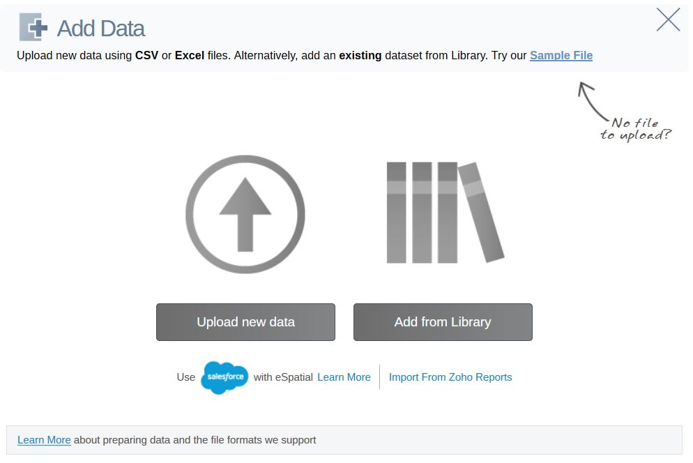
eSpatial provides an interesting approach to GIS. They focus on the sales, marketing, and operations aspects. Precisely, they aim to help organizations prospect, market more precisely, reduce delivery times, and overall, be more efficient and profitable. We tested eSpatial ourselves, and here is our review.

As part of a welcome industry trend, eSpatial is available as a cloud-based web app. just like CARTO, GIS Cloud, or Mapbox. It would not matter if you were on Windows, macOS or Linux. It is also available as a fully integrated Salesforce App. Read more: Salesforce bets on power of location with MapAnything acquisition
As all progress is saved online, multiple users can collaborate on a single map, and that is certainly an advantage. On the enterprise-class plan, there is even a possibility of controlling access among accounts.
 For those on a paid plan, eSpatial offers over 100 third party dataset libraries to use right out of the box. They include political boundaries, and demographic data such as population, income, education, and housing. Even just having the political boundaries would save a lot of time when doing geospatial analysis.
What can it be used for?
Some useful visualiations and analyses offered by eSpatial are:
Pin maps: to see POI data on the map
Heat maps: to identify concentrations of data, eg. where most traffic accidents occur. Both hot spot heat maps and regional heat maps are available.
Radius maps: to identify priximity from a single or multiple points of data on a map.
Route maps: for us, one of the highlights of eSpatial was that it allows employees to schedule a day of meetings and prospecting through mapping. Additionally, it will allow the user to identify pit stops, add in estimated length of time at each stop, and provide a summary of the day.
Territory Management: Territory alignment sets sales footprints and workloads, allocates customers or products to representatives, and assigns personnel to territories.
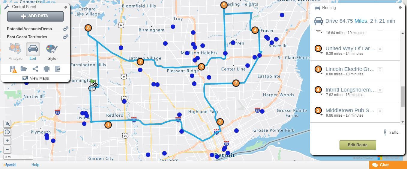
An example of planning your day with eSpatial using route maps
Additionally, eSpatial exports to PDF, PowerPoint booklet format, and provide a URL for sharing an interactive map. They also support single sign on (SSO) for enterprise accounts to ensure the security of access and data sharing.
Additionally, eSpatial comes with a mobile app, which is built for those on the go (eg. when naviating with route maps or to present a map on a tablet).
What can’t it do?
As many basic mapping operations were fast and easy because of the software and third-party datasets, the limitations of eSpatial become more apparent after using a bit more
First, it is quite a closed ecosystem and does not allow much third-party integration or customization, such as changing the projection system, or importing your base maps – not that there aren’t many to choose from.
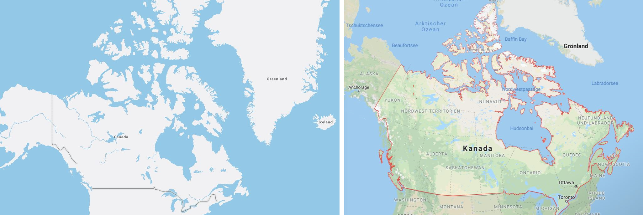
Left: Canada and Greenland projected on the Mercator system on eSpatial. Right: Canada and Greenland projected on a sphere on Google Maps. It is unclear if this will affect distance calculations further from the equator.
As eSpatial is mostly an analysis and visualization tool, it does not allow much calculations or query expressions to be used. At the moment, it seems like all of the data should be calculated and cleaned into CSV, XLS, and XLSX format (that’s right, no JSON or shapefiles, since it’s not what their target market generally asks for) before importing it to the software. Still, I would be interested to see if there are ways to integrate eSpatial with live datasets in the future. This also means that there are no ways to add remote sensing imagery or render 3D visualizations.
As with all cloud-based web apps, eSpatial cannot be used offline, so internet downtime would further hinder productivity when it comes to using eSpatial.
As mentioned before, there are many factors on why you would choose a specific GIS software. Based on what we discussed,
We would not recommend eSpatial for:
- Professionals who need their GIS software to perform a complete and robust set of data processes
- Heavy and repetitive location data processes
- Cartographers who make creative and out of the box maps
We would recommend eSpatial for:
- Businesses who want to harness the power of location to get a better understanding of the market and be more efficient on a day-to-day basis with a fast and lightweight software
- Organizations who make maps to supplement their core work and analyses
- Fresh or casual mappers who could benefit from a lower learning curve. eSpatial also comes with training and support
For the organizations who could use a geospatial boost, we would certainly recommend eSpatial for their sales and marketing efforts.
But don’t take our word for it. Try it for free yourself, and see if eSpatial can help you harness the power of location data!