
Our cellphones generate billions of signals when we call someone, send a text, or simply browse the Internet. Telecom companies have been known to use this data to generate marketing insights and come up with targeted ads for their subscribers. But what happens when you put this data into the hands of a group of scientists from one of the world’s top technical universities?
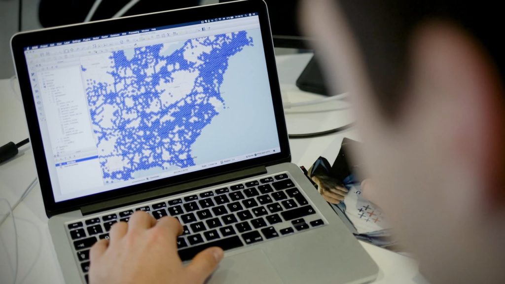
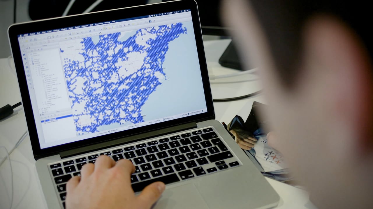
Well, nothing much, except you get the key that could unlock fascinating insights on human mobility patterns. You could understand how many people are traveling between any two points in a city using different modes of transportation, and figure out the main pressure points on the infrastructure. You could interpret the changing population trends and recognize where new roads need to be built. You could learn how people move before, during and after a natural disaster, like a hurricane, and prepare city officials and emergency services to respond better. You could even find out the levels of air pollution in a city without installing expensive CO2 sensors!
 Teralytics, a Switzerland-based startup spun out of ETH Zurich, is doing all this and more by applying powerful data analytics, complex machine learning algorithms, and deep learning technology to transform anonymized cellphone data into actionable intelligence.
With customers spread across the United States, Germany, Singapore, and Hong Kong Teralytics has already collaborated with nine different telecom operators. The founders insist that they have an ironclad system in place to protect people’s privacy, otherwise, they wouldn’t have found favor with Germany’s stringent data protection watchdog.
So, why cellphone data?
CEO and Co-Founder Georg Polzer explains in an interview, “The nature of the data is [such] you get a lot of data points per person per day.” Compared to the typical app SDK data, which allows you to see a person’s location only when they open that particular app (or even after, if you are Accuweather), cellphone pings mean you get a minimum of 150 data points every day.
https://www.youtube.com/watch?v=FTtaL0AdqF4
“When you then look into the use-case we tackle — which is mobility, understanding how humans move around, which routes they take, which mode of transport they take — you need to have that path, that journey of a person. And we believe the only data that really provides that is telecom data,” Polzer explains.
Teralytics’ pilot study on air pollutants in a German city was found accurate up to a 77% level – an impressive number when compared to the cost of installing and operating monitoring stations. In reality, the startup wasn’t even expecting this kind of success rate. Its business development executive Maximilian Groth admitted that much: “The results from this pilot study exceed our expectations. We are confident that we will soon be able to scale this product to cities worldwide to support urban planners in making our air cleaner.”
What’s next?
Teralytics has a plan in place; its sales pitch is targeted at the trending topics of smart cities in the backdrop of climate change. The startup understands how critical it is for city governments to provide clean air and efficient and unhindered mobility channels to their citizens. Which is why it is developing models that can reveal what will happen if a city decides to shut down a train service or reconstructs a bridge. The analytical platform is even equipped to gauge the impact of car-hailing and ride-sharing applications like Uber and Lyft on a city.
However, the startup’s success depends on the geographical footprint of millions of people. And it remains to be seen how comfortable and willing mobile users would be to have their personal data openly tracked and dissected by a private company.

#Business


Next article

Google gave us the best use case for virtual reality by quietly putting the whole world within our reach with its Google Earth VR platform last year. The technology let you walk around your favorite cities or ‘teleport’ to the top of a mountain range in a jiffy, soaring through the sky like a bird!
And just when you thought this experience could not be any more amazing, Google picked up a bunch of Street View imagery and threw it into the mix! So now, if you point the controllers of your HTC Vive or Oculus Rift virtual reality headsets closer to the ground level, you may catch the ‘Street View available’ icon.
Dive right in, because you will be taken inside an immersive 360° photo which has been taken either by the Street View team or crowdsourced from other users around the globe (just like you see in Google Maps). This is what it’s going to look like:

Quite something, isn’t it? Right now, Google has made imagery from 85 countries available in this feature. Google recommends you start with fun spots like the AT&T Park in San Francisco, or head to Croatia to explore the King’s Landing from Game of Thrones (seen above).
Don’t own a VR headset?
Relax, you can still check out Street View in VR with your phone by downloading the Street View app for Daydream (Android) and Cardboard (iOS and Android), though we are hoping that Google adds more support for the platform soon. Bon voyage!