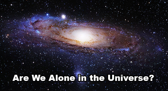

 “Are we alone in this universe?” is a question that evokes a lot of interest and am sure many a starry night, you would gazed at the beautiful night sky wondering “Are there more Earth-like planets in the galaxy ?”. I was sure that NASA, IRSO and the space organizations around the world had some data that would point in that direction and luckily, help was at hand 🙂
Using data from NASA’s Kepler Space Telescope, New Scientist has made an interactive map that illustrates the potential Earth-like planets light years away from us.
The website and the information is a real treat for Outer Space enthusiasts.
Although the website itself has all the information, I still couldn’t resist the temptation of writing about it a little bit before I share the link and the awesomeness with you 🙂
Kepler Telescope identified potential Earth-like planets by measuring the dip in the parent star’s luminosity i.e. imagine you have a telescope and are staring at the sun. When the Earth comes exactly in front of the Sun (the parent star) there is a slight dip in the light you see.
This technique coupled together with simulations of Kepler data by Courtney Dressing and David Charbonneau of the Harvard-Smithsonian Center for Astrophysics in Cambridge, Massachusetts, helped the New Scientist to estimate and map the density of habitable worlds across the whole sky i.e. the known spectrum of the universe. Who knows how much we are missing. Just as an example, the Kepler Telescope was able to record information only for 0.30 percent of the known universe.
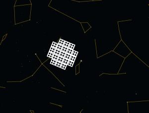
The region that kepler telescope covered
Source: newscientist.com
Given that the Milky Way is thought to contain between 100 and 200 billion stars, newscientist.com estimates of the total number 15 to 30 Billion planets that are Earth-like.
Wow! 30 BILLION Earth-like planets.
Oh yeah, the link to Space awesomeness. Here you go: How many Earths?
The map of galaxy’s habitable planets is probably going to serve as a spaceship map for the generations to come 😉
Source: New Scientist


#Featured


Next article

Who haven’t watch “Pirates of the Caribbean! I guess we could hardly find someone who haven’t seen these movies. Oh! that was a complete fun.
History says, Mediterranean sea was the first free land of the pirates but later on these pirates were chased out of the Mediterranean Sea by the French and the pirates sailed to live in the Caribbean. The fancy Caribbean pirate stories started there between the time 1519 and 1780 which was known as the Golden Age of Piracy. Gore Verbinski and other directors of the movies were motivated by the fictional historical setting and of course by the piracy time and pirate’s place. Now, if any director wants to make a pirate movie on the contemporary pirate’s tail where should be the movie and of what time?
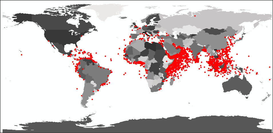
The spatial distribution of the pirate attacks from 1978 to the present
US National Geospatial-Intelligence Agency has recorded the pirate attack all over the world. The dataset has attributed almost 6000+ pirate attacks cases which have been recorded over the last 30 years. This first map shows the spatial distribution of the attack and tells us the pirate legends have moved from Caribbean to Arabian Sea, Andaman sea, Red sea, Java sea and so. Second map shows where the attacks have been recorded (also with a temporal distribution presented in a bar chart), with four clear areas standing out when the data is aggregated into hexagon bins. This presentation has more precisely mapped the Gulf of Guinea, Gulf of Aden, Bay of Bangle and Andaman sea as Pirate attack hotspot. So, now you also know where you be thrilled and careful when moving through these gulfs.
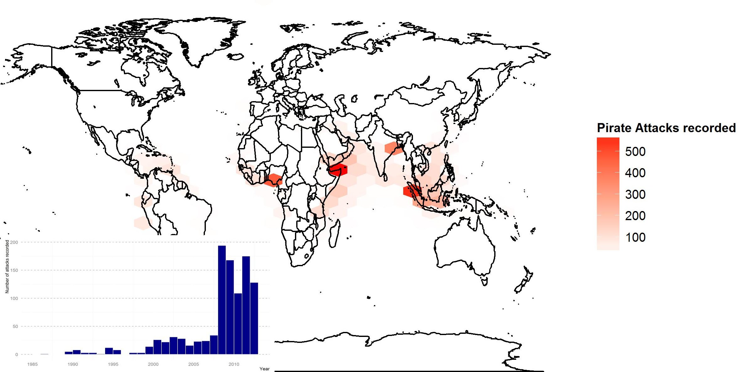
Pirate attacks hotspot from 1978 to the present
some R-bloggers have also took one step further to build an animation of cumulative, yearly IRL pirate attacks from 1978 to the present. They have found it a bit interesting to see how the hotspots shifted over time.
animation of cumulative, yearly IRL pirate attacks from 1978 to the present
SO based on the spatial distribution and hotspot of pirate attacks, and geographical diversity suggests that the Andaman sea (surrounded by Java sea, Gulf of Thailand, Riau Island, Sprartly island, cost of Malaysis, Thailand, Indonesia, Philippines and so) will be a great region to look for interesting pirate stories and make a movie titled, “Pirates of the Andaman”