How drone manufacturers should take care of their clients? Wingtra might have figured it out

I’ve been in the drone industry for the past 4 years. I work in a company focused on drone data analytics, software development and advisory. I talk to a lot of drone manufacturers, fly drones myself (I’m a licenced BVLOS pilot) and subcontract a lot of work around the world to drone surveying companies.
Over the years, I’ve experienced a lot of problems with the work delivered by contractors operating fixed-wing and VTOL drones. While flying a DJI Phantom 4 Pro or Matrice is fairly straight forward, and the number of accessories is high, operating a fixed-wing drone over a large area is a much more complex task. A lot of things might go wrong, resulting in the hardware being destroyed and/or data captured being of poor quality.
To avoid such problems, I’ve developed the whole procedure to verify the subcontractors that include hardware verification, spare parts verification, software verification, flight planning and GCP distribution verification, pilot and the second pilot verification, insurance check and the list doesn’t stop here. It’s a time consuming and therefore expensive process for both my team and the contractors. Unfortunately, it is required as I need to make sure my clients will not get their often critical infrastructure damaged.
If only there were a way to verify if all these requirements are met?
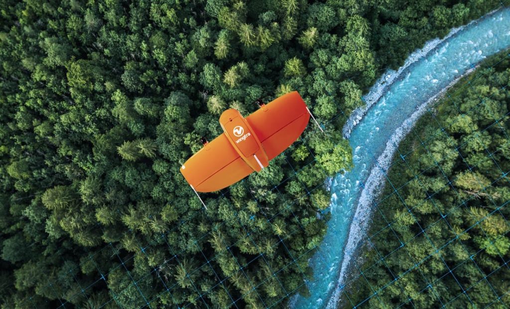
Actually, Wingtra might have just released the solution I was looking for. The Swiss manufacturer of a popular VTOL drone that is widely used around the globe has recently introduced the Extended Services package. These new services include spare parts and add-ons, training and consulting, maintenance plans and a second-year warranty option.

Wingtra’s “Total Maintenance Plan” includes an all-in-one maintenance subscription that basically gives drone operators a new drone every two to four years and allows to fix all the hardware issues for a flat yearly fee. From my perspective, if a drone pilot has such a subscription, it’s proof that the hardware is in good shape with proper maintenance is in place.
Another important part is Wingtra’s training and consulting. If I see a certification of a drone pilot completing a full 2-day training, it gives me peace of mind the operators know the hardware and they would be able to get immediate Wingtra support in case of issues in the field. Finally, the package offers add-ons such as spare drones and sensors, battery packs, propellers and accidental damage protection, among others.
This is all very important, as I’ve had drones of contractors crushed on mine sites in the middle of Africa, wrong setup of PPK/RTK that caused poor georeferencing, blurry images that made the data unusable, lack of spare parts in the middle of nowhere, and much more. All of that caused delays and money, but most importantly, it compromised the reliability and trust to drone technologies by the end clients.
With that being said, having proof that a drone operator has WingtraOne with their Extended Services package is something that would make my life much easier when it comes to verifying and contracting teams for my drone projects worldwide. I would wish other drone manufacturers follow the same approach.

#Business

Next article

Geoawesomeness Digital meetup is all about bringing the spatial community together and enabling interactions within the community whether its for fun and/or profit. And along the way, we hope that the meetup will help us all better understand how location data and technology are transforming the world for better.
We are quite excited about our digital meetup series and it’s great to see that you are excited about it as well! We promise it’s going to be #geoawesome! In the meantime, if you have ideas/suggestions for us to make this a regular feature on your calendar, do let us know!
Upcoming Events
Past Events
Watch all the presentations on Geoawesomeness YouTube Channel.
Digital Meetup #1 on 4th June 2020 – Location Intelligence, Maps and Logistics.
Digital Meetup #2 on 16th July 2020 – Earth Data and Analytics.
Digital Meetup #3 on 26th August 2020 – Maps for mass consumption: Doing it the right way
Digital Meetup #4 on 1st September 2020 – Copernicus and Entrepreneurship: Enabling ground-breaking business ideas to find their competitive edge
Digital Meetup #5 on 10th September 2020 – Enabling sustainable supply chains through satellite technology.
Digital Meetup #6 on 22nd October 2020 – How Deep Learning is changing the Earth Observation industry and beyond.
Digital Meetup #7 on 18th November 2020 – Unleashing the power of 3D location data
Digital Meetup #8 on 3rd December 2020 – Travel Time and the ETA conundrum