
When a loved one is travelling in an unfamiliar area, worrying about their safety can turn many of us into a bundle of nerves. More so if you are tracking someone’s location remotely and they suddenly drop off the grid.
Therefore, to make sure you don’t imagine the worst if you are not able to get in touch with someone you care about, Google Maps has introduced a nifty new feature: When someone shares their location, you would also be able to see how much battery juice their phone has. Here’s a sample:
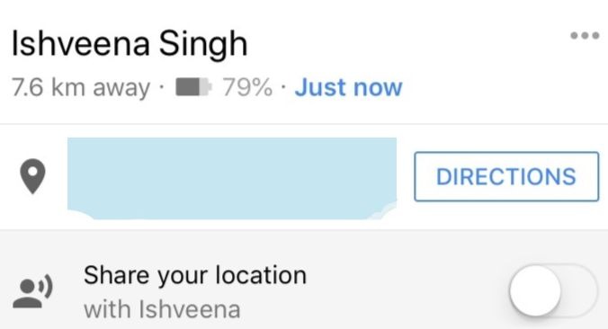
So, instead of conjuring random graphic scenarios in your head, you can breathe a li’l easy knowing that the reason someone is not responding is because their battery has died on them. Conversely, if you cannot get through a friend or family member despite their battery being stocked up, you can probably raise some alarm bells.
Honestly, it’s a great new feature from the point of safety and we are glad that Google is releasing it simultaneously on Android and iOS across the world. On the other hand, it also means you can no longer make excuses to your parents or friends and not take their calls citing battery drain!
What do you think about this feature? Yay or nay? Try it out and let us know in comments below!
Now read: 5 new Google Maps features you should get excited about

#Business


Next article
There are dozens of websites that NASA uses to host its remote-sensing data and tools (more than 50, we kid you not!). So, for someone not too familiar with the geospatial industry, making sense of all this information or even figuring out which asset can be located where could be an overwhelming exercise. Not surprisingly, NASA has not been able to make startups or other small businesses tap into its full commercialization potential, even though these companies could benefit greatly from access to free and open remote-sensing data.
But now, the status quo is set to be altered with the latest offering from NASA’s Technology Transfer program. Called the Remote Sensing Toolkit, this online resource combines satellite data, the tools you require to analyze that data, and the code you need to create your own remote sensing tools – all in one place!
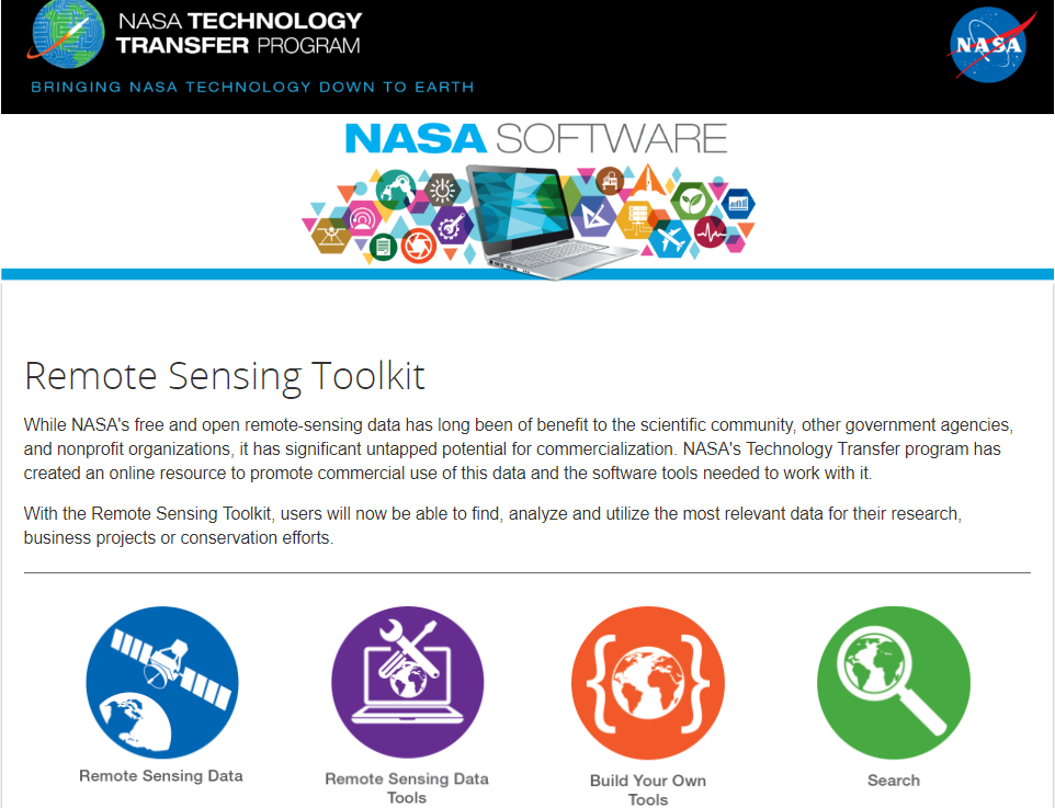
The portal gives you a choice between near real-time or archived data, pulling information from the AIRS, AMSR2, MISR, MLS, MODIS, MOPITT, OMI and VIIRS instruments and other Earth Science data holdings. NASA is giving you ready tools to work with each category of data or you can build your own custom tools for data management, data analysis, data visualization, etc.
NASA’s vision for this portal is that it ignites innovation in the entrepreneurial community and leads to the creation of more commercial products that use satellite data. According to NASA Earth Science Division’s Kevin Murphy, “Over the years, many organizations around the world have found innovative ways to turn NASA satellite data into beneficial information products here on Earth. Remote Sensing Toolkit will help grow the number of users who put NASA’s free and open data archive to work for people.”
You can check out the Remote Sensing Toolkit by clicking here.