

Editor’s note – Geoawesomeness Guest Features is an on-going series that spotlights the thoughts, experiences and expertise of our guest writers. We want to encourage a broad set of writers to inform, delight and challenge us all. Together, let’s build a more diverse, inclusive and welcoming Geospatial community.
Give Me a Standard, Any Standard
I’ve spent the last year or so doing very little with geospatial technology, but I find myself missing it tremendously. Of course “in my blood” and “how I’m wired” and similar aphorisms apply to how I’m feeling, but that’s not what really has me missing geospatial. In a shocking (for me) turn of events, I find myself missing the influence of OGC on the geospatial technology community.
I’ve spent the last year working on integrating several SaaS systems, including Stripe, Salesforce, NetSuite, and others. I’ve touched upon this in previous posts. All of them implement some form of REST API, but fostering interoperability doesn’t seem to be a primary purpose of those APIs as much as is the enablement of a proprietary partner/strategic-alliance ecosystem. As a result, these APIs, while generally well-documented, are essentially arbitrary. They implement the HTTPS+JSON pattern in the same way that many written languages implement the Roman alphabet. I can sound out the words, but I don’t really have any idea what I’m saying.
In the geospatial field, the work of OGC gives us a bit more shared understanding. Because of the Simple Features Specification, we have GeoJSON, GML, GeoPackage, and various similar implementations across multiple open-source and proprietary database systems and data warehouses. Each of those implementations has benefits and shortcomings, but their common root shortens the time to productivity with each. The same can be said of interfaces, such as WxS. I have often been critical of WxS, but, for all the inefficiencies across the various specs, they do provide a level of predictability across implementing technologies which frees a developer to focus on higher-level issues. I include Esri here, which does a good job of implementing simple features and makes some WxS interfacing available, even if they keep their more compelling capabilities behind a proprietary curtain.
Outside of geospatial, there seem to only be proprietary curtains, which you cannot part without an NDA, or a partner agreement, or a strategic alliance or some other piece of paper which serves to ensure that the walls around the garden are both high and well-guarded. Feature-completeness takes a back seat to lock-in. As a result, API-to-API integrations are fragile, IPaaS solutions generally don’t expose everything from platforms they “support,” and data integration strategies are limited by whatever the proprietary APIs choose to expose.
Among all of this, there’s the additional issue of understanding. The content itself is fully bespoke from the top down, turning each integration project into an exercise where every API and its content must be approached as though it is the first API we have ever seen.
Venturing through the wilderness of mainstream tech has made me appreciate the efforts of OGC a little more. It’s easy, when focused heavily on only geospatial tasks, to overindex on the gaps and shortcomings of OGC specifications and their various implementations. Viewed in relief, against the backdrop of arbitrary and proprietary technologies outside of geospatial, the value of the baseline standardization established by OGC, and the expectation of such in the geospatial community, becomes much more apparent.
Header image: Mark Turner from Plymouth, England, CC BY 2.0 https://creativecommons.org/licenses/by/2.0, via Wikimedia Commons.
This article was originally published by Bill on his blog “Geomusings” and has been republished here with permission.


#Ideas


Next article
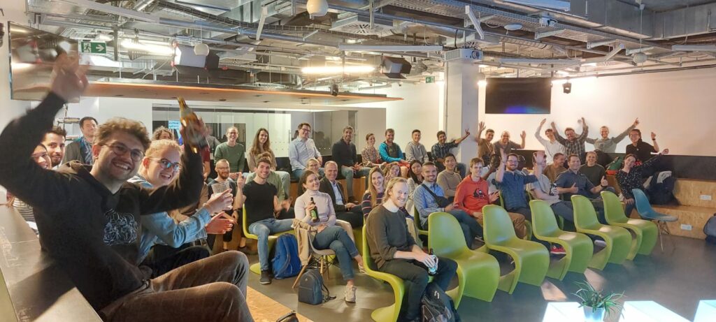

From the whole Geoawesomeness Munich event team, we wanted to thank you all again for coming out and joining us at the event on June 9th in Munich at Wayra. After 2 years of distancing, we had so much fun seeing everyone in person once again. To us, it was a celebration that we have made it through a few waves of corona and the spirit of the community is still here and hungry for more pizza, beer, and meetups!
We heard from a full lineup of speakers that evening, where the theme of the event was AI and Earth Observation. We started with a highly technical yet fascinating topic from TUM PhD candidate Zhaiyu, all about his own algorithm for improving and smoothing 3D building construction from LiDAR using deep implicit fields. Secondly, we welcomed Anna Brand, Remote Sensing and GIS Expert at RSS GmbH to discuss the clever way her company uses earth observation and deep learning to help identify and clean up plastic debris which ended up in rivers in Italy. Thirdly, we heard from Ororatech’s Remote Sensing Lead Dmitry Rashkovetsky, who spoke about the company’s EO AI technology to help quickly identify wildfires in Australia and the implications of wildfires on climate change. Lastly, Dr. Manfred Krischke of Cloudeo AG spoke about his work in the EO industry from the push to create the first privately funded satellite mission ever, RapidEye, to his current geospatial marketplace company, Cloudeo.
The speakers came from a range of technical and professional backgrounds, which led to a lively panel discussion with questions from the audience. Topics ranged from technically challenging calibration of deep learning algorithms, to views on where the industry is headed more broadly in the next few years. Thank you again to all the speakers for sharing your work with your peers!
The best part (in our opinion) about the meetups is the people. We were delighted to see so many faces at the event and afterwards for networking. It is clear from the amazing turnout that the geo community in Munich is alive and well (and hiring!). In total, there were more than 50 of you who were in attendance! “It is so nice to see so many young professionals excited about geospatial,” said a refreshed Dr. Manfred Krischke, CEO Cloudeo AG. With all the new updates from the last 2 years, there was so much to talk about and catch up on.
We also owe a huge thank you to our sponsors RSS GmbH, who graciously provided the beers and pizza, as well as Wayra for the wonderful event space. You can check out more information about them at https://rss-gmbh.com and https://www.wayra.de. Thanks are in order also to Muthu and Aleks for their continued support.
If you couldn’t attend this one, have no fear! We hope you will join us again for the next one, so stay tuned for updates on our next event and join the Munich Geoawesomeness Community on https://www.meetup.com.
All the best,
Your Munich GeoAwesomeness Team