
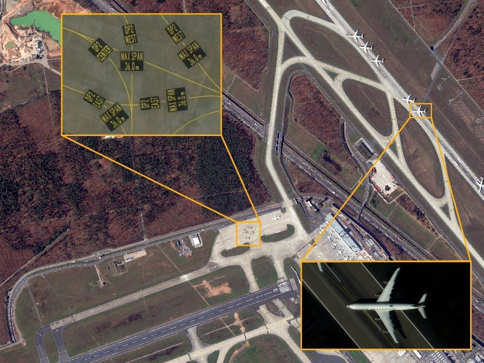
Earlier this year, satellite imagery market leader Maxar laid bare the intentions to make its highest-quality imagery products even better. Introducing a proprietary technique, called High-Definition (HD) technology, Maxar detailed that it would refine satellite images to ensure precise edges and well-reconstructed details which would reduce clutter and pixilation, and deliver a superior visual experience.
In the below example, an image originally collected at 50 cm resolution (left) has been converted into a 30 cm HD image on the right using HD technology. You can see how smaller features can be identified much more easily because of the enhanced clarity.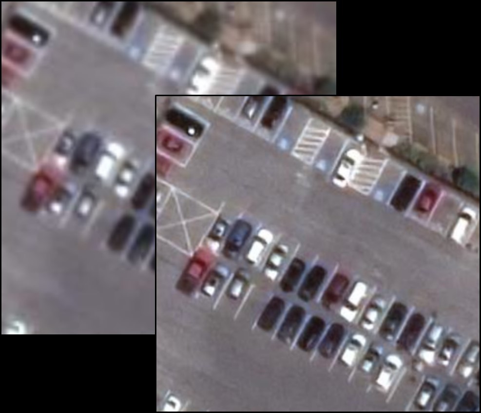
Maxar was quick to point out then that HD wouldn’t replace natively collected 30 cm imagery; it would only give one more way to acquire the quality and utility of 30 cm imagery. And now, by applying this technology to the native 30 cm imagery, the company has developed an unprecedented 15 cm HD product.
Today, 15 cm HD is available for Maxar’s View-Ready and Map-Ready satellite imagery products, and soon, it will be available for Vivid and Dynamic basemap products as well.
Here are some examples of the insights that 15 cm HD imagery will be able to uncover:
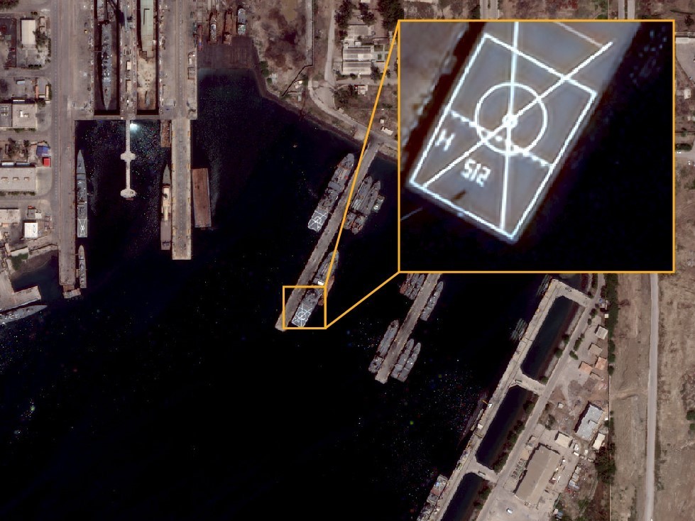
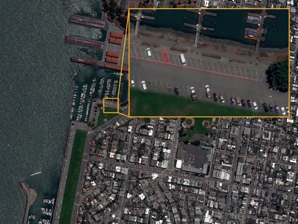
Monitoring: 15 cm HD maximizes the ability to see smaller features that can be gathered from satellite imagery, such as high-value assets, environment, agriculture, and change over time.
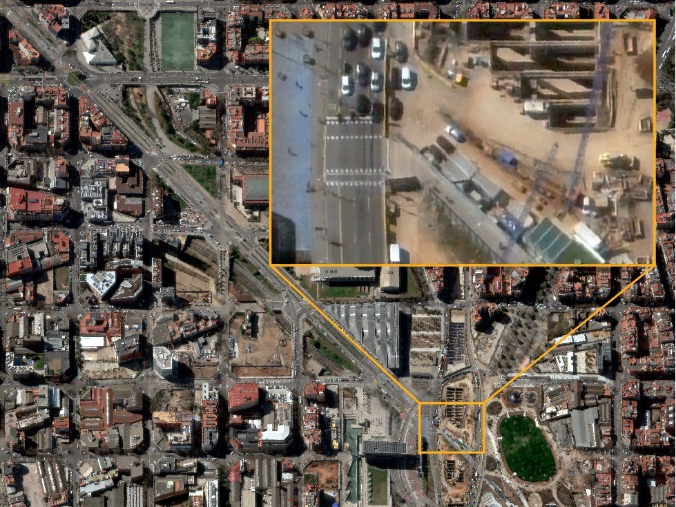
 Mapping: In large-scale projects, 15 cm HD enables a level of detail that allows governments, organizations, and businesses to verify features, such as light poles, signs, and road and infrastructure conditions, without the inconvenience or cost of sending in-field inspection teams.
AI/ML Applications: Maxar’s in-house experiments have proven that HD technology can improve the average precision of the object detection of the ML algorithm. 15 cm HD provides additional detail for automated analysis and feature extraction, the experiments have shown.
Supplementing Aerial Mapping: HD imagery can augment data collection in regions that are too remote to fly aircraft. A global 15 cm HD coverage can also support aerial mapping missions that have been affected by COVID-19.
Did you like the article? Read more and subscribe to our monthly newsletter!

#


Next article

 Around seventy percent of the world’s property is unregistered, causing land insecurity and poverty. Creating a system to document and formalize land ownership is the only way to ensure that the land is developed sustainably into the future. Medici Land Governance works in partnership with governments at the national, state and city level to provide low-cost and innovative land-titling solutions that help people secure property rights.
“We map areas to get the underlying data to be used for enumeration, property valuation, and cadastral systems,” said Ben White, GIS Engineer at Medici Land Governance. “We can then build a portal for countries or places to see the data and draw parcel boundaries in it so there’s a record for that property.”
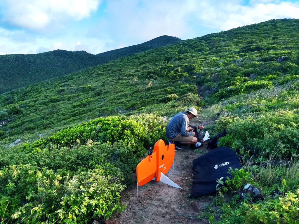
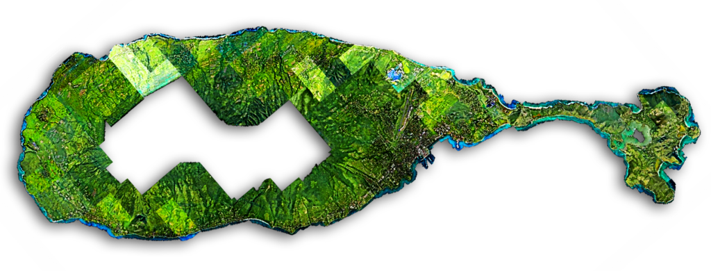
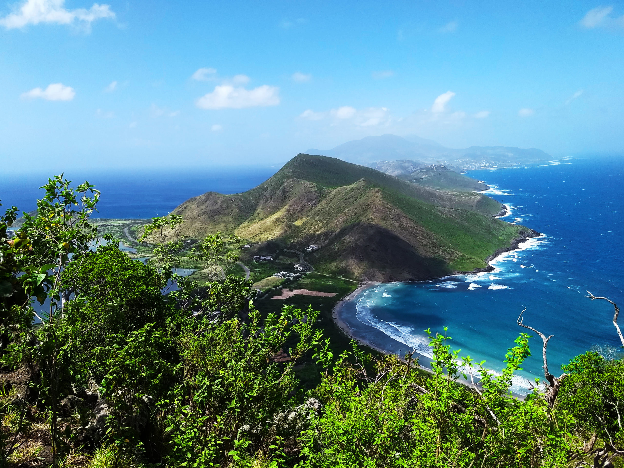
White and a team of three other specialists recently mapped the island of St. Kitts, which is one of two Caribbean islands composing the nation-state of the Federation of St. Kitts and Nevis. The island measures around 168 km2 (65 mi2), and the team mapped 104 km2 (40 mi2) of it with WingtraOne in just 28 days / 65 hours of flight time—overcoming volcanic terrain and windy conditions.
It’s stunning really. The WingtraOne data is very accurate. And with all the new imagery you can see all the different use cases for it, like city planning, tracking new and degraded roadways, and farming certain areas.
Ben White
GIS Engineer at Medici Land Governance
Drone mapping instead of hiring costly airplane surveys is opening opportunities to make more high-accuracy maps of more of the world. In particular, WingtraOne’s ability to capture large amounts of high-accuracy data in short periods of time across challenging terrain makes it a cost-effective tool in the push to document land rights.
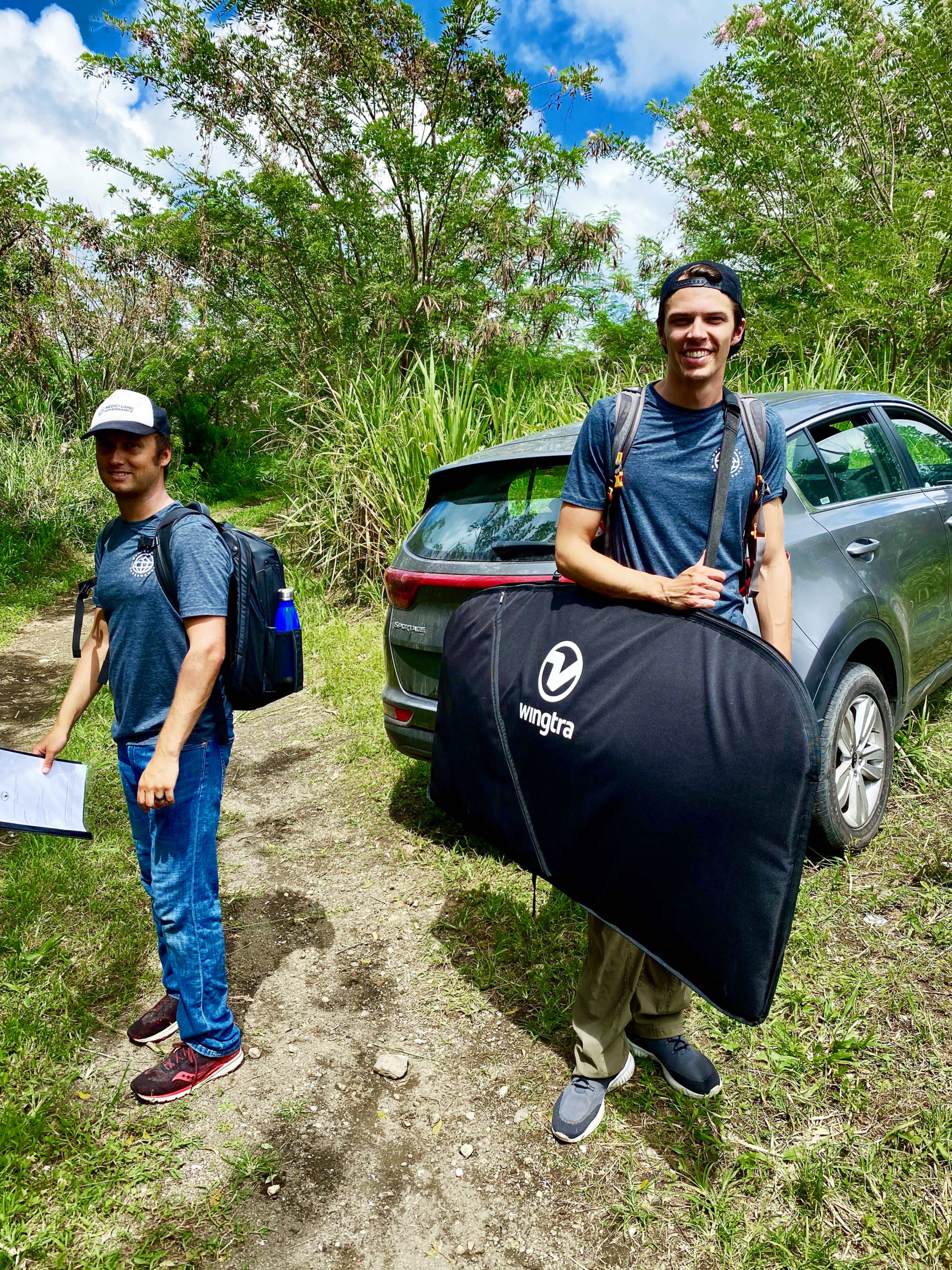
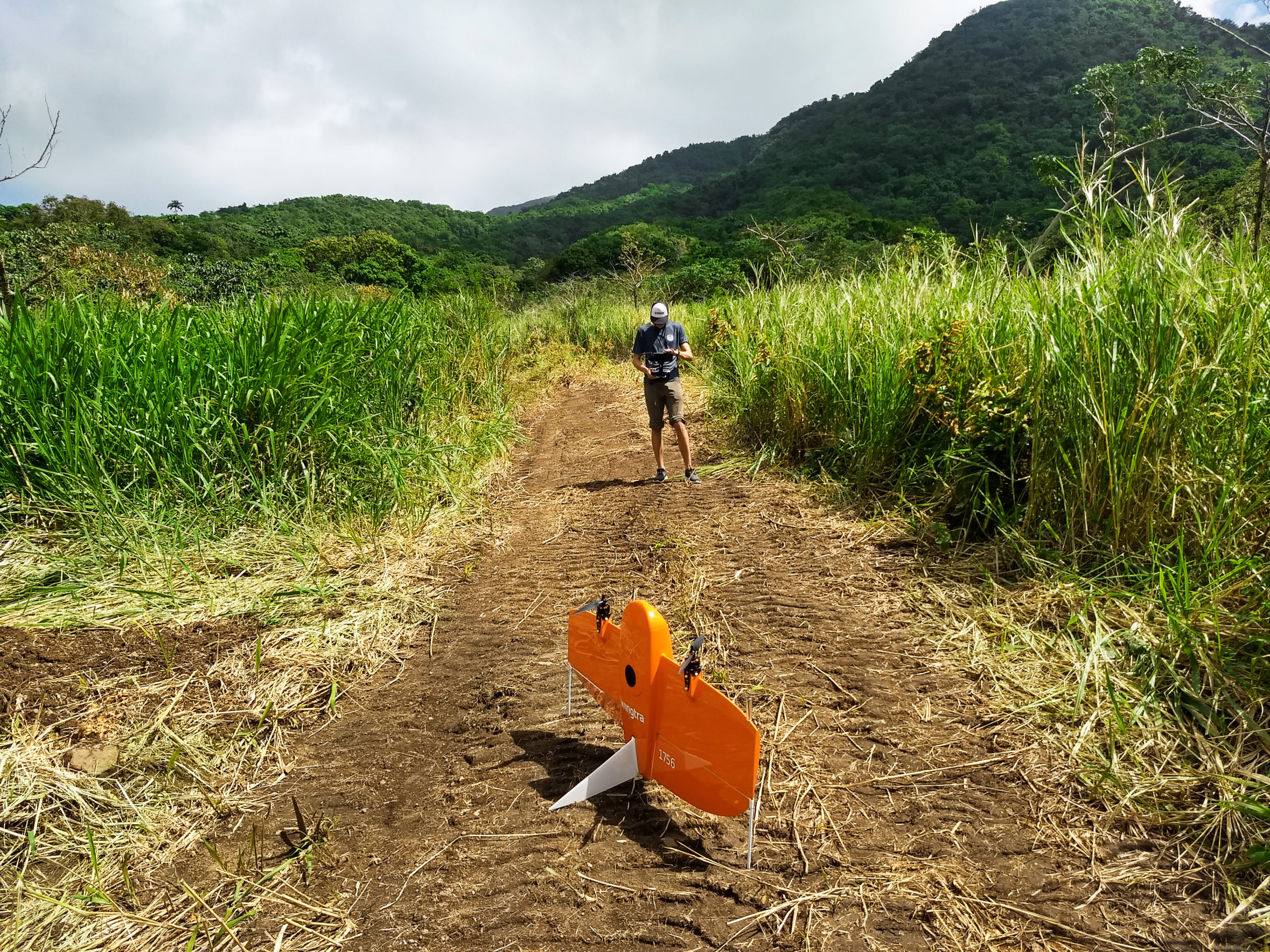
“With WingtraOne, we could fly higher because of the 42 MP camera,” White said. “We could fly at 700 feet (213 meters) above ground and cover a large area in a 45 minute flight. We budgeted 40 days to map what we needed and achieve it in 28.”
A land registry based on high-accuracy location data can help people move out of poverty and enjoy a higher quality of living. First of all, owned property can be taxed in order to fund and expand utilities and services. Drone data can back up the exact area parameters of properties. Environmental conditions improve as well, because if people have proof that they own land, they’re more likely to make sustainable developments and increase investments in land.
“The sense of owning one’s property and having accurate, tamper-proof records of that ownership is invaluable. It provides financial, social and psychological security,” White said. “It’s also really important in terms of having a sense of ‘home’ and a sense of place during international crises like this pandemic.”
Land titling improves socio-economic status and impacts the social determinants of health. Medici Land Governance is a cutting-edge company that offers land registry systems at a lower cost. And WingtraOne now plays a major role in making this possible.
Ben White
GIS Engineer at Medici Land Governance
Cutting costs and overcoming challenges to map the St. Kitts
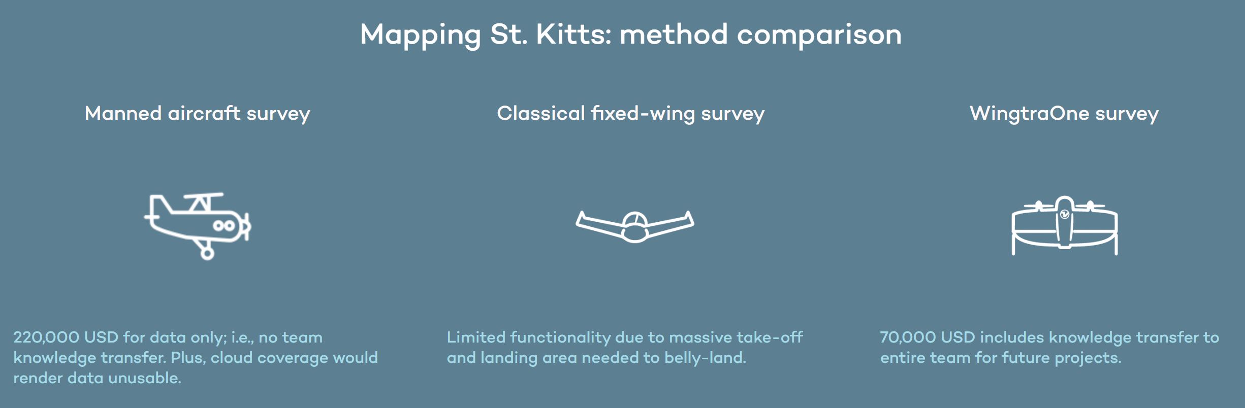
For its first projects, Medici gathered location data from manned aircraft surveys plus ground-level data collection to capture fine details of the places they were contracted to cover, White explained. Besides the cost being much more, the knowledge gained by this method was limited as well as the quality of the data.
“With drones, I budgeted 70,000 dollars, which was 150,000 dollars less than for manned aircraft data capture,” White said. “And you also have to figure the in-house knowledge gained with a drone. For me to be an airplane pilot, I need a commercial license in the US, which is so much more investment. We are a startup. We’re on the ground to help people, and it’s a lot more feasible with the drone.”
In addition to high cost, airplanes presented safety concerns and issues with cloud cover, since all of Medici’s images must be cloud-free. Satellite data wasn’t sufficient either, White said. Fixed-wing drones could get the data they needed, so they invested in an eBee. But in a place like St. Kitts, they realized they would also need VTOL.
“What we found is that St. Kitts is very windy. It’s also heavily forested and steep because it’s a volcanic island. So I identified places where I could land with the eBee—playing fields, stadiums, parks. We mapped around 15-20 km2 (5-7 mi2) with it.”
We needed 60 meters (196 feet) for an eBee belly landing, or 35 (115 ft) if the landing was steep. Sometimes I only had less than 10 meters to land, so we needed a VTOL, and we liked Wingtra’s approach: focused on surveying and mapping down to 1 cm (0.4 in) accuracy.
Ben White
GIS Engineer at Medici Land Governance
“That’s how easy it is with this system”
In addition to capturing high-accuracy data efficiently, White and the small Medici team needed a user-friendly solution to map such a large area in a short time. They also needed it to be dependable.
“The safety checks with WingtraOne are great, White said. “They aren’t overwhelming, and are just enough to ensure you are flying safe. Across most of St. Kitts, we didn’t have internet in the field, so it was really nice to be able to download those base maps and the elevation profile into WingtraPilot.”
Our second pilot was two weeks into working with us. He had GIS experience with manned aircraft routes but had just gotten his remote pilot license, and had never flown a WingtaOne before. He went from not being a drone pilot to mapping a whole island with me. That’s how easy it is with this system.
Ben White
GIS Engineer at Medici Land Governance
White said he’s also impressed by the easy and transparent data processing in WingtraHub and Wingtra’s extensive knowledge base, featuring quick image and text modules with support insight on any procedure or troubleshooting that can come up in the field. All of this lined up with the company’s goal to keep overhead lean and knowledge transfer robust among team members.