
The Landsat program from USGS/NASA is certainly the most iconic Earth Observation program ever. Not only does it provide the longest continuous space-based record of Earth but the Landsat program also democratized access to satellite imagery, enabling researchers across the world to use latest satellite imagery for various Remote sensing and GIS studies. (Read more: Landsat 8 Captures dramatic details of the Earth; will push the Earth – Monitoring Envelope).
Although Landsat satellite imagery have been available for the public for a while now, we haven’t had a project that can be considered as the OpenSatelliteImagery project, well until now. Mapbox has changed that with Landsat-live, a geoawesome project that utilizes the latest Landsat 8 data is publicly available on Amazon Web Service via the Landsat on AWS Public Data Set.

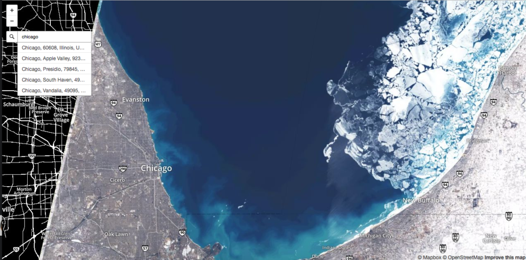
Chicago March 11, 2015 (Landsat 8 imagery via Mapbox Landsat-live)
With every pixel captured within the past 32 days, Landsat-live features the freshest imagery possible around the entire planet. – Camilla Mahon, Mapbox blog
Finally, a project that lets us understand how the planet changes in weeks, instead of the picture perfect – sunny, green satellite imagery that we are so used to by now thanks to Google Earth and other similar projects. Mapbox‘s Landsat-live is going to help showcase the big gap between how we perceive the world in our maps with satellite imagery overlays and how it actually is. And of course, Mapbox choose to overlay the satellite imagery with OpenStreetMap data 🙂
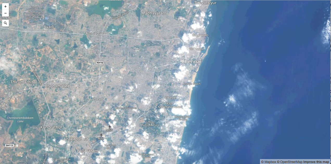
Chennai, India
With a 30 meter resolution, a 16 day revisit rate, and 10 multispectral bands, this imagery can be used to check the health of agricultural fields, the latest update on a natural disaster, or the progression of deforestation. – Camilla Mahon, Mapbox blog
Besides the Earth Observation projects that Landsat-live would make possible, I am sure it is not going to be long before someone decide to create the next Geoguessr with this project. Satguessr – the Landsat-live based Geography game! maybe we should 😉 Anyone interested in the idea? 🙂
Five years from now, real-time maps might be as ubiquitous as YouTube videos—but for now, they feel as futuristic as movies might have to Victorians. – Charlie Loyd, Mapbox to Citylabs
Mapbox’s Landsat-live project showcases the Landsat program in the kind of spotlight, it deserves.
P.S: @Mapbox: maybe you guys can think about adding a timeline functionality for the Landsat-live service! It would be all the awesome to see how things have changed in the last few satellite revisit periods.


#


Next article
The European Space Agency is offering the “ultimate hitchhiking opportunity”; the agency plans to carry 6 CubeSats onboard its Asteroid Impact Mission (AIM) that is scheduled for 2020.
Team of researchers and companies from ESA member states are free to compete as part of ESA’s SysNova competetion to put their CubeSat in deep-space. So if you have an innovative idea for CubeSat onboard a deep-space Asteroid mission that will help improve the Missions’ scientific returns, this is THE competition! CubeSats in deep space!!! Not for nothing is ESA calling it the “ultimate hitchhiking opportunity”.
CubeSats in Deep Space
CubeSats are among the smallest types of satellites with a 10 cm cubical structure, providing affordable access to space for universities, research organizations and satellite start-ups like SkyBox, Planet Labs, Spire and more (Read: How Earth Observation Startups and CubeSats are changing the Industry). Till date, CubeSats have mostly been deployed in low earth orbits and this mission could well be the first one to propose to have CubeSats in Deep-Space, opening up a whole new opportunity for CubeSats.
Considering the fact that the size of a solar panel that can accommodated on the CubeSat is rather small and usually in a deep-space mission, the satellites’ receive a fraction of the solar energy that they would in a low earth orbit, which means there would be lesser energy in total to power the sensors. It would be interesting to see how the trade-off between power requirements and sensors onboard a CubeSat in a Deep-Space mission is approached.
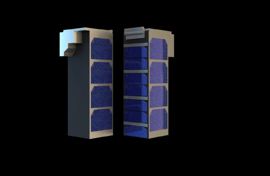
“AIM has room for a total of six CubeSat units,” explains Ian Carnelli, managing the mission for ESA. “So potentially that might mean six different one-unit CubeSats could fly, but in practice it might turn out that two three-unit CubeSats will be needed to produce meaningful scientific return. – ESA Press Release

A pair of triple-unit CubeSats. ESA’s 2020 Asteroid Impact Mission spacecraft will have room to carry six CubeSat units – potentially single-unit miniature spacecraft but more probably a pair of larger CubeSats as seen here.
Asteroid Impact Mission (AIM)
The mission is humanity’s first mission to a binary system – the paired Didymos asteroids and is part of the larger NASA-led mission – Asteroid Impact & Deflection Assessment (AIDA) mission to explore technologies that could one day address planetary defense questions i.e. protecting earth from asteroids.
The NASA-led Double Asteroid Redirection Test (DART) probe will impact the smaller body, while AIM will perform detailed before-and-after mapping, including pinpointing any shift in the asteroid’s orbit. – ESA
Source: CubeSats offered deep-space ride on ESA asteroid probe