
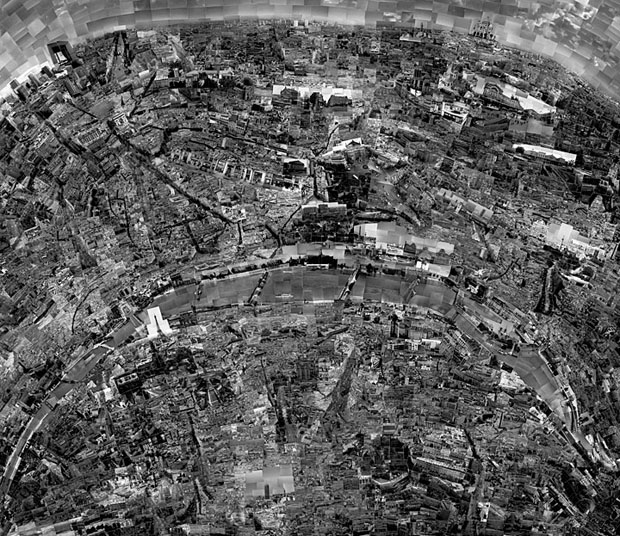
What you see above is a “map” of Paris created by collaging thousands of photographs shot in the city. It’s just one of the pieces in Japanese photographer Sohei Nishino‘s Diorama Map project. The series contains maps of many of the world’s most famous cities, and all of them are photographed and collaged by hand.
The Diorama Maps are made from Nishino’s experience of travelling around a city. He sketches a rough outline of the city’s layout and then cuts up pictures and glues them into a map. Of course its not going to be accurate but since it’s a spatial representation of the space we can still call it a map. Although it not the best representation of the topography of the city it shows it’s soul, and for many purposes it’s the most important aspect of mapping.

#Ideas

Next article

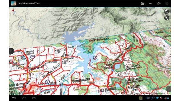
Particularly for people who move outside as cartographers, habitat mappers etc. the collection of spatial data becomes a challenge in terms of equipment as one is not eager to carry his laptop all the way around. A new android app for tablerwas developed to assist with this kind of problem facilitating the data gathering and accurate data processing. It provides display layers for professionals and also amateurs and copes with vector and raster files for recording and calculating accurate geo-information. It even offers the option of real-time tracking, which being outside can be of high interest. Summing up, the app provides all tools that are necessary to perform GIS operations on location. Still, it does not replace GIS-desktop systems, which are able to carry out large volume data processing, but supports several GIS-formats when the project is copied to a desktop system. And where does the recipe come from? From down-under where outpack is a real topic! The name of it: Mappt.
Currently supported tablets:
- Google Nexus 10
- Motorola Xoom 2
- ASUS Transformer
- ASUS Transformer Prime
- Samsung Galaxy Tab 2
- Google Nexus 7
I remember the time when I was working as a habitat mapper during summer and can imagine that this app is a big ease for recording data on location (compared to PDA).
Source: Mappt